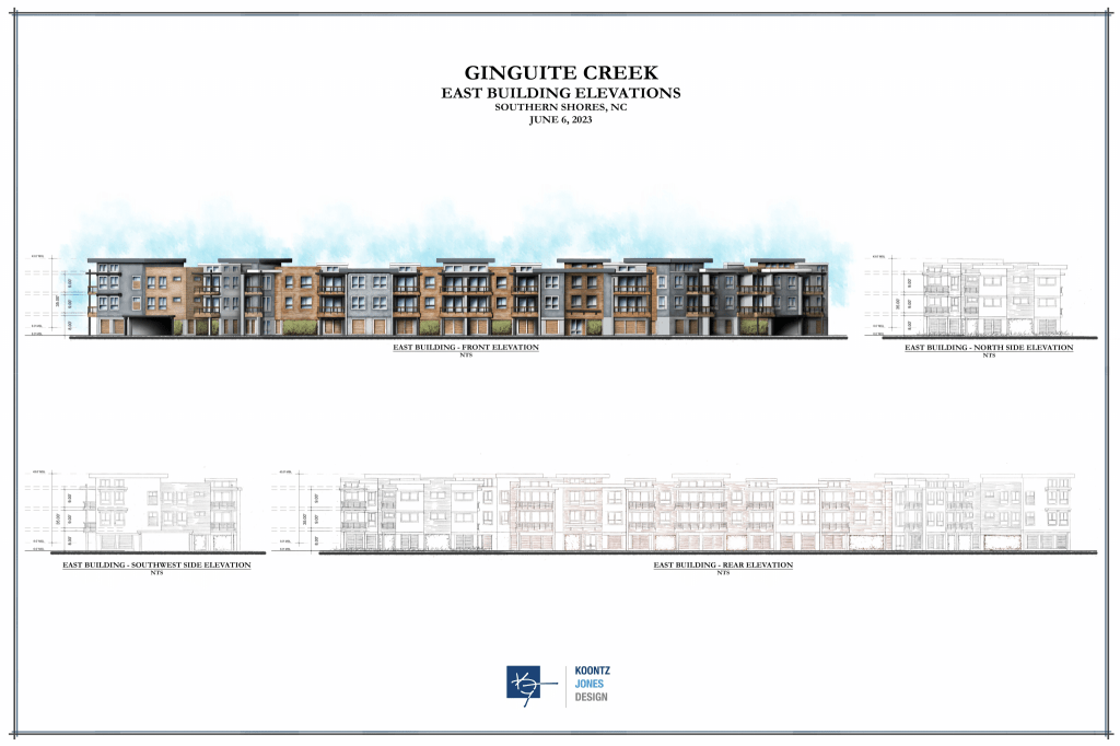
Ginguite, LLC, has proposed constructing a “mixed-use group development” consisting of 36 “multifamily” dwellings and space for retail, offices, and restaurants in two buildings on 4.55 acres of vacant property on Ginguite Creek at 6195 N. Croatan Hwy. (U.S. Hwy. 158).
One building would be strictly residential and contain 30 dwellings with ground-floor parking, according to Ginguite, while the other building would house a mix of six dwellings and the various commercial uses.
In order to proceed, Ginguite must receive a special use permit from the Town of Southern Shores because its development is not one that is permitted “as of right” in the Town’s C General Commercial District.
According to Ginguite LLC, which is a subsidiary of SAGA Realty & Construction, the property is predominantly in the Town’s C General Commercial District, but a small portion of land north of the Ginguite Creek basin is in the R-1 (low-density) residential district.
The Town may require SAGA/Ginguite to meet explicit conditions before it approves its permit.
(Zoning districts are defined in Article IX of the Town Code, which begins with section 36-202.)
Before June 7, 2022, when the Town Council unanimously voted to add the “mixed-use” of residential and commercial buildings on one property as a “conditional” or “special” use in the commercial district and specified the requirements for such developments, projects like SAGA’s were prohibited in Southern Shores. (See Town Code 36-207(c)(11) for the mixed-use provisions enacted by Zoning Text Amendment 22-06, a ZTA that was introduced by SAGA/Ginguite.)
The SAGA/Ginguite proposal is the first mixed-use development to be considered by the Town.
This is the basic factual premise that was before the Town Planning Board for its Sept. 18 review of Ginguite’s permit application, known as SUP 23-01. The subsidiary was represented at the Board meeting by Sumit Gupta, Co-Founder, Partner, and Chief Executive Officer of SAGA, and engineer Michael Strader of Quible & Associates.
We went over the salient details of SUP 23-01 in our first part of this meeting report, posted 9/19/23 and titled “After Homeowners’ Objections, Planning Board Painstakingly Begins Review of Special Use Permit for SAGA’s Ginguite Creek Project.”
The Planning Board will make a recommendation about the SUP to the Town Council, which will hold a public hearing and make the final decision.
Today we consider only one significant issue, which was a major sticking point last year between SAGA/Ginguite LLC and the Planning Board, when ZTA 22-06 was being analyzed and revised, and between the Planning Board and the Town Council, which disagreed on it: the maximum allowable lot coverage.
LOT COVERAGE NUMBERS
According to SAGA/Ginguite’s SUP application materials, the Ginguite Creek parcel is 6.96 acres, including the creek basin, which Mr. Strader told Planning Board Chairperson Andy Ward, upon his inquiry, Ginguite LLC owns.
“The owner does have deed to the bottom of Ginguite Creek basin,” the Quible engineer advised a skeptical Mr. Ward.
An acre of land is 43,560 square feet, so the entire parcel area is 303,177.6 square feet (“SF”). SAGA/Ginguite also cited the following other measurements with its application:
- The area of the parcel without “surface water” and without the northern portion of R-1 property is 5.19 acres or 226,076.4 SF.
- The “net acreage” of the parcel, which Town Code sec. 36-57 defines as “total area to be developed minus any areas covered by waterways, marshes, or wetlands,” is 4.55 acres or 198,177.73 SF, according to SAGA’s calculation .
SAGA further represents that its development would have the following lot coverage:
- 2,115 SF for existing asphalt
- 41,158 SF for buildings
- 7,075.8 SF for permeable pavers (developers who incorporate the use of permeable pavement may be accorded a higher maximum lot coverage, as we explain below)
- 24,272.3 SF for decking and walks
- 46,852.2 SF for new asphalt (this includes 200 parking spaces)
- 5,885.0 SF for concrete
- TOTAL = 127,358.3 SF
This total lot coverage covers 64.26 percent of the net area of the parcel (SAGA calls it 64.2 percent); 56.3 percent of the total area without surface water and the R-1 property; and 42 percent of the total 303,177.6-square-foot parcel.
SAGA also represents that the total residential building and parking coverage is 54,313.4 SF, a figure derived by adding 41,158 SF for buildings and 13,155.4 SF for parking. This is important because the Town’s mixed-use ordinance requires a minimum of 25 percent and no more than 40 percent lot coverage of the net parcel area associated with the residential building and parking footprints. See Code section 36-207(c)(11)(e).
SAGA’s proposed residential coverage is 27.4 percent of the net area, well within the range.
A DISCONNECT
In his “Cliff’s Notes” column for the Sept. 25 newsletter, Town Manager Cliff Ogburn appears to respond to comments that we made at the Sept. 18 meeting in the second comment period regarding a disagreement between the Planning Board and the Town Council about the mixed-use ordinance. We address that disagreement here and refer you to The Beacon’s coverage on 5/26/22, 6/10/22, 6/20/22, and 7/19/22.
The Planning Board spent months last year, talking, deliberating, and negotiating with Mr. Gupta over ZTA 22-06. The Beacon took a post-election months-long hiatus and did not create a paper trail documenting these meeting exchanges. We had to catch up in May.
At the Board’s May 19, 2022 meeting, Mr. Ward said it was reviewing the fourth version of the proposed mixed-used ordinance. At that meeting, the Planning Board voted to recommend denial of ZTA 22-06, as it then existed, but to recommend approval of it with additional conditions, the majority of which already were in the Town Code standards for the commercial district and the R-8 (high-density) multifamily residential district.
The Planning Board essentially favored a “blending” of district standards to arrive at a new hybrid commercial district. The rub in its blending was arriving at the maximum allowable lot coverage restriction for the hybrid district: Lot coverage permitted in the commercial district is considerably more than that permitted in any residential district, where there are density concerns associated with occupancy. (See The Beacon, 5/26/22.)
The Board opted to blend the maximums allowed in the RS-8 residential district (40 percent) and the commercial district (60 percent) and recommend a 50 percent maximum lot coverage—a figure that Mr. Ward thought was “a pretty good average.”
Because the maximum 60 percent lot coverage in the commercial district can be increased to 67 percent with the use of permeable pavers in excess of 5 percent of the total lot coverage, the Board also recommended an increase in the mixed-use property zone from 50 percent to 55 percent with pavers at 5 percent. (See Code sec. 207(d)(5)).
The Planning Board further recommended calculating all mixed-use lot coverage according to the “net” parcel area, the standard used in the RS-8 residential district, in contrast with the “total” parcel area standard applied in the commercial district.
Not surprisingly, Mr. Gupta opposed a lot-coverage limitation of 50 percent, viewing it as a penalty for including residential uses in any development it might propose.
Mayor Elizabeth Morey and Mayor Pro Tem Mattew Neal agreed at the Town Council’s June 7, 2022 meeting with Mr. Gupta. They thought that mixed-use lot coverage should be calculated just as it is on other commercial property, as 60 to 67 percent, depending on pavers, and on the basis of the total parcel area, and that is what the Council unanimously decided to do.
Mayor Morey led off the Council’s discussion about ZTA 22-06 with the pronouncement: “This is a commercial development, and we’re pulling in dense residential into it.” There would be no blending.
She then framed, and limited, the choices before the Town Council by saying either it should vote to 1) impose the 60 percent maximum lot coverage standard applied in the commercial district or 2) use total parcel area in calculating a maximum lot coverage below 60 percent.
The Town Council accepted the Planning Board’s recommendation that a minimum lot coverage of 25 percent should be established for the residential area of a mixed-use development.
Mr. Ward spoke in the public hearing for ZTA 22-06 against the lot-coverage provisions that the Town Council adopted. He later sent an email to the Mayor and Town Council, which he read at the Planning Board’s July 19, 2022 meeting, expressing his extreme disappointment with the Council’s decision.
In his June 8 email, Mr. Ward said that the mixed-use maximum lot coverage that the Council approved allows SAGA/Ginguite, whose property includes “more than an acre of marsh and wetlands,” an additional 27,182 square feet of “hard structure lot coverage” than the Planning Board recommended and Mr. Gupta was “amenable to accepting.”
“Given the fragility of this particular parcel and the gateway into our town,” he wrote, “I feel we have strayed from our founders’ original vision of Southern Shores which speaks to ‘land use that naturally protects environmental resources and fragile areas by limiting development and growth.’”
He concluded his letter by saying that “Allowing 27,182 sq. feet of lot coverage over-and-beyond what the applicant stated he would accept, is a giveaway I find hard to reckon with. Sometimes, less is more.”
(See The Beacon, July 19, 2022.)
A public workshop that Mr. Ward said the Mayor proposed to discuss the “disconnect” between the two governing bodies was never held, and no other public followup occurred.
HOW MUCH DIFFERENCE DOES IT MAKE?
OK, let’s crunch the numbers, as SAGA/Ginguite represented them to be, and, we presume, the Southern Shores Planning Department verified. Mr. Ward arrived at his 27,182 SF by using the 5.2-acre total parcel area in the Dare County GIS listing for 6195 N. Croatan Hwy.
As noted above, SAGA/Ginguite derived a net parcel area of 4.55 acres and proposed a 64.26 percent lot coverage, covering 127,358.3 SF of 198,177.73 SF.
If the Town Council had accepted the Planning Board’s recommendation of a 50 percent maximum lot coverage, with a possible increase to 55 percent with pavers, SAGA/Ginguite would only be able to build on 108,997.75 SF, a deduction of 18,360.55, or a little less than a half-acre.
Mr. Ward’s point is best made by comparing 55 percent and 67 percent of the total area figures of 5.19 acres (226,076.4 SF) and 6.96 acres (303,177.6 SF): They would be 124,342 SF versus 151,471.2 SF and 166,747.7 SF versus 203,129 SF, respectively.
SAGA’s proposed coverage is well shy of 67 percent of either total, but it runs afoul of the 55 percent maximum that the Planning Board recommended when applied to the 5.19-acre total, for a difference of about 2,939 SF.
Bottom line: The Ginguite Creek project could cover much more ground than has been proposed.
If there is a different way to calculate the total area of this property, it was not presented at the Sept. 18 meeting. Planning Board member Ed Lawler asked about the Army Corps of Engineers’ assessment of the wetlands on the site and requested proof that the Corps “has signed off” on the parcel.
Mr. Strader referred to local environmental scientist George Wood as having “worked things out” with the Corps some years ago, but he did not specify what may have occurred officially.
He further said that “There are no proposed wetland impacts associated with the development,” a comment that drew a stir from the audience.
“We want to build [the project] so that it meets all rules and is environmentally sensitive,” Mr. Gupta said, while also acknowledging that there will undoubtedly be “some impact on the environment.”
Until Sept. 18, Mr. Gupta spoke openly in public meetings about aspiring to build high-end condos or “luxury multifamily” dwellings, similar to the Run Hill Luxury Apartment Villas owned by SAGA in Kill Devil Hills.
“Affordable, workforce housing,” he said at the May 19, 2022 Planning Board meeting, “is not [our] focus.” (See The Beacon, May 26, 2022.) He said the same at the Town Council’s June 7, 2022 public hearing.
Mr. Gupta was considerably less adamant last week about his desire for a luxury-condominium community, although he did say that he wanted to “condominize” all dwelling units.
The SAGA project is limited to a maximum of eight dwelling units per net acre, which is the standard in the R-8 residential district, and allegedly has 7.91 units per net acre.
Mr. Gupta said the 30 units in the residential building will have two or three bedrooms, and the six units in the residential/commercial building will have three or four bedrooms. He did not provide a unit size or sales price.
RECOMMENDED CONDITIONAL APPROVAL
Deputy Town Manager/Planning Director Wes Haskett has recommended that the Planning Board recommend to the Town Council conditional approval of SUP 23-01. In his staff report, he enumerates eight conditions, the most important of which to neighbors and other members of the public are probably the following:
- The elimination of a proposed marina, dock/picnic area/kayak storage, and proposed dock extending into Ginguite Creek, because the Town Code does not permit such structures in the commercial district.
- The maintenance of a 50-foot setback from the eastern property line shared with the Southern Shores Landing to any buildings, parking spaces, incinerators, trash collection areas, etc., on the SAGA property and the preservation of the existing vegetative buffer.
- The maintenance of a 50-foot setback from the northern property line shared with All Saints’ Episcopal Church to buildings, parking spaces, etc., on the SAGA property, and the preservation of the existing vegetative buffer.
The italicized language above is from the Town Code section that regulates the C General Commercial district. A 50-foot setback is required in the commercial district from boundaries of “residential districts.” See sec. 36-207(d)(7).
Mr. Gupta said last week that he has no issue with the SUP approval conditions suggested by Mr. Haskett, except for the 50-foot setback with the Landing. He said he had arranged for a 34-foot setback from this shared boundary and is only required by the Town Code to observe a 15-foot setback because the Landing is in a commercial district, not a residential district.
In support of this contention, the SAGA CEO said that the Landing is a Planned Unit Development (PUD), which is only “allowed under a commercial designation.”
Indeed, the Town Code specifies that PUDs are permitted uses in the commercial district. (See sec. 36-207(b)(6)). The zoning status of the Landing has been a matter of much confusion and dispute: Mr. Ogburn has said that it is commercial.
“We submitted something [a site plan] that we thought had some consideration for the neighbors,” Mr. Gupta observed. “We did increase setbacks,” but he said he was “having heartburn about” the Landing setback.
***
Folks, we apologize for writing so much in this post, but editing time has not been afforded to us this week. We may post a Part Three to this report, but it will not be before the week of Oct. 9.
The Planning Board will continue its review of SUP 23-01 on Monday, Oct. 16, at 5 p.m. in the Pitts Center.
Ann G. Sjoerdsma, 9/29/23