The in-season Friday trash pickups started on May 29 and will continue until Sept. 4.
Judging from the number of trashcans we have seen on the roadside on the Thursdays before the past two Fridays, we think word about the increase in pickups may not have reached many Southern Shores residents.
The increase in garbage collections during the summertime accommodates both the increase in the town’s population and an increase in the garbage that the population generates with outdoor activities.
Monday trash pickups will continue as usual, as will Friday recycling pickups. We will give you a heads-up when the two-per-week collections end.
PLANNING BOARD
The Southern Shores Planning Board meeting scheduled for Monday at 5 p.m. in the Pitts Center has been canceled. The next meeting is scheduled July 20. In other Planning Board news:
The Town Council voted unanimously at its June 2 meeting to appoint regular Planning Board member Ed Lawler to another three-year term on the five-member Board, starting July 1.
Mr. Lawler was first appointed to the Board in 2018 to fill the unexpired term of Board member Glenn Wyder after his death. Mr. Wyder had recently been elected chairperson.
Board members’ terms run on the fiscal year, from July 1 to June 30, and are staggered. Mr. Lawler is the only Board member whose term expires in 2026.
The Planning Board elects its chairperson and vice-chairperson at its July meeting each year.
Mayor Pro Tem Matt Neal suggested at the Town Council meeting that a “rotation” of Planning Board members might be desirable to allow other interested residents, who do not apply for a position because of the perception that longtime members hold on to their seats, to serve. He said he has heard from a number of residents who would like to volunteer for the Planning Board.
Mr. Neal also suggested expanding the Planning Board to include more members.
The Town Council also might consider constituting a separate Board of Adjustment, instead of having the Planning Board members serve in this capacity, too. Southern Shores is the only Dare County town that does not have an independent Board of Adjustment.
If you are interested in volunteering for the Board, you are advised to submit an application to Mr. Haskett, who will keep it on file to consider when a vacancy arises. Mr. Haskett makes appointment recommendations to the Town Council based on the applications on file.
Heretofore, the Town has appointed those Board members whose terms are expiring to another three-year term if they wish to continue.
Besides the five Board member seats, there are two alternate positions. Serving as an alternate is a stepping stone to a Board appointment.
Among the objections raised by Town Council members to the placement of pool and mechanical equipment, generators, and small accessory structures five feet closer to side- and rear-yard property lines were unsightliness and noise. The Planning Board raised the same concerns.
The Town Council voted 4-1 at its meeting last Tuesday to reject a five-foot reduction in the minimum side- and rear-yard setbacks in the RS-1 residential district for the placement of pool and mechanical equipment, generators, and 144-square-foot accessory structures.
Mayor Pro Tem Matt Neal, a homebuilder, cast the dissenting vote.
The vote on Zoning Text Amendment 26-04 means setbacks in the primary residential district of Southern Shores remain 15 feet for the side-yard and 25 feet for the rear-yard.
ZTA 26-04 grew out of ZTA 26-01, which was submitted in March by a local general contractor who sought a reduction in the setback minimums so he could use a pool cabana that, as mistakenly constructed, infringed upon a setback by about eight inches.
The Town Council tabled ZTA 26-01 at its May 5 meeting and asked Town staff to prepare two more Zoning Text Amendments to address the factual circumstances raised by the contractor.
One, ZTA 26-03, would allow the Zoning Administrator—Wes Haskett, the Town’s Deputy Managing Editor/Planning Director—to approve up to a 10 percent reduction in “minimum yard requirements” when a good-faith, “honest mistake” by a builder has occurred.
The other, ZTA 26-04, altered ZTA 26-01 by adding generators to the equipment that could be placed five feet closer to a side- or rear-yard property line and reducing the size of allowable accessory structures from 150 square feet to 144 square feet.
The Beacon has extensively covered the language and the action taken by the Planning Board and the Town Council on all three of these ZTAs in recent posts. See The Beacon, 6/1/26, 5/25/26, 5/17/26, and 4/21/26.
All we can say is what a difference one person makes.
The Town Council held public hearings last Tuesday on ZTA 26-03 and ZTA 26-04, but not on ZTA 26-01, which was withdrawn by the contractor.
While Mr. Neal dissented from the majority opinion on ZTA 26-04, he joined the rest of his Council colleagues in approving the “honest-mistake” exception ZTA.
The Beacon will elaborate upon the Town Council’s discussion about the setbacks reduction proposal later in the week when we have more time.
Councilwoman Paula Sherlock, who was absent for the May meeting and is the one person to which we refer, led the opposition to ZTA 26-04, and Councilmen Mark Batenic and Rob Neilson quickly fell in behind her, after being rather noncommittal at the May meeting when ZTA 26-01 was discussed.
In May, it appeared inevitable that some version of the setbacks-reduction ZTA would be enacted, despite the Planning Board’s keen opposition.
Last week, as soon as Ms. Sherlock announced that she was a “no,” the pendulum swung against enactment. TBC.
***
ZTA 26-02, EXCEPTIONS TO RECOMBINATION: The Town Council also unanimously approved ZTA 26-02, which excludes from mandatory recombination adjacent lots owned by the same ownership that are subject to development or redevelopment “when there is no proposed increase in the footprint of existing decks and/or stairs.” ZTA 26-02 amends Town Code section 36-132(2).
The primary reason the ordinance on mandatory recombination exists is because most of the land parcels sold and developed on Ocean Boulevard, Skyline Road, and other nearby beach-side roads were 100-foot-wide parcels consisting of two 50-foot-wide lots.
As we said before, Kitty Hawk Land Co. platted land in this manner so that buyers would feel like they were getting “two lots for the price of one.” According to developer and real estate agent David Stick in his memoirs, it was a salesmanship ploy. No buyers treated the parcels as two separate lots for development.
These sales occurred before the Town was incorporated, and the Town Council set minimum dimension standards for lots. The Town’s mandatory minimum lot width is 100 feet. The Town would like these 50-foot-wide lots to be “recombined” into one 100-foot-wide lot, so that the parcel “conforms” to the width requirement.
Recombination, however, is a costly and time-consuming effort, requiring a land survey (costing at least $1500) and preparation of a recombination plat; presentation of the recombination plat to the Town, which charges a fee of at least $100, for its approval; and registration of the recombination plat by the homeowner or his/her agent in the Register of Deeds office, which also charges a fee.
When homeowners are simply seeking building permits so that they can repair or replace decks and/or stairs on homes—many of them rental homes—that do not increase the development footprint, recombination constitutes an onerous burden. With the Town Council’s enactment of ZTA 26-02, that burden no longer exists.
FISCAL YEAR 2026-27 BUDGET: The Town Council also unanimously approved the Town Manager’s Recommended FY 2026-27 budget of $12,981,790. (See The Beacon, 6/1/26, for background.)
No one spoke during the public hearing on the budget.
As we previously observed, the Town will be buying a new fire engine. We now understand why Town Manager Cliff Ogburn wrote in his narrative accompanying the recommended budget that the fire engine will need to be under contract by July 2026, “with $1,255,000 payable in 2029.” (We quoted this remark in our 6/1/26 meeting preview.)
At Tuesday’s meeting, Mr. Ogburn explained that “it takes three years to take possession” of a new fire engine, so the Town plans to order the truck in July and receive it in 2029. The expense for the fire engine will be in the FY 2029-30 budget.
When we elaborate on the Town Council’s discussion about the setbacks ZTA that it defeated, we also will address some aspects of the new budget.
By Ann G. Sjoerdsma, The Southern Shores Beacon, 6/8/26
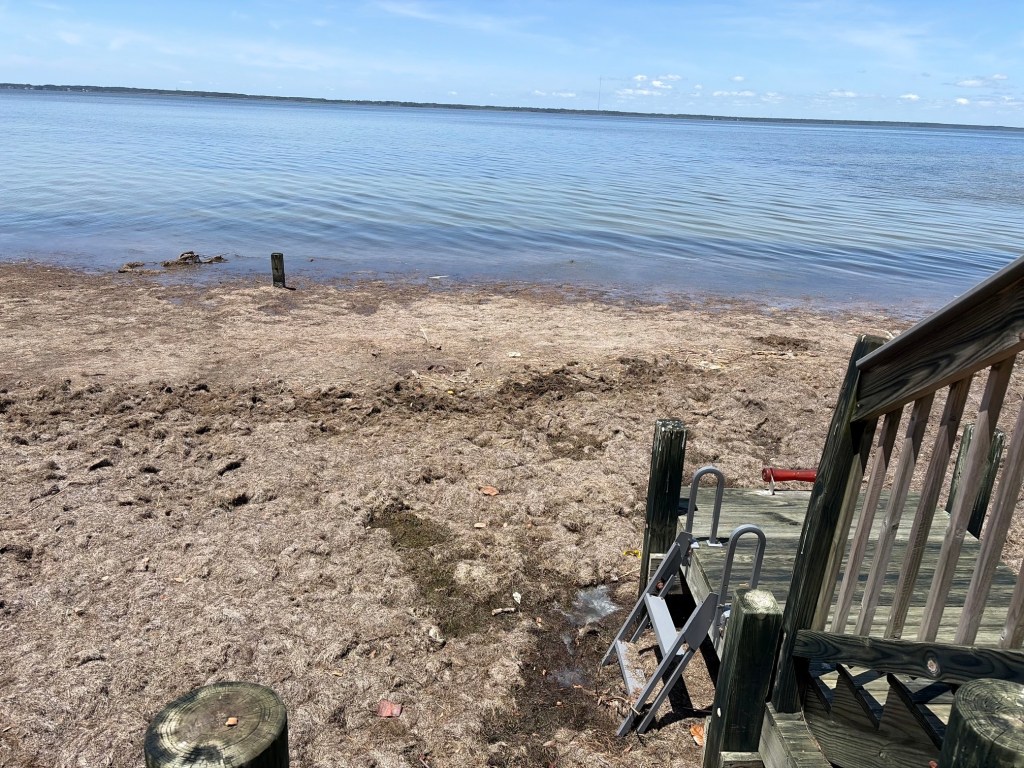
The seagrass-covered beach at Soundview Park on North Dogwood Trail.
The community seminar about seagrass accumulation on the soundfront scheduled today from 4 p.m. to 6 p.m. has been canceled because of the illness of one of the presenters, according to a notice posted on the Town of Southern Shores website.
The event, which was co-sponsored by the towns of Southern Shores and Duck, will likely be rescheduled in early fall. In the meantime, according to the Town’s notice, the towns will work together to develop and share educational resources and to answer residents’ questions on websites and social media.
Please see The Beacon, 5/31/26, for more information.
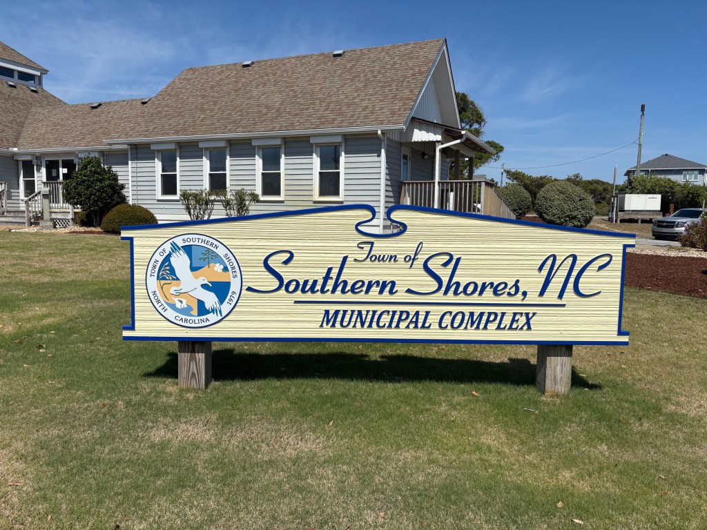
Public hearings will be held at the Town Council’s meeting tomorrow (Tuesday) at 10 a.m., on the four Zoning Text Amendments that The Beacon reported upon recently and on the Town Manager’s recommended fiscal year 2026-27 budget of $12,981,790.
The meeting will be in the Pitts Center and can be live-streamed on the Town’s You Tube website.
Absent from the meeting agenda is any mention of beach nourishment.
The Town Council has delayed making a commitment to another dredging project in 2027 until after it receives a May update on the condition of the Southern Shores beaches from its coastal engineering consultant. The first nourishment project was performed in 2022-23.
(See The Beacon, 5/25/26 and 5/17/26, for background on the ZTAs, one of which is the original setbacks reduction proposal, ZTA 2026-01, which the Town Council tabled at its May 5 meeting.)
The budget total of $12,981,790 is an increase of $1,185,018 or 10.04 percent over the FY 2025-26 adopted budget. The Town budget is subject to amendment throughout the fiscal year.
Page 26 of Mr. Ogburn’s recommended budget enumerates the proposed expenses, by Town department or service. The five departments or services that have the highest line-item budgets include:
Streets, Bridges, [Beaches,] and Canals: $3,055,124
The Town Manager has added “beaches” to this category this year and included the last year of debt service on the 2022 beach nourishment project: It amounts to $1,119,534. Infrastructure costs are projected at $1.3 million, and a list of streets targeted for reconstruction is included in the report.
Police Department: $2,803,037
Salaries make up 57 percent of the police-department budget. Expenses for holiday and overtime pay, FICA, group health insurance, and the employee retirement account for another 28 percent.
Fire Department: $2,323,908
The Town continues to pay $314,020 annually in debt for the firehouse construction. It will buy a new fire engine in FY 26-27, but we are uncertain how much of the truck’s cost will be paid in this fiscal year. According to the Town Manager’s narrative accompanying the Fire Department budget, the fire engine will need to be under contract by July 2026, “with $1,255,000 payable in 2029.”
Salaries and other employee expenses account for about 46 percent of the department’s budget. The Town added eight full-time Fire Department employees in FY 2025-26 and plans to add four more full-time firefighters in FY 2027-28.
Administration Dept.: $1,860,276
Salaries and other expenses related to employees account for the lion’s share of the Administration Department’s costs.
Sanitation Services: $1,071,503
The major costs within sanitation services are, in descending order of amount:
Landfill tipping fee: $306,687
Recycling collection: $252,810
Residential collection: $226,000
Limb and branch removal: $199,006
BALANCING THE BUDGET: The recommended budget is being balanced with a transfer of $537,000 from the Unassigned Fund Balance, which must maintain $3.5 million for emergency and disaster relief, and $950,000 from the Capital Reserve Fund.
Projected fiscal-year revenues without these transfers are $11,494,783, of which $5,870.904 comes from ad valorem taxes and $3,932,856 from occupancy, sales, and land-transfer taxes.
ALSO ON THE AGENDA TOMORROW . . .
Introduction and ceremonial swearing in of Deputy Fire Chief Jim Davidson.
Presentation about the Door Saver Program, an initiative by the Southern Shores Fire Department to help emergency responders access homes quickly and safely without causing damage by forced entry.
An update on the Mid-Currituck Bridge by Mr. Ogburn, who is expected to encourage residents to write to Governor Stein, North Carolina’s U.S. senators, our U.S. Congress representatives, and other public officials for help in securing funding to build the bridge. A sample letter and addresses of public officials are included in the meeting packet.
By Ann G. Sjoerdsma, The Southern Shores Beacon, 6/1/26
The beach at Soundview Park on North Dogwood Trail, as it appears today, covered with foul-smelling seagrass. No one can use it.
The towns of Southern Shores and Duck will host a community seminar tomorrow, from 4 p.m. to 6 p.m., in the Pitts Center about the noxious problem of soundside seagrass accumulation, which has caused a foul odor to infiltrate the air on South and North Dogwood trails in Southern Shores for months (and months).
Sean Charles, Ph.D., a scientist, researcher, and assistant professor with the Coastal Studies Institute, and other experts will speak, after which a moderated panel discussion with environmental, scientific, and state regulatory experts and a community Q&A session will occur, according to a news release by the Town that we are just learning about.
There has been no mention of this event in the Town’s most recent newsletters, nor did The Beacon receive a press release about it, otherwise we would have promoted it sooner. Notice of the event has just hit the Town website news page. (We check it every day.)
Southern Shores Town Manager Cliff Ogburn apparently sent emails to people who attended a previous meeting about the seagrass problem and signed a contact list, notifying them about tomorrow’s seminar. They were able to submit questions in advance—the deadline was May 27—for the panel to consider.
This is insufficient notice. We did not attend the previous meeting because of insufficient notice, and the Town has repeated this failing.
It is past time for the Town to bring this foul predicament out of the closet so that all residents can understand why it has occurred and what can/will be done about it.
Many residents take advantage of Soundview Park and the soundside marinas, which are owned by the Southern Shores Civic Assn., and walk on North Dogwood Trail. (The stench can be smelled on South Dogwood Trail, too, but not with the same potency as the stench on North Dogwood Trail, especially when the wind blows off the Currituck Sound.)
If the SSCA is tasked with cleaning up the beach at Soundview Park (above, as pictured today), all members of the SSCA will be financially affected. Members who have rental properties in Southern Shores and pay for SSCA memberships for them have lost an asset that is popular with vacationers.
No one with roots in Southern Shores can feel good about what has happened to David Stick’s soundfront park, which was once known quaintly as the Bathing Beach, because you could swim there!
According to the Town’s news release, “The seminar will feature scientists, environmental experts, and regulators discussing the causes, impacts, and environmental significance of increasing seagrass accumulation along the soundside. Following the presentations, Southern Shores Town Manager Cliff Ogburn and Duck Planning and Permits Manager Cross will lead a panel discussion and community Q&A session.”
Regretfully, we cannot attend the seminar. Had we known earlier about the event, we might have changed our schedule, but we cannot now.
We ask members of the community who can attend the seminar to send reports of the proceedings, especially news of any proposed solutions, to Ann Sjoerdsma at ssbeaconeditor@gmail.com.
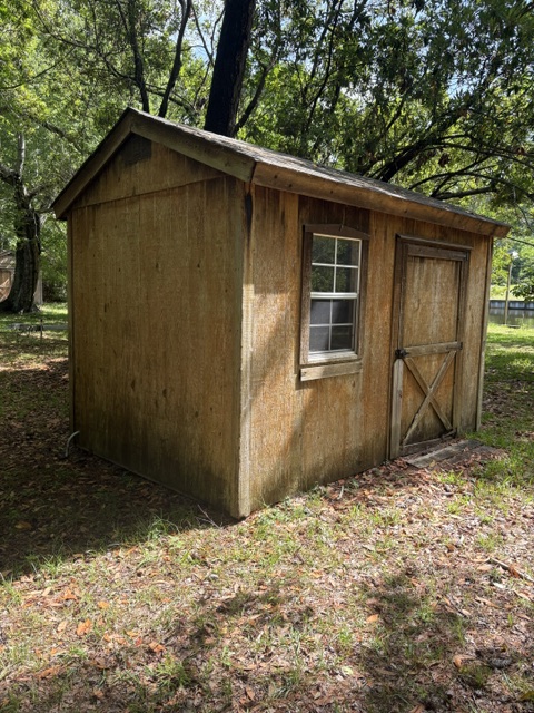
A homeowner uses this 104-square-foot “accessory structure” as a storage shed.
The three members of the Planning Board who attended last Monday’s regular monthly meeting voted to recommend to the Town Council the three Zoning Text Amendments (ZTA) before them, subject to their own amendments, as we will discuss below.
Two of the ZTAs stem from a ZTA submitted in March by a local general contractor who sought relief from an “honest mistake” that was made when a constructed pool cabana encroached 7.4 inches into a yard setback. The other ZTA seeks redress for an onerous situation that has developed under the Town’s nonconforming lots/recombination ordinance.
The Town submitted all three, the first two at the Town Council’s request during its May 5 hearing on the contractor’s ZTA 26-01 and the third at Deputy Town Manager/Planning Director Wes Haskett’s initiation.
(See The Beacon, 5/17/26 for more background.)
The Planning Board’s votes were not all unanimous.
Board member Robert McClendon did not join colleagues Jan Collins and Board Chairperson Andy Ward in recommending approval of an amended version of the new setback-reduction proposal, ZTA 26-04, but did not explain why. Ms. Collins and Mr. Ward continued the objection all Board members raised in their April 20 hearing on ZTA 26-01 to allowing “accessory structures” to be five feet closer to property lines.
RECENT HISTORY OF PROPOSED ZTAS ON SETBACKS REDUCTION
As you will recall, ZTA 26-01 sought to reduce by five feet the minimum required 15-foot side- and 25-foot rear-yard setbacks in the RS-1 single-family-dwelling district for pool equipment and sheds, mechanical equipment (HVACs), and accessory structures up to 150 square feet.
The Planning Board, including Mr. McClendon, unanimously recommended a scaled-back version of this ZTA, allowing for reduced setbacks for platforms for pool mechanical equipment and HVACs only. It also indicated that a variance might be a more appropriate remedy for the contractor with the 7.4-inch mistake.
The Board adamantly opposed including accessory structures. Such structures are defined in Town Code section 36-57 under “use, accessory,” strictly in relation to the principal building or use of the property that they serve.
Mr. Haskett supported 144 square-foot accessory structures, which do not require a building permit to build, but not 150 square-foot structures, which do.
Mr. McClendon’s “no” vote last week left Mr. Ward perplexed. Mr. McClendon’s failure to explain his vote perplexed us.
Was he refusing to permit generators in reduced setbacks, a local builder’s suggestion that ZTA 26-04 now allows? Or had he changed his mind about accessory structures? Inasmuch as he represents the public, he should have gone on the record.
We raised in our last posting the question of whether the Planning Board “process,” which involves, in important part, holding hearings on proposed amendments to the Town’s zoning code and making recommendations to the Town Council, is working.
The five-member Board, and its two alternates, represent the public’s interests and must ensure, when a proposed Town Code zoning amendment comes before them, that the change conforms to the Town’s coastal Land Use Plan (LUP), in particular its’ “community vision statement.”
(The latest LUP was revised by the Town and certified by the N.C. Division of Coastal Management in 2024. It is available on the Town website.)
Each member should know more about the LUP and the Town zoning ordinances than the average Southern Shores resident. Each member also should do his or her homework before a meeting—doing a memory refresh and/or a deep dive into the Code, if necessary—and show up prepared to discuss the issues. Each member also should make clear his/her views.
A lot of responsibility comes with being a volunteer member of the Planning Board.
Although the Board has the authority under the Town Code to request that new ZTAs be prepared by Town staff to address a planning concern, it largely has functioned reactively, and, increasingly, the Town Council is not heeding its advice on ZTAs.
Perhaps members’ frustration with the disconnect between its Board and the Town Council accounts for the absenteeism last Monday.
During the Council’s May 5 hearing on the setbacks ZTA, the Town Council clearly responded to comments by local builders—who unsurprisingly supported the setback-space reduction—but not to Mr. Ward, who also spoke. The Planning Board had a robust discussion about ZTA 26-01 in April with four regular members and both alternates present.
When Mayor Pro Tem Matt Neal, a homebuilder, made a motion to redraft the ZTA, he largely dismissed the Planning Board’s concerns about noise and other nuisances—apparently assuming that other Town ordinances would deal with them—and Mayor Elizabeth Morey said, “We are relying on the expertise of the staff and the interaction with our local builders and homeowners to come up with their best recommendation.”
This was after she earlier had said she would like “more input from the public.”
Town Councilman Rob Neilson added to the Mayor’s list of parties upon whom the Town is relying for a ZTA redraft, “and the Planning Board,” and she hastened to add it.
Besides Mr. Ward, the only member of the public who spoke during the Council’s hearing was a relatively new homeowner who said he wanted to clean out his garage and move the contents to an accessory structure on his property.
Absent a reduction in the side-yard setback, he said, his only choices would be to ruin “sight lines” by putting the structure toward the middle of his 20,000-square-foot canalfront lot or cut down trees in the 15-foot side-yard setback.
It is at the Planning Board that the Mayor and other Town Council members are most likely to get “input from the public.” The Planning Board is the public. No Council member regularly attends the Board’s meetings.
Mr. Haskett said the desire for more setback space to contain equipment and accessory structures is a “common concern” among people, but he did not identify which people: home builders, new property owners who are building their first house, and/or longtime homeowners? Nor could he quantify this concern, when asked by the Town Council to do so.
SETBACKS REDUCTION, NEW ZTA 2026-04 is the “best recommendation” to which Mayor Morey referred. It amends Town Code section 36-202 to allow a minimum side-yard setback of 10 feet and a minimum rear-yard setback of 20 feet for “generators, pool equipment, mechanical equipment (HVAC), and their associated platforms” and for “accessory structures up to 144 square feet.”
ZTA 26-04 reflects what builders want. Mr. Haskett did not support adding generators to the setback exceptions because of their noise, but included them at the Town Council’s request.
At last Monday’s hearing on ZTA 26-04, Mr. Ward read from the 2024 LUP vision statement, which stresses the Town’s identity as “a quiet coastal community . . . of low-density single homes with . . . forests, and open space,” and seeks to preserve the “Town’s unique qualities by maintaining the existing community appearance and form.”
During their discussion, all three of the Planning Board members rejected allowing “accessory structures” to be built five feet closer to side and rear property lines, or at least they appeared to. Mr. McClendon supported “sheds,” which are a form of accessory structure. (See photo above.)
Mr. Ward said he struggled with the revised ZTA and concluded with an observation with which many homeowners might agree:
“We’re the envy of a lot of places, and if you want more and you want to be more crowded into your neighbors, maybe this isn’t the place for you.”
“HONEST MISTAKE,” ZTA 26-03, which was requested by the Town Council on May 5, adds section 36-103 to the Town Code, establishing requirements for the approval of a reduction in “minimum yard requirements” when a good-faith, no-fault error has occurred in the construction process.
Pursuant to ZTA 26-03, the “Zoning Administrator”—Mr. Haskett—determines whether the error qualifies for such a setback reduction. The proposed ZTA sets forth five determinations that the Administrator must make first before permitting a reduction. The most important is that the error cannot exceed 10 percent of the minimum yard-setback requirement, which would be 18 inches for 15-foot setbacks and 30 inches for 25-foot setbacks.
The Town based the language of ZTA 26-03 on Duck’s ordinance about “minimum yard requirements in residential districts based on error in building, structure, or site feature location.” See: https://www.southernshores-nc.gov/media/13816.
The three Planning Board members unanimously recommended approval of ZTA 26-03, subject to the following proposed amendments:
The original ZTA language refers to the Zoning Administrator having determined that the mistake “occurred in good faith and through no fault of the property owners.” The Planning Board recommended revising this to having “occurred in good faith by the property owner and/or his agent,” striking the fault consideration.
The original language states that the Zoning Administrator also must determine that enforcing “the minimum yard or setback requirements would cause unreasonable hardship upon the owner.” The Board recommended revising this to “unreasonable hardship upon the owner and/or his agent.”
ELIMINATING AN ONEROUS EFFECT OF RECOMBINATION ORDINANCE
ZTA 2026-02, the third ZTA that the Planning Board took up, was one of first impression and had not been previously discussed. Mr. Haskett said last Monday that a homeowner had earlier spoken to the Planning Board at a public meeting on Jan. 29, 2025, about the problem, but the Board had not followed up.
We wonder why Mr. Haskett did not follow up, considering that the problem was “another common concern,” as he said, among homeowners. Well, he has now.
ZTA 2026-02 adds exceptions to Town Code section 36-132(2), which requires recombination of adjacent lots owned by the “same ownership” when certain situations of development, demolition or redevelopment, sale, or transfer of lots are proposed.
(See our discussion of the history of the recombination ordinance on 5/17/26. The ordinance was rewritten in 2019 to clearly prevent property owners from dividing 100-foot-wide lots in half and selling them as two 50-footers.)
Many 100-foot-wide lots in Southern Shores were platted as two 50-foot-wide lots, not one single lot. According to written accounts by Southern Shores developer and real estate agent David Stick, this was done to make buyers believe they were getting two lots for the price of one. It was strictly a salesmanship ploy.
Under the current ordinance, if a homeowner wants to renovate, repair, or replace old decks or stairs on a dwelling that sits on a single lot comprised of two or more lots, he or she has to “recombine” the lots before qualifying for a Town building permit.
The recombination process is costly, cumbersome, and time-consuming. The homeowner first must commission a land survey ($1500), then present the survey with a fee to the Town ($50 per lot), which issues a recombination that the homeowner must physically take to the Dare County Register of Deeds in Manteo and file with a fee.
“It’s expensive and it cost people a lot of heartache to do,” Mr. Haskett told the Planning Board, especially owners who live out of town.
ZTA 26-02 excludes from mandatory recombination lots that are subject to development and demolition or redevelopment “when there is no proposed increase in the footprint of existing decks and/or stairs.”
The Planning Board unanimously approved recommending ZTA 26-02 to the Town Council.
But wait! Mr. Ward smartly recognized that other exceptions to recombination—in the interest of fairness—might exist and should be addressed: He focused on interior house renovations that do not increase the footprint of the house.
According to Mr. Haskett, interior renovations that exceed $42,000 require a building permit—and, heretofore, possibly, a lot recombination.
Mr. Ward asked Mr. Haskett to draft a ZTA to relieve homeowners who are doing interior development that does not increase the footprint of the house from filing a recombination.
Good show. That is planning.
(The Town Council will hold a public hearing on each of the ZTAs during its June 2 regular monthly meeting, 5 p.m., at the Pitts Center.)
By Ann G. Sjoerdsma, The Southern Shores Beacon, 5/25/26
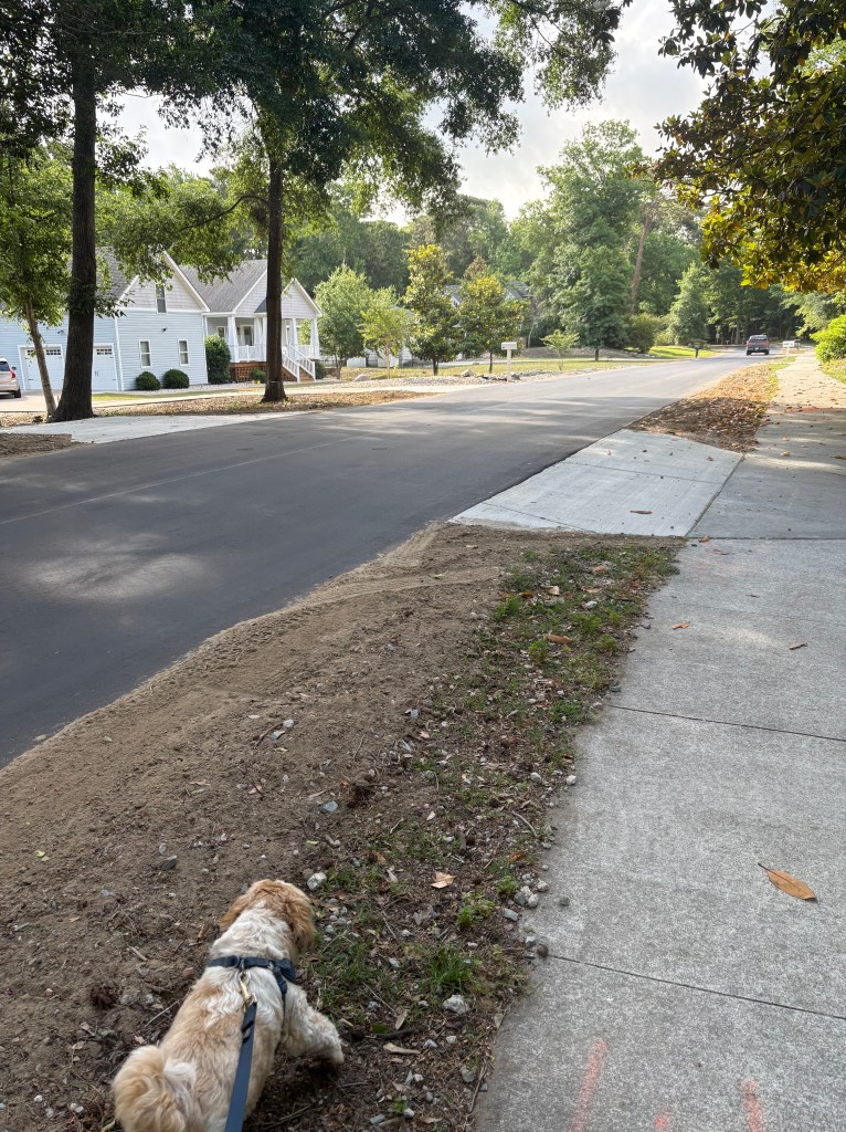
A dog walker’s view this morning of the newly opened and reconstructed East Dogwood Trail.
The heavy equipment and road-closure signs are gone, and the newly reconstructed East Dogwood Trail is now open to all traffic—just in time for the Memorial Day weekend.
While it appears that a few road tasks remain, such as the painting of crosswalk lines, the heavily used connector between South Dogwood Trail and Duck Road has been restored for both vehicle and pedestrian traffic alike. It is free of obstructions. Enjoy!
COMING UP ON THE BEACON: We will fill you in on the Southern Shores Planning Board’s action on three Zoning Text Amendments it considered on Monday. (See The Beacon, 5/17/26, for background.)
Unfortunately, only three regular members of the five-member Board attended Monday’s meeting, a number sufficient for a quorum, but not for a cross-section of community opinion. Neither of the two alternates substituted for a missing Board member.
The Planning Board has five regular members and two alternates who are appointed by the Town Council to serve three-year terms. Unlike Council representatives, each of whom receives compensation, Planning Board members are volunteers. Nonetheless, when fewer than half of those volunteers attend a meeting, especially one in which the important subject of changing residential setbacks is discussed, the process is not working. More on this later.
The Southern Shores Planning Board will consider three Zoning Text Amendments (ZTAs) tomorrow at its monthly meeting, two of which stem from a ZTA seeking to reduce residential setbacks for pool-related structures and equipment that it considered last month—and the Town Council tabled at its May 5 meeting—and the other of which proposes to amend the Town’s nonconforming lot-recombination requirements to provide exceptions.
The Board will meet at 5 p.m. in the Pitts Center behind Town Hall. You may live-stream the meeting on the Town’s You Tube website.
Many of you will recall the Town’s efforts in 2019 to regulate nonconforming lots in Southern Shores after enterprising homeowners and builders succeeded in dividing and selling/developing 50-foot-wide lots that formerly were combined to support one house on a 100-foot-wide lot.
Nonconforming lots are those that do not meet the minimum dimensional requirements imposed by the Town Code in the various zoning districts, RS-1 being the single-family-dwelling district where most people live.
The minimum lot width in the RS-1 district is 100 feet, but because 100-foot-wide lots were platted in Southern Shores as two 50-foot-wide lots, long before the Town’s incorporation, an opportunity existed for people to create and sell nonconforming 50-foot-wide lots—absent prohibition by the Town.
Eight years ago, the Town Attorney at the time advised that the existing nonconforming lots ordinance did not prevent such divisions and sales, despite the obvious intent to do so, and the Town held multiple meetings to draft a new ordinance that would.
The resulting Town Code section 36-132 contains a recombination requirement, which, as interpreted strictly by the Town Planning Department, has forced homeowners who simply want to replace a longstanding deck or a set of stairs at a beach cottage to commission a land survey (costing approx. $1500) and “recombine” the lots on which those cottages have sat for decades before they could get a permit.
More about this below. Now let’s tackle setbacks . . .
REDUCING SETBACKS FOR POOL CABANAS, EQUIPMENT, HVACS, ETC.
On March 20, General Contractor Daniel S. Osman of Southern Shores submitted a ZTA seeking to reduce by five feet the minimum required 15-foot side- and 25-foot rear-yard setbacks in the RS-1 district for pool equipment and sheds, accessory structures up to 150 square feet, and mechanical equipment (HVACs).
The Town Code mandates 15-foot side-yard setbacks in section 36-202(d)(4), and a 25-foot rear-yard setback in section 36-202(d)(5). Mr. Osman’s ZTA 26-01 proposed adding language of exception to these regulations to allow 10-foot side-yard and 20-foot rear-yard setbacks for the aforementioned equipment and structures.
Mr. Osman filed ZTA 26-01 upon the advice of Deputy Town Manager/Town Planning Director Wes Haskett, who refused to approve a “recently constructed pool cabana” at an unspecified property site, one corner of which, the contractor said, encroached the 25-foot rear-yard setback by 7.4 inches.
The factual circumstances of Mr. Osman’s situation have not been detailed in any public documents that have been posted on the Town website. In a post previewing the Planning Board’s April 20 hearing on ZTA 26-01, The Beacon regretfully assumed Mr. Osman was advocating for his own property, but that was not the case, and we apologized for our error.
Mr. Osman characterized this 7.4-inch encroachment during the Planning Board hearing as “an honest mistake” and asked the Town to “give us a little graciousness.” The construction cost of the cabana, he said, was $35,000.
The Planning Board did not recommend approval of Mr. Osman’s ZTA 26-01. Instead, it unanimously approved a revised version of ZTA 26-01, which eliminated the inclusion of pool sheds and accessory structures and sought only to allow reduced setbacks for “platforms for pool mechanical equipment and mechanical equipment (HVAC).” (See The Beacon, 4/21/26.)
The Board’s primary objections to ZTA 26-01 concerned the nuisance posed to neighbors by pool cabanas and other accessory structures being built five feet closer to property lines, especially the noise created by people using such structures. Board members also thought aesthetics would be harmed by the proposed setback changes.
Mr. Haskett recommended a revised version of ZTA 26-01, which supported most of Mr. Osman’s ZTA, but reduced the permissible size of an accessory structure to 144 square feet and eliminated pool “sheds.” A 144-square-foot accessory structure does not need a building permit, just a zoning permit, he explained.
(An “accessory structure” is defined in Town Code section 36-57.)
TOWN COUNCIL MIXES IN AFTER MOSTLY HEARING FROM BUILDERS
The various versions of the ZTA—Mr. Osman’s, the Planning Board’s, and Mr. Haskett’s—went to the Town Council for a public hearing on May 5. The Council did not vote on any of them.
Mr. Haskett told the Council that finding space or encroaching the setbacks for pool-related equipment and accessory structures is “one of our most common concerns.”
When asked by Mayor Pro Tem Matt Neal, who is a home builder, if he could quantify how often the issue arises, Mr. Haskett said he could not, but it is a common question.
During the Planning Board hearing, Mr. Osman told the four regular members and one alternate member who voted on his ZTA, “Everybody [today] wants a 3,000 or 4,000-foot house with a swimming pool,” and the Town’s regulations are “very constrictive.”
Mr. Osman did not speak at the Town Council hearing, but two local builders (Mark Martin of Sandmark Custom Homes and James Mehfoud of Mancuso Development); Joseph (Duke) Geraghty, the Government Affairs Director for the Outer Banks Home Builders Assn., who lives in Manteo; and a homeowner on Duck Woods Drive who would like to “reclaim” his garage and build a shed on his property that does not disturb sight lines, did.
Only Planning Board Chairman Andy Ward spoke in favor of limiting any reduction in the setbacks to equipment only, not structures.
The five members of the Planning Board, none of whom is a builder, conscientiously considered the impact of a setback reduction on adjacent property owners and tried to protect their interests and the community’s vision.
We cannot agree with the Town Council or Mr. Haskett who suggested May 5 that the Town’s noise and lighting ordinances will prevent excessive noise and bothersome lights in accessory structures that are five feet closer. We’ve been around rental cottages for far too long and know better. Plus, the police have better things to do.
In his remarks, Mr. Ward stressed the intent of Town Code section 36-202, which sets forth the land uses and the dimensional requirements in the RS-1 district. Quoting from the intent section, 36-202(a), Mr. Ward read that the district promotes, among other things, “abundant open space, and low impact of development on the natural environment and adjacent land uses.”
It was our impression that the Town Council, which was operating with only four members—Councilwoman Paula Sherlock was absent—responded to builders’ concerns, but not to the public concerns raised by Mr. Ward.
We would like to know what other members of the community think about the loss of setback space and the proximity of outdoor equipment.
In a motion made by Mr. Neal, the Town Council asked Mr. Haskett to prepare a new ZTA that would rely primarily upon Mr. Haskett’s recommended version and add generators to the named equipment.
Mr. Martin brought up generators in comments he made during the hearing, saying that increasingly new homeowners want them.
Mr. Neal also moved to ask the Town staff to prepare a ZTA creating what Mayor Elizabeth Morey called “an administrative variance” to address “honest mistakes” by builders.
Clearly, Mr. Neal and Ms. Morey had discussed this remedy before the hearing, but Council members Mark Batenic and Rob Neilson had not been apprised.
Mr. Neal’s motions passed unanimously.
ZTAS BEFORE THE PLANNING BOARD TOMORROW
Tomorrow evening, the Planning Board will consider:
“HONEST MISTAKE”-ZTA 2026-03, which adds a section to the Town Code establishing requirements for the approval of a reduction in “minimum yard requirements” when a good-faith, no-fault error has occurred in the construction process. The “Zoning Administrator”—Mr. Haskett—determines whether the error qualifies for a reduction. The error cannot exceed 10 percent of the minimum yard-setback requirement, so 18 inches for 15-foot setbacks and 30 inches for 25-foot setbacks.
The Town based the language of ZTA 26-03 on Duck’s ordinance about “minimum yard requirements in residential districts based on error in building, structure, or site feature location.” See: https://www.southernshores-nc.gov/media/13816.
NEW ZTA 2026-04, allows a minimum side-yard setback of 10 feet and a minimum rear-yard setback of 20 feet for “generators, pool equipment, mechanical equipment (HVAC), and their associated platforms” and for “accessory structures up to 144 square feet.”
ZTA 2026-02, concerning recombination, adds logical exceptions to Town Code section 36-132(2), which requires recombination of adjacent lots owned by the “same ownership” when certain situations of development, demolition or redevelopment, sale, or transfer of lots are proposed.
The ordinance is unduly complicated. It was in 2019 when it was drafted, and it still is.
All ZTA 26-02 does is exclude from mandatory recombination lots subject to development and demolition or redevelopment “when there is no proposed increase in the footprint of existing decks and/or stairs.”
We have personal knowledge during the past three years of two sets of homeowners having to recombine “lots” on which their beach cottages were built before they could get permits, in one case, to build a new back deck to replace one built in 1981, and in the other, to build a new front staircase to replace one built in 1999.
The lots on which these cottages sit were carved out in the 1970s before the Town was incorporated, and the Kitty Hawk Land Co. made patchwork deals with prospective owners. The two “lots” under the 1981 cottage add up to 14,000 square feet; the lots under the 1999 cottage constitute 25,000 square feet.
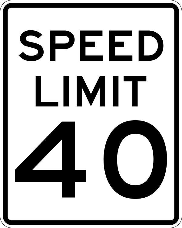
Starting tomorrow the speed limit for a section of Duck Road (N.C. Hwy. 12) in Southern Shores will increase from 35 mph to 40 mph. The new 40-mph zone will run from Porpoise Run, which is just north of the cell tower, to Sea Oats Trail/13th Avenue, according to a Town announcement.
The speed limit for the rest of N.C. Hwy. 12, including all of Ocean Boulevard, will remain 35 mph.
As The Beacon previously reported, the Town Council sought a speed-limit change last year in order to help “reduce conflicts between low-speed vehicles and faster-moving traffic,” as the Town explained in its announcement. (See The Beacon, 12/5/26.)
In fact, the Town Council voted unanimously at its Dec. 2, 2025 meeting to increase the speed limit on the entirety of N.C. Hwy. 12 from 35 mph to 40 mph, after members expressed frustration over driving behind so-called “low-speed vehicles” (LSV), which one Councilman characterized as “upgraded golf carts.”
During the summertime, Town Councilman Mark Batenic noted at the December meeting, vacationers often drive such carts, which can seat up to six passengers, to and from Duck on Duck Road, impeding the traffic flow of other vehicles.
In North Carolina, LSVs, which are street-legal motorized carts with legally mandated safety features (headlights, turn signals, e.g.), licensure, and other requirements, can drive on roads that have speed limits of 35 mph or less.
Their top speed, however, is 20 to 25 mph, thus making them a nuisance to other drivers who wish to proceed at the posted speed limit and get stuck behind them.
While the impetus for the Town Council’s speed-limit change appeared initially to be eliminating the inconvenience that LSVs pose to other drivers, its discussion evolved into one about safety—which was the reason that it voted unanimously on Aug. 2, 2022 to implement the year-round speed limit of 35 mph on N.C. 12.
Previously, the year-round speed limit on N.C. 12 was 45 mph except from May 15 to September 15 when the speed limit decreased to 35 mph for a section of the highway that included all of Ocean Boulevard, which is the Town’s primary beach zone.
Community Feedback After December Vote
After the Town Council’s December vote, it heard from Southern Shores residents, businesses, and others in town who had concerns about the safety of pedestrians, cyclists, and drivers along N.C. 12, especially on Ocean Boulevard, if the speed limit were to increase to 40 mph.
LSV drivers also raised the issue of their losing access to interior roads throughout town, if they couldn’t drive on N.C. 12.
Because of this feedback, the Town Council adjusted its thinking and voted unanimously at its May 5 meeting to increase the speed limit to 40 mph only in the Porpoise Run-to-Sea Oats Trail/13th Avenue zone. The speed limit will remain 35 mph from the Southern Shores-Kitty Hawk town line to Porpoise Run and from the intersection of Duck Road with Sea Oats Trail/13th Avenue to the Southern Shores/Duck town line.
The Council’s vote came after the Town met with representatives of the N.C. Dept. of Transportation to request the change. NCDOT, according to Town Manager Cliff Ogburn, who briefed the Council May 5 about this meeting, expressed concern over increased crashes and other deleterious changes with the higher speed limit.
The Town agreed to reinstate the 35 mph limit if adverse effects occur.
The Town also brought up with NCDOT the possibility of eliminating all passing zones on N.C. 12 in Southern Shores, Mr. Ogburn said, but the government agency did not support this change, saying it needed to do further evaluation.
*****
A NOTE TO BEACON READERS: We will do our best in the next two weeks to catch up with Town news, after being “out of pocket” since late April.
Also at the Council’s May 5 meeting, Mr. Ogburn presented a recommended fiscal year 2026-27 budget of $12,981,790, and the Town Council tabled a Zoning Text Amendment (ZTA 2026-01) that would have reduced residential side- and back-yard setbacks by five feet for pool equipment and sheds, HVACs, and accessory structures.
The public hearing on the proposed FY 2026-27 budget will be held at the Council’s June 2 meeting at 10 a.m.
Next year’s budget does not include a property tax increase for the Town’s general fund or for the beach nourishment municipal service districts.
The Southern Shores Planning Board will take up at its May 18 meeting two newly drafted Zoning Text Amendments that relate to the setback changes proposed in ZTA 2026-01. We will try to preview them for you before Monday.
The Planning Board also will discuss a proposed ZTA that amends the Town’s lot recombination requirements in Town Code sec. 36-132 by establishing an exclusion for development “when there is no proposed increase in the footprint of an existing structure.”
It is a shame that this logical exception was not present in the ordinance from the beginning. It would have saved some homeowners the hefty costs of a recombination, which includes the price of a land survey.
The Planning Board meets at 5 p.m. Monday in the Pitts Center. To access the Board’s agenda and the three ZTAs, go to:
Happy Earth Day, everyone. Today marks the 56th anniversary of this day founded by U.S. Senator Gaylord Nelson of Wisconsin to raise awareness about U.S. environmental issues, particularly air and water pollution, and to shake up the political establishment about the planet’s well-being.
Inspired by protests in the 1960s, the late Senator Nelson envisioned the holiday as a series of rallies and environmental “teach-ins” across the country—essentially, a large-scale grass-roots demonstration on behalf of protecting the environment.
Senator Nelson’s Earth Day took off like gangbusters and has evolved into a worldwide celebration of the Earth’s natural resources.
As you may have heard, the Town of Southern Shores is participating in the N.C. Resilient Coastal Communities Program (RCCP) and working with the N.C. Division of Coastal Management to identify storm, flooding, and other coastal hazards in order to plan better for community response to them.
The RCCP aims to identify coastal risks and develop strategies that protect neighborhoods, infrastructure, and natural resources.
Currently in the early phases of the RCCP, the Town is seeking residents’ responses to a short online survey that is designed to assess the current state of flooding and storm impact in Southern Shores through on-the-ground experiences–your experiences.
You will find the survey and more information about the RCCP here: