Southern Shores native and local builder, Matt Neal, is one of four candidates vying in November for three seats on the Town Council. The candidates will meet in a forum hosted by the Dare County League of Women Voters next Monday, from 7 p.m. to 9 p.m., at the Pitts Center. Early voting begins Oct. 16.
A majority of the Town Council appears prepared to spend $17-$20,000 or more to hire a beach-nourishment financial planning consultant, even though it has not voted to proceed with a nourishment plan, and it has made no effort to do its own far-less-costly financial research.
The chief item of business on the agenda for tomorrow’s Town Council meeting is the consideration of an FY 2019-20 budget amendment that would enable the Town to pay beach-nourishment financial planners, DEC Associates, Inc., “half of the total amount due [them] for financial planning . . . for beach nourishment.”
Doug and Andrew Carter, the father-son team that owns the Charlotte-based DEC Associates, told the Town Council seven months ago, at its Feb. 26 planning session, that they would charge $35-$40,000 to develop a financial plan, set up a “beach fund,” and decide what monies would go into the beach fund (i.e., do the “planning”); and then another $30,000 to work on finding the financing.
If DEC Associates’ costs have not increased, “half of the total amount due for financial planning” is either $17,500 to $20,000, or about $35,000, which would be half of what the company would charge if it were to manage funding for a fill project.
We will find out tomorrow what the agenda item wording means. The Town Council meeting will convene at 5:30 p.m. in the Pitts Center.
This appropriation is an idea that Councilman Jim Conners floated at the Town Council’s Sept. 17 planning session, when the Town’s elected officials considered a coastal-engineering consultant’s latest report on beach nourishment along Southern Shores’ 3.7-mile-long shoreline. Mr. Conners appeared then to have majority support for his budgetary idea. (See The Beacon’s report on the planning session, 2/28/19.)
The Beacon differs with them all. We believe the proposed appropriation is a terrible waste of money that exposes how lax the Council and Town staff have been about doing obvious homework–during at least the past seven months–that would have saved the Town both time and money. The Beacon also believes it is not too late for the Town to do its own homework at a more economical cost. The Town has an attorney and an interim town manager: Use them.
WHERE WAS THE PLANNING?
APTIM Program Manager Kenneth Willson presented his coastal-engineering firm’s December 2017 analysis of the Southern Shores shoreline at the Town Council’s Feb. 26 planning session.
Mr. Willson actually filed this report, titled the “2018 Vulnerability Assessment and Beach Management Plan,” with the Town last December. Thus, the assessment and its conclusions were available for scrutiny two months before they were formally presented.
Correspondence between Mr. Willson and former Town Manager Peter Rascoe indicates that Mr. Rascoe read an early draft of the assessment that was submitted last November. Adding in that time, the Town will have nearly a year’s notice about APTIM’s data and recommendations before it finally makes a decision on financing a nourishment project.
The Beacon attended the Feb. 26 planning session, and we spoke at length afterward with the Carters, who specialize in shoreline-project funding.
Also in attendance at the planning session were Mayor Tom Bennett, Councilmen Fred Newberry, Gary McDonald, and Conners; Town Manager Rascoe, then-Deputy Town Manager/Planning Director Wes Haskett, and Finance Officer Bonnie Swain; and, most significantly, Town Attorney Robert B. Hobbs, Jr., who also represents Duck, which renourished its beaches in 2017.
Councilman Christopher Nason was out of town.
Fortunately, for all, the meeting was videotaped. The Beacon trusts that Mr. Nason has viewed it and that all other elected officials have reviewed it. If they have not, they have let their constituents down.
Mr. Willson, who is a geologist with certification in coastal engineering, outlined in the 2018 assessment report three beach-management plan “options” for Southern Shores, then ranging in cost from about $9 to $13 million.
About two-three weeks ago, he filed a new report, based on updated May 2019 beach-survey data. APTIM and Mr. Willson are now recommending that the Town choose between two beach-nourishment plan options that range in cost between $14-$16 million, and that the Mayor said Sept. 17 would likely cost more. (See The Beacon, 9/17/19 and 9/19/19.)
Two Field Research Facility oceanographers who live in Southern Shores—Dr. Katherine Brody and Dr. Nicholas Cohn—questioned APTIM’s conclusions at the Town Council’s September planning session, saying they are “based on limited data” and “on short-term trends that are not particularly helpful.” The scientists said APTIM’s recommendations are based on statistics and engineering, not science. (See The Beacon, 9/19/19.)
There is no follow-up discussion to the oceanographers’ expert opinions planned for tomorrow’s meeting—at least, not as indicated on the agenda.
After Mr. Willson spoke in February, the Carters explained the various financing methods available for a fill project, some of which include 1) general obligation bonds, which would require a voter referendum; 2) purchase by installments, which, Andrew Carter said, would be “more like a mortgage,” and would be governed by N.C. General Statutes (NCGS) 160A-20; and 3) and 4) special-assessment bonds, which Mr. Carter described as “very complicated,” and special obligation bonds, both of which are subject to State law.
WHAT SAY THE TOWN ATTORNEY(S)?
The Town has under contract the law firm of Hornthal, Riley, Ellis & Maland, where both Mr. Hobbs and his colleague, Benjamin M. Gallop, a very capable municipal attorney, work. Surely, Mr. Gallop, who attends all of the Town Council’s meetings, or Mr. Hobbs can explain to the Council how shoreline financing works—without billing the Town for $20,000.
The Beacon further believes that the town attorneys, town managers, and/or other responsible staff of Kitty Hawk, Kill Devil Hills, and Nags Head—all of which have financed beach-nourishment projects—would be happy to speak with Mr. Gallop/Mr. Hobbs, if they need supplementary information, or Interim Town Manager Wes Haskett about the financing method(s) their towns used.
It was The Beacon’s impression on Feb. 26 that the Carters have worked with some, if not all, of the Dare County beach towns. In any case, the Town can learn and benefit from our neighboring beach towns’ experiences. We need not start out on page one of the beach nourishment financing playbook. The plays have already been designed.
It would seem to be fairly easy for Mr. Gallop and Mr. Haskett, perhaps with assistance from Mrs. Swain, to pool their resources and to compile a short report that would detail for the Town Council the financial options and their implications for the Town and its taxpayers. They could assume the beach-management plan would cost $16 million, of which the Town would pay 50 percent and Dare County would pay 50 percent.
The Beacon finds it very discouraging that, since February, the Town Council has not called publicly upon the Town Attorney(s), the Town Manager, or any other knowledgeable people at its disposal to help it to make an intelligent and informed decision about beach nourishment and its financing. The Beacon could probably do a quick educated study just by conducting research on the Internet!
The Town has not done its due diligence, but that’s no excuse for either dipping yet again into the undesignated fund balance—as the majority did to pay for the South Dogwood Trail sidewalk—or diverting revenue from elsewhere to pay for an expense that it need not incur.
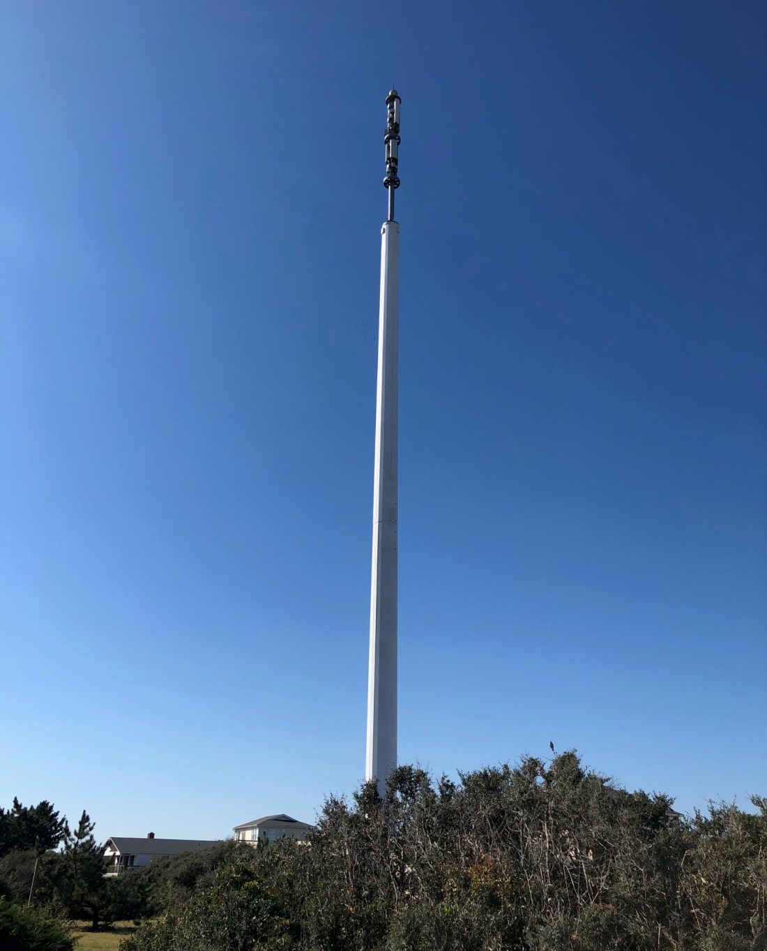
The naked cell tower after Hurricane Dorian: The Beacon wonders where all of the pieces landed. (We saw one chunk.) And why did they detach?
Less than six months after the N.C. Coastal Resources Commission (CRC) certified Southern Shores’ most recent land-use plan (LUP), Mayor Hal Denny and the then-Town Council replaced the plan’s vision statement with their own version. They sought to change the town’s character and access by making it less “exclusive” and more “public-friendly.”
The vision statement that these five elected officials directed Town Manager Peter Rascoe to draft on Feb. 19, 2013, and then unanimously adopted March 5, 2013, emphasized opening up the town to the “general public.” In order to do that, they committed the Town to taking any legal means available, including eminent domain, to acquire land to use for “public purposes.”
The vision statement is a key element of a N.C. coastal town’s CAMA-approved land-use plan. It reflects the community’ aspirations for the future, and the CRC must sign off on those aspirations. (See The Beacon, 9/25/19, for background on CAMA, land-use plans, and the CRC.)
But the replacement vision statement passed by former Mayor Denny and then-Council members Jodi Hess, George Kowalski, David Sanders, and Larry Lawhon did not emerge from a LUP-update process, nor did they seek public opinion or CRC approval. It came out of an annual Town Council retreat held Feb. 19, 2013, during which the five alone planned for “future land use, acquisition, and development.”
In so doing, these five individuals–three of whom ran unopposed for their seats in 2011– substituted their own judgment for that of the many people who had participated in the lengthy and comprehensive process that the Town underwent in 2005-07 to update its 1997 land-use plan.
The Beacon finds their audacity staggering.
In a detailed blog post 9/25/19 in which we called upon the current Council to update the 2008 LUP, after three members backed out nearly two years ago, The Beacon explained the Coastal Area Management Act (CAMA) and the value of land-use plans; outlined Southern Shores’ most recent LUP update process; and discussed some of the content in the Town’s 2008 LUP, which the CRC did not certify until Aug. 30, 2012.
The Town submitted its updated land-use plan to the N.C. Division of Coastal Management, which serves as staff to the CRC, in August 2008, but the Town delayed its certification by not responding promptly to questions raised by the DCM. Southern Shores has had a LUP since 1980 and has updated it four times.
Don Smith served as Southern Shores mayor from December 2005 through November 2009. Hal Denny succeeded him in December 2009 and served through November 2013.
Although the agenda published for the Feb. 19, 2013 retreat, which occurred after the Council held a full regular meeting, said only, “Annual Retreat—Various Topics for Discussion,” the minutes of the meeting reflect a wide-ranging discussion about how the Town could acquire property that it could develop for public use.
(There is no meeting videotape to know who said what.)
According to the minutes, which show that considerable planning went into identifying the “retreat agenda items,” Mayor Denny and the Town Council discussed the “Vision Statement to go forward? [i.e., Exclusivity v. Open to Public?]”
The minutes note in conclusion: “It was Council’s consensus to move toward a more ‘public-friendly’ town . …”
“Council’s consensus.” Council, not the land-use plan, not the Town’s property owners. “Council.”
TOWN COUNCIL’S SUBSTITUTION OF PERSONAL AGENDA FOR LUP
The five elected officials who rewrote the Town’s vision statement promoted their judgment ahead of the well-researched conclusions of the Town Planning Board’s Long-Range Planning Committee, which identified a Town vision, issues, goals, and objectives in its January 2006 report. This report was one of several that factored into the LUP update.
They also subordinated the viewpoints expressed by both property owners who had responded to a 2005 town-wide survey and/or attended a 2007 “Speak Out” community workshop and by Town staff, to their own personal viewpoints.
The “consensus” that the team of Denny-Hess-Lawhon-Sanders-Kowalski derived became Resolution 2013-03-01, which was titled: “Resolution Adopting a Statement of Vision and Policy Regarding Use and Acquisition of Properties Owned, Controlled, Administered, or Maintained for Public Purposes.”
The Beacon views this resolution adopted by Mayor Denny’s Town Council as an abuse of power and authority. We consider these five citizens’ substitution of their judgment for that of the judgment expressed in the 2008 LUP illegitimate and undeserving of any deference or respect. That these five citizens, who were elected by the voters, decided they could overrule the voters, without any notice to the people they serve, much less a hearing, is both shocking and appalling.
When you hear “old-timers” talking about how the Town has changed, you have only to look back to the contrasting administrations of Mayor Smith and Mayor Denny. We will do that, but today, we look only at the “Denny” vision of how Southern Shores should be.
THE DENNY VISION OF OPENING UP TOWN TO PUBLIC
On 9/25/19, The Beacon published the current vision statement in the Town’s 2008 land-use plan. As you may recall, it begins with “The Town of Southern Shores is a quiet seaside community comprised primarily of small low density neighborhoods consisting of single family homes primarily on large lots . . . interspersed with recreational facilities . . . beach accesses, walkways and open spaces.” (LUP, p. 8)
We further observe that the first two land-use and development goals included in the LUP section, “Plan for the Future,” are:
1) “Encourage the maintenance and improvement of existing private access facilities to public trust waters and shorelines in order to improve recreational opportunities.”
2) “To protect, enhance and support land uses that are compatible with surrounding land uses and maintain the existing community character of Southern Shores.”
According to the LUP, these goals were formulated from “input through the public involvement process . . . and from the Town staff, the Steering Committee, Planning Board, and Town Council.” (LUP p. 51.) They are two of five goals listed.
We ask you to contrast this content about maintaining private-access facilities and the Town’s community character with the text of Resolution 2013-03-01, which purportedly represents a “consensus” reached “after thorough discussion by the [five] members of the Council” on a Tuesday afternoon in March 2013. (The minutes record that the retreat began at 12:30 p.m. and adjourned at 2:20 p.m.)
Although the “whereas”es of the resolution are revealing, we quote only the five officials’ “vision statement” and “policy statement,” which are:
The vision: The Town “shall be an inviting place to live and visit. Residents and the general public shall be encouraged to use and enjoy any resources, infrastructure, services, natural areas, recreation areas, public trust areas, and open spaces owned, controlled, administered, or maintained by [the Town. The Town] shall reserve the right to enact ordinances and policies regarding fees, licenses, or permits to ensure users of such facilities equitably contribute towards the cost of acquisition and maintenance.”
The policy: [The Town] is committed to ensuring that its residents and the general public, including citizens with disabilities, have reasonable access to natural areas, recreation areas, public trust areas, and open spaces which are now, or in the future, owned, controlled, administered or maintained by the Town . . .
“To ensure that the [Town] remains an inviting place to live and visit for its residents and the general public, the Town is committed to seek and act on any reasonable opportunity to acquire, in fee simple title or by easement, land to be used for public purposes described in these statements. [The Town] is committed to acquiring land for such public uses by gift, donation, negotiated sale, or imminent [sic] domain proceeding.”
The general public is not the vacation public renting properties in town.
While some of us may view Southern Shores as too exclusive, there has never been a groundswell of support among property owners for opening it up to the “general public.”
What’s more, there has never been community-wide discussion among property owners about why and how to do that.
When I first learned in 2014 about the Denny resolution, I questioned then-Town Manager Peter Rascoe about it.
He informed me that the 2013 vision statement “supersedes” the vision statement in the Town’s CAMA-approved land-use plan, but he had no answer for how the Town Council can do this without approval from the Coastal Resources Commission. Southern Shores is not just any small town with picket fences, ballparks, and sidewalks. It’s a State-protected coastal town with precious natural resources.
He also informed me, when I asked how many members of the public attended the February 2013 retreat, and, therefore, knew what the Council was doing, that there was only one present: Leo Holland, who did not comment.
If a Town government is not transparent about its intent, its goals, and its actions, and it is not solicitous of public opinion, policies, planning, and development can radically and quickly change. And that’s precisely what happened.
MOVE TO ACQUIRE PRIVATE PROPERTY BY ‘QUICK TAKE’
In one of his first official acts, Mayor Tom Bennett, who succeeded Mr. Denny in December 2013, sought to secure an accelerated right of eminent domain—known as “quick take”—for the Town in the event it:
1) decides to proceed with beach nourishment or take some other action to preserve the beach and quickly requires property title rights or
2) wants to establish “access for the public to public trust beaches and appurtenant parking areas.” (The language comes from N.C. General Statutes 40A-3(b1) 10-11. NCGS chapter 40A concerns eminent domain.)
At the beginning of a Feb. 4, 2014 Town Council hearing on quick take, Mayor Bennett assured the public that there was no beach-nourishment project planned.
Like all municipalities, the Town already has eminent-domain power. The resolution at issue in January-February 2014 would have added the two provisional cases—of access for beach renourishment and access for the public to the beaches, including the creation of nearby parking areas—to its existing authority and also enabled the Town to secure condemnation through an accelerated procedure.
Under quick-take eminent domain, a town can take title to private property with just 30 days of notice to the landowner and without giving the landowner a hearing. “Standard procedure” eminent domain requires the town to give the landowner 120 days of notice and afford him or her a hearing, if requested. Quick take gives a town a right of immediate possession.
Proposed Resolution 2014-02-01 was a statement by the Town of its desire for quick-take eminent domain under NCGS 40A-3(b1)(10)-(11) and a request that the N.C. General Assembly consider adopting legislation to enable this authorization. The other Dare County beach towns of Duck, Kitty Hawk, Kill Devil Hills, and Nags Head sought the same.
Quick-take authorization, thus, depended on the cooperation of the State legislature for fruition, especially then-State Senator Bill Cook and then-State Representative Paul Tine, who represented Dare County in the General Assembly.
The Southern Shores public reacted swiftly and furiously to the proposed resolution, strongly opposing quick take as unnecessary and potentially destructive of Southern Shores’ low-density character and privacy. The Southern Shores Civic Assn., which owns the beach accesses, and oceanfront property owners said they would readily consent to temporary easements, if beach nourishment were necessary.
No one supported publicly owned parking lots for beachgoers.
Despite hearing only opposition from the 14 residents who spoke during the Feb. 4, 2014 public hearing and receiving numerous emails against it, the Town Council unanimously voted to pass Resolution 2014-02-01, seeking quick-take authority through the N.C. General Assembly.
Leo Holland, who is running for Town Council now, voted with the Mayor and Council members Mrs. Hess, Mr. Lawhon, and Mr. Sanders—all of whom had embraced the Denny vision—in supporting quick take and rejecting overwhelming popular opinion.
Despite losing at the town level, Southern Shores property owners lobbied their representatives at the state level and prevailed.
According to homeowners involved in the quick-take fight, State Senator Cook was especially responsive to the people who emailed and called him. No legislation was introduced into the N.C. General Assembly to authorize quick-take eminent domain in Southern Shores. It exists in the other beach towns, but not in Southern Shores.
THE WATERSHED YEARS: WHEN THINGS CHANGED
Mayor Hal Denny first won a seat on the Town Council in the November 1999 election, at a time when the mayor was still elected by a vote of the Council, not by voters. The then-Town Council elected Paul Sutherland to serve as mayor, and he continued in the office until he resigned Oct. 5, 2004, a year ahead of his term expiration.
The Council then appointed Mr. Denny, who had won re-election to a two-year term, to be mayor until the first-ever popular election of the mayor was held in November 2005.
Ironically, Mr. Denny beat Don Smith in the 2003 election for the two-year term—which was implemented in order to stagger Town Council elections in different years—but then lost to Mr. Smith in the 2005 mayor’s race.
Both Mrs. Hess and Mr. Sanders had served on the Town Council from December 2003 until November 2007, at which time Mrs. Hess won re-election, and Mr. Sanders lost. Mr. Sanders regained a seat on the Council in the 2011 election, when Mr. Lawhon also won.
In 2011, Mrs. Hess, Mr. Lawhon, and Mr. Sanders ran unopposed for the three open seats. Only 240 votes were cast, reflecting a 9.23 percent turnout of the town’s 2600 registered voters.
Elected to the Town Council in 2009, Mr. Kowalski, the fifth person on Mayor Denny’s renegade Council, was a losing mayoral candidate in 2013.
Mr. Holland ran unopposed in the November 2013 election for Mr. Kowalski’s Town Council seat. The others who competed in 2013 for the mayor’s office were Gary McDonald, who was elected to the Town Council in 2015 and is not seeking re-election; Susan Dineen; and the victor, Tom Bennett.
Mr. Holland served four years and then did not seek re-election in 2017. Councilman McDonald ran against Mayor Bennett that same year and lost.
The 2009 contest between incumbent Mayor Smith and Mr. Denny, who had retired, was hotly contested. It turned out to be a watershed event for the Town.
Mayor Smith was under fire for not paying enough attention to deteriorating infrastructure. People still speak today about how he ignored road repairs.
But a cursory examination of the minutes of the Town meetings during Mayor Smith’s term reveals a different picture of his administration.
It was during his watch, for example, that the first-ever Capital Improvement Plan was adopted (2008). He also accepted the Long-Range Planning Committee’s 2006 report and arranged for joint meetings of the Planning Board and the Town Council, and he oversaw the LUP update.
The Town had both a Stormwater Management Committee, under the auspices of the Planning Board, and an independent Vegetation Management Advisory Board during Mayor Smith’s term.
The Town Planning Board actually believed (correctly) that it had Town Code authority to plan, and it did. It was proactive, not reactive, like it became under Sam Williams’s nine-year chairmanship (2009-18).
(Planning Board appointments by the Town Council are for three years, but the Board elects a new chair and vice-chair every year–choices that the Council must approve.)
The Planning Board also existed independently of the Town Board of Adjustment (BOA), which was comprised of five other people.
On April 1, 2014, the same Town Council consisting of Mayor Bennett and members Hess, Sanders, Lawhon, and Holland consolidated the two boards, so that Planning Board members started wearing two hats. The BOA reportedly had not convened to do business in years when it was merged with the Planning Board, but why that mattered to Planning Director Wes Haskett and Town Attorney Ben Gallop, who championed the consolidation, was not explained in the minutes that The Beacon has read.
Several Planning Board members, including current Chairperson Elizabeth Morey, who is running for Town Council, have publicly expressed their discomfort with serving as BOA “judges.”
The consolidation, which the Town Council unanimously approved, eliminated the Board of Adjustment as an independent quasi-judicial body that does not collaborate with Town staff and, therefore, can make decisions on variances and other zoning matters without undue influence by the Town’s judgment.
It also reduced the number of people involved with planning matters by five—five unique individuals with their own unique perspectives, backgrounds, experiences, knowledge etc., etc.—and increased the potential for the biases, ignorance, indifference, whatever, of just three people on the Planning Board to determine important Town planning matters.
The development of nonconforming 50-foot-wide lots on Ocean Boulevard was enabled by the Planning Board/Board of Adjustment.
Southern Shores is the only Dare County town that has a consolidated board. Duck, Kitty Hawk, Kill Devil Hills, Nags Head, and Manteo all have separate planning boards and boards of adjustment.
NEXT UP
The Beacon will look next in this series about land use and the Town’s vision at the contrasting terms of Mayor Smith and Mayor Denny.
As I personally recall, and as other property owners have told me, Mayor Smith was disliked and soundly defeated largely because of his volatility and angry behavior at Town Council meetings, not because of his policies. By comparison, Mayor Denny, who acted more behind the scenes, appeared gentlemanly.
If you would like to be interviewed for this article and have factual information to share that can be independently verified, please contact The Beacon at ssbeaconeditor@gmail.com. We will follow up as soon as possible.
We will return Monday with commentary about the Town Council’s agenda for its Oct. 1 meeting.
These new houses, built on 50-foot-wide lots at 155 Ocean Blvd., which originally was developed as a 100-foot-wide parcel with a single house, are an example of the type of housing that the community opposed in the Town’s 2008 Land Use Plan. The house on the left is now for sale by the real-estate agent and former Planning Board vice chairperson who owns it for $1.2 million. The house on the right is owned by a local builder.
On Jan. 9, 2018, after nearly a year of effort by the Town Council, the Town Manager, and the Town Planning Director—effort that included a Councilman’s request for funds, budgeting and approval by the full Council of funds in fiscal year 2017-18; two requests for proposals; and a staff review and in-person presentation of proposals submitted by two consultants—newly elected Town Councilman Jim Conners made a motion “to take no action to update” the Town’s CAMA-approved land-use plan, which dates to 2008.
At the Town Council’s planning session last week, during a discussion on updating this same land-use plan (LUP)—long a concern of Councilman Fred Newberry’s—Councilman Conners again questioned whether “we even need to do this [update].”
“I’m wondering what the value of it is to the individual towns,” Mr. Conners said, asking Wes Haskett, who is now serving as both town manager and planning director, whether other Dare County towns are engaging in updates.
Mr. Haskett replied that Duck and Kill Devil Hills are updating their land-use plans, as is Dare County, which is required by CAMA to do so.
The Beacon strongly believes that a three-person majority on the Council should not be allowed to defeat a land-use plan update again. The action initiated by Mr. Conners nearly two years ago was a mistake.
CAMA is an acronym for the Coastal Area Management Act, a North Carolina statute (law) passed by the State legislature in 1974. (See the CAMA primer below for details.)
At the Jan. 9, 2018 meeting, in a matter of what The Beacon surmises were mere minutes, Mr. Conners, who had been in office for just a month, undercut the work of numerous hours spent by the Town staff and the Town Council since February 2017 in laying the groundwork for an update of the Town’s LUP.
We say “surmises” because the videotape of the Jan. 9, 2018 Town Council meeting ends abruptly after just an hour and five minutes “due to technical difficulties.” More than 50 percent of the content of the meeting, including the Council’s discussion about updating the land-use plan, was not recorded.
“Take no action” is how the minutes of the Jan. 9, 2018 describe Mr. Conners’s motion.
The minutes also record that Mr. Conners asked Planning Director Haskett, “if Southern Shores is required to update its Land Use Plan.”
The Town Council had discussed an update of the latest Town land-use plan, which is based on data collected and compiled between 2005 and 2007, over multiple Council meetings in 2017, including in September, October, and December.
Nonetheless, Mr. Conners’s motion passed 3-2, with the support of Mayor Tom Bennett and Councilman Christopher Nason, both of whom had previously supported the land-use plan update and voted unanimously with Council members Newberry, Gary McDonald, and Leo Holland to set aside $60,000 in the FY 2017-18 Town budget for it.
Mr. Conners was elected to Mr. Holland’s seat in November 2017 and sworn in a month later.
Despite numerous public opportunities to do so, neither the Mayor nor Mr. Nason had previously opposed an update. Unfortunately, there is no voice record of what they said in executing their sudden about-face.
JAN. 9, 2018 COUNCIL MEETING
According to the sketchy minutes of the Jan. 9, 2018 meeting, the Mayor asked “Council what they thought to accomplish with the Land Use Plan update, as the Town is already regulated by CAMA and has a Land Use Plan in place.”
Inasmuch as the current LUP is based on opinions and data circa 2007, when the Town was a very different place than it is now, the answer to “Why update?” should have been evident to the Mayor. Someone should have (and might have) asked the Mayor: “Why not?”
The Beacon can think immediately of numerous “update” issues that have arisen since the Town’s 2008 LUP was researched and written, including: beach nourishment; special-event houses (mini-hotels); houses with more than seven bedrooms (7-BR was the limit before June 2015); accessory structures; Airbnb rentals; development on nonconforming lots; increased clear-cutting of forested lots; increased seasonal and year-round cut-through traffic in the residential areas; installation of a cell tower . . . etc., etc.
All of these issues were evident in January 2018, when the three-person Council majority derailed the LUP update process.
The Mayor’s purported suggestion, according to the minutes, that the Town wait until “the Town Code update is complete” is laughable, considering that the Code revision, which was begun in 2015, is still incomplete. Also, the Town Code is simply one evidentiary source to consider in doing an update. Further, as new Councilman Conners pointed out at the meeting before technical difficulties interrupted, the Code update was not intended to be substantive.
Planning Director Haskett, who is now interim town manager, requested the LUP update in FY 2017-18. In response to his RFPs, he received two proposals from planning consultants, one based in Kannapolis and the other in Wilmington, that came in at about half the budgeted amount.
The Town may not have been required by the State to update its LUP, but it was required to submit a CAMA Land-Use Plan “Implementation Status Report” in 2018. The N.C. Coastal Resources Commission (CRC), which oversees CAMA, now requires land-use plan implementation reports every two years.
On Sept. 7, 2018, former Town Manager Peter Rascoe submitted an “Implementation Status Report,” which you may access here:
In his report, Mr. Rascoe wrote: “There have been no unforeseen land use issues that have arisen since certification of the CAMA land use plan,” which occurred in 2012.
Really? The Beacon certainly did not expect, among other surprises, 1) the N.C. State legislature’s invalidation in 2015 of the Town’s restriction on the number of bedrooms in a single-family dwelling; 2) SAGA Realty and Construction’s attempt in 2015-16 to build a 16-bedroom wedding-destination venue on the Southern Shores oceanfront; 3) the Town Council’s fundamental rewrite in 2016 of the definition of a single-family dwelling, 4) the pre-September 2018 trend toward selling off 100-foot-wide parcels as 50-foot-wide lots that could be developed separately. (Etc., etc.)
SEPT. 17, 2019 COUNCIL MEETING
At the Council’s planning session last week, Mr. Haskett gave a succinct explanation of the “value” of a land-use plan and its update, in response to Mr. Conners’s skepticism.
“It’s a tool for making decisions for zoning and other things,” he said. It describes the Town’s “policies” on a myriad of concerns, which can change over time.
The LUP is “a guide for how the town wants to move forward or sees how to move forward,” Mr. Haskett stated. “It’s not required, but it may be necessary occasionally.”
As they have for at least three years, Councilmen Newberry and McDonald strongly advocated last week for an update.
Said Mr. Newberry: It “provides guidance to everything that we do in Town.” Mr. McDonald referred to the public input that informs the LUP.
Councilman Nason asked how the 2020 U.S. Census “interacts” with the LUP, suggesting a lack of familiarity with the content in this vital document.
“If we need that information, we should wait,” he said, clearly unaware that U.S. Census data feature only in one section of a land-use plan, which is titled “Population, Housing, and Economy Analysis.”
Mr. Conners was unaware that grant money is available for the Town’s preparation and drafting of the LUP, even though the second page of the current LUP cites the financial support that the Town received. Mr. Haskett told him that State grant money is available “every spring.”
Mr. Conners also asked: “When does our current land-use plan expire?”
It doesn’t. It is updated–four times since 1980.
The Beacon wonders, if Town Council members do not know what it is in the Town’s LUP, how can they ever conduct business? They are elected to implement the goals and policies in the LUP, not impose their own. Certainly, they cannot cast informed and intelligent votes on whether or not to update it if they have not read it first.
A PRIMER: CAMA AND THE STATE PLAYERS
Briefly stated, the Coastal Area Management Act, or CAMA, establishes a “cooperative program of coastal area management” between the State and local governments in a 20-coastal county area for the primary purpose of preserving coastal lands and waters.
Although people in Southern Shores, including Town Council members, tend to refer to CAMA as if it were an agency, it is not. It is a statute: Specifically, it is Article 7 of Chapter 113A of the N.C. General Statutes (NCGS). You will find all of the statutory provisions of CAMA at NCGS sec. 113A-100 through sec. 113A-134.9.
A key provision of CAMA is its requirement that each of the 20 coastal counties develop a land-use plan consisting of “statements of objectives, policies, and standards to be followed in public and private use of land within the county,” supplemented by certain maps. If a town does not develop its own land-use plan, it is subject to the plan of the county in which it is located.
Although coastal towns are not required by CAMA to have land-use plans, The Town of Southern Shores has had a LUP since 1980—one year after its incorporation. It subsequently updated its plan in 1985, 1992, 1997, and 2008 (2012).
The Beacon recalls the goal set by previous Town Councils of updating the land-use plan every five years. Each one of the first four plans is described in the current LUP as a “sketch plan,” which is a plan for a municipality that is completely platted, knows the upper limits of growth, and is not experiencing rapid growth or change.” (LUP, p. 7.)
According to CAMA’s sec. 113A-110(a), every land-use plan must give “special attention to the protection and appropriate development of areas of environmental concern,” which are designated in sec. 113A-113(b) and further defined in rules established by the N.C. Coastal Resources Commission.
As stated above, the Coastal Resources Commission is CAMA’s supervising State administrative agency. In that capacity, it has promulgated guidelines and rules pertaining to land-use planning and plans, which are codified in the State agency “rulebook,” known as the N.C. Administrative Code (NCAC).
The CRC’s guidelines, which would be controlling authority for any consultant doing an update, provide a common format for each land-use plan and a set of issues to be considered during the planning process. (See 15A NCAC subchapter 7B.)
It may be difficult for people unfamiliar with administrative law to understand that the requirements of CAMA extend beyond just the statutory act that the N.C. State legislature passed, but they do. They also consist of policies, procedures, and rules created by the CRC to implement the statute.
At the risk of complicating legal matters further, we advise that the N.C. Division of Coastal Management (DCM), which is a division of the State Dept. of Environmental Quality, serves as staff to the CRC. The DCM has employees in eight offices in the N.C. coastal area—such as field representatives who investigate CAMA permit applications—whereas the CRC consists of 13 individuals who are appointed by the Governor, the Speaker of the House, and the Senate President Pro Tempore.
Currently, Nags Head Commissioner/former Nags Head Mayor Renee Cahoon, an appointee of Governor Roy Cooper, chairs the CRC. Her term expires in 2022.
Bottom line: The CRC makes the rules to effectuate CAMA, and the DCM enforces them. Most important among its duties, the DCM issues CAMA permits to enable development that it has approved for a coastal “area of environmental concern.” The DCM also administers a Planning and Management Grants Program, which a Town Council member can learn about by just clicking a mouse.
AREAS OF ENVIRONMENTAL CONCERN AND ‘MINI-HOTELS’
The CRC has established four categories of areas of environmental concern. They are:
1) The estuarine and ocean system
2) The ocean hazard system
3) Public water supplies
4) Natural and cultural resources areas
The first AEC includes the waters of the Atlantic Ocean and the Currituck Sound and the shorelines of these water bodies. The “ocean hazard system” is comprised of ocean beaches, frontal dunes, inlet lands, and other areas in which conditions indicate a substantial possibility of excessive erosion or flood damage from storms and hurricanes.
CAMA mandates that all CAMA-required development permits be consistent with local land-use plans. A permit can be denied by the State if it is “inconsistent” with local land-use plans. (See NCGS sec. 113A-120(8).)
The two Southern Shores property owner-petitioners who filed appeals last November of the State’s granting of CAMA development permits to SAGA Realty and Construction for its “mini-hotels” at 98 Ocean Blvd. and 134 Ocean Blvd., contend that the structures SAGA proposed to build were “inconsistent” with the Town’s land-use plan.
So, you can see immediately what “value” the LUP has.
(One of the petitioners also filed an appeal with the Town of the zoning permit it issued for 134 Ocean Blvd. She has appealed the Town Board of Adjustment’s 3-2 decision affirming the permit to the Dare County Superior Court.)
Although an administrative law judge ruled against the petitioners in a preliminary round of the CAMA-appeal litigation, in a decision that, the petitioners believe, relied erroneously on the Town’s zoning law, rather than CAMA, they have appealed that adverse result to the Wake County Superior Court, where it is pending.
The Town’s land-use plan has considerable influence over what can be built on the Southern Shores oceanfront, which is an important area of environmental concern.
THE CURRENT SOUTHERN SHORES LAND-USE PLAN (2008)
A first draft of the current town land-use plan, which was certified by the N.C. Coastal Resources Commission on Aug. 30, 2012, was actually submitted to the N.C. Division of Coastal Management in August 2008. The data upon which the plan is based, therefore, were actually compiled and calculated 12 to 15 years ago.
At last Tuesday’s meeting, Mayor Bennett recalled that update efforts for this plan started in 2005.
Indeed, a note on the first page of the 2008 LUP states that the Division of Coastal Management submitted comments about its draft to the Town in December 2008, but . . .
“Due to a variety of factors,” the note says, “there has been a substantial delay in the Town’s response to these comments. Despite this delay, this Land Use Plan update should be considered a 2008 update. The data in this Plan reflects the circumstances at the time of the initial submission.”
Thus, by the time the CRC certified the Town’s land-use plan, it was nearly time for an update!
The Coastal Resources Commission is limited by law to determining whether land-use plans have been properly prepared. It cannot assist a municipality in the actual plan preparation, but it can, and has, set forth the required elements of every CAMA-approved land-use plan.
Remember the agency rulebook? In Rule 15A NCAC 07B.0702, the Commission lists the required elements of a land-use plan, which are to appear in this order:
(a) Organization of the Plan
(b) Community Concerns and Aspirations
(c) Existing and Emerging Conditions
(d) Future Land Use
(e) Tools for Managing Development
The 2020 U.S. Census data that seemed to hang up Councilmen Conners and Nason last week are part of a multi-factorial analysis of “Existing and Emerging Conditions.” Also within this element are analyses of land use and development; community facilities; natural systems, and more.
THE VOICE OF THE PEOPLE
To ascertain “Community Concerns and Aspirations,” the organizer(s) of the last Town LUP update used a process “that included a review of emerging issues and conditions identified through interviews with Town staff, input by a steering committee, input from a public workshop entitled ‘Speak Out for Southern Shores,’ input from a 2005 citizens survey and a review of data, reports, GIS data and [other] plans,” including:
*All of the previous land-use plans
*A 2005 Southern Shores Hazard Mitigation Plan
*A 2006 Vegetation Management Plan for the Town [later rejected by a reconstituted Town Council]
*A 2005 Long-Range Plan and Long-Range Plan Opinion Survey Statistical Results
*The Town Zoning Ordinance
*The Town Building Code
*Input from the community-wide meeting, “Speak Out for Southern Shores,” which was held March 29, 2007 at the Duck Woods County Club
(LUP, p. 9)
The purpose of the Speak Out meeting, which was handled by volunteer facilitators, “was to help develop a vision statement for the plan and gain an understanding of local issues of concern.” (LUP, p. 10)
The “overarching themes” that emerged from this brainstorming session, according to the 2012 LUP, were:
1) Maintaining the low-density residential character of the Town;
2) Not permitting large, oversized homes;
3) Not permitting an increase in commercial development;
4) Not permitting density to increase through either lot subdivision or combining lots;
5) Maintaining N.C. 12 as a two-lane highway [There was much talk then of widening the road];
6) Maintaining vegetation and preventing clear-cutting; [You can hear at the end of the partial recording of the Jan. 9, 2018 Council meeting a discussion between Councilmen McDonald and Newberry, on the one hand, and former Planning Board Chairperson Sam Williams, on the other, about the Planning Board’s decision not to include a clear-cutting prohibition in the revised Town Code, despite a strong surveyed community sentiment for one.]
7) Developing a Capital Improvement Program and road maintenance plans;
8) Maintaining the beaches and the dunes;
9) Creating a stormwater management program.
The Long-Range Planning (steering) Committee identified the following major issues as priorities:
1) Priority One: The Currituck Bridge, N.C. 12 issues, congestion on U.S. 158 and N.C. 12, canal dredging, and general communication improvement.
2) Priority Two: Seasonal traffic congestion, stormwater runoff/flooding, multi-purpose paths and pedestrian safety, volunteerism, and Town staff efficiency.
3) Priority Three: Speeding and short cuts, a master plan for rebuilding roads, continued fair enforcement of Town codes and rules, and the home-business ordinance.
4) Priority Four: Cost of living and taxes and available employees to service the community.
(LUP, p. 10)
If you were to give the Town a letter grade ranging from “A” to “F” for how well it has addressed the “overarching themes” and planning priorities expressed by property owners and a citizen committee 12 to 15 years ago, what would it be?
There is much more substantive content in the LUP. We are just scratching the surface here. The important “Plan for the Future” section, for example, enumerates the Town’s goals and policies and analyzes how they square with CAMA coastal-management goals and planning objectives.
Every time the Planning Board votes to recommend a new zoning text amendment, it has to confirm by majority vote that the ZTA is consistent with the Town’s land-use plan. The Town Council has to do the same when it approves new ZTAs and Town Code amendments.
The Beacon has attended enough meetings of both boards during the past five years to regard many of those decisions as rubberstamps and to wonder if some of the members of the Planning Board, like the Council, have read the LUP.
At the very least, each Council and Planning Board member should know the content of the LUP Vision Statement, which reads:
“The Town of Southern Shores is a quiet seaside residential community comprised primarily of small low-density neighborhoods consisting of single family homes primarily on large lots (i.e., at least 20,000 sq. ft.) interspersed with recreational facilities (e.g., marinas, tennis facilities, athletic fields, and parks), beach accesses, walkways and open spaces. These neighborhoods are served by picturesque local roads (rather than wide through streets) along the beach, in the dunes or in the sound-side maritime forest. The scale and architecture of new development and re-development is compatible with existing homes. . . . The desired plan for the future is to maintain the existing community appearance and form.”
We believe this statement needs to be strengthened with specificity and more precise wording. It is a statement of Southern Shores’ identity, as well as its vision for its present and future.
THE LUP MUST BE UPDATED
A land-use plan is a blueprint for growth in a municipality, a blueprint that depends on the input of the people who live and own property there. Its value should be self-evident to anyone who serves in the Southern Shores government, as an employee, an appointee, or an elected official.
“Land-use planning provides one of the best opportunities for public involvement in the N.C. Coastal Management Program,” the Dept. of Environmental Quality states on a website page about the DCM. “By getting involved as your coastal community develops or updates its land use plan, you have an opportunity to shape the policies that will guide CAMA permit decisions in your community—and the growth of your community in the future.”
Beach nourishment; special-event houses; occupancy limits; clear-cutting; infrastructure needs . . . these issues and many more should be considered in the Town’s LUP updating process.
Will a majority of the Town Council support an update next year when, Mayor Bennett said, by way of concluding the discussion at last week’s planning session, the Council “will look at hiring a consultant and bring [the LUP] up to date”?
If they do not, they will not be serving the voters who elected them. Again.
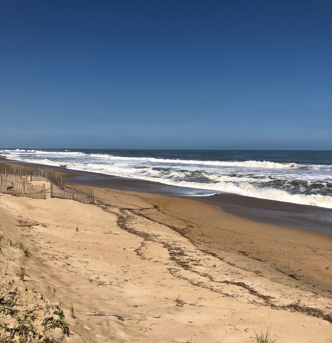
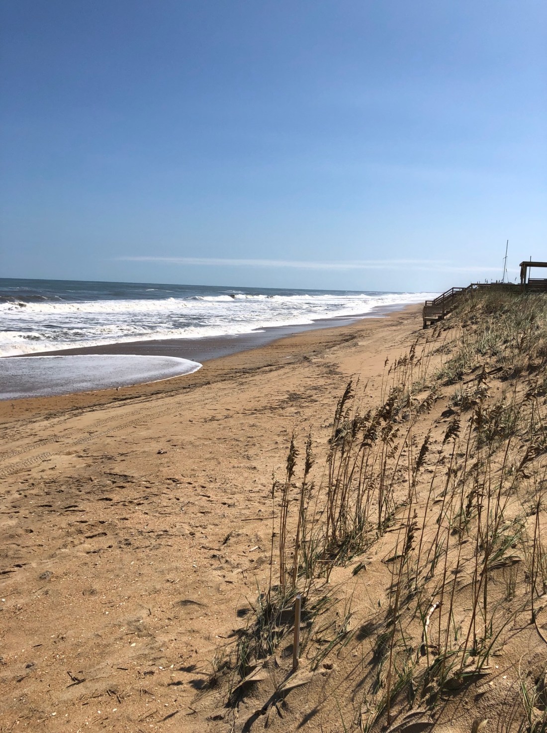
This scene shows a section of the Southern Shores oceanfront in what APTIM has labeled the “Main Placement Area,” a 10,000-linear-foot portion that it has recommended for beach nourishment.
Two oceanographers from the Field Research Facility north of Duck questioned beach-nourishment recommendations made by APTIM, the Town’s coastal-engineering consultant, at the Town Council’s special planning session Tuesday because, they said, they are “based on limited data” and “on short-term trends that are not particularly helpful.”
Despite educated reservations expressed by Dr. Katherine L. Brodie and Dr. Nicholas Cohn, about both APTIM’s research and its conclusions, three of the five Town Council members—including Mayor Tom Bennett—appeared ready to approve a beach nourishment plan for Southern Shores that will likely cost more than $16 million.
Councilman Conners qualified his interest in choosing one of APTIM’s two recommended plan options at the Council’s Oct. 1 meeting by saying he would do so “for the sole purpose of trying to get some cost” data, which strikes The Beacon as putting the cart before the horse.
Dr. Brodie, who, like Dr. Cohn, lives in Southern Shores, told the Town Council in public comments that, “Historically, Southern Shores has been one of the most stable areas of our coastline here on the Outer Banks, but,” she acknowledged, “it may not always be.”
Both oceanographers skeptically questioned APTIM’s recent calculation of an annual erosion rate that it used to increase the amount of sand volume in its recommended beach-fill plan options. These increases have led to markups in the costs of the two plans the Town Council is now considering of nearly 25 percent.
Dr. Brodie advised that “there is a lot of seasonal variability in our coastlines and so if you survey in the summer one time and in the winter another time [as APTIM did], you could just be looking at that seasonal variability, versus long-term trends.
“It’s really hard,” she continued, “to extrapolate some of these short-term and long-term erosion rates from two different data points taken at very different times of the year.”
Dr. Brodie also corrected an observation made by APTIM Program Manager Kenneth Willson, who presented his firm’s latest 18-month survey of the Southern Shores coastline. (The Town has retained APTIM for several short-term shoreline assessments over the past three years.)
Mr. Willson had stated that “sand is traveling more laterally than it is north to south.” Dr. Brodie said unequivocally that sand “transport” is north to south.
(Please see The Beacon’s 9/17/19 post for background on the beach nourishment option plans that the Wilmington, N.C.-based APTIM Coastal Planning & Engineering of North Carolina has recommended to the Town. The Beacon also wrote about APTIM’s research in blog posts on 2/28/19, 3/31/19, and 4/3/19.)
Dr. Cohn spoke Tuesday about looking at “larger implications,” not just “short-term trends.”
APTIM derived a “pretty small change in terms of erosion,” Dr. Cohn said, of the firm’s calculated rate of 3 cubic yards per linear foot (cy/lf). He cautioned that culling such a statistic from a short-term trend “may not be particularly reliable.”
Dr. Cohn also said there are more “data sets available” on the state of the Southern Shores shoreline than the consultant analyzed in its report, which goes back to 2006 and a U.S. Army Corps of Engineers survey done then.
Both Dr. Brodie and Dr. Cohn offered their professional expertise to the Town Council in helping it to make an informed and educated decision about beach nourishment. Two other oceanographers who work with them at the coastal observatory known as the Duck Research Pier, also attended the meeting, and one of them lives in Southern Shores.
Dr. Brodie described the job of making “objective decisions based on really limited data,” such as APTIM’s data, “challenging.”
In the Town Council comment period after public comments, Councilman Fred Newberry expressed an interest in learning more from the scientists.
“I heard some comments tonight from folks . . . that have a different view on how to interpret the data,” said Mr. Newberry, who suggested that another public hearing be held before the Town Council votes on beach nourishment—an idea that was resisted by Mayor Bennett and Councilmen Jim Conners and Christopher Nason.
Councilman Gary McDonald backed the idea.
“What’s [another hearing] going to give us that we don’t already have?” the Mayor asked
When Councilman Newberry said he would value more public input because “I don’t think the decision is all ours,” Mr. Conners quickly remarked: “I think we’re elected to make that decision.”
Later in the meeting Mayor Bennett made clear that he is “not favoring the more expensive option” of two that APTIM is now recommending—clearly indicating that he has decided to go forward with beach nourishment, despite the skepticism and objections of Ph.D. scientists in his own back yard.
The Field Research Facility, which was established in 1977 by the U.S. Army Corps of Engineers, has long had a website with contact information. It would not have been difficult for the Mayor or former Town Manager Peter Rascoe or any member of the Town Council to have picked up the telephone and spoken to an expert. Any one of them could have convened a public forum with Field Research Facility scientists.
If Mayor Bennett is now thinking about meeting with these experts in private—behind the scenes—The Beacon believes he would be compounding his mistake. The public trust has been damaged enough.
TOWN COUNCIL FAILS TO DO DUE DILIGENCE
Months ago The Beacon advocated procuring second opinions and objective expert evaluations of APTIM’s methodology, data, and conclusions in its Beach Vulnerability Assessment and Management Plan, which was submitted in December 2017. (See 2/28/19 and 3/31/19 posts.) Its 2019 Beach Assessment Report, submitted to the Town this month, is an 18-month update of the 2017 report.
The Town Council took no steps after Mr. Willson presented APTIM’s vulnerability and management plan at its Feb. 26 planning session—which Mr. Nason did not attend—to obtain an independent analysis. The Beacon believes it failed to do its due diligence in vetting APTIM’s research, and it further did not meet its fiduciary responsibilities. In fact, The Beacon would call it negligent.
In remarks they made Tuesday, the Mayor and Councilmen Conners and Nason, who often vote as a bloc, indicated that they have uncritically accepted APTIM’s data and recommendations. Although Mr. Nason acknowledged that the data are “limited,” and “new information” has arisen, he nonetheless pronounced APTIM’s data “good,” and “all that we’ve got.”
(See The Beacon’s 9/17/19 blog for a description of these plans, which would apply to a 15,000-linear foot area of the Southern Shores shoreline, from about Third Avenue south to the Kitty Hawk border, and cost either $14,026,800 or $16,749,900, or more, as the Mayor admitted Tuesday.)
That APTIM stands to gain financially from a beach-nourishment project in Southern Shores should have made everyone on the Council skeptical, not just the two “minority” members. Not only did Mr. Willson work with Southern Shores on the 2017 Pelican Watch project, he has arrangements with every other Dare County beach town. APTIM has cornered the beach-nourishment market on the Outer Banks.
The three majority members made clear on Tuesday their intent to base their decisions on voting for a 2022 beach-fill project on the availability of monies from the Dare County Beach Nourishment Fund, not on sufficient and reliable data or on good science.
“If we don’t act somewhat promptly, we’re going to miss out,” Mr. Nason said, “and if we miss out, then the Town is on the hook for a huge chunk of money, and we haven’t done our job.”
This opinion forecloses the possibility that the Town will actually be out nothing because it will not embark on a beach-fill project.
Mr. Conners also said that his decision “depends on how we fund this” in addition to the County’s contribution.
According to a lengthy notice written by Mr. Rascoe about the Town Council’s April 2 public hearing on beach nourishment, Dare County would kick in 50 percent of the Town’s costs.
Six months ago, Mr. Rascoe also said that the County needed to know “as soon as possible”—preferably in April—if Southern Shores would be requesting this funding, which comes from the collective occupancy taxes of the towns.
The scheduling of a 2022 beach-fill project coincides with when Duck, Kitty Hawk, and Kill Devil Hills will be doing their five-year beach-nourishment maintenance. Southern Shores also will be renourishing the Pelican Watch dunes then.
When asked Tuesday by Mr. Newberry when the Town needs to convey its funding request and commitment to Dare County, Mayor Bennett said, as Mr. Rascoe did in March, “as soon as possible,” and warned that the money could disappear if the Town did not step up.
Later, Mr. Bennett, who also expressed concern in April about the money being given to someone else, clarified the timing by saying: “In November.”
The Beacon believes a vote by the Town Council on APTIM’s recommended beach management plan options at its Oct. 1 regular meeting would be ill-advised, if it does not first–and finally–do its due diligence on the data and the financing and bring the public into the loop.
REPORT IS ENGINEERING AND STATISTICS, NOT SCIENCE
Dr. Brodie, Dr. Cohn, and their colleagues confirmed in interviews after the planning meeting what The Beacon first wrote 2/28/19: APTIM’s surveys constitute engineering and statistics, not science. Scientists know how statistics can be manipulated. Non-scientists, like those on the Town Council, who typically do not know how to analyze statistics and critically scrutinize engineering surveys, should talk to people who do.
The Beacon has long been troubled by how APTIM arrived at its conclusions about how much sand volume it believes is required in sections of the Southern Shores shoreline to sustain the beaches. Its calculations of sand-volume “density” in cubic yards per linear foot are what informs its recommendations and are based on a design storm model.
As it explained in its vulnerability assessment, APTIM used technology to simulate the characteristics of the 2003 storm, Hurricane Isabel—its wave heights, wave period, water level, and duration—at three different sea levels to derive its target goals of sand-volume density. It came up with goals of either 846 cy/lf or 858 cy/lf, depending on the portion of the beach. Because a 15,000-linear-foot section of the Town’s shoreline falls short of APTIM’s target goals, the firm recommended beach nourishment there.
The Beacon would like to ask Dr. Brodie or Dr. Cohen what she or he thinks of APTIM’s storm-model methodology, or what Dr. Brodie called “numerical modeling and analysis.” Is APTIM’s methodology valid? Two of the sea-level scenarios APTIM considered strike The Beacon as dubious; one of them simulated “the storm with 30 years of sea-level risk from present day (2048 equivalent).”
Are the target volume-density goals truly significant? Or are they just theories about sustaining the beaches that lack real evidence? Should they compel an investment in excess of $16 million?
The skepticism of these scientists, who are readily available to the Town Council, should be enough to stop the Council from going forward with beach nourishment. To do otherwise strikes The Beacon as grossly irresponsible.
At a March 2018 meeting of the Town Council, Ken Willson presented his firm’s 2017 assessment of the Southern Shores beaches. He said then that “the shoreline is looking fairly stable” and there is “no big rush” to “jump” on beach nourishment.
“I think time is in on your side,” he concluded.
At the time Mr. Willson’s company had surveyed 22 beach “profiles,” which are shoreline locations that are spaced 1,000 feet apart from each other, and determined that 1) the shoreline is “stable,” having lost only 0.4 feet (that’s five inches) between 2006 and 2017; and 2) the volume of sand in the system had actually increased during the same time period. APTIM has used these profiles in subsequent surveys.
Despite the positive report, Mr. Willson recommended that the Council authorize APTIM to conduct a “vulnerability assessment of the oceanfront structures [i.e., houses]” and to determine the “minimum cross-section of [sand] volume” that should be maintained to protect the shoreline from storm damage. That minimum cross-section is what he calls the volume density.
The Town Council unanimously agreed.
So, it is that only 18 months after Mr. Willson gave the Southern Shores shoreline a clean bill, three of five Town Council members appear on the verge of committing the Town—meaning taxpayers—to an expenditure of at least $8, $9, $10 million, on the basis of questionable data and without truly understanding how the financing would work.
It was abundantly clear Tuesday that, although Town Council members remember the name of the father-son financial-adviser team from Charlotte that spoke to them in February, they know very little about the financial planning process, much less the impact project funding will have on their constituents.
“We need to have more transparency on how much this is going to cost,” said Yvonne Duiker of Kingfisher Trail at the April 2 public hearing. The same is true today.
Doug and Andrew Carter of DEC Associates told the Council in February that their consulting fees would be $35-$40,000 for developing a financial plan and setting up a “beach fund” for the earmarked funds; and $30,000 for working on finding the financing, which is typically for five years. In another five years, more funding would be required to finance maintenance of the beach-fill.
Both Councilmen Conners and Nason previously have expressed interest in special obligation bonds, which permit the Town to set up “municipal service districts” and to levy different tax rates within the MSDs, so that, for example, people who own oceanfront property—many of whom are absentee owners—would pay more than other property owners do for the beach fill.
But this is only one option that the Carters mentioned, and it is a disadvantageous one to many of Mr. Nason’s and Mr. Conners’s constituents—enough so that they personally should be researching other options before they make any decision on beach nourishment. They, and their colleagues, have a financial fiduciary responsibility to the public they serve. It’s past time that they exercise it.
COUNCIL HAS TOO MUCH CONSOLIDATED POWER
We conclude by observing that, as is true in so many other Town matters, the formation of a technical committee on beach nourishment would have been helpful to the elected officials. It could have been formed under the auspices of a Town planning committee, which the Town once had, along with a finance committee. The Town Council needs advisers who have knowledge, skills, and perspectives that they lack. They don’t have—and are not expected to have—all of the answers.
Ever since the Mayor, Mr. Nason, and former Town Councilman Leo Holland, who served from 2013-17, eliminated all of the Town’s standing committees, except one—the capital improvements committee, which the Mayor and the like-minded Mr. Conners co-chair—too much discretion, power, and decision-making authority have been vested in three people, or 1/10 of one percent of the Town’s population. This consolidation has led to a bogging down of action on important issues, such as nonconforming lots, and to ill-formed discussions on the Town Council of others, such as special-event houses.
That has to change.
NEXT UP: The Beacon looks at updating the Land-Use Plan, a document that identifies the concerns, priorities, and aspirations of the entire community, as well as how well the Town is meeting the management goals, policies, and other requirements imposed by the Coastal Area Management Act (CAMA). Typically, during the update process, property owners are surveyed on long-range planning goals for the Town and given an opportunity to “speak out” at a community-wide forum.
That the opinions and other data underlying the current Land-Use Plan, which was finally certified by the N.C. Coastal Resources Commission in 2012—after having been submitted by the Town in 2008 (the CRC had many questions)—date back more than 10 years is a serious problem. The years-long update process will require a consultant to oversee and does not need to be delayed until 2020 U.S. Census data are available—as Councilmen Conners and Nason seemed to believe Tuesday. The sections on population, growth trends, and other demographic data may be inserted when available.
Although a 10,000-linear-foot central area on the Southern Shores oceanfront experienced both an increase in sand volume and a “positive shoreline change” between December 2017 and May 2019, the Town’s coastal engineering consultant recommends in a new report that the so-called “Main Placement Area” undergo beach nourishment.
APTIM Coastal Planning & Engineering of North Carolina also recommends beach nourishment, aka “fill,” for a 5,000-linear-foot area south of the Main Placement Area, which it calls the “Transition Area” and where it reports a minor loss in sand volume and beach width (shoreline change) during the same time period.
A third analyzed “portion” of Southern Shores’ 3.7-mile shoreline, which is north of the Main Placement Area and starts around Fifth Avenue, also gained sand volume and underwent a positive change in width, APTIM reports, and is not a target for nourishment.
Mr. Willson will present the results of his firm’s latest beach survey to the Town Council today at its special planning session, which starts at 5:30 p.m. in the Pitts Center. The Town Council may decide to choose from among the “design options” that Mr. Willson recommends for a Town beach nourishment plan, which would occur in summer 2022, with financial planning starting next year.
Earlier this year, the Town Council and Southern Shores property owners considered APTIM’s 2018 Vulnerability Assessment and Beach Management Plan, which the company filed with the Town last December.
The cost estimates for three beach-fill plan “options” submitted by APTIM in its 2018 assessment report ranged from $9 million to $13.5 million. The projected costs of the two options that Mr. Willson now recommends are $14,026,800 and $16,749,900—substantial increases in costs that property owners already found daunting.
(See The Beacon, 2/28/19 for background on the 2018 assessment report and a writeup on the Town Council’s Feb. 26 special planning meeting. The Beacon subsequently reported on a public hearing on beach nourishment held by the Town Council April 2.)
The controversial subject of beach nourishment tops this evening’s overly ambitious Town Council meeting agenda. Also on the agenda are the following important town-planning matters, ranked in an order determined by Mayor Tom Bennett:
*Future capital rehabilitation/replacement of Town buildings
*Capital apparatus/equipment needs of The Southern Shores Volunteer Fire Dept.
*Town land-use plan update
*Town-wide walking path system
*Seasonal cut-through traffic
*Stormwater
The Beacon believes these concerns are upside-down in terms of importance to Southern Shores property owners, with seasonal cut-through traffic and stormwater runoff being bread-and-butter concerns that deserve airing before discussion about Town buildings, an update of the Land-Use Plan, and a town-wide walking path system.
A town-wide sidewalk system has never been discussed by the Town Council before, nor has it been a subject of public comments by property owners at Council meetings.
****
Returning to beach nourishment . . .
The shoreline that APTIM calls the Main Placement Area extends from near Third Avenue south to about 450 feet south of where Chicahauk Trail intersects with Ocean Boulevard. Although this area experienced a gain in sand volume, APTIM does not consider the gain to be sufficient.
An area that APTIM refers to as the “taper” extends about 500 feet north of Third Avenue. Above the taper is the northern portion of the Southern Shores shoreline, which starts just north of Fourth Avenue and ends at the Southern Shores-Duck border. This area is not included in any beach-nourishment plan option.
The Transition Area of the Town’s shoreline extends from the southern border of the Main Placement Area to the town’s border with Kitty Hawk. According to APTIM’s 2019 update, this area averaged a sand-volume decrease of about 27 cubic yards per linear foot between December 2017 and May 2019.
The Southern Shores shoreline, according to APTIM’s 2018 assessment report, is highly variable, in terms of the height and width of the primary dune, the distance that residential structures are set back from the vegetation line, and the rates of sand-volume change. Again, in its 2019 report, as it did in its earlier assessment, APTIM describes the shoreline as “relatively stable.”
As explained in the 2018 report, APTIM used special technology and design storm scenarios to arrive at target sand-volume densities in cubic yards per linear foot (cy/lf) that it says must be maintained along the Southern Shores oceanfront in order to sustain it.
The engineering technology it used is known as a “Storm-Induced Beach Change Model” (SBEACH). The results that APTIM obtained with its model, according to its 2018 assessment report, “informed the development [of the beach-nourishment plan options] with regards to what sections of the Town may be vulnerable to impacts from the design storm, and what amount of additional [sand] volume would be required to reduce that vulnerability.”
In other words, APTIM based its 2018 assessment report recommendations of sand volume density on theoretical storm scenarios. The coastal-engineering firm also conducted a physical assessment of the Southern Shores beach in February 2018.
BEACH-NOURISHMENT PLAN OPTIONS
In its 2018 assessment report, APTIM recommended the following beach nourishment-options for “managing” the Southern Shores shoreline:
2017 DESIGN OPTION ONE, projected to cost $11,593,000, targeted a volume-density goal of 846 cy/lf. The average density measured along the Main Placement Area in APTIM’s December 2017 survey was reportedly 801 cy/lf. Therefore, Option One posited a recommended “fill density” of 45 cy/lf. At this density, the Main Placement Area would require 450,000 cubic yards of sand.
Option One also included fill for the taper and Transition Area. The average volume density measured along the Transition Area in December 2017 was 818 cy/lf. Altogether, the total volume of sand projected for this option nearly two years ago was 665,650 cubic yards.
2017 DESIGN OPTION TWO, projected to cost $9,010,400, also targeted a volume density of 845 cy/lf, but recommended adding only 30 cy/lf to the Main Placement and Transition areas. The total sand volume for Option Two was 492,300 cubic yards.
2017 DESIGN OPTION THREE, projected to cost $13,557,000, targeted a volume density of 858 cy/lf. This option’s total design volume for the taper, Main Placement, and Transitions areas of the shoreline was 803,050 cubic yards.
APTIM has updated design volumes, based on changes that have occurred to the oceanfront since the December 2017 survey. In doing so, it notes, significantly:
“The measured rate of erosion that occurred along the portion of the Town where beach fill is being recommended [the 15,000-linear-foot Main Placement and Transition areas] averaged 3 cy/lf/yr. This volume was used to determine the amount of advanced fill to include in the beach fill options, resulting in an increase of 225,000 cy for each option.”
It now presents the recommended options as follows:
2019 DESIGN OPTION ONE: The total design volume decreased by 60,000 cubic yards, from 600,000 cy to 540,000 cy. “However,” the 2019 report states, “with the significant increase in the advanced fill, the total volume required for Option One increased by 162,750 cy or 24 percent.”
2019 DESIGN OPTION TWO: “Given the erosional trend measured along the southern 5,000 feet of the beach, Design Option Two is essentially the same as Design Option One,” the report states.
2019 DESIGN OPTION THREE: The total design volume remained the same at 720,000 cy. “However,” the 2019 report states, “with the significant increase in the advanced fill, the total volume required for Option Three increased by 222,750 cy or 28 percent.”
With the increase in volume that APTIM recommends, the cost for Option One has increased by 21 percent to $14,026,800; the cost for Option Three has increased by 24 percent to $16,749,900.
APTIM concludes its 2019 report by recommending that the Town:
1) Determine which option to pursue;
2) Continue coordination with Dare County and neighboring communities;
3) Initiate financial planning, which will require professional financial advice;
4) Initiate permitting and design of the beach bill, projected to start in February 2020;
5) Continue monitoring the Southern Shores beaches
Projected construction would occur in summer 2022, when the Towns of Duck, Kitty Hawk, and Kill Devil Hills are doing five-year maintenance (renourishment) of their beach-fill projects. A collaborative effort would save on expense, APTIM points out.
The “biggest cost” in any beach-fill project, Mr. Willson told the Town Council in February, is sand, especially if its source is distant.
Doug and Andrew Carter, the father-son team who own DEC Associates in Charlotte, explained the various complicated methods available for beach-nourishment funding to the Town Council at its Feb. 26 special planning meeting.
Popular among these methods are special obligation bonds, which permit a town to set up “municipal service districts” and to levy different tax rates within the MSDs, Andrew Carter explained, so that, for example, people who own oceanfront property would pay more than other property owners do for the sand fill/replenishment.
Once a beach town embarks upon a nourishment plan, said Mr. Carter, whose firm specializes in N.C. shoreline protection financial planning, it commits to “long-term planning” for future periodic maintenance and beach operating costs.
He echoed Mr. Willson’s earlier assertion at the February meeting that beach nourishment is “an exercise in adaptive management. . . . It is never seen as a one-time event.”
The question for the Southern Shores Town Council and its constituents is whether APTIM’s data compel Southern Shores to make the “forever” commitment to beach nourishment now. The Beacon believes both the data and the commitment deserve further thoughtful study.
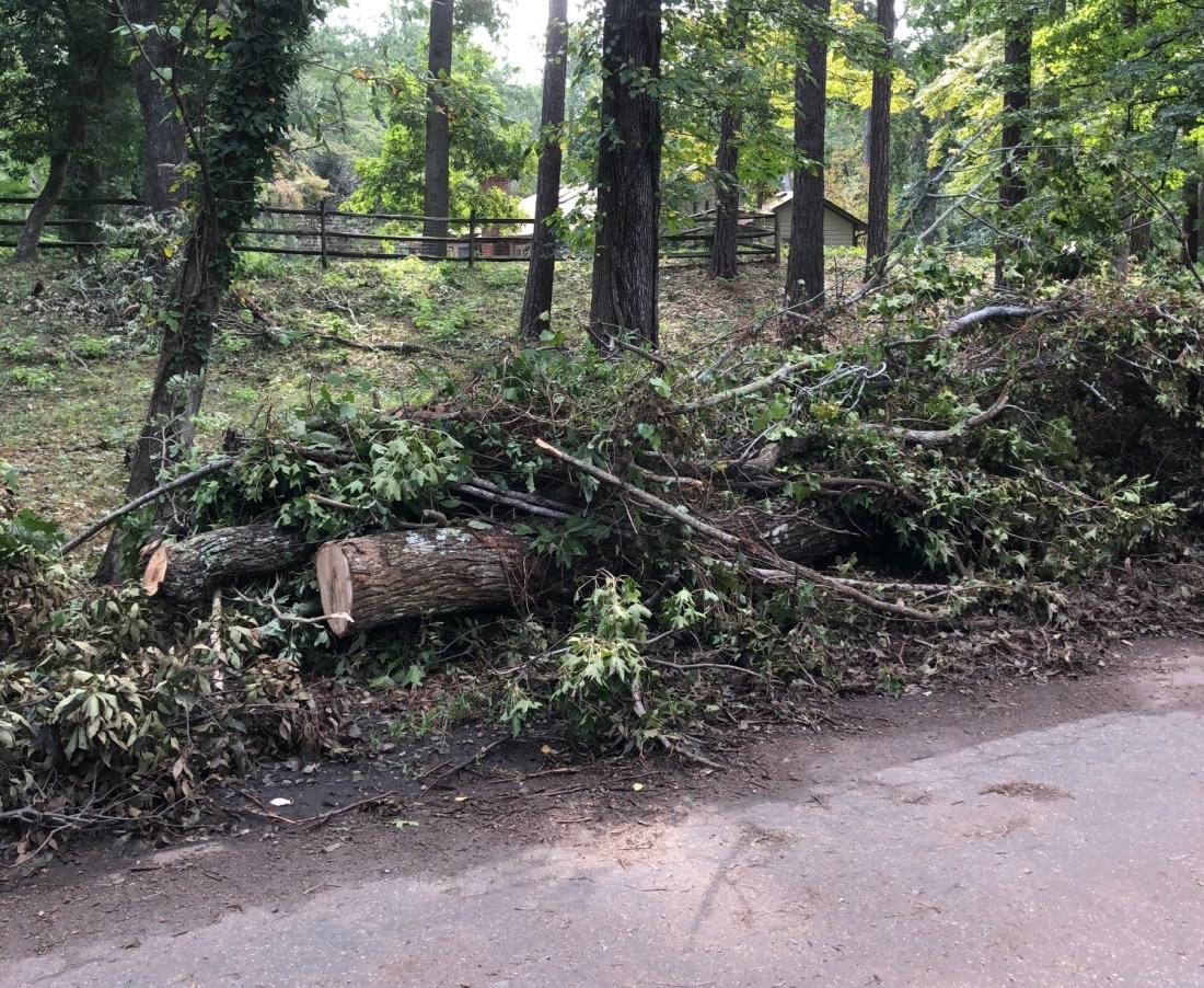
Storm debris pickup on both Town-owned and private streets will begin next Monday, the Town of Southern Shores announced today.
As previously reported, the Town requests that you separate your vegetative debris (tree trunks, limbs, etc.) from your construction and demolition debris (shingles, siding, etc.) and pile up both in the right-of-way, not in the street, for removal. Debris that is bagged will not be removed. Damaged appliances and other large-item goods, such as outdoor furniture, will be picked up during the fall bulk-item collection, which has been postponed from October to November.
BEACH NOURISHMENT, IMPORTANT MEETING: The Town Council is holding an important long-range planning meeting tomorrow at 5:30 p.m. in the Pitts Center, during which the Council may vote on whether and how to proceed with one of three beach nourishment options, presented in a “2018 Vulnerability Assessment and Beach Management Plan” by consultant APTIM Coastal Planning & Engineering of North Carolina, Inc.
APTIM Program Manager Kenneth Willson will explain tomorrow the results of his company’s 2019 update assessment of the Southern Shores beaches for shoreline and volumetric (the amount of sand) changes. A negative shoreline change shows landward movement in the width of the beach (a loss), whereas a positive shoreline change shows seaward movement (a gain).
APTIM’s report analyzes the Southern Shores beaches in portions. A southern 5,000-foot portion from approximately 450 feet south of Chicahauk Trail to the Southern Shores-Kitty Hawk boundary experienced the most negative changes, the report shows.
In contrast, a northern 5,000-foot portion of beach from about 70 feet south of Fifth Avenue north to the Southern Shores-Duck boundary experienced the most positive shoreline and sand-volume changes.
The northern oceanfront gained sand volume between December 2017 and May 2019, according to the report, as did an in-between 10,000-foot portion, known as the “Main Placement Area,” from the Fifth Avenue point to the Chicahauk Trail point.
APTIM’s report is not easy reading, and The Beacon has only just skimmed the Executive Summary and Conclusions. The bottom line is that Mr. Willson is recommending that the Town Council choose one of two of the three beach-management “design” options that he previously outlined in the 2018 Beach Management Plan. It is unfortunate that, as far as The Beacon could discern, these options are only referenced in the 2019 report as Design Option 1 and Design Option 3, with recommended updates to the amount of beach fill being proposed, and their original descriptions are not reproduced in full. (Pages 24-25 of the 2019 report.)
The Beacon will try tomorrow to post further details about the alleged shoreline and sand-volume changes to the beaches, as well as a comparison of the two options that Mr. Willson is recommending, before the 5:30 p.m. meeting. The cost of each plan has substantially increased, according to the 2019 report. Design Option 1 now costs $14,026,800 (up 21 percent) and Option 3 costs $16,749,900 (up 24 percent).
Mayor Bennett has called beach nourishment “the elephant in the room.” The Beacon wonders how much of an elephant it would be if all property owners, who financially benefit from and enjoy the Town’s beaches, were taxed equally for any project.
Only vegetative debris and construction and demolition debris will be picked up during the Town’s storm cleanup at a time still to be determined, according to an announcement issued by Town Hall yesterday. Appliances, furniture, and other bulk items damaged during Hurricane Dorian will not be picked up until the fall large-item collection, which is now scheduled to occur in November, rather than October, according to the email notice.
The Town asks that residents place their vegetative debris and construction debris in separate piles in the right-of-way. As Interim Town Manager Wes Haskett advised at the recent Town Council meeting, the debris-collection contractor will make only “one pass through Town.” Debris pickup on private streets will likely occur on a different date than the one set for collection on the Town-owned streets.
The Beacon will notify you of the debris-collection schedule as soon as the Town announces it.
In The Beacon’s Sept. 12 post, we publicized two upcoming Town meetings, one of the Planning Board on Monday at 5:30 p.m. in the Pitts Center and the other as follows:
BEACH NOURISHMENT: The Town Council will meet for a special long-range planning session Sept. 17 at 5:30 p.m., also in the Pitts Center. The agenda for this special meeting is loaded. At the top of it are a presentation by the coastal engineering consultant of the latest beach survey results and the Council’s consideration of beach nourishment. Additional topics, which merit their own exclusive forums, include: seasonal cut-through traffic, stormwater runoff, rehabilitation/replacement of town buildings, an update of the Town’s land-use plan, and more.
The Beacon further advises that the “2019 Beach Assessment Report” submitted by APTIM Coastal Planning and Engineering of North Carolina, is included in the meeting packet of materials, which you may access here:
We strongly urge all property owners to read the “Executive Summary” of this report, if not the entire report. Both the need for beach nourishment in Southern Shores, which has long had stable beaches—unlike those in neighboring towns—and the method of raising revenue to pay for any nourishment project that the Town Council may approve are key questions for Town property owners that are not without controversy.
The Beacon will try to analyze the consultant’s 2019 assessment report on Monday. If time does not permit, we will preview it Tuesday morning.
Much of the roadside “debris” in town is impressive in size.
The confusion was evident Tuesday evening in their questions, in their facial expressions, and in the unanimous decision they made to instruct the Town Planning Board to continue to look for “further exceptions” to the nonconforming lots ordinance they enacted Sept. 5, 2018: The Southern Shores Town Council still does not have a grasp on how the Town Code currently deals with nonconforming lots and whether its regulation reflects good land-use planning, in light of how the town was platted and lots were sold.
The intent of the Town’s nonconforming lots ordinance, which is Code sec. 36-132 (“Regulation of Structures and Uses Nonconforming”), is to restrict the number of lots being developed that do not conform to the Town’s minimum dimensional requirements. In the RS-1 single family residential district, where most of us live, Town Code sec. 36-202(d) specifies that the minimum required lot area is 20,000 square feet, and the minimum required lot width is 100 feet.
Unfortunately, while these dimensions readily apply to oceanfront lots and other lots on Ocean Boulevard, they do not comport with standard-size lots in sections of the town that were platted and developed later.
There has long been regulation in Southern Shores of nonconforming lots. Last September the Town Council did not enact a new ordinance; it enacted a replacement ordinance. As Town Attorney Ben Gallop explained Tuesday (yet again), the previous sec. 36-132 contained “loopholes.” The language of the ordinance, he said, “was loose.”
While The Beacon has disagreed with Mr. Gallop’s interpretation of the previous ordinance, we agree that it was not clearly and unambiguously written.
When the Town Council unanimously voted Tuesday to approve ZTA 18-09PB01, which carves out exceptions to the replacement Town Code sec. 36-132, it did so to alleviate “hardships” experienced by property owners, as Councilman Fred Newberry noted. The Beacon supported relief for all such owners who do not own oceanfront property.
Each of the exceptions enumerated in ZTA 18-09PB01 could be, and has been, identified in public meetings by the last name of the property owner who was disadvantaged by replacement Town Code sec. 36-132, which tightened up the preexisting 36-132: Hurd, Ausband, Love, Roughton. Those of us who have followed the Planning Board’s deliberations know which of the measure’s provisions is “the Hurd exception” or “the Love exception.”
Planning Board Chairperson Elizabeth Morey told the Town Council Tuesday that her Board’s intent with ZTA 18-09PB01 was to create a “very targeted list of exceptions.” The Planning Board deliberately identified “which lots we wanted to give exceptions to,” she said, based on “conditions that we were aware of.”
Ms. Morey indicated that the Planning Board would be willing to consider drafting more zoning text amendments to create more exceptions to sec. 36-132.
The Beacon believes that taking such an approach would be a major mistake.
The Beacon asks: Why is the Town Council stuck on this issue and metaphorically running in place? Why are members continuing to consider the issue of regulating nonconforming lots as a matter of carving out exceptions to the rule, rather than examining the equities of the rule? Where is the wholistic view? The big-picture approach?
Perhaps it is the legal language of Town Code section 36-132 and the legal language of proposed amendments to the section that confound Mayor Tom Bennett and the four Town Council members. Or perhaps it is a lack of preparation, follow-through, and comprehension on the part of individual members of the Council.
Certainly the Town Council has not “owned” the issue by showing initiative and leadership. That one member, Councilman Christopher Nason, who voted against the replacement nonconforming lots ordinance enacted last September, has had a business and personal relationship with a well-known property owner who would like to develop a nonconforming 50-foot-wide oceanfront lot certainly has not furthered thoughtful discussion among them. Nor has that property owner’s decision to have his attorney, Starkey Sharp, speak in his behalf at Planning Board and Town Council meetings.
On Tuesday night, Council members not only went over old ground, they asked Interim Town Manager/Planning Director Wes Haskett to do an assessment of nonconforming lots in Southern Shores—a task that he has already done, and the results of which he has already submitted and posted on the Town website.
After a months-long effort, undertaken pursuant to a Feb. 5 request by the Town Council. Mr. Haskett presented the results of a survey he compiled with the help of Town Permit Officer Dabni Shelton and the Dare County Register of Deeds office at a special April 23 meeting of the Planning Board. He reported its completion to the Town Council at its May 7 meeting. (These dates are contained in a staff report prepared by Mr. Haskett, which was included in the Council’s Sept. 10 meeting packet.) This information is readily available online:
The Beacon is not going to hazard a guess as to how many Town Council members have accessed and studied these data.
We first reported the survey results on 4/24/19 and have referenced them subsequently in other postings. We also have repeatedly credited local builder and Southern Shores native Matt Neal, who is running for Town Council, with presenting maps and lot information to the Planning Board and the Town Council, starting many months ago, that should have informed both boards about where the nonconforming lots are and why.
The fact is, most current nonconforming lots were platted that way. Lot-size standards differed from area to area, as Southern Shores was developed. There are apples and oranges throughout town.
Mr. Haskett reported in April that there are 3,037 total lots in Southern Shores, 846 of which—or about 28 percent—are less than 20,000 square feet in area. He also reported that, of the 3,037 lots, 241 of them, or about 8 percent, are 50-foot-wide lots that are part of parcels consisting of two or more lots. Of these 241 lots, 28 are vacant: They represent less than 1 percent of the total number of lots in Southern Shores
Perhaps it “all boils down to,” as Councilman Gary McDonald said during the Town Council’s discussion Tuesday, a lack of planning by the Council itself.
“This Board needs a plan to go forward with,” Mr. McDonald said, after noting that it is up to the Council to determine “what the town wants.”
The Planning Board and the Town Council have been kicking around the problem of developing nonconforming lots in town for at least 17 months. It arose because property owners on and near the oceanfront were demolishing structures that were built on 100-foot-wide parcels and selling off the land as two 50-foot-wide lots, each of which could be developed, thus doubling the number of houses. The replacement Code sec. 36-132 stopped this trend, but its regulatory mechanism extended too far.
Councilmen Nason and McDonald delved Tuesday into changing what Mr. McDonald called “zoning districts” in order to reflect the realities of how Southern Shores was platted and developed. The Beacon believes this is thinking oriented in the right direction. If the minimum dimensional requirements imposed by the Town Code according to residential district do not reflect the realities of Southern Shores, then changes must occur.
It is unfortunate that the Town Council seems incapable of giving even basic informed direction to the Town Planning Board about such changes. In concluding the Council’s discussion on nonconforming lots, Mayor Bennett spoke of “pass[ing] this venture to the Planning Board” for “further ordinance consideration.”
DELAY OF TOWN MANAGER HIRING
Mayor Bennett also chose to delay any action in the search process for a new town manager until the new Town Council is seated in December.
By the time the first step in the selection process is initiated, it is likely to be January, nearly six months after former Town Manager Peter Rascoe announced his retirement.
Councilmen Gary McDonald and Fred Newberry protested this delay, but to no avail. A motion made by the Mayor to have the new Town Council, which will be seated in December, handle all aspects of the town-manager hiring, even the selection of the search firm that the Town will use, was seconded by Mr. Conners and supported by him and Mr. Nason in a 3-2 vote.
Per the Town Council’s request last month, Interim Town Manager/Planning Director Wes Haskett compiled a list of four search firms (aka recruiters) for the Town Council to consider. They are N-Focus of Kannapolis; Developmental Associates, LLC, of Chapel Hill; The Mercer Group, Inc., of Raleigh; and Hartwell Wright of Raleigh. Mr. Haskett did not explain how he happened to choose these four, nor did any Council members inquire.
Mr. Newberry questioned the Mayor’s motion—pointing out all of the steps that must be taken in the hiring process, from selecting the search firm, to advertising the position, to reviewing applicants, interviewing attractive applicants, etc. He then asked him why he would deliberately delay the process, to which Mr. Bennett replied: “What’s the harm?”
Mr Bennett followed up with a statement that The Beacon considers very biased: “We have a manager in place, and he’s doing a fine job.”
“That’s not the issue,” Mr. Newberry replied, making the case for opening up the search for the benefit of the public, who might like more choices in, and a voice in choosing, who runs the everyday operations of the Town.
“We owe it to the public,” Mr. Newberry said, to “give them that opportunity.”
Councilman Nason, who clearly was the swing vote in this decision, expressed concern over the “qualities” that he might seek in a new town manager versus the qualities that the new Town Council might seek.
“I don’t want to saddle the new Council with my opinions,” he said.
The Beacon doubts that people would disagree much, if any, over the necessary qualifications for a good town manager. That wheel has already been invented. We also do not see how interviewing the four firms; selecting one from among them; and having that firm advertise the position would do anything but assist the new Town Council in the search process. The hiring decision rightfully belongs to the new Council.
After the vote was taken, Councilman McDonald persisted in his protest of it, saying to the Mayor: “I personally feel that this is just delaying the process. You were not in favor of going forward with this process at the last meeting. This is just a delay tactic, Tom.”
Annoyed, Mr. Bennett terminated all further discussion, citing the vote, and saying, “That’s pretty much the end of it.”
That we have a mayor who thinks he can anoint the next town manager, according to his own personal preference (Wes is “doing a fine job”), is appalling to The Beacon. He is only doing a disservice to Mr. Haskett, who deserves to earn the job competitively.
We also wonder how Mr. Haskett can adequately serve as both town manager and planning director for six months. Doesn’t the Town need both? Mayor Bennett said nothing about the workload that Mr. Haskett will be shouldering until a new town manager is hired or, if he is promoted, until a new planning director is hired.
The Town paid Mr. Rascoe $206,913 in total salary and benefits for FY 2018-19 and had budgeted $214,902 for his salary and benefits in FY 2019-20. Mr. Rascoe was the highest paid town manager on the Outer Banks. (The Beacon has salary data from the other beach towns and still intends to write a story.)
As deputy town manager/planning director, Mr. Haskett earned $108,260 in total salary and benefits in FY 2018-19 and is slated to earn $112,613 in FY 2019-20. He is receiving only $1,000 more per month ($250/week) for taking over Mr. Rascoe’s job.
It would seem that the Mayor’s delay decision may prove the expendability of a staff position. Certainly, it saves taxpayers money.
IN OTHER NEWS FROM TUESDAY’S MEETING:
DEBRIS REMOVAL: In his Town Manager’s report, Mr. Haskett said that he hopes to be able to announce the Town’s debris removal schedule and protocols by the end of the week. There will be only one debris pickup, he said, “one pass through the town,” so you must have your debris in the right-of-way and ready for pickup when your time arrives. The Town will send a special announcement by email to its newsletter subscribers and post a notice on its Facebook page when the schedule is known.
If the storm is declared to be ineligible for FEMA assistance, Mr. Haskett said, there may be restrictions on pickups from private streets in town.
SOUTH DOGWOOD TRAIL SIDEWALK CONTRACT BID OPENING DELAYED; ADA COMPLIANCE TO BE DETERMINED: Mr. Haskett also reported that the South Dogwood Trail sidewalk bid opening that was scheduled for Sept. 5 has been postponed to Oct. 3 at 10 a.m., in order to give the Town time to ensure that the sidewalk design complies with the Americans With Disabilities Act (ADA).
According to Mr. Haskett, the Town will “have a small number of sections of the path [design] evaluated” for ADA compliance prior to the opening of the bids. If redesign of the walkway is necessary, there may be cost added to the contract.
Homeowner Al Ewerling of South Dogwood Trail has adamantly insisted at Council meetings that the Town Engineer’s sidewalk design comply with the ADA.
In public comments Tuesday, Mr. Ewerling expressed appreciation for the Town’s decision to evaluate the sidewalk design with the ADA in mind, but he also advised that “The Town seems to be doing [things] backwards,” by building a sidewalk before it addresses the Town’s traffic problems, especially on South Dogwood Trail.
CUT-THROUGH TRAFFIC: As for the traffic, The Beacon gave an update on the petition to dead-end Hickory Trail at Hillcrest Drive and on the Town Council-sanctioned traffic committee yesterday. We will further mention only that Lauren Van Riper, of Hillcrest Drive, made quite an impression when she told the Town Council that she has twice been hit by moving cars when she has retrieved her mail at the road! Ms. Van Ripen also described being stuck in her home during summer weekends, from 8 a.m. to 8 p.m., because of traffic backups on Hillcrest Drive, and having drivers honk at her when she tries to pull out of her driveway.
Norman St. Laurent of Hickory Trail repeated his urgent request for police enforcement of the 25-mile-an-hour speed limit on his street.
UPDATE FROM LIBRARY COMMITTEE: Chairperson Michael Fletcher reported that the Exploratory Committee for a Potential Branch Library in Southern Shores has eight members on it, including non-voting members. The committee has done a “property suitability” study of “four or five” potential library sites, he said, and one of them, which he would not identify, is “very promising.”
Mr. Fletcher also said the committee would be generating a survey to distribute to surrounding communities to determine “their potential use of the library.” He concluded by saying that he was “optimistic” that the committee’s work would be “done in the next few months.”
“We’re making pretty good progress,” he said.
COMING UP NEXT:
The Planning Board meets Monday, Sept. 16, at 5:30 p.m. for its regular monthly meeting in the Pitts Center.
BEACH NOURISHMENT: The Town Council will meet for a special long-range planning session Sept. 17 at 5:30 p.m., also in the Pitts Center. The agenda for this special meeting is loaded. At the top of it are a presentation by the coastal engineering consultant of the latest beach survey results and the Council’s consideration of beach nourishment. Additional topics, which merit their own exclusive forums, include: seasonal cut-through traffic, stormwater runoff, rehabilitation/replacement of town buildings, an update of the Town’s land-use plan, and more.
The intersection of Sea Oats Trail and Duck Road around midday on Monday.
Dear Readers:
I will be posting a full report of last night’s Town Council meeting tomorrow. Because of preexisting commitments, I do not have the time today to do more than post a few highlights.
Many of you will be interested to know that David Watson withdrew his petition to dead-end Hickory Trail at its intersection with Hillcrest Drive. Mr. Watson, a homeowner on Hickory Trail, is now a member of Tommy Karole’s Town Council-sanctioned committee to explore ways to curb the cut-through traffic. Mr. Karole announced last night that Victoria Green, a homeowner on Hillcrest Drive, is also a member of this committee, which Councilman Fred Newberry oversees.
Mr. Karole reported to the Town Council that he anticipates holding two public forums on the traffic this fall, one next month and the second in November. He further provided an email address where people can reach him: TOSStraffic@gmail.com. Interim Town Manager Wes Haskett will be meeting with Mr. Karole soon to discuss setting up a Town email address for his committee. Communications with Mr. Karole will be a matter of public record.
Mr. Karole and his family have been coping this summer with the illness and death of a very close loved one. The Beacon extends its sincere condolences to Tommy, his wife, and children.
Despite frequent trips out-of-town during the past three months, Mr. Karole said last night that he has talked to a number of people about their cut-through traffic solutions. He also has been carefully considering committee members and will likely add more to a group that he would like to be representative of the different areas of town.
The Beacon would like to thank everyone who contacted the Mayor and Town Council about the petition signed by Hickory Trail and Red Bay Lane property owners, whether you opposed or supported it. As I said on The Beacon Facebook page yesterday, I viewed the petition as the start of a much-needed community conversation. In public comments last night, I called it a “cry for help.”
Please don’t go away. Keep raising your voices. And make a point of attending all public forums and asking Town Council candidates where they stand on this important issue.
NONCONFORMING LOTS
In other action last night, the Town Council, as expected, unanimously approved ZTA 18-09PB01, which grants exceptions to the nonconforming lots ordinance (Town Code sec. 36-132), enacted last September, to known individual property owners. The vote was 4-0 because Town Councilman Christopher Nason was recused.
During the public hearing on ZTA 18-09PB01, Councilman Jim Conners heatedly interrupted remarks I was making, seeking to prevent me from using the words I chose to use. I was not being profane or inflammatory in my advocacy.
Interruptions by the Town Council during public remarks have long been considered inappropriate; hostile interruptions like Mr. Conners’s are even more objectionable.
I was explaining how a 50-foot-wide oceanfront lot at 64 Ocean Blvd. was created from a 137 ½-foot-wide vacant parcel owned by SAGA Realty and Construction when Mr. Conners cut me off, and Mayor Tom Bennett intervened, seeming to support his objection. The Mayor certainly did not chastise his colleague for censoring me.
My personal opinion is that ZTA 18-09PB01 is ill-conceived and that the subject of nonconforming lots—which exist throughout Southern Shores because of how the town was platted and developed—should be considered wholistically in big-picture planning.
It does not make sense to apply the minimum dimensions for oceanfront lots, for example, to lots in the dunes and elsewhere that were not platted with the same dimensions in mind.
Local builder and Town Council candidate Matt Neal has been carrying maps of the town, showing the variations in lot area and width, to public meetings since at least last January, perhaps even last year. Despite Mr. Neal’s presentations, the Town Council has supported a piecemeal approach of identifying exceptions to the prohibition of nonconforming lots in town.
Again last night, Mr. Conners made a motion, which was unanimously approved, to refer the issue of nonconforming lots back to the Town Planning Board to “look for further exceptions.” Mr. Conners singled out as possible exceptions lots in Seacrest Village.
It has long been known that Seacrest Village is a community of nonconforming lots. This should not be news to any Town Council member. Mr. Neal has publicly stated this fact on several occasions, including before the Town Council, and The Beacon has published it. Nonconforming lots on Skyline Road and Wax Myrtle Trail also have been discussed before the Town Council and the Planning Board.
I will end this writeup about last night’s meeting, which I intended to be brief, with mention of an instrument that I recalled for Councilman Conners and that we all should prize: the First Amendment. Americans are privileged to live under the U.S. Constitution, especially the extraordinary Bill of Rights.
No member of a governmental body should ever censor a member of the public simply because he does not like what he is hearing. If Mr. Conners is not able to listen open-mindedly to all of his constituents, without imposing judgments upon them of what he believes they should be permitted to say, he should resign his office.
IN CASE YOU HAVE NOT YET HEARD . . . Dr. Greg Murphy, a Republican who currently serves in the N.C. legislature, is our new U.S. Congressman.
This debris pileup is on Hickory Trail, near East Dogwood Trail, where quite a few trees came down in the roadway, and one hit a nearby house.
A special election for North Carolina’s third U.S. Congressional district will be held today to determine who will serve out the term of the late Walter Jones, the longtime Congressman who died Feb. 10, after being reelected last November.
Voters in Southern Shores may cast their ballots at the Pitts Center until 7:30 p.m. Polls opened at 6:30 a.m.
The candidates are, in alphabetical order:
Tim Harris (Libertarian Party)
Greg Holt (Constitution Party)
Gregory Murphy (Republican Party)
Allen Thomas (Democratic Party)
The third congressional district includes all or part of 17 northeastern N.C. counties, including Dare, Currituck, and Hyde counties, as well as Marine Corps Base Camp Lejeune in Jacksonville and Marine Corps Air Station Cherry Point in Havelock.
Please vote if you have not done so already.
Note: The special election will not conflict with the Town Council meeting in the Pitts Center at 5:30 p.m. The polling station is set up in the hallway outside of the main meeting room.
DEBRIS PICKUP
In other news, the Town of Southern Shores sent an email out to property owners on its newsletter-subscriber list late yesterday afternoon announcing that the schedule and protocols for storm-generated debris would be announced “as soon as possible.”
The Town advises all property owners to place their debris in the roadside right-of-way and to separate it into piles consisting of: 1) vegetative debris; 2) construction and demolition debris; and 3) white goods (appliances).
Earlier, I suggested, based on past storm experience, that there would be no pickup of construction materials. This was an error.
In a bulletin (#10) issued the morning of Sept. 7, Dare County Emergency Management advised that Dare County Public Works would pick up vegetative debris, construction and demolition materials, metal (appliances), and household hazardous waste and electronics (e.g., oil, bleach cleaners, televisions, computers). It was unclear to me then if the Town of Southern Shores would be handling pickup independently or if the County would manage it. The Town’s email does not clarify this point.
Hazardous waste and electronics are not included among the storm-generated debris that the Town advises will be picked up.
The Town’s autumn solid waste/bulk item pickup will be held in October. The Town’s email asks that you not place items that are suitable for removal then at the roadside now.
DISASTER RELIEF: The Outer Banks Community Foundation is collecting disaster-relief donations for Dare County and Ocracoke. If you would like to donate, please visit http://www.obcf.org/disaster. All donations are tax-deductible and will be used exclusively for direct assistance to people in need.
BY THE WAY . . . if you see a person walking around with a laptop, looking officious, that’s a U.S. Census worker, not a town or county employee assessing storm damage.