No meaningful conclusions can be drawn about the Southern Shores beaches from the surveys performed in the past few years by the Town’s coastal engineering consultant because the data are too short-term, and there are insufficient historic data with which to compare them. They are too short-term even to suggest trends.
We have reviewed the draft report of the “2020 Beach Assessment Report” presented at last week’s Southern Shores Town Council meeting by Ken Willson of Coastal Protection Engineering of North Carolina (CPE)—just as we did the consultant’s 2017 and 2019 beach surveys and find it, like the others, to be of little value except as a recent snapshot in time.
Mr. Willson is program manager for the $14 to $16 million 2022 town-wide beach nourishment project approved unanimously by the Town Council last year. CPE is responsible for permitting, design, and oversight of the project; it will not do the actual construction.
A series of beach snapshots taken over an extended period of time—during the same month each year—eventually will yield a useful portrait of Southern Shores’ ever-changing 3.7-mile-long shoreline. But we are not there yet.
The 2022 project, however, does not address actual damage to the beaches—except in the “hot spot” area south of Skyline Road, where a fill project occurred in 2017.
Slated for construction from May to October 2022, the town-wide beach nourishment project is designed to put sand on the beaches in order primarily to reduce potential storm damage from a potential storm comparable to Hurricane Isabel.
Isabel hit Dare County in 2003, but as one noted North Carolina coastal engineer and erosion specialist told The Beacon, it “pretty much petered out by the time it got to Kitty Hawk.”
“Storm patterns are pretty scattered” in the northern Outer Banks, in contrast to Hatteras Island and the southern Outer Banks, Spencer Rogers of UNC-Wilmington’s Center for Marine Science told us in an interview last year. Nor’easters that occur in the fall through the late spring pose more of a threat to the Southern Shores shoreline than hurricanes do. (A nor’easter has been forecasted for later this week.)
According to Mr. Rogers, Southern Shores has not been directly hit by a severe storm since the Ash Wednesday storm of 1962, an “Extreme Nor’easter” that took out the old Sea Ranch Hotel at the current site of Pelican Watch, next to the Kitty Hawk Pier. Since this March 1962 event, no buildings in Southern Shores have been destroyed or even threatened by erosion. This makes Southern Shores unique among Dare beach towns.
We have written extensively about beach nourishment in the past few years and bring up this background because people still do not understand that the 2022 project is based on a storm-simulation computer model. Southern Shores has a history of low long-term average erosion rates, but long-term erosion has never part of the beach-nourishment conversation held by the Town Council. (These rates are obtainable from the N.C. Division of Coastal Management.)
Aptim Coastal Planning and Engineering (APTIM), of which CPE is a corporate offshoot, performed beach surveys of the Southern Shores shoreline in December 2017 and May 2019. In 2018, it produced Southern Shores’ “Beach Management Plan,” which provided three “discretionary” beach-nourishment options for the Town to consider. This plan was updated in 2019, when the options were reduced to two, and then modified in 2020 with the addition of a new goal beyond storm damage reduction: that of maintaining a “sufficient useable beach.” The project options then expanded.
(For an elaboration of “useable beach,” see the section, “The 2020 Report Data,” below.)
In the 2020 Beach Assessment Report (“The 2020 Report”), which Town Manager Cliff Ogburn provided us, CPE states that its data will be used for “updating” the 2022 beach nourishment project design and will serve as “the conditional survey to develop construction documents to bid the proposed project.”
The bidding process will occur in June. Mr. Willson said last week that there are only five beach construction companies in the nation that can handle a project of this scope.
The 2020 Report compiles measurements taken last June along the Southern Shores shoreline at 22 “stations,” which are locations on the beach that are spaced 1,000 feet from one to the next. These same stations were monitored in the earlier two surveys.
We will discuss some of the data collected by CPE in 2020, as compared with 2017 and 2019, but only with the red-alert caveat that such short-term comparisons do not yield reliable conclusions upon which reliable recommendations can be made.
Before we get into the data, we would like to discuss the natural processes of the coastal environment and how beach nourishment works. Warning: We wax long in this blog.
All of CPE’s 2020 data will inevitably change as the beaches inevitably change. Changes in data over 13 months (from May 2019 to June 2020) or 2 ½ years (December 2017 to June 2020) are just a drop in the bucket.
THE SEASONAL CYCLE OF THE COASTAL ENVIRONMENT
To quote Spencer Rogers, who has worked with the renowned research, education, and outreach program, N.C. Sea Mark, for more than 40 years: “The beach oscillates in width from season-to-season and from year-to-year.”
Seasonal erosion occurs because of variations in wind and wave energy, the two drivers of coastal environmental change.
The beach is at its widest in late July and early August, according to retired longtime U.S. Army Corps (USACE) of Engineers Field Research Facility coastal engineer and former Southern Shores homeowner Bill Birkemeir. As most of you know, the USACE’s Field Research Facility (FRF) is in Duck.
In the “seasonal cycle,” Mr. Birkemeier told The Beacon last year, the beach is “narrow and steep in winter” and “comes back in the summer.” Passing hurricanes and other storms push the sand off-shore, but it returns. The beach maintains an equilibrium.
“It’s really simple,” Mr. Birkemeier noted, and very important to understand. (See “How The Beach Works 101” below.)
On Sept. 19, 2020, oceanographer Dr. Katherine L. Brodie of the FRF, who lives in Southern Shores, told the Town Council at a special planning meeting that APTIM’s conclusions about the town’s need for beach nourishment were “based on limited data” and “on short-term trends that are not particularly helpful.”
“There is lots of seasonal variability” in erosion [loss] and accretion [gain] of beaches, she said, and the time to measure beach erosion is not in the winter, as APTIM had done in 2017.
“Historically,” Dr. Brodie advised, “Southern Shores has been one of the most stable areas of our coastline here on the Outer Banks.”
The Beacon interviewed both Mr. Rogers and Mr. Birkemeier for a comprehensive report about beach nourishment that we published 2/1/20. We refer you to it now as a helpful guide. We also recommend that you read the opening sections of Mr. Rogers’s book, “The Dune Book,” which is an excellent primer on how the beach works and changes.
You may download “The Dune Book” here: https://ncseagrant.ncsu.edu/ncseagrant_docs/products/2000s/dune_book.pdf
The only “historic” data referenced in CPE’s draft report date to October 2006, when the Field Research Facility collected measurements on the southern 15,000 feet of the Southern Shores shoreline, roughly from Third Avenue south to the Kitty Hawk line.
Unfortunately, the FRF’s data-collection methodology is not explained, so we don’t know whether a comparison of the 2020 data with the 2006 data is even valid. (This may be explained in the report appendix, which we did not obtain.)
CPE tries to fill the historic gap by referencing some data collected in September 2013 in the three northernmost stations—this is from Ninth Avenue to the Duck line—by an engineering firm hired by the Town of Duck. It does not disclose this methodology, either.
HOW THE BEACH WORKS 101
A fundamental principle in “How The Beach Works 101” is that change is the only constant. The coastal environment is dynamic, filled with energy and constantly changing.
“[O]cean waves dominate the beach,” Mr. Rogers explains in “The Dune Book,” and “waves absorb energy from the wind.”
Another principle: Stronger winds and larger storms create larger waves, which have a stronger impact on the coast when they break. Where and how the waves break on the visible beach is critical to understanding how beach nourishment works.
In The 2020 Report, CPE discusses the design of beach-nourishment projects, but this material is woven into data analyses and lost.
For a straightforward explanation, we refer you to a 2017 white paper written by Mr. Willson and other members of the Science and Technology Committee of the American Shore & Beach Preservation Assn.: WhitePaper_85_2_Profile_Eq.pdf (asbpa.org). Some of the language of this article is incorporated into The 2020 Report.
The dry-sand beach that we see and walk upon represents only a “fraction,” Mr. Willson writes, of the active beach “profile,” which is the area from the landward dunes and vegetation line east to what is known as the “depth of closure,” the seaward boundary.
The depth of closure is just beyond where the largest waves break; it is usually 15 to 25 feet beneath the ocean.
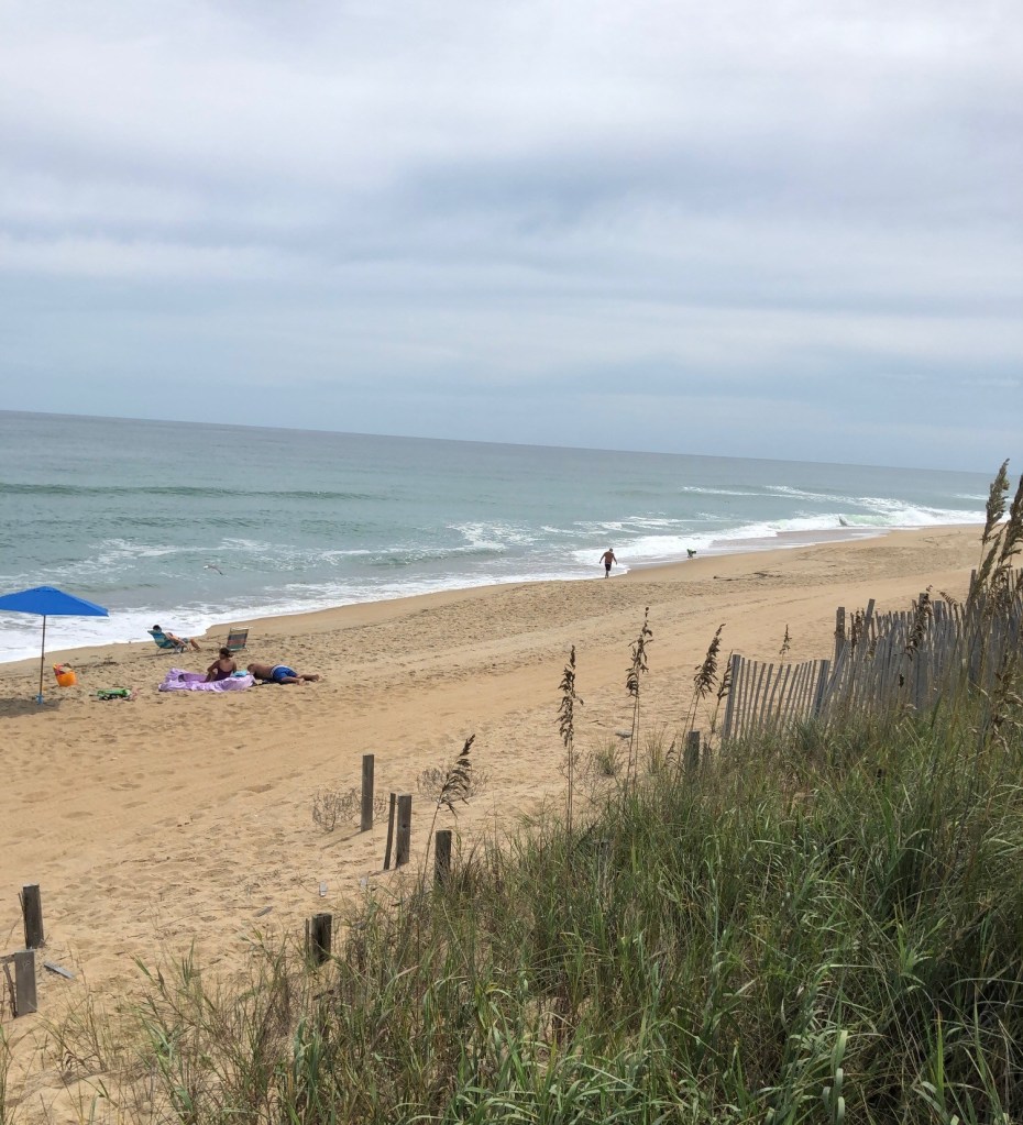
The dry-sand beach where you put your towel is known as the berm.
According to Mr. Rogers, who spoke at Southern Shores’ beach nourishment forum at the Hilton Garden Inn: “It is very difficult to eyeball the shoreline” and assess its status, which, of course, is what laypeople tend to do.
Not only is much of the beach profile under water, there are “radical changes” going on in the dry-sand area that the eye cannot detect, Mr. Rogers said.
Let’s consider erosion.
There are four different types of erosion, according to Mr. Rogers, only two of which we believe most people appreciate: seasonal fluctuations caused by varying weather and storm patterns, and storm-induced erosion, such as dune escarpment.
Neither of these “erosions” is permanent, because the dunes and berm will recover when the beach profile regains its equilibrium.
Long-term or chronic erosion, which causes the dune to erode and move landward, is one of the other two, but as we noted, the Southern Shores shoreline has held up well over the decades. The fourth type, inlet erosion, does not apply to our area.
“On summer days,” Mr. Rogers writes in “The Dune Book” (p. 5), “it is hard to imagine that the berm is temporarily eroded almost every year. On a typical North Carolina beach, the waterline moves about 75 to 100 feet every year due to seasonal fluctuations.”
Actually, he writes, seasonal fluctuations are not true erosion—provided the volume of sand that is lost in the winter returns for the summer.
Similarly, sand is moved from the visible beach to submerged areas off-shore by severe storms that create large breaking waves on the shoreline and a rise in water level. Large wave action may flatten the slope of the berm and temporarily erode the dunes.
But as more sand moves off-shore, the water depth near the shoreline gets shallower, a change that forces the waves to break farther off-shore. As soon as the breaking of the waves recedes, erosion of the visible beach slows down. You may have noticed that storm waves frequently form off-shore sand bars, which also act as a filter for the largest waves, slowing them.
In time, as the wave action reduces, the beach moves toward its equilibrium, experiencing little erosion. Dunes also provide protection from the waves.
When a beach-nourishment project is designed, the natural processes of the entire profile from season-to-season are accounted for and taken advantage of. Wind and wave action will distribute any sand placed on the dunes and/or the berm by dump truck or dredge over the entire profile, including, and perhaps most importantly, off-shore.
Sand deposited on the dunes and the berm is known as design or beach fill. Sand placed just to the east of the design fill in an area of the profile that is more steeply sloped is known as advance or advanced fill. Advanced fill is critical to reducing or dissipating the wave energy. It forces the waves to break farther off-shore, thus “widening” the dry-sand beach area.
(According to Mr. Willson, the sand that will be transported from off the shores of Kitty Hawk and Kill Devil Hills to “nourish” our beaches in 2022, will be “finer” and, as a result, “the slope of [our] beach may end up being a little flatter.”)
“The most important protective feature of the beach and dune system is the submerged offshore slope,” Mr. Rogers writes. “As a wave moves into shallower water, friction-like factors internally affect the wave form, slowing the base of the wave but having less effect on the crest or top of the wave. The decreasing depth [the shallow waters] causes the wave to increase in height, slow in speed and become much steeper. At some point, the crest of the wave is moving too fast for the bottom of the wave form to keep up. Then the wave becomes unstable and breaks, dissipating part of its energy before reforming into a smaller wave.”
The shape of the beach—its elevation contours, both in the dry sand area and off-shore—also changes constantly with changes in wave action.
A picture of the Southern Shores beaches in December (egad!), May, or June is not a picture of the beaches at their most robust. If CPE is going to continue its annual monitoring, it should pick a summer month in which to do it.
If CPE elects to continue with springtime monitoring, because of a concern about an early hurricane, it should choose one month or the other—May or June—and make its timeframe consistent.
Indeed, CPE itself recognizes in its draft report that “the same timeframes” should be used from year to year “to mitigate the influence of seasonal differences.”
We wonder why it did not do this last year.
You may recall that Hurricane Dorian passed by the Southern Shores shoreline in September, and we experienced several damaging nor’easters last winter and early spring. The effects of Dorian’s passage and the pounding of the other storms on the shoreline’s condition in 2020 are not mentioned in CPE’s draft report.
THE 2020 REPORT DATA
For purposes of monitoring the Southern Shores shoreline, CPE-NC divided it into three areas:
- The Northern Section: from around Third Avenue north to the Southern Shores/Duck line.
- The Central Section, formerly known in the Beach Management Plan as the “Main Fill”: from Third Avenue south to about 450 feet south of Chicahauk Trail.
- The Southern Section: from 450 feet south of Chicahauk Trail south to the Southern Shores/Kitty Hawk line.
CPE then measured shoreline change; sand-volume change (called “volumetric change”), and useable beach width at the 22 stations in these three sections. There are seven stations in the Northern Section; nine in the Central Section; and six in the Southern Section.
Data can and do vary substantially from one station to the next. With such variability, we do not find averages useful, but note that CPE-NC calculated them.
The metrics the consultant used to assess the condition of the shoreline are as follows:
Shoreline change: The “bar” for measuring shoreline change is the mean high-water (MHW) mark on the dry-sand beach. If the MHW moves landward, there is a negative shoreline change; seaward movement connotes a positive change.
Volumetric change: This metric essentially refers to the volume of sand measured at a beach station, both what is visible in the profile and what is off-shore up to the closure depth. Volumetric changes are measured in cubic yards per linear foot (cy/lf).
Useable beach width: APTIM/CPE-NC defined this concept, in response to a request by the Town Council in late 2019, as the distance between two specific elevation contours on the beach. They are identified as the +12.0 ft. NAVD88 Contour, which marks the landward limit on the dry-sand beach; and the +4.0 ft. NAVD88 Contour, which is the seaward limit on the dry-sand beach.
On Dec. 3, 2019, a unanimous Town Council—with three new members sworn into office just that evening—decided to add “sufficient useable beach width,” as a goal of the Town’s Beach Management Plan. This action was taken in response to repeated complaints from two Seventh Avenue homeowners about their allegedly narrow beach.
Persistent and driven, and armed with visual aids during their many appearances before the Town Council, Paul Borzellino and Mark Peters of Seventh Avenue are primarily responsible for the Council’s decision to include the beach north of Third Avenue in the 2022 nourishment project.
To see how CPE came up with the definition of a “sufficient” useable beach, we refer you to its Jan. 29, 2020 report at Southern Shores – Addendum A FINAL January 29, 2020 | Town of Southern Shores, NC (southernshores-nc.gov).
As we understand it, CPE relied upon photographs of the Southern Shores stations taken in May 2019 to derive both station-by-station measurements, as well as an average useable beach width in town south of Third Avenue of 84 feet.
It also came up with an average useable beach of 103 feet for the beaches from Skyline Road in Southern Shores, south to a point about 200 feet south of the Asheville Street beach access in Kill Devil Hills. The 2020 Report does not recap how CPE made this determination. This is the area that was nourished in the 2017 projects.
At no time did the coastal engineering firm ever evaluate sufficiency. See The Beacon, 12/14/19.
The station-by-station June 2020 measurements of beach width represent a “one point-in- time reading,” Mr. Willson explained in response to Councilman Matt Neal’s question last week about the existence of historic data documenting the beaches’ linear footage. Mr. Willson said LIDAR (Light Detection and Ranging) data dating to 1996 could be “pulled together” to give a perspective of 24 years. We hope this will be done.
In this draft report, we are only looking at a few years in the life of a shoreline that has existed for thousands of years—during which residential development has existed for about 80 years.
CPE’s data on shoreline and sand-volume changes in the Northern Section do not support beach nourishment. They did not in December 2017, and they do not in June 2020.
From December 2017 to June 2020, according to The 2020 Report, the entire Northern Section experienced a positive change in sand volume in the beach profile. In the same time period, the shoreline change along the seven stations varied, with a purported positive gain in the MHW mark of 9.1 feet around Eighth Avenue—in other words, the MHW moved seaward—and a loss of 8.7 feet between Third and Fourth Avenues.
The Seventh Avenue beach experienced a negligible change of -0.2 ft., or a landward move of 2.4 inches.
As for the measured change in the useable beach of the Northern Section between May 2019 and June 2020, it increased by an average of about 12 feet. The Seventh Avenue beach purportedly picked up 8 feet.
We find the comparative data conclusions reached by CPE-NC about the Central Section to be the most problematic. According to the draft report, the change in sand volume for this area in the 2 ½-year period was an average of -0.3 cy/lf per year.
CPE measured primarily negative volumetric changes from Third Avenue to the southern boundary of 226 Ocean Blvd. and in an area between 600 feet north of Chicahauk Trail to 450 feet south of Chicahauk Trail.
Between 330 feet south of East Dogwood Trail to about 500 feet south of the Duck Road split, however, the volume of sand increased during the same time.
Notably, between October 2006 to June 2020, all of the Central Section stations gained sand volume.
Shoreline change between December 2017 and June 2020 was also variable for the Central Section, with the station around First Avenue gaining 9.6 inches per year; the station around Dolphin Run picking up 13 ft./yr.; and the station at Bluefin Lane gaining 7.7 ft./yr.
CPE shows a loss of shoreline, as measured by the MHW, in other stations within this section for the same timeframe, especially near Trout Run; but the long-term shoreline change, assessed by using the FRF’s 2006 data, is not nearly so dramatic. The shoreline change at all Central Section stations from October 2006 to June 2020 is much less severe, suggesting again that short-term data are not reliable indicators.
CPE reports that between May 2019 and June 2020, the useable beach width in the Central Section decreased at every station, except one near the Duck Road split—and by as much as 33 feet between Bluefin Lane and Trout Run. We will be interested to see the 2021 measurements for this metric. The width measurements are “one point in time” measurements, and the 2019-20 off-season was a turbulent one.
The Southern Section, part of which was nourished in 2017, experienced volume loss in all of its stations in the 2 ½-year period, the worst occurring around Skyline Road. The shoreline change in the south also was uniformly negative, as well as precipitous, and the useable beach width change in one year took a dive of between 10 feet and 45 feet!
We have never argued that the Southern Section of the Southern Shores shoreline is not an erosion hot spot. The Southern Section needs beach maintenance in order for its oceanfront to remain attractive to vacationers.
We are troubled, however, by the Town Council’s decision to broad-swipe the rest of the shoreline in a beach nourishment project that can best be described as proactive, but not necessary.
If you would like to receive a copy of the consultant’s draft report, please write to us at ssbeaconeditor@gmail.com, and we will email a PDF to you. We welcome readers’ opinions.
THE PELICAN WATCH NOURISHMENT PROJECT
Thanks to a question by Councilman Leo Holland at last week’s meeting about sand lost in the Southern Section of the shoreline where beach nourishment occurred in 2017, we learned for the first time that this project was not designed. It was largely a matter of placing advance fill as a “stop-gap” measure, Mr. Willson explained.
Councilman Holland voted to approve the so-called Pelican Watch project when he served on the Town Council from 2013-2017 and was surprised to learn this, as were we. Mayor Tom Bennett said that advance fill “saved” the Pelican Watch oceanfront.
When engineers like those employed by CPE design a nourishment project, they determine how much sand must be placed in a beach profile to meet “a stated goal”—such as preventing waves from overtopping the dunes during a storm event and washing out N.C. Highway 12, as the community of Avon on Hatteras Island seeks to do. (See Mr. Willson’s White Paper, above, for this proposition.)
Some of the sand that is placed on the dry-sand area is intended to be transported off-shore, in order to change wave action, as we explained above.
According to Mr. Willson, the Pelican Watch project was an “emergency” project to stop a “crisis.” It was not designed. Within a month of placing beach fill on the shoreline, most of the sand had moved off-shore, he said. Advance fill created the wider beach, and sand fencing installed by the Town helped the dune to rebuild itself, he explained.
This project cost $1 million, of which the Town of Southern Shores paid $500,000 and Dare County paid the other $500,000, according to an accounting given at last week’s Town Council meeting.
Thirty percent of the Town’s contribution, or $150,000, was paid by Pelican Watch homeowners through a special assessment. The rest of us (we are the Town) picked up the tab for $350,000.
The Town Council is not proposing to contribute any monies from the Town’s general fund for the 2022 project.
Ann G. Sjoerdsma, 1/26/21

This is a very informative and balanced article
LikeLike