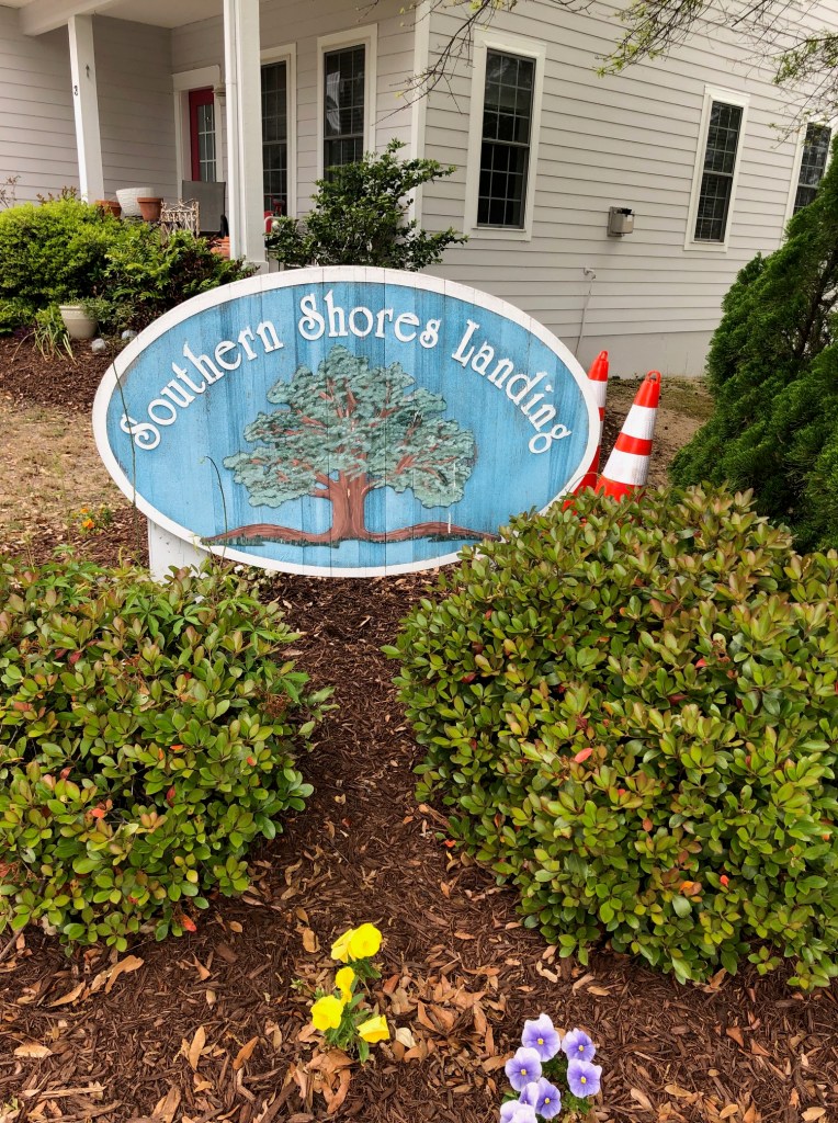
Confusion over whether the Southern Shores Landing, a “planned unit development” of cluster housing approved by the Town in 2005, is zoned C General Commercial or RS-10 (high density) Residential has Landing residents concerned over how close any future development on an adjacent commercial property that fronts on U.S. Hwy. 158 may be to their homes.
The Landing is located on the northwest corner of the U.S. 158-S. Dogwood Trail intersection. Some of the houses in the development back up to property owned by Ginguite LLC (a SAGA investor group) at 6195 N. Croatan Hwy. (U.S. 158), which is zoned commercial, but may be re-zoned mixed-use development.
All residential districts in Southern Shores enjoy a 50-foot setback from buildings, parking spaces, incinerators, and other facilities that may be erected on an adjacent commercial or mixed-use development property. This protection is set forth in Town Code sections 36-270(c)(11)(j) [mixed use] and 36-270(d)(7) [commercial].
The Code also requires a 20-foot-wide vegetative “buffer” between commercial and mixed-use districts and residential districts, apparently within the 50-foot setback.
The Town’s Planned Unit Development (PUD) ordinance slightly differs, requiring a “minimum buffer” of just 35 feet between the PUD’s “exterior boundary line” and all structures, parking areas, or other uses of adjacent property except for open spaces. (Town Code sec. 36-265(4).)
While it would seem obvious that the Landing is in a high-density residential district, a flawed 2005 zoning map showed it as being entirely commercial, according to Town Manager Cliff Ogburn at a workshop meeting held March 21 by the Town Council to address the situation.
A 2007 map, he told the Council, showed the Landing as two-thirds RS-10 and one-third, C General Commercial.
Zoning maps in the current Land Use Plan (LUP), which is dated 2008, clearly show the Landing as being in a high-density residential zoning district. The LUP itself singles out the Landing on p. 37 as being one of the high-density residential areas.
(As The Beacon recalls, the Landing’s development in 2005 was affected by a Town moratorium on building and by a water supply issue. We were unable to research the situation further on the Town’s website through Council meeting minutes. There should be ample records in Town Hall about the Landing’s planning, approval, zoning, and development.)
According to Mr. Ogburn, the Town has always treated the Landing as if it were zoned RS-10, and property owners have assumed this residential zoning. The Dare County GIS also shows the Landing’s zoning as RS-10, but Mayor Elizabeth Morey said at the March 21 meeting that the GIS is wrong.
Several Landing residents spoke at the Council’s April 4 meeting, asking for a 50-foot setback, which would resolve any confusion or mapping mistakes in their favor. Their remarks were a carry-over from the Town Council workshop, during which Mr. Ogburn sketched out the zoning issue, but the Council made few public comments, choosing instead to hold a closed session, after which it instructed the Town staff on future action it should take.
Residents had expected the Council to consider Zoning Text Amendment 23-02, which authorized a zoning change for all residences from commercial to RS-10, and Zoning Map Amendment 23-01. Both were submitted by a Landing property owner and designed to correct errors made by the Town in favor of Landing property owners. Instead, the Town withdrew the zoning amendments, Mr. Ogburn explaining that Town staff are working on revising both.
Mayor Morey said both the ZTA and the ZMA should be introduced by the Town, not a private property owner.
Perhaps the most telling comments made at the March workshop, which lasted only 20 minutes, came from Town Attorney L. Phillip Hornthal III, who emphatically stated that if a title search had been done by the closing attorney of a buyer of a Landing property, “the record title would have shown it was commercial.”
Sounding very much like a litigator, he further stated that buyers are “charged with knowledge of record title.”
“That’s why people buy title insurance,” Councilman Mark Batenic interjected.
Mr. Hornthal enthusiastically agreed, saying: “Spot on!”
In the course of public comments at the workshop, Michael Strader, an engineer with Quible & Associates who appeared on behalf of Ginguite LLC, said that a mixed-use project for its property is “in the works,” but nothing has been submitted to the Town Planning Board yet. Not surprisingly, Mr. Strader said his client purchased its property on Ginguite Creek (in 2014), believing that the Landing development was zoned commercial. He offered to work with the Town and Landing residents to arrive at a compromise on setbacks.
After holding a closed session to discuss the situation with Mr. Hornthal, the Town Council returned to pronounce three directives, or “action items,” as the Mayor called them. The Town staff is to:
- Continue researching the impact of planned unit developments in Southern Shores; [Note: PUDs are addressed in Town Code sections 36-263 to 36-265, which were enacted in 1988. They are permitted solely for residential uses, according to the ordinances.]
- Update the zoning map to reflect the proper zoning district for the Landing; and
- Draft a zoning text amendment to address lot width measurements.
These actions are pending. Inasmuch as there is no “proper” zoning of the Landing, just historical zoning, as revealed by legal titles, zoning maps, and other reliable evidence, and lot width is not the same as a setback or buffer, we understand why both Landing property owners and Ginguite LLC would be dissatisfied with the workshop’s outcome.
We also question the justification for the closed session, which was to preserve attorney-client privilege during the Council’s consultations with the Town Attorney. There is no legal action pending for the Council to discuss.
One Landing resident who spoke at the last Town Council meeting characterized the Council’s action at the workshop as “very Kill Devil Hills,” a criticism that we leave to others to interpret.
4/18/23 UPDATE: According to Planning Director/Deputy Town Manager Wes Haskett, who spoke at last night’s Planning Board meeting, the Board may consider a Zoning Text Amendment submitted individually by Matthew Huband, who has been a liaison between the development’s homeowners’ association and the Town, at its May 15 meeting. Mr. Huband and his wife own a house on Landing Trail that is set back from the road and very close to the Ginguite LLC’s property boundary. In response to Mr. Haskett’s announcement about this ZTA, Planning Board Chairperson Andy Ward said he would like to help residents of the Landing.
ANN G. SJOERDSMA, 4/17/23

Excellent coverage of this issue- Thank you-
LikeLike