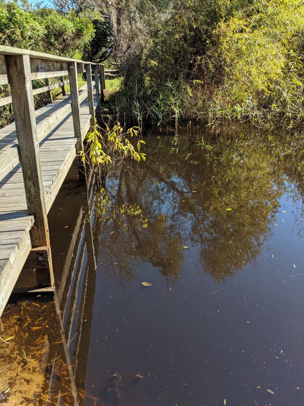
Pictured above is a view of Circle Pond from the bridge along the pathway that leads from/to Circle Drive to/from Ocean Boulevard. The pathway and bridge are two of the quaint tucked-away features of Southern Shores.
At the Oct. 7 Town Council candidate forum, Southern Shores Civic Assn. president, Rod McCaughey, asked a comprehensive question about water—water, “as in,” he said:
“stormwater runoff on our streets”
“the health of our canals and Currituck Sound”
“the health of the Southern Shores ponds”
“Do you see [water problems] as a serious issue?” Mr. McCaughey asked. “If yes, what should be done?”
All of the candidates expressed concern about water problems: Town Councilman Fred Newberry said they are of “critical importance.” But only Matt Neal, who, as a builder, has to consider stormwater runoff in his construction projects, offered possible solutions based on firsthand knowledge.
Mr. Neal joined the other three candidates, who also include Elizabeth Morey and Leo Holland, in suggesting that the N.C. Dept. of Environmental Quality could assist the Town in dealing with water quality in the Currituck Sound. He suggested making an “active request” for help. (No one mentioned the canals, per se.) Mr. Neal then addressed what he called “direct-impact” problems: flooding from the ponds and stormwater.
According to Mr. Neal, both Dare and Currituck counties are employing “groundwater lowering devices,” including “collection pipes or cisterns or pumps” to lower the water level in ponds.
Before a storm, he explained, the counties will “actively pump these [water] systems down and drain the ponds and provide collection holding pens within those ponds,” to prevent flooding.
This is an “achievable thing” for Southern Shores, Mr. Neal said. It’s a question of paying the money and making the commitment.
As for stormwater runoff, he said, the problem is “the streets can’t handle it.”
He spoke of “design parameters” to manage stormwater that builders must adhere to in constructing residential and commercial development. In the case of residences, he said, the design parameter is 1 1/2 inches of stormwater; for commercial buildings, it’s 4 inches.
“Nobody has a design parameter for 10 inches of rainfall,” he observed.
But, he said, the Town could target a different design parameter and apply an engineering solution to the stormwater that runs off driveways into the streets. He characterized both the pond flooding and the runoff as “low-hanging fruit” that the Town could “go after.”
Mr. Neal also shared a “model” that Kitty Hawk uses for its “bowl-like areas” where stormwater collects and flooding occurs: “Kitty Hawk pumps as soon as the storm has left,” he said. It acts “immediately.”
The new Council will have an opportunity to decide whether controlling pond flooding and stormwater runoff are priority issues for the Town and to take action.
WHO OWNS THE PONDS?
After the forum, The Beacon spoke with Mr. McCaughey in order to clarify a point that we have long wondered about: Who owns the ponds in Southern Shores?
It turns out that’s a tricky question to answer: The answer largely turns on whether the pond is natural or man-made.
Mr. McCaughey shared a legal opinion that he obtained about the ownership of the J-shaped Circle Pond, which is bounded by privately owned single-family homes and SSCA-owned common area fronting on Duck Road, Periwinkle Place, Ocean Boulevard, Hickory Trail, and Circle Drive.
According to this opinion, the Kitty Hawk Land Co.—which developed Southern Shores—conveyed to the SSCA in 1978 the “man-made lagoons, canals or waterways” that then existed within the boundaries of the Southern Shores Community.” (This conveyance explicitly excepted the Chicahauk subdivision.)
Were ponds included in this conveyance? Is a pond a lagoon?
Certainly common sense and dictionary meanings would lead you to believe that a pond is not a lagoon. You also could argue that if the KHLC had wanted to give the SSCA title to all then-existing man-made ponds, it could have so specified.
One thing is certain: The SSCA does not own any “naturally occurring” ponds, which, according to the SSCA’s attorney, Circle Pond is.
In October 2016, the combination of weeks of precipitation, water-saturated ground, and rains from Hurricane Matthew led to Circle Pond’s overflow. It was not the only pond that flooded, and rendered roadways impassable for weeks, but it did more damage than pond flooding elsewhere.
So who owns Circle Pond?
If the KHLC has not deeded it to the Town, and the SSCA’s attorney didn’t find that it had, the KHLC still does. This would seem to be the case with all naturally occurring ponds in Southern Shores.
What about the man-made ponds?
In 2005, the SSCA sold to the Town “all of the existing man-made lagoons, canals or waterways within the boundaries of the Town of Southern Shores as described in deed recorded in Book 31, Page 445, Dare County Registry,” except those in Chicahauk, which the 1978 deed excluded, and those lying on the boundaries of the lands of the Duck Woods Country Club. This conveyance covered substantively all of the same property that was covered in the 1978 conveyance.
The 2005 deed also excepted any “ponds or waterways” that are on SSCA-owned property—even though a pond, presumably, is not a lagoon, and the inclusion of ponds in the exception language wasn’t necessary.
It appears that if the SSCA owns the land around a man-made pond, it also owns the pond.
Generally speaking, therefore, the SSCA owns the man-made ponds in Southern Shores; but there is one noteworthy exception: Ginguite Pond, which sits behind single-family homes situated on Ginguite Trail and in the Mallard Cove community.
According to a 2017 written opinion provided to former Town Manager Peter Rascoe by an attorney representing the Town, Ginguite Pond, a/k/a Mallard Cove Pond, a/k/a Duck Woods Pond, which is man-made, is owned by the Kitty Hawk Land Co., not the SSCA or the Town.
In addition to the 1978 and 2005 deeds, attorney M.H. Hood Ellis of Hornthal, Riley, Ellis & Maland cited as support for his opinion 1) correspondence sent by former KHLC president Mickey Hayes to the Town in 2004 and 2006 reflecting his belief that the KHLC owns the pond, and 2) an “overflow device” that the KHLC “engineered, permitted and installed [at the pond] . . . at a cost of over $50,000.”
It appears to The Beacon that the Town Council should be talking with both the Kitty Hawk Land Co. and the SSCA about pond overflow.
If you disagree with a majority viewpoint on the Town Council, are you being “divisive” when you express your contrary opinion, which is also the opinion of some of your constituents? Are you being “uncivil” when you persist in advocating your position and challenge the majority’s perspective?
Suppose you’re in the Council majority and you work and communicate only with your like-minded colleagues before a meeting, in preparation of a motion on an important policy, are you being divisive? Later, are you being uncivil when you insist upon calling the vote on your prepared motion before the excluded minority-view members of the Council have had time to discuss it?
The question of “divisiveness” and “incivility” among Town Council members came up at the League of Women Voters of Dare County’s candidate forum last Monday, when audience member Lorelei Costa unfortunately described these states as “hallmarks” of “Southern Shores politics” in prefacing a question about Council relations.
What Ms. Costa, who is executive director of the Outer Banks Community Foundation, actually asked of the four candidates for the three open seats on the Town Council was: “How would you work together positively with your fellow [Council members], even those with whom you sometimes disagree?”
Ms. Costa’s question proved to be a nice springboard for candidates Elizabeth Morey, an eight-year member of the Town Planning Board who has been its chairperson since January, and Matt Neal, a local builder who has advised both the Planning Board and the Town Council on zoning issues.
Mr. Neal called “working together” the “key” to the “new Council” and said he didn’t think any of the four candidates would “get into the baring the teeth that we might have become accustomed to.”
Ms. Morey suggested that the Council use the model of cooperative communication that she uses with her fellow Planning Board members: “I call my [colleagues] on the phone regularly and have conversations with them,” she said.
[The Beacon notes that Ms. Morey’s predecessor, the late Glenn Wyder, used such a model, but informed sources have told us that Sam Williams, who was Board chairperson for nine years, didn’t.]
Incumbent Town Councilman Fred Newberry, who has never raised his voice or behaved discourteously in a Council meeting—not that we’ve witnessed in attending the majority of the meetings during the past four years—took to heart Ms. Costa’s apparent allegations of divisiveness and incivility.
“A lot of times we have meetings, and we disagree,” he said, “[but] disagreement to me is not incivility. I think it’s everyone’s right to speak for themselves—freedom of speech—[and to] speak for the people in the community. . . . [T]hey’re bringing their skills and their experience to make good points, although they not always be the popular points.”
Earlier in the forum, Councilman Newberry, who has been in the minority on “a lot of 3-2 votes,” he said, made the point that he often asks questions of majority Town Council members to which he knows the answers, just so the answers will be on the public record.
The majority bloc of Mayor Tom Bennett and Councilmen Jim Conners and Christopher Nason is known to confer behind the scenes, without including Mr. Newberry and Councilman Gary McDonald.
“Just because I didn’t vote with the majority doesn’t mean I’ve been uncivil,” Mr. Newberry said. “It means I’m trying to present a different perspective. I’m coming up with facts that haven’t been discussed before. I think it’s critical that we have that open dialogue.”
Mr. Neal empathized with Mr. Newberry’s position, saying: “It’s tough to have it all out on major issues over a four-hour period in the evening [at a Council meeting], and it’s tough to be in a voting minority sometimes and to feel like the constituents you’re hearing from aren’t being represented.”
He also echoed Ms. Morey’s comments about communication. “Talking to Council members, individually, especially on hot-topic issues before the board meeting, is going to be critical,” Mr. Neal said.
Pursuant to State open-meeting laws, two Council members may talk to each other about Town business without their conversation having to be public, but not three. If three public officials are conferring simultaneously, then there must be an “open” (public) meeting. Email is a murkier area of the law.
Ms. Morey advocated one-on-one phone conversations among Council members that would include all of them.
“It’s not hard” to work together, she said. “You just need to start talking with each other. You need to not make it personal.”
There are “always going to be disagreements” about issues, said candidate Leo Holland, who served on the Town Council from 2013-17, “[but] sometimes it can get personal and that’s where things go astray and uncivil liberty comes up.”
Emails, he observed, “can get pretty vicious,” and people can get “upset.”
Mr. Holland, too, advocated picking up the phone and talking to people.
“I’ve always been a proponent of trying to work with whoever I’m with,” he explained. “You don’t always have to agree, but you know at the end of the day that you can shake hands and still be friends and not ignore each other.”
While the Beacon supports “working together,” we don’t believe that all Town Council members necessarily can be friends with each other, nor should friendship be an objective. Opinions can be sought and respected among elected officials without personal relationships being forged.
We agree with Ms. Morey, who said: “Good decisions are going to come about from leaders who are in communication with each other.” Leaders. Not friends.
We believe that disagreements are inevitable. We don’t live in Mayberry, and we don’t have an amiable, fair, and wise sheriff looking after us and providing leadership. When our Town Council makes decisions, they are bound to cost us many more tax dollars than what the Mayberry folk would pay for a Founders Day statute in Town Square.
While we all agree that we live in a naturally beautiful place, a protected coastal area, one resident’s vision of the Southern Shores he or she loves may not be the vision that another resident has. There are people who roll their eyes when tree preservation is mentioned and others who roll their eyes when they see how many lots in the maritime woods have been clear-cut. Our population is not of one mind.
Growth and development are hot-button issues everywhere in this nation. Change may be inevitable, but not all change is desired by all people.
That we live in tolerance of one another’s opinions, and that some of us, in striving for consensus, accept results that don’t thrill us, is to our credit. We need leaders on the Town Council who believe in the open dialogue that Councilman Newberry espoused and who seek out and respect other people’s viewpoints, rather than simply propounding their own personal agendas. The Town Council oversees a government, not a social club.
AGREEMENT AMONG ALL
The candidates expressed unanimity on the following issues:
HIRING THE NEW TOWN MANAGER: All four office-seekers agreed that the hiring process for the new town manager, which the current Town Council has left to its successor Council, should be open and should be handled by a recruiter/consultant who, as Mr. Newberry said, will “bring the best talent that we can find to fill this position.”
Councilman Newberry spoke of advertising the job locally, regionally, and perhaps even nationally.
Mr. Neal agreed with Mr. Newberry, saying that the Town needs to “see who’s out there.” He also noted that the interim town manager, Wes Haskett, “should be given a shot,” if he’s interested.
Ms. Morey envisioned a consultant receiving and reviewing 75 to 100 applications. She described the town manager as the “face” of Southern Shores and called the position “critical.” Mr. Holland described the job as “challenging” and called filling it a Town priority.
MAINTAINING LOW-DENSITY HOUSING: In response to a question about creating “essential housing” for seasonal workers—affordable apartments, for example—all four candidates said they would not increase the density of development in Southern Shores. Mr. Newberry cited the vision statement in the Town’s land-use plan for the community’s commitment and desire for low-density housing.
Said Mr. Holland: “I don’t believe we need to have more houses here. As a municipality, we need to work with the county” to develop areas outside of Southern Shores. Mr. Neal suggested that the Town take “leadership” and work with the county on finding “locations in other areas,” where the zoning would be appropriate.
Ms. Morey brought up Southern Shores firefighters and police officers who can’t afford to live in town, especially those who are young.
“There are high-density areas [in Town] now,” she noted, that could be used to house either seasonal residents or Town personnel. “We’d have to partner with the community,” she said, to create multiple-unit housing in those areas.
PRESERVING THE TOWN’S ‘AMBIANCE’: Everyone agreed that Southern Shores’ unique ambiance and sense of community should be preserved.
“It’s a beautiful place to live,” said Mr. Neal, who grew up in Southern Shores and describes himself as “third generation.”
Mr. Newberry likes “the small-time atmosphere” in town, but “at the same time,” he said, “we want to be progressive and get modern conveniences.”
Mr. Holland expressed an interest in enhancing the town’s “friendliness,” saying, “We’ve got to talk with each other.”
Perhaps Ms. Morey summed up the feelings of all when she said: “We love this place, and we want it to thrive.”
THE BEACON will return with one more article related to last week’s candidate forum. We would like to address separately a very important issue raised in a question posed by Southern Shores Civic Assn. president Rod McCaughey: that of water, and the problems associated with it, especially stormwater runoff.
After the forum, we spoke in more detail with Mr. McCaughey about the ponds in Town, in particular, about their ownership. What Mr. McCaughey told us may surprise you.
REMEMBER: EARLY VOTING STARTS WEDNESDAY, and runs through Nov. 1, at the Kill Devil Hills Town Hall and at the Dare County Administration Building in Manteo. Weekday hours are 8 a.m. to 5 p.m. Here’s the schedule: https://www.darenc.com/Home/Components/Calendar/Event/49615/357.
Planning Board Chairperson Elizabeth Morey is one of four Town Council candidates who participated in a public forum Monday, sponsored by the local League of Women Voters.
About 140 people jammed into the Pitts Center Monday night for a Town Council candidate forum that played out as an affable, low-key affair among the four contenders—who elected not to accentuate their differences or to share many ideas.
The two-hour question-and-answer session, mediated by its sponsor, the League of Women Voters of Dare County, produced no break-out sound bites or rallying moments, although intermittent applause occurred.
The questions, chosen by the League from audience submissions, covered beach nourishment, the cut-through traffic, the Town’s land-use plan and its effectiveness, stormwater problems, the hiring of a new town manager, the candidates’ visions for Southern Shores’ future, the South Dogwood Trail sidewalk, Internet service in town, and more.
A question about the “deer problem” allowed the candidates either to profess their affection or respect for the wildlife, or to tell them to “scram,” as former Town Councilman Leo Holland did in recommending a product called Deer Scram.
Both Mr. Holland, a Chicahauk homeowner, and Matt Neal, a Southern Shores native and local builder (Neal Contracting Co.), warned of coyotes overtaking the town’s deer population. Mr. Neal also offered his 3-year-old daughter as an alternative to “Scram.”
Current Town Planning Board chairperson, Elizabeth Morey, took a gentler approach: “We live in nature. We live in their back yard,” she said. The deer are here to stay.
“I kinda like them,” incumbent Town Councilman Fred Newberry noted.
OVERVIEW OF CANDIDATE MESSAGES
The Beacon perceived no dominant personality among the candidates, although Mr. Neal impressed with his broad knowledge of the Town’s zoning code, the Southern Shores shoreline, options for stormwater management, and even information technology. We think he dropped the ball on cut-through traffic, however.
The 36-year-old Mr. Neal, who is currently serving as the president of the Outer Banks Home Builders Assn. (OBHBA), described himself as a research “nut” who does not form hasty opinions. Although he represented himself as a cooperative, open-minded problem solver, he didn’t take that approach in dealing with the traffic question, which is of concern to numerous residents. Mr. Neal lives on Wax Myrtle Trail
Questioned by a homeowner about possible conflicts of interest that he would have serving as both a Town Council member and the OBHBA president, Mr. Neal replied that he thought the roles would be more complementary than conflicting. He cited OBHBA’s critical input in the drafting of the Town’s new occupancy ordinance, which limits vacation cottages to 14 overnight occupants. Nonetheless, he said he would resign his OBHBA presidency, if he were elected.
Town Councilman Newberry, 71, said he would like to be “progressive and guide the town into the future while maintaining [its] ambiance.” He stressed careful planning and budgeting and “input” from the public about the issues the Council has to decide—so that “tax dollars are spent wisely.” He came out in his opening statement as being against “mini-hotels.”
Throughout his tenure, Mr. Newberry, who lives on North Dogwood Trail, has emphasized public involvement and public opinion in Town government decisions. He and Town Councilman Gary McDonald are responsible for there being two public-comment periods during Council meetings and for meeting packets being available to the public online.
Councilman Newberry also opposed the elimination of the Town’s standing committees on planning, finance, and public safety—a move proposed by Mayor Tom Bennett and supported by then-Councilman Holland and Councilman Christopher Nason. (The Mayor did not have to sit on every committee.)
Elizabeth Morey, 60, an eight-year Town Planning Board member who has been chairperson since January, stressed “collegiality and a sense of common purpose.” She said she would “seek to build consensus” and not have a “predetermined” agenda.
“I’m good at listening,” Ms. Morey said, characterizing herself as an “independent thinker.”
The Ginguite Trail homeowner also called herself “passionate about protecting and enhancing this unique place that we live in.”
Mr. Holland, 78, who has been active in the Southern Shores Civic Assn. and served on the Council from 2013-17, spoke of seeking a return to office because citizens “deserve good government,” as well as a Council whose “members seek to work together for the common good of the Town.”
But he offered no examples of when the current Town Council members, who definitely don’t agree with each other, often voting 3-2 on issues, didn’t put the “common good” first. (The Beacon will take up a question about civility on the Town Council in Part Two of our forum analysis.)
Mr. Holland cited “civility, common sense, and practicality” as hallmarks of his governing philosophy. He lives on Spindrift Trail.
PROFFERED IDEAS: DEALING WITH TRAFFIC, SUING THE STATE
The Beacon thought style largely trumped substance Monday night, as specific proposals were hard to come by. One exception was Councilman Newberry’s commitment to tackling seasonal cut-through traffic.
Saying it is “inexcusable” that the Council has not “addressed [the problem] properly,” Mr. Newberry declined to try to explain why the Mayor Bennett-led majority has failed to act during his four-year term (December 2015-November 2019).
“I don’t know,” he said simply.
The traffic problem arose in a question posed by Eleventh Avenue homeowner Greg Pensabene, who directed it to Mr. Holland and Mr. Newberry as “incumbents.” Mr. Holland’s “re-elect” signs that have been posted throughout town have led some people, especially newcomers, to believe that he is a Council incumbent.
Mr. Holland actually was on the Town Council that ignored the results of the paid-facilitator-led October 2014 public workshop on cut-through traffic, attended by upward of 150 people. After considering numerous options, including temporary speed humps and increased stop signs, workshop attendees reached a consensus in support of preventing a left turn on to South Dogwood Trail from U.S. Hwy. 158 on summertime weekends.
First to respond to Mr. Pensabene’s question, Mr. Holland stumbled, confusingly stating, “We tried the left-turn program. That is in the Kitty Hawk municipality, and you got the NC DOT [N.C. Dept. of Transportation] you have to live with and work with. We can do certain things within the town, but we also get some Pell grants that have an impact on that as well.”
N.C. DOT exercised its jurisdiction over U.S. Hwy. 158 to enable last year’s no-left-turn weekend trial, which Mr. Newberry and Councilman Gary McDonald spearheaded, and the Town didn’t have to ask twice. DOT, which sent two representatives to a Town Council meeting months ahead of the weekend trial, at which time it was discussed, was very accommodating. The Kitty Hawk police were not involved.
The Town receives an annual roads grant—known as the Powell grant, not Pell, which is a federal education grant—from the State, but, as Mr. Newberry observed, its amount is “not that significant.” In recent years, it has been $119,000.
“I wish I had an answer” to the cut-through traffic, Mr. Holland concluded, suggesting that maybe the Town should “look into employing a traffic engineer.”
Noting that last year’s no-left-turn weekend trial was “very successful”—despite “numbers” from the police department about traffic volume—Mr. Newberry said, “People have been complaining and speaking up for many years. This is nothing new. There are options. There are things that we can do”
Rather than mention any options, however—which was disappointing to The Beacon—Mr. Newberry cited his sponsorship of a Town Council-sanctioned citizens’ traffic committee, which he said Monday is expected to provide recommendations to the new Council in December.
Given an opportunity to comment, as well, Mr. Neal took a naysaying approach to cut-through traffic reduction, much to The Beacon’s surprise. Prefacing his remarks by saying he “spoke at length with the Police Chief about this last week,” he first dismissed the idea of having “[no] through-traffic signs,” which would be “difficult to enforce,” and then said that the “next step mechanically would be to gate the town, and we would have pass codes and key cards.”
There has never been a groundswell of public support for no through-traffic signs.
We believe Mr. Neal took a giant leap from installing roadside signs to gating the Town 24/7, 365 days a year—another idea that no one has seriously endorsed—and he needs to talk to people other than the Police Chief and those who have similar views in doing his research. He sounded very close-minded when he quoted exorbitant cost figures for year-round gating, which he presumably obtained from Chief Kole and which we remember as being prepared by former Town Manager Peter Rascoe. (Mr. Neal said he would supply The Beacon with documentation.)
Mayor Bennett is on the record as being opposed to impeding the flow of northbound tourist traffic on the cut-through route. He first stated his opposition in a Jan. 23, 2015 “Word from the Mayor” in the Town newsletter. See www.icontact-archive.com/vbh4RGfk5zTd6P1EhGEnwxgUIb2y1Z9h.
The only gating that has ever realistically been discussed by the public—for example, at the October 2014 workshop—has been gating during the heavy summertime weekends. If year-round gating is the direction in which Mr. Newberry’s committee is headed, it will encounter resistance.
Mr. Neal also suggested taking a “nuanced” approach to the traffic, but he didn’t elaborate on what that might be.
Ms. Morey’s comments on cut-through traffic struck The Beacon as those of someone who is sympathetic to Town residents, but coming late to the issue. For example, she suggested staggering rental check-in days to alleviate congestion. Rental companies on the Outer Banks already stagger check-ins on Friday, Saturday, and Sunday and have for many years. Check-ins on other days—Ms. Morey mentioned Thursday—strike The Beacon as a tough sell.
***
The Beacon applauds Ms. Morey, however, on raising what we thought was the biggest idea of the forum: that of suing the State of North Carolina, in particular, its legislature, for usurping municipal power. Her idea came up in the context of a question about the Town’s land-use plan.
“The folks in Raleigh seem to think that they know better what’s good for us than what we know,” she said, and have diminished the ability of municipalities to “play the role that they should play,” which she described as chiefly to “manage density” and to “protect public health and safety.” She mentioned, in particular, the legislature’s decision to deprive the Town of its ability to restrict the number of bedrooms in a house.
“I say we take it [the legislature] to court. We’ll win, in my opinion,” Ms. Morey said, stating her belief that the Town would be on “solid ground.”
“I would welcome a lawsuit,” she confidently concluded.
While The Beacon would have liked Ms. Morey to elaborate on the specifics of her reasoning—Has she spoken with an attorney? Why does she think the Town has a case and that it would win?—we nonetheless applaud her bold outside-of-the-box stance.
We were less taken with her casual response to a question about the South Dogwood Trail sidewalk, which was simply: “I look forward to walking on the trail as soon as it’s completed . . . with my dog.”
Contractor bids on the sidewalk construction were opened Oct. 4—both Mr. Neal and Mr. Holland misstated the amount of the low bid, which was $623,839.35—and the lame-duck Town Council is expected to choose at its Nov. 6 meeting from among the three bidders. (See The Beacon, 10/5/19)
More important than the cost, we believe, is the considerable design work that the Town Engineer has left for the contractor to figure out—with oversight delegated by the Council to the “Town Manager.” Interim Town Manager Wes Haskett was not the town manager when the Council granted this authority.
With no mention made by the candidates of remaining sidewalk design issues, The Beacon is left wondering who, besides Mr. Newberry, has reviewed the engineer’s plans. We wish the candidates had told us if they have.
PRIORITIES AND BEACH NOURISHMENT
The first question posed by a Southern Shores homeowner at the forum asked the candidates to list what they believe are the top three “priorities” of Southern Shores residents? Residents, not candidates. Only Mr. Neal directly answered the question.
The other three office-seekers provided their own top-three issues—which the League had asked them about in its questionnaire—which are not necessarily, and indeed, are not in some cases, residents’ priorities. The candidates’ questionnaires are available through www.vote411.org. Mr. Neal’s responses are not yet online.
First to answer, Mr. Newberry elaborated upon his campaign’s issues: 1) better money management and planning; 2) the cut-through traffic; and 3) public input in governmental decision-making. (Mr. Newberry was later asked by a homeowner if he would continue to advocate for a five-year Town plan, with budgeting, as he has the past four years, and he said he would.)
Ms. Morey replied: 1) “protection and enhancement of the place we live in”; 2) “better communications between Town Council members”; and 3) “improved communications between the Council and the people who live here.” (Ms. Morey distinguished between a resident priority, which No. 1 represents, and her own priorities, in Nos. 2 and 3. In her forum remarks, she emphasized communication, but she never explained why she thought communication now was lacking.)
Mr. Holland said: 1) the traffic; 2) beach nourishment; and 3) hiring of the town manager. (He cited all three as “Town” priorities.)
Mr. Neal replied: 1) development, in particular, large houses, small lots, and stormwater runoff; 2) traffic; and 3) road improvements and beach management, which have raised cost concerns among residents.
These are the priorities, he said, “that most of you all are telling me when I knock on your door.”
(If you were to list your top three priorities, what would they be, and how closely do they match up with those expressed by the candidates?)
Non-answers also occurred to the second question, which Geri Sullivan, a candidate for Town Council in 2017, asked. Her inquiry was:
“Our town is considering approving a $14 million beach nourishment project, even though several experts from Duck [Research] Pier have questioned the data on which it was proposed. Where do you stand on beach nourishment and how do you think the Town should proceed?”
In their responses, only Mr. Neal and Mr. Newberry took serious note of Ms. Sullivan’s reference to the Field Research Facility oceanographers who questioned the “limited data” of the coastal engineering consultant’s (APTIM’s) most recent beach surveys at the Council’s Sept. 17 planning session.
Calling beach nourishment a “tough issue for me personally,” because he likes the coarse sand, the steep slope, and the natural contour of the Southern Shores beaches, Mr. Neal stated that there are “legitimate questions” about the methodology that APTIM used. He said he would like outside expertise in deciding how “best to interpret the knowledge that comes from APTIM.”
He said the Duck oceanographers, whom he knows personally, view beach nourishment as a “proactive choice” for the Town, but they question the methodology that led to APTIM’s conclusions. (In an interview that The Beacon had with two of them after the Town’s planning session, they scoffed at APTIM’s erosion rate, which is driving its recommendations.)
After the Ash Wednesday storm, which pounded the Outer Banks from March 6-8, 1962, and “knocked out the first flat tops,” Mr. Neal explained, then-unincorporated Southern Shores “created” a new artificial beach.
“We decided to hold our shoreline in 1963 when we built the dune,” Mr. Neal said. “We created that beach. . . . We’ve already impacted [the beach]”
Commenting that he has watched the beach “retreat and come back” at 176 Ocean Blvd., which is the site of a vintage flat top that happens to be next to my family’s 1970s-era cottage, Mr. Neal said, “We have already held our beach with our dune system.”
Despite giving a history lesson illustrating the smarts of the Town’s yesteryear elders, Mr. Neal concluded his wide-ranging remarks by observing that his primary issue with beach nourishment is its cost, not its need.
Mr. Newberry agreed with Mr. Neal’s comments and expressed a desire for “more data and more information,” including from the Duck Research Pier scientists, as well as more public input. “We can’t let emotion override clear reasoning,” he said.
Mr. Newberry said he prefers to view the beach on a “case-by-case basis,” inasmuch as the 3.7-mile-long shoreline differs from one “profile” point to another. The beach in front of Pelican Watch, next to the Kitty Hawk Pier, for example, has eroded much more than other areas. (It was destroyed in 1962.) In 2017, the Pelican Watch beach was renourished for more than $1 million, according to Mr. Newberry.
The Council, he said, informally calculated that the Town would have to pay $1.3 million annually just in interest on a five-year debt to finance a $14-million-plus project.
“We are the people who have to pay for it,” the Councilman said, asking “how are we going to finance it?” and “where is the money coming from?”
Although he mentioned tax increases, Mr. Newberry did not address municipal service districts (MSDs), nor did any of the other candidates. (See The Beacon, 10/2/19, for information about special-obligation bonds and MSDs.)
Calling himself a “proponent” of beach nourishment, Mr. Holland made no mention of the consultant’s data, saying only that we need to ask ourselves two questions: 1) “Is the beach an asset or a liability?” and 2) “Why do tourists come here?”
The Beacon does not consider these rhetorical questions dispositive of a decision on what Mr. Newberry stated will likely be a $16 million-plus project, which anyone who reads APTIM reports can recognize as being based on engineering, not science.
“We need to figure out how we can fund it,” Mr. Holland simply concluded, expressing no opinion on the financing models that have been discussed.
Although she characterized beach nourishment as a “complicated” issue, and made cogent observations about the westward migration of the Outer Banks, the rise in sea level, and the worsening nature of storms, Ms. Morey said she doesn’t view the beach nourishment question in terms of science. Rather, she asks: “What would happen if we don’t do beach nourishment?” and “Does it make sense to not do it at all?”
She cited the Town’s “window of opportunity” to do the project in 2022 with money from Dare County and with the cooperation of the other beach towns that are doing their five-year maintenance then. The next project, she observed, would not be until 2027.
Inasmuch as one obvious answer to Ms. Morey’s first question is “nothing” and another obvious answer is “we may be in an improved situation,” The Beacon was disappointed with her analysis.
“Does it make sense to not do it at all?” Yes, it just might. Before approving beach nourishment, Town Council members should find out.
We would have preferred that Ms. Morey analyze the data that we have now to analyze, including data available through the Duck Research Pier, talk to experts to obtain other opinions, and either challenge or substantiate her own view of inevitability. Once the Town buys into beach nourishment, it’s in a maintenance plan forever.
The Beacon will return on Sunday or Monday with Part Two of our forum analysis, which we promise will be much shorter. Early voting starts next Wednesday.
The Carolina blue house at 134 Ocean Blvd. last October was not the subject of two lawsuits, as the current development at that site is.
The Beacon is highly disappointed that SAGA’s “mini-hotel” at 134 Ocean Blvd., which is the subject of two pending lawsuits, is featured on this year’s Outer Banks Parade of Homes.
We also are chagrined to see that one of the other two Southern Shores houses on the tour is a three-story house built by Duck builder/developer/owner Olin Finch on a 50-foot-wide lot at 155 Ocean Blvd. that was once part of a developed 100-foot-wide parcel.
Surely there are other new or remodeled houses, and builders, in Southern Shores that are more deserving of exposure than these two.
The parade starts Thursday and continues through Sunday. We will not be attending.
SAGA Realty and Construction Inc. built the controversial 12-bedroom, 12-bathroom (and 3 half-baths), hotel-like structure at 134 Ocean Blvd. on the Southern Shores oceanfront at “its own risk,” as the Town warned in writing.
Rather than heed the warning, or try to negotiate with its opponents, the developer chose to ignore the legal challenges lodged against it by two Southern Shores property owners. (One challenge pertains to a permit decision related to SAGA’s other mini-hotel at 98 Ocean Blvd.)
That the Outer Banks Home Builders Assn. and the Outer Banks Assn. of REALTORS®, which sponsor the Parade of Homes, have given SAGA’s mini-hotel such high-profile publicity, despite the litigation and the community’s well-known opposition to their development, decidedly rubs The Beacon the wrong way.
According to Matt Neal, president of the OBHBA and a candidate for Southern Shores Town Council, there is no screening process for parade entrants. Any builder who pays the $600 entrance fee may enter a home, provided it is ready for showing.
(Mr. Neal announced at the Town Council candidates’ forum last night that, if he is elected, he will resign from his OBHBA office. The Beacon will cover the forum later this week.)
SAGA actually has three structures on the 17-house tour, giving it the highest profile of any builder, for which it paid $1800. The only other builder with more than one entry in the parade is Reliant Construction, LLC, with two houses.
Last year’s parade, which The Beacon promoted without reservation, featured 24 homes.
***
The Finch property, now known as 155A Ocean Blvd., was part of a deal that the builder arranged with real estate agent and former Planning Board member Gray Berryman, who owns an identical house at 155 Ocean Blvd. Mr. Berryman recently listed his westside property for sale at $1.2 million.
Until 2018, a modest bungalow built in the 1950s sat across the two 50-foot-wide lots that made up the 100-foot-wide tract at 155 Ocean Blvd. This structure, as well as an accessory building, were demolished by Mr. Finch and Mr. Berryman after the seller, James A. Miller, sold the two nonconforming lots separately.
Acting as the representative of Mr. Miller, Mr. Berryman succeeded in obtaining from the Town Board of Adjustment 12-foot-wide side-setback variances for both lots—before he and Mr. Finch had even bought them. They were well aware of the Town Code ordinance that prohibits development of nonconforming lots like theirs and exploited an apparent loophole to get around it.
At the Miller/Berryman Board of Adjustment (BOA) variance hearings, Town Attorney Ben Gallop complimented Mr. Berryman for thinking ahead and, in essence, evading the intent, if not the strict letter, of the Town ordinance.
Southern Shores property owners have legally challenged both the zoning permit that the Town issued to SAGA for 134 Ocean Blvd.—claiming that the then-proposed mini-hotel was not a “single-family residential dwelling”—and the State-issued CAMA permit, on the grounds that it was “inconsistent” with the Town’s land-use plan.
Although they lost their claims at the initial administrative level (in the zoning case, that’s the Town Planning Board sitting as the Board of Adjustment), they have appealed the unfavorable rulings in superior court: The zoning-permit appeal is in Dare County; the CAMA permit appeal is in Wake County. The petitioners are confident that sufficient errors were made at the lower levels to overturn the rulings or otherwise give them relief.
Before the March 19, 2018 BOA hearings about 155 Ocean Blvd., Planning Board Chairperson Sam Williams read a prepared written statement: He addressed the accelerating trend by landowner applicants to seek variances for 12-foot-wide side setbacks, a reduction from the 15-foot-wide standard, in order to build on nonconforming 50-foot-wide lots.
In the course of this statement, Mr. Williams said that the BOA had already approved three such variances and that “I don’t favor these variances as a matter of land-use planning and policy.”
Nonetheless, in voting in favor of the 155 Ocean Blvd. variances, Mr. Williams had to approve them as being in compliance with the Town’s Land-Use Plan. Only the Town’s CAMA-approved Land-Use Plan, not Mr. Williams’s own land-use planning, is relevant to a variance decision.
The Beacon not only disputes the BOA’s conclusion on Land-Use Plan compliance, but, as we’ve written on many occasions, we disagree with Mr. Gallop’s interpretation of the nonconforming lots ordinance then in effect. It is that interpretation of Town Code sec. 36-132(a) that convinced the BOA that the Town could not prevent Mr. Miller from selling his developed 100-foot-wide parcels as two 50-foot-wide lots—as long as he left the demolition to the buyers.
Only the late Glenn Wyder, who was then serving as an alternate Planning Board member, voted against the variances. Mr. Williams, regular members Elizabeth Morey and David Neal, and alternate member Carlos Gomez voted in favor of them.
The BOA’s approval of these side-setback variances—which Mr. David Neal, Matt Neal’s father, later said he thought had been a “mistake”— finally compelled the Town to act by rewriting Code sec. 36-132, so that there would be no uncertainty about the ordinance’s meaning. Those of you who have followed the nonconforming-lots issue in town know how that rewrite turned out.
The price of a ticket for the 2019 Parade of Homes is $10. The Beacon asks you to consider making a $10 donation to the legal fund of the property owners who are fighting SAGA’s mini-hotels, instead.
Both SAGA’s unwelcome structure, which, practically speaking, has been enlarged beyond the maximum 6,000 square feet by a large unenclosed outdoor partying area on the ground floor that does not count toward house size, and Finch and Co.’s high-density-population structure, constructed on half the required lot size in the ocean district, defy the Town’s Land-Use Plan and its Code of Ordinances.
Once again, the developer is pressuring a town to accept its rewriting of local zoning so it can build the hotel it would like to build, not the one that a community decided could be built. Hatteras Island was an earlier target. This time Manteo is in its cross-hairs.
SAGA is seeking to change the height and size restrictions established for a waterfront boutique hotel in Manteo’s Marshes Light community.
The Beacon stands with the people of Manteo who would like to preserve the small-town feel and look of their waterfront and insist that SAGA conform to the rules.
The Manteo Planning and Zoning Board will be taking up SAGA’s proposed zoning text amendment today at its 6 p.m. meeting in Town Hall, 407 Budleigh St., downtown Manteo. Here is the Board’s agenda and accompanying documentation:
The low bid submitted for the South Dogwood Trail sidewalk construction project came in nearly $400,000 below the $1 million appropriated for the capital expense by the Town Council and was one of three bids accepted by the Town last week.
A fourth bid, submitted by Barnhill Contracting Co., was disqualified because it was incomplete. The bids were opened on Oct. 3.
The three acceptable bids, which range from $623,839.35 to $975,862.80, will be considered by the Town Council at its Nov. 6 regular meeting.
Earlier this year, the Council voted 3-2 to appropriate $1 million from the Town’s undesignated fund balance for the sidewalk project because the capital improvement budget has insufficient funds to pay for it. The principal purpose of the undesignated fund balance is to serve as an emergency reserve in case of natural disaster.
It is expected that the Town will receive some funding from Dare County for the project, perhaps as much as 50 percent of the total cost, according to an informed source.
Hatchell Concrete, Inc., of Manteo—a family-owned business which, according to its website, has been operating since 1988—submitted the low base bid. RPC Contracting, Inc., a contractor that the Town has frequently hired for infrastructure projects, bid $819,710.00 on the project, and Belvin Built General Contracting, Inc., of Powells Point, submitted the high bid.
Town Engineer Joseph J. Anlauf estimated a base-bid range on the sidewalk project of between $862,127.19 and $1,034,552.62, according to the Town’s bid documentation.
Construction of the sidewalk has been conceptualized in two segments: one starting at the intersection of North, South, and East Dogwood trails and running to Fairway Drive, and the other starting at Fairway Drive and running to the Southern Shores Cemetery. Five pedestrian crossings have been planned: at Sassafras Lane, Yaupon Trail, Marina Circle, Osprey Lane, and Wild Swan Lane.
Each contractor’s proposal should be included in the meeting packet for the Nov. 6 Town Council meeting, so the public can see what each bidder has in mind.
PAST ELECTIONS IN SOUTHERN SHORES
In a 9/28/19 blog, The Beacon recalled recent history of Town Council elections in Southern Shores. We promised to fill in some blanks about the November 2011 election, when Jodi Hess, David Sanders, and Larry Lawhon were elected to the three open seats.
The Beacon has confirmed that the three ran unopposed. According to Dare County election records, only 240 votes were cast, reflecting a 9.23 percent turnout of the town’s 2600 registered voters. Both Mrs. Hess (2003, 2007) and Mr. Sanders (2003) had earlier been elected to the Town Council in contested elections, but Mr. Lawhon had not.
Two years later, incumbent Town Councilman George Kolwalski ran unsuccessfully for mayor, and Leo Holland ran unopposed for Mr. Kowalski’s Council seat.
Although Town Council elections have been contested before—e.g., in 2003, six candidates ran for three seats—the number of candidates vying in the November 2015 election for Mrs. Hess’s, Mr. Sanders’s, and Mr. Lawhon’s seats was unprecedented. Eight candidates ran, of whom current Town Councilmen Gary McDonald, Fred Newberry, and Christopher Nason were the top vote-getters. Only Mr. Newberry is running for re-election.
The Town Council election The Beacon finds the most intriguing was a November 2009 face-off between George Kowalski and Brian McDonald, who was then the incumbent. Mr. Kowalski beat Mr. McDonald by two votes! The tally was 495-493. Even more stunning: Mr. Kowalski was a write-in candidate.
Regretfully, I do not know the politics behind this election, although I voted in it. Can anyone fill in the blanks?
REMEMBER, the Town Council candidates’ forum sponsored by the League of Women Voters of Dare County is Monday, from 7 p.m. to 9 p.m., in the Pitts Center. You will be given an opportunity to submit questions that you’d like to ask the candidates. The candidates will answer selected questions and also be allotted time to give opening and closing statements.
Incumbent and former Mayor Pro Tem Fred Newberry, whose experience is in executive planning and management, is running for re-election to his seat. Mr. Newberry and his three opponents, who are vying for three places on the Town Council, will meet Monday, 7 p.m. to 9 p.m., in the Pitts Center, for a forum sponsored by the Dare County League of Women Voters.
The usual Town Council majority voted last night to approve spending $35,000 to hire a beach-nourishment financial planner, even though the Council has not committed to doing a project and, as dissenting Councilman Gary McDonald said, “We can come up with [the] scenarios” for financing, without a consultant’s assistance.
Mayor Tom Bennett and Councilmen Jim Conners and Christopher Nason voted in favor of a budget amendment that was described in the meeting agenda as “half of the total amount due for financial planning from DEC Associates, Inc. for beach nourishment.” For some reason, the dollar amount of the amendment was not indicated on the agenda.
The Beacon erred in its report 9/30/19 in believing that the dollar amount had deliberately been left open-ended, to be decided at the meeting. When we looked in the 76-page meeting packet posted online, we did not see a page indicating that the amendment authorized the transfer of $35,000 out of the unassigned fund balance to expenditures.
The page was there. We apologize for our oversight.
As we wrote on Monday, the father-son team who owns DEC Associates, Inc., a Charlotte-based firm, told the Town Council seven months ago that it would charge the Town $35-$40,000 to develop a financial plan, set up a “beach fund,” and decide what monies would go into the beach fund (i.e., do the “planning”); and then another $30,000 to work on finding the financing.
According to Mayor Bennett, who spoke with The Beacon after the Council meeting, DEC Associates gave him a “worst-case scenario” for an up-front estimate now of its total services: $70,000. When asked if $70,000 represented a cap on costs that would be paid to DEC Associates, in the event the Town approves beach nourishment, the Mayor was noncommittal.
Earlier during the meeting, Mayor Bennett confirmed that all of the Dare County beach towns that have done beach nourishment—Duck, Southern Shores (for the Pelican Watch beaches), Kitty Hawk, Kill Devil Hills, and Nags Head—have used DEC Associates.
The Mayor further showed by his comments that, although he has not publicly shared what he knows, he is well-informed about the financing methods that are available for beach nourishment. He explained, for example, that Duck used special obligations bonds to pay for its 2017 beach nourishment, which will undergo “maintenance” in 2022.
He indicated that he has spoken with officials in the other towns about their projects.
SPECIAL OBLIGATION BONDS SIDESTEP VOTERS
Unlike general obligation bonds, special obligation bonds do not require approval by voter referendum. They are secured by a limited or specific revenue source: In the case of beach nourishment, those property owners who are presumed to benefit most directly from the project supply the revenue through increased real-estate taxes.
That means that oceanfront and oceanside property owners are taxed more than property owners who live farther away from the ocean, but who still benefit substantially from the beaches.
The truth is that Duck, Kitty Hawk, Kill Devil Hills, and Nags Head have all used special obligation bonds to raise the financing needed for their beach projects, and Mayor Bennett knows this.
For as long as The Beacon has heard the Town Council discuss beach nourishment, the majority has clearly stated its preference—we call it bias—for special obligation bonds and the creation of municipal service districts. We heard this bias again last night.
Mr. Nason even acknowledged that he didn’t know about other bonds and revenue-raising methods that could be used, even though DEC Associates went through them all at the Council’s February planning session, which Mr. Nason did not attend, but was videotaped.
The idea that DEA Associates is going to shed some great light on “how we finance this thing,” as Mayor Bennett said, i.e., provide insightful “recommendations” that the Town Council and staff cannot make on their own, strikes The Beacon as absurd.
In 2007, Nags Head voters rejected a general-bond referendum for a beach-nourishment project that was estimated to cost $32 million. Thereafter, the elected officials of Nags Head rejected the will of the voters and embraced special obligation bonds, and other officials in nearby towns have followed suit.
MSDs: TAXING OCEANFRONT PROPERTY OWNERS MORE
When a town pays for beach nourishment with special obligations bonds, it pays for the debt by sorting properties into “municipal service districts” and levying different tax rates on the owners, according to where the property is located relative to the beach. The same would be true for a special obligation bond that pays for “another improvement,” such as a highway, recreational park, or sidewalk.
The Town Council majority might have capitalized the $1.2 million South Dogwood Trail sidewalk with a special obligation bond and sought revenue from the homeowners along South Dogwood Trail, rather than appropriate the money from the Town’s unassigned fund balance, which is used principally for natural-disaster relief.
A sidewalk is arguably a “transit-oriented development project,” which, under N.C. law, can be paid for with a special obligation bond.
The same could be said for the multi-million-dollar canal dredging project, another “transit-oriented” project, which property owner Trish Farinholt pointed out in public comment last night, was capitalized through equal taxation on all property owners, not by taxing only those who own canal-front property or boat in the canals.
In 1974, North Carolina passed a law that allows municipalities to establish MSDs, which are commonly referred to as Business Improvement Districts, in order to raise capital to fund a project that is beneficial to the community. Through MSDs, towns can levy varying increments of taxes on property owners, based on who is presumed to benefit most directly from the improvement.
According to Mayor Bennett, Duck had two municipal services districts for its beach-nourishment tax funding: The “oceanfront” MSD picked up 50 percent of the cost of the fill project; and the “oceanside” MSD picked up 30 percent. The remaining 20 percent came from the Town, in general, which did not increase its tax rate.
Here is how the Town of Duck describes its project funding on its website:
“The project cost was approximately $14,057,929 and was funded through revenue derived from the Dare County Beach Nourishment Fund ($7,094,929), with the remaining $6,963,000 funded through a combination of General Fund appropriation of the Municipal Service Districts (MSD). That is, the Town’s portion of the cost of the project was funded by a contribution from all of the taxpayers in Duck (no tax increase occurred for this portion of the funding) with additional funding provided by property owners in the project area, both oceanfront and non-oceanfront (MSDs). The Town issued Special Obligation Bonds to pay its portion of the project cost with debt service for the bonds to be paid back over a five-year term, ending in FY 2022. The debt service cost to the Town is $1,221,390 per year for the five-year term with additional funding being provided from the Dare County Beach Nourishment Fund.”
(One way to look at the burden placed on Southern Shores property owners in an oceanfront MSD is to say that they are disadvantaged whenever a dollar is deducted from the Town’s General Fund for another high-priced project, such as the South Dogwood Trail sidewalk, that doesn’t benefit them at all. Pitting Us-vs.-Them is never a good idea in town government or community relations.)
Who doesn’t benefit from the beaches?
The Dare County Beach Nourishment Fund contains monies set aside by the county from the 6-percent occupancy tax that it levies. The set-aside is 2 percent of the total annual occupancy-tax revenue collected.
Ms. Farinholt, who owns a flattop at 69 Ocean Blvd., summarized the case for “general fairness” in funding, if a beach-fill project goes forward, when she said:
“All of the property owners should pay equally for the beach renourishment. There should not be any districts. There is one district, and it’s called Southern Shores, the town. Raise the taxes across-the-board.”
Whether you live near the corner of Hillcrest Drive and East Dogwood Trail, at the corner of Trinitie Trail and Gravey Pond Lane, or on Duck Woods Drive, you benefit from the ocean and the tourist dollars that both the ocean and oceanfront rental property owners bring in Your house would have considerably less value if it were in most any other non-coastal town in North Carolina. In fact, you probably wouldn’t be here.
CHANGES IN THE LAW THAT BENEFIT PROPERTY OWNERS
Since the Town of Duck approved its two MSDs in March 2015, the N.C. law about such entities has changed. In 2016, the N.C. General Assembly passed several significant amendments to the MSD statutes: MSDs are not without their detractors.
Two relevant changes include:
1) Adding the requirement that all new MSDs must be created, modified, and/or abolished by ordinance.
To establish a new MSD, as the Southern Shores Town Council would be doing, the enabling ordinance must receive majority support of the voting members present at two consecutive meetings of the Council.
2) Giving property owners more direct input in the MSD creation and modification process.
Property owners now may petition the Town Council to request:
i) The creation of a specific MSD;
ii) The exclusion of a property parcel from an MSD; and
iii) The removal of a property parcel from an MSD.
The N.C. statute directs a municipal governing board to adopt a process for considering all properly submitted petitions at regular intervals.
In the case of an exclusion request, the property owner must file his or her petition in writing within five days after the public hearing on a proposed municipal service district has been held.
The Beacon believes the Southern Shores Town Council may have its hands full with petitions.
The Town could have prepared a report for all property owners that summarizes the coastal-engineering consultant’s reports in simpler, less obtuse terms—not the deadly prose they are in—and outlined the financing methods available, including special obligation bonds, but it didn’t.
It also could have reached out to property owners, both resident and non-resident, in its newsletter, but it hasn’t.
Ms. Farinholt aptly concluded the discussion about funding last night when she observed to the Council: “You’re much less likely to spend your own money than you are [the money of] all the folks who live out of town.”
You’re also much more likely to run into obstacles.
STORM DEBRIS REMOVAL DELAYED
The removal of roadside storm debris started Sept. 24, Interim Town Manager Wes Haskett reported last night, but the work has been done by only two trucks.
Mr. Haskett explained that the two contractors hired by the Town underestimated the amount of debris and the time it would take them to pick up and dump that debris, choosing to disregard the Town’s more realistic estimates.
Truckloads of debris must be dumped in Mann’s Harbor, which is an hour-long round trip from Southern Shores, said Mr. Haskett, who added that additional trucks “will be working as soon as possible.”
Upon being asked by Councilman Newberry whether the contractors had a street schedule for roadside debris pickup, Mr. Haskett replied that he didn’t know.
Councilman McDonald then interjected that he had spoken with workers in the street near his home and been informed that the pickups are done “randomly,” with “large piles” being the priority, so that the workers are not continuously starting and stopping.
Mr. McDonald said he had been informed that six more trucks would soon be available.
Southern Shores native and local builder, Matt Neal, is one of four candidates vying in November for three seats on the Town Council. The candidates will meet in a forum hosted by the Dare County League of Women Voters next Monday, from 7 p.m. to 9 p.m., at the Pitts Center. Early voting begins Oct. 16.
A majority of the Town Council appears prepared to spend $17-$20,000 or more to hire a beach-nourishment financial planning consultant, even though it has not voted to proceed with a nourishment plan, and it has made no effort to do its own far-less-costly financial research.
The chief item of business on the agenda for tomorrow’s Town Council meeting is the consideration of an FY 2019-20 budget amendment that would enable the Town to pay beach-nourishment financial planners, DEC Associates, Inc., “half of the total amount due [them] for financial planning . . . for beach nourishment.”
Doug and Andrew Carter, the father-son team that owns the Charlotte-based DEC Associates, told the Town Council seven months ago, at its Feb. 26 planning session, that they would charge $35-$40,000 to develop a financial plan, set up a “beach fund,” and decide what monies would go into the beach fund (i.e., do the “planning”); and then another $30,000 to work on finding the financing.
If DEC Associates’ costs have not increased, “half of the total amount due for financial planning” is either $17,500 to $20,000, or about $35,000, which would be half of what the company would charge if it were to manage funding for a fill project.
We will find out tomorrow what the agenda item wording means. The Town Council meeting will convene at 5:30 p.m. in the Pitts Center.
This appropriation is an idea that Councilman Jim Conners floated at the Town Council’s Sept. 17 planning session, when the Town’s elected officials considered a coastal-engineering consultant’s latest report on beach nourishment along Southern Shores’ 3.7-mile-long shoreline. Mr. Conners appeared then to have majority support for his budgetary idea. (See The Beacon’s report on the planning session, 2/28/19.)
The Beacon differs with them all. We believe the proposed appropriation is a terrible waste of money that exposes how lax the Council and Town staff have been about doing obvious homework–during at least the past seven months–that would have saved the Town both time and money. The Beacon also believes it is not too late for the Town to do its own homework at a more economical cost. The Town has an attorney and an interim town manager: Use them.
WHERE WAS THE PLANNING?
APTIM Program Manager Kenneth Willson presented his coastal-engineering firm’s December 2017 analysis of the Southern Shores shoreline at the Town Council’s Feb. 26 planning session.
Mr. Willson actually filed this report, titled the “2018 Vulnerability Assessment and Beach Management Plan,” with the Town last December. Thus, the assessment and its conclusions were available for scrutiny two months before they were formally presented.
Correspondence between Mr. Willson and former Town Manager Peter Rascoe indicates that Mr. Rascoe read an early draft of the assessment that was submitted last November. Adding in that time, the Town will have nearly a year’s notice about APTIM’s data and recommendations before it finally makes a decision on financing a nourishment project.
The Beacon attended the Feb. 26 planning session, and we spoke at length afterward with the Carters, who specialize in shoreline-project funding.
Also in attendance at the planning session were Mayor Tom Bennett, Councilmen Fred Newberry, Gary McDonald, and Conners; Town Manager Rascoe, then-Deputy Town Manager/Planning Director Wes Haskett, and Finance Officer Bonnie Swain; and, most significantly, Town Attorney Robert B. Hobbs, Jr., who also represents Duck, which renourished its beaches in 2017.
Councilman Christopher Nason was out of town.
Fortunately, for all, the meeting was videotaped. The Beacon trusts that Mr. Nason has viewed it and that all other elected officials have reviewed it. If they have not, they have let their constituents down.
Mr. Willson, who is a geologist with certification in coastal engineering, outlined in the 2018 assessment report three beach-management plan “options” for Southern Shores, then ranging in cost from about $9 to $13 million.
About two-three weeks ago, he filed a new report, based on updated May 2019 beach-survey data. APTIM and Mr. Willson are now recommending that the Town choose between two beach-nourishment plan options that range in cost between $14-$16 million, and that the Mayor said Sept. 17 would likely cost more. (See The Beacon, 9/17/19 and 9/19/19.)
Two Field Research Facility oceanographers who live in Southern Shores—Dr. Katherine Brody and Dr. Nicholas Cohn—questioned APTIM’s conclusions at the Town Council’s September planning session, saying they are “based on limited data” and “on short-term trends that are not particularly helpful.” The scientists said APTIM’s recommendations are based on statistics and engineering, not science. (See The Beacon, 9/19/19.)
There is no follow-up discussion to the oceanographers’ expert opinions planned for tomorrow’s meeting—at least, not as indicated on the agenda.
After Mr. Willson spoke in February, the Carters explained the various financing methods available for a fill project, some of which include 1) general obligation bonds, which would require a voter referendum; 2) purchase by installments, which, Andrew Carter said, would be “more like a mortgage,” and would be governed by N.C. General Statutes (NCGS) 160A-20; and 3) and 4) special-assessment bonds, which Mr. Carter described as “very complicated,” and special obligation bonds, both of which are subject to State law.
WHAT SAY THE TOWN ATTORNEY(S)?
The Town has under contract the law firm of Hornthal, Riley, Ellis & Maland, where both Mr. Hobbs and his colleague, Benjamin M. Gallop, a very capable municipal attorney, work. Surely, Mr. Gallop, who attends all of the Town Council’s meetings, or Mr. Hobbs can explain to the Council how shoreline financing works—without billing the Town for $20,000.
The Beacon further believes that the town attorneys, town managers, and/or other responsible staff of Kitty Hawk, Kill Devil Hills, and Nags Head—all of which have financed beach-nourishment projects—would be happy to speak with Mr. Gallop/Mr. Hobbs, if they need supplementary information, or Interim Town Manager Wes Haskett about the financing method(s) their towns used.
It was The Beacon’s impression on Feb. 26 that the Carters have worked with some, if not all, of the Dare County beach towns. In any case, the Town can learn and benefit from our neighboring beach towns’ experiences. We need not start out on page one of the beach nourishment financing playbook. The plays have already been designed.
It would seem to be fairly easy for Mr. Gallop and Mr. Haskett, perhaps with assistance from Mrs. Swain, to pool their resources and to compile a short report that would detail for the Town Council the financial options and their implications for the Town and its taxpayers. They could assume the beach-management plan would cost $16 million, of which the Town would pay 50 percent and Dare County would pay 50 percent.
The Beacon finds it very discouraging that, since February, the Town Council has not called publicly upon the Town Attorney(s), the Town Manager, or any other knowledgeable people at its disposal to help it to make an intelligent and informed decision about beach nourishment and its financing. The Beacon could probably do a quick educated study just by conducting research on the Internet!
The Town has not done its due diligence, but that’s no excuse for either dipping yet again into the undesignated fund balance—as the majority did to pay for the South Dogwood Trail sidewalk—or diverting revenue from elsewhere to pay for an expense that it need not incur.
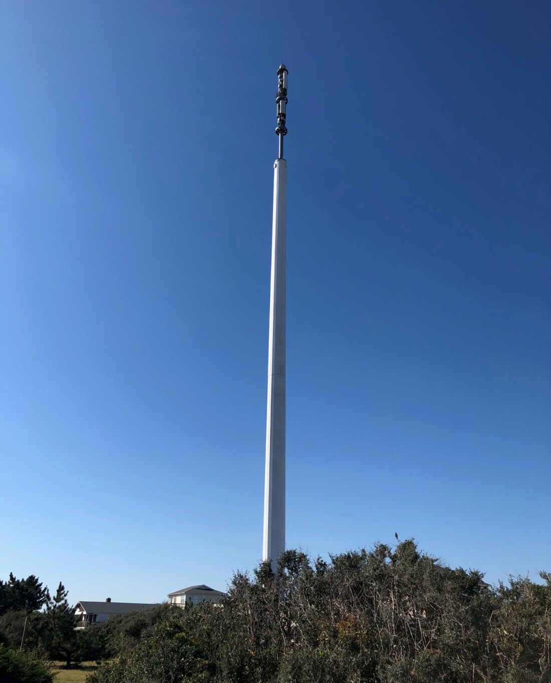
The naked cell tower after Hurricane Dorian: The Beacon wonders where all of the pieces landed. (We saw one chunk.) And why did they detach?
Less than six months after the N.C. Coastal Resources Commission (CRC) certified Southern Shores’ most recent land-use plan (LUP), Mayor Hal Denny and the then-Town Council replaced the plan’s vision statement with their own version. They sought to change the town’s character and access by making it less “exclusive” and more “public-friendly.”
The vision statement that these five elected officials directed Town Manager Peter Rascoe to draft on Feb. 19, 2013, and then unanimously adopted March 5, 2013, emphasized opening up the town to the “general public.” In order to do that, they committed the Town to taking any legal means available, including eminent domain, to acquire land to use for “public purposes.”
The vision statement is a key element of a N.C. coastal town’s CAMA-approved land-use plan. It reflects the community’ aspirations for the future, and the CRC must sign off on those aspirations. (See The Beacon, 9/25/19, for background on CAMA, land-use plans, and the CRC.)
But the replacement vision statement passed by former Mayor Denny and then-Council members Jodi Hess, George Kowalski, David Sanders, and Larry Lawhon did not emerge from a LUP-update process, nor did they seek public opinion or CRC approval. It came out of an annual Town Council retreat held Feb. 19, 2013, during which the five alone planned for “future land use, acquisition, and development.”
In so doing, these five individuals–three of whom ran unopposed for their seats in 2011– substituted their own judgment for that of the many people who had participated in the lengthy and comprehensive process that the Town underwent in 2005-07 to update its 1997 land-use plan.
The Beacon finds their audacity staggering.
In a detailed blog post 9/25/19 in which we called upon the current Council to update the 2008 LUP, after three members backed out nearly two years ago, The Beacon explained the Coastal Area Management Act (CAMA) and the value of land-use plans; outlined Southern Shores’ most recent LUP update process; and discussed some of the content in the Town’s 2008 LUP, which the CRC did not certify until Aug. 30, 2012.
The Town submitted its updated land-use plan to the N.C. Division of Coastal Management, which serves as staff to the CRC, in August 2008, but the Town delayed its certification by not responding promptly to questions raised by the DCM. Southern Shores has had a LUP since 1980 and has updated it four times.
Don Smith served as Southern Shores mayor from December 2005 through November 2009. Hal Denny succeeded him in December 2009 and served through November 2013.
Although the agenda published for the Feb. 19, 2013 retreat, which occurred after the Council held a full regular meeting, said only, “Annual Retreat—Various Topics for Discussion,” the minutes of the meeting reflect a wide-ranging discussion about how the Town could acquire property that it could develop for public use.
(There is no meeting videotape to know who said what.)
According to the minutes, which show that considerable planning went into identifying the “retreat agenda items,” Mayor Denny and the Town Council discussed the “Vision Statement to go forward? [i.e., Exclusivity v. Open to Public?]”
The minutes note in conclusion: “It was Council’s consensus to move toward a more ‘public-friendly’ town . …”
“Council’s consensus.” Council, not the land-use plan, not the Town’s property owners. “Council.”
TOWN COUNCIL’S SUBSTITUTION OF PERSONAL AGENDA FOR LUP
The five elected officials who rewrote the Town’s vision statement promoted their judgment ahead of the well-researched conclusions of the Town Planning Board’s Long-Range Planning Committee, which identified a Town vision, issues, goals, and objectives in its January 2006 report. This report was one of several that factored into the LUP update.
They also subordinated the viewpoints expressed by both property owners who had responded to a 2005 town-wide survey and/or attended a 2007 “Speak Out” community workshop and by Town staff, to their own personal viewpoints.
The “consensus” that the team of Denny-Hess-Lawhon-Sanders-Kowalski derived became Resolution 2013-03-01, which was titled: “Resolution Adopting a Statement of Vision and Policy Regarding Use and Acquisition of Properties Owned, Controlled, Administered, or Maintained for Public Purposes.”
The Beacon views this resolution adopted by Mayor Denny’s Town Council as an abuse of power and authority. We consider these five citizens’ substitution of their judgment for that of the judgment expressed in the 2008 LUP illegitimate and undeserving of any deference or respect. That these five citizens, who were elected by the voters, decided they could overrule the voters, without any notice to the people they serve, much less a hearing, is both shocking and appalling.
When you hear “old-timers” talking about how the Town has changed, you have only to look back to the contrasting administrations of Mayor Smith and Mayor Denny. We will do that, but today, we look only at the “Denny” vision of how Southern Shores should be.
THE DENNY VISION OF OPENING UP TOWN TO PUBLIC
On 9/25/19, The Beacon published the current vision statement in the Town’s 2008 land-use plan. As you may recall, it begins with “The Town of Southern Shores is a quiet seaside community comprised primarily of small low density neighborhoods consisting of single family homes primarily on large lots . . . interspersed with recreational facilities . . . beach accesses, walkways and open spaces.” (LUP, p. 8)
We further observe that the first two land-use and development goals included in the LUP section, “Plan for the Future,” are:
1) “Encourage the maintenance and improvement of existing private access facilities to public trust waters and shorelines in order to improve recreational opportunities.”
2) “To protect, enhance and support land uses that are compatible with surrounding land uses and maintain the existing community character of Southern Shores.”
According to the LUP, these goals were formulated from “input through the public involvement process . . . and from the Town staff, the Steering Committee, Planning Board, and Town Council.” (LUP p. 51.) They are two of five goals listed.
We ask you to contrast this content about maintaining private-access facilities and the Town’s community character with the text of Resolution 2013-03-01, which purportedly represents a “consensus” reached “after thorough discussion by the [five] members of the Council” on a Tuesday afternoon in March 2013. (The minutes record that the retreat began at 12:30 p.m. and adjourned at 2:20 p.m.)
Although the “whereas”es of the resolution are revealing, we quote only the five officials’ “vision statement” and “policy statement,” which are:
The vision: The Town “shall be an inviting place to live and visit. Residents and the general public shall be encouraged to use and enjoy any resources, infrastructure, services, natural areas, recreation areas, public trust areas, and open spaces owned, controlled, administered, or maintained by [the Town. The Town] shall reserve the right to enact ordinances and policies regarding fees, licenses, or permits to ensure users of such facilities equitably contribute towards the cost of acquisition and maintenance.”
The policy: [The Town] is committed to ensuring that its residents and the general public, including citizens with disabilities, have reasonable access to natural areas, recreation areas, public trust areas, and open spaces which are now, or in the future, owned, controlled, administered or maintained by the Town . . .
“To ensure that the [Town] remains an inviting place to live and visit for its residents and the general public, the Town is committed to seek and act on any reasonable opportunity to acquire, in fee simple title or by easement, land to be used for public purposes described in these statements. [The Town] is committed to acquiring land for such public uses by gift, donation, negotiated sale, or imminent [sic] domain proceeding.”
The general public is not the vacation public renting properties in town.
While some of us may view Southern Shores as too exclusive, there has never been a groundswell of support among property owners for opening it up to the “general public.”
What’s more, there has never been community-wide discussion among property owners about why and how to do that.
When I first learned in 2014 about the Denny resolution, I questioned then-Town Manager Peter Rascoe about it.
He informed me that the 2013 vision statement “supersedes” the vision statement in the Town’s CAMA-approved land-use plan, but he had no answer for how the Town Council can do this without approval from the Coastal Resources Commission. Southern Shores is not just any small town with picket fences, ballparks, and sidewalks. It’s a State-protected coastal town with precious natural resources.
He also informed me, when I asked how many members of the public attended the February 2013 retreat, and, therefore, knew what the Council was doing, that there was only one present: Leo Holland, who did not comment.
If a Town government is not transparent about its intent, its goals, and its actions, and it is not solicitous of public opinion, policies, planning, and development can radically and quickly change. And that’s precisely what happened.
MOVE TO ACQUIRE PRIVATE PROPERTY BY ‘QUICK TAKE’
In one of his first official acts, Mayor Tom Bennett, who succeeded Mr. Denny in December 2013, sought to secure an accelerated right of eminent domain—known as “quick take”—for the Town in the event it:
1) decides to proceed with beach nourishment or take some other action to preserve the beach and quickly requires property title rights or
2) wants to establish “access for the public to public trust beaches and appurtenant parking areas.” (The language comes from N.C. General Statutes 40A-3(b1) 10-11. NCGS chapter 40A concerns eminent domain.)
At the beginning of a Feb. 4, 2014 Town Council hearing on quick take, Mayor Bennett assured the public that there was no beach-nourishment project planned.
Like all municipalities, the Town already has eminent-domain power. The resolution at issue in January-February 2014 would have added the two provisional cases—of access for beach renourishment and access for the public to the beaches, including the creation of nearby parking areas—to its existing authority and also enabled the Town to secure condemnation through an accelerated procedure.
Under quick-take eminent domain, a town can take title to private property with just 30 days of notice to the landowner and without giving the landowner a hearing. “Standard procedure” eminent domain requires the town to give the landowner 120 days of notice and afford him or her a hearing, if requested. Quick take gives a town a right of immediate possession.
Proposed Resolution 2014-02-01 was a statement by the Town of its desire for quick-take eminent domain under NCGS 40A-3(b1)(10)-(11) and a request that the N.C. General Assembly consider adopting legislation to enable this authorization. The other Dare County beach towns of Duck, Kitty Hawk, Kill Devil Hills, and Nags Head sought the same.
Quick-take authorization, thus, depended on the cooperation of the State legislature for fruition, especially then-State Senator Bill Cook and then-State Representative Paul Tine, who represented Dare County in the General Assembly.
The Southern Shores public reacted swiftly and furiously to the proposed resolution, strongly opposing quick take as unnecessary and potentially destructive of Southern Shores’ low-density character and privacy. The Southern Shores Civic Assn., which owns the beach accesses, and oceanfront property owners said they would readily consent to temporary easements, if beach nourishment were necessary.
No one supported publicly owned parking lots for beachgoers.
Despite hearing only opposition from the 14 residents who spoke during the Feb. 4, 2014 public hearing and receiving numerous emails against it, the Town Council unanimously voted to pass Resolution 2014-02-01, seeking quick-take authority through the N.C. General Assembly.
Leo Holland, who is running for Town Council now, voted with the Mayor and Council members Mrs. Hess, Mr. Lawhon, and Mr. Sanders—all of whom had embraced the Denny vision—in supporting quick take and rejecting overwhelming popular opinion.
Despite losing at the town level, Southern Shores property owners lobbied their representatives at the state level and prevailed.
According to homeowners involved in the quick-take fight, State Senator Cook was especially responsive to the people who emailed and called him. No legislation was introduced into the N.C. General Assembly to authorize quick-take eminent domain in Southern Shores. It exists in the other beach towns, but not in Southern Shores.
THE WATERSHED YEARS: WHEN THINGS CHANGED
Mayor Hal Denny first won a seat on the Town Council in the November 1999 election, at a time when the mayor was still elected by a vote of the Council, not by voters. The then-Town Council elected Paul Sutherland to serve as mayor, and he continued in the office until he resigned Oct. 5, 2004, a year ahead of his term expiration.
The Council then appointed Mr. Denny, who had won re-election to a two-year term, to be mayor until the first-ever popular election of the mayor was held in November 2005.
Ironically, Mr. Denny beat Don Smith in the 2003 election for the two-year term—which was implemented in order to stagger Town Council elections in different years—but then lost to Mr. Smith in the 2005 mayor’s race.
Both Mrs. Hess and Mr. Sanders had served on the Town Council from December 2003 until November 2007, at which time Mrs. Hess won re-election, and Mr. Sanders lost. Mr. Sanders regained a seat on the Council in the 2011 election, when Mr. Lawhon also won.
In 2011, Mrs. Hess, Mr. Lawhon, and Mr. Sanders ran unopposed for the three open seats. Only 240 votes were cast, reflecting a 9.23 percent turnout of the town’s 2600 registered voters.
Elected to the Town Council in 2009, Mr. Kowalski, the fifth person on Mayor Denny’s renegade Council, was a losing mayoral candidate in 2013.
Mr. Holland ran unopposed in the November 2013 election for Mr. Kowalski’s Town Council seat. The others who competed in 2013 for the mayor’s office were Gary McDonald, who was elected to the Town Council in 2015 and is not seeking re-election; Susan Dineen; and the victor, Tom Bennett.
Mr. Holland served four years and then did not seek re-election in 2017. Councilman McDonald ran against Mayor Bennett that same year and lost.
The 2009 contest between incumbent Mayor Smith and Mr. Denny, who had retired, was hotly contested. It turned out to be a watershed event for the Town.
Mayor Smith was under fire for not paying enough attention to deteriorating infrastructure. People still speak today about how he ignored road repairs.
But a cursory examination of the minutes of the Town meetings during Mayor Smith’s term reveals a different picture of his administration.
It was during his watch, for example, that the first-ever Capital Improvement Plan was adopted (2008). He also accepted the Long-Range Planning Committee’s 2006 report and arranged for joint meetings of the Planning Board and the Town Council, and he oversaw the LUP update.
The Town had both a Stormwater Management Committee, under the auspices of the Planning Board, and an independent Vegetation Management Advisory Board during Mayor Smith’s term.
The Town Planning Board actually believed (correctly) that it had Town Code authority to plan, and it did. It was proactive, not reactive, like it became under Sam Williams’s nine-year chairmanship (2009-18).
(Planning Board appointments by the Town Council are for three years, but the Board elects a new chair and vice-chair every year–choices that the Council must approve.)
The Planning Board also existed independently of the Town Board of Adjustment (BOA), which was comprised of five other people.
On April 1, 2014, the same Town Council consisting of Mayor Bennett and members Hess, Sanders, Lawhon, and Holland consolidated the two boards, so that Planning Board members started wearing two hats. The BOA reportedly had not convened to do business in years when it was merged with the Planning Board, but why that mattered to Planning Director Wes Haskett and Town Attorney Ben Gallop, who championed the consolidation, was not explained in the minutes that The Beacon has read.
Several Planning Board members, including current Chairperson Elizabeth Morey, who is running for Town Council, have publicly expressed their discomfort with serving as BOA “judges.”
The consolidation, which the Town Council unanimously approved, eliminated the Board of Adjustment as an independent quasi-judicial body that does not collaborate with Town staff and, therefore, can make decisions on variances and other zoning matters without undue influence by the Town’s judgment.
It also reduced the number of people involved with planning matters by five—five unique individuals with their own unique perspectives, backgrounds, experiences, knowledge etc., etc.—and increased the potential for the biases, ignorance, indifference, whatever, of just three people on the Planning Board to determine important Town planning matters.
The development of nonconforming 50-foot-wide lots on Ocean Boulevard was enabled by the Planning Board/Board of Adjustment.
Southern Shores is the only Dare County town that has a consolidated board. Duck, Kitty Hawk, Kill Devil Hills, Nags Head, and Manteo all have separate planning boards and boards of adjustment.
NEXT UP
The Beacon will look next in this series about land use and the Town’s vision at the contrasting terms of Mayor Smith and Mayor Denny.
As I personally recall, and as other property owners have told me, Mayor Smith was disliked and soundly defeated largely because of his volatility and angry behavior at Town Council meetings, not because of his policies. By comparison, Mayor Denny, who acted more behind the scenes, appeared gentlemanly.
If you would like to be interviewed for this article and have factual information to share that can be independently verified, please contact The Beacon at ssbeaconeditor@gmail.com. We will follow up as soon as possible.
We will return Monday with commentary about the Town Council’s agenda for its Oct. 1 meeting.
These new houses, built on 50-foot-wide lots at 155 Ocean Blvd., which originally was developed as a 100-foot-wide parcel with a single house, are an example of the type of housing that the community opposed in the Town’s 2008 Land Use Plan. The house on the left is now for sale by the real-estate agent and former Planning Board vice chairperson who owns it for $1.2 million. The house on the right is owned by a local builder.
On Jan. 9, 2018, after nearly a year of effort by the Town Council, the Town Manager, and the Town Planning Director—effort that included a Councilman’s request for funds, budgeting and approval by the full Council of funds in fiscal year 2017-18; two requests for proposals; and a staff review and in-person presentation of proposals submitted by two consultants—newly elected Town Councilman Jim Conners made a motion “to take no action to update” the Town’s CAMA-approved land-use plan, which dates to 2008.
At the Town Council’s planning session last week, during a discussion on updating this same land-use plan (LUP)—long a concern of Councilman Fred Newberry’s—Councilman Conners again questioned whether “we even need to do this [update].”
“I’m wondering what the value of it is to the individual towns,” Mr. Conners said, asking Wes Haskett, who is now serving as both town manager and planning director, whether other Dare County towns are engaging in updates.
Mr. Haskett replied that Duck and Kill Devil Hills are updating their land-use plans, as is Dare County, which is required by CAMA to do so.
The Beacon strongly believes that a three-person majority on the Council should not be allowed to defeat a land-use plan update again. The action initiated by Mr. Conners nearly two years ago was a mistake.
CAMA is an acronym for the Coastal Area Management Act, a North Carolina statute (law) passed by the State legislature in 1974. (See the CAMA primer below for details.)
At the Jan. 9, 2018 meeting, in a matter of what The Beacon surmises were mere minutes, Mr. Conners, who had been in office for just a month, undercut the work of numerous hours spent by the Town staff and the Town Council since February 2017 in laying the groundwork for an update of the Town’s LUP.
We say “surmises” because the videotape of the Jan. 9, 2018 Town Council meeting ends abruptly after just an hour and five minutes “due to technical difficulties.” More than 50 percent of the content of the meeting, including the Council’s discussion about updating the land-use plan, was not recorded.
“Take no action” is how the minutes of the Jan. 9, 2018 describe Mr. Conners’s motion.
The minutes also record that Mr. Conners asked Planning Director Haskett, “if Southern Shores is required to update its Land Use Plan.”
The Town Council had discussed an update of the latest Town land-use plan, which is based on data collected and compiled between 2005 and 2007, over multiple Council meetings in 2017, including in September, October, and December.
Nonetheless, Mr. Conners’s motion passed 3-2, with the support of Mayor Tom Bennett and Councilman Christopher Nason, both of whom had previously supported the land-use plan update and voted unanimously with Council members Newberry, Gary McDonald, and Leo Holland to set aside $60,000 in the FY 2017-18 Town budget for it.
Mr. Conners was elected to Mr. Holland’s seat in November 2017 and sworn in a month later.
Despite numerous public opportunities to do so, neither the Mayor nor Mr. Nason had previously opposed an update. Unfortunately, there is no voice record of what they said in executing their sudden about-face.
JAN. 9, 2018 COUNCIL MEETING
According to the sketchy minutes of the Jan. 9, 2018 meeting, the Mayor asked “Council what they thought to accomplish with the Land Use Plan update, as the Town is already regulated by CAMA and has a Land Use Plan in place.”
Inasmuch as the current LUP is based on opinions and data circa 2007, when the Town was a very different place than it is now, the answer to “Why update?” should have been evident to the Mayor. Someone should have (and might have) asked the Mayor: “Why not?”
The Beacon can think immediately of numerous “update” issues that have arisen since the Town’s 2008 LUP was researched and written, including: beach nourishment; special-event houses (mini-hotels); houses with more than seven bedrooms (7-BR was the limit before June 2015); accessory structures; Airbnb rentals; development on nonconforming lots; increased clear-cutting of forested lots; increased seasonal and year-round cut-through traffic in the residential areas; installation of a cell tower . . . etc., etc.
All of these issues were evident in January 2018, when the three-person Council majority derailed the LUP update process.
The Mayor’s purported suggestion, according to the minutes, that the Town wait until “the Town Code update is complete” is laughable, considering that the Code revision, which was begun in 2015, is still incomplete. Also, the Town Code is simply one evidentiary source to consider in doing an update. Further, as new Councilman Conners pointed out at the meeting before technical difficulties interrupted, the Code update was not intended to be substantive.
Planning Director Haskett, who is now interim town manager, requested the LUP update in FY 2017-18. In response to his RFPs, he received two proposals from planning consultants, one based in Kannapolis and the other in Wilmington, that came in at about half the budgeted amount.
The Town may not have been required by the State to update its LUP, but it was required to submit a CAMA Land-Use Plan “Implementation Status Report” in 2018. The N.C. Coastal Resources Commission (CRC), which oversees CAMA, now requires land-use plan implementation reports every two years.
On Sept. 7, 2018, former Town Manager Peter Rascoe submitted an “Implementation Status Report,” which you may access here:
In his report, Mr. Rascoe wrote: “There have been no unforeseen land use issues that have arisen since certification of the CAMA land use plan,” which occurred in 2012.
Really? The Beacon certainly did not expect, among other surprises, 1) the N.C. State legislature’s invalidation in 2015 of the Town’s restriction on the number of bedrooms in a single-family dwelling; 2) SAGA Realty and Construction’s attempt in 2015-16 to build a 16-bedroom wedding-destination venue on the Southern Shores oceanfront; 3) the Town Council’s fundamental rewrite in 2016 of the definition of a single-family dwelling, 4) the pre-September 2018 trend toward selling off 100-foot-wide parcels as 50-foot-wide lots that could be developed separately. (Etc., etc.)
SEPT. 17, 2019 COUNCIL MEETING
At the Council’s planning session last week, Mr. Haskett gave a succinct explanation of the “value” of a land-use plan and its update, in response to Mr. Conners’s skepticism.
“It’s a tool for making decisions for zoning and other things,” he said. It describes the Town’s “policies” on a myriad of concerns, which can change over time.
The LUP is “a guide for how the town wants to move forward or sees how to move forward,” Mr. Haskett stated. “It’s not required, but it may be necessary occasionally.”
As they have for at least three years, Councilmen Newberry and McDonald strongly advocated last week for an update.
Said Mr. Newberry: It “provides guidance to everything that we do in Town.” Mr. McDonald referred to the public input that informs the LUP.
Councilman Nason asked how the 2020 U.S. Census “interacts” with the LUP, suggesting a lack of familiarity with the content in this vital document.
“If we need that information, we should wait,” he said, clearly unaware that U.S. Census data feature only in one section of a land-use plan, which is titled “Population, Housing, and Economy Analysis.”
Mr. Conners was unaware that grant money is available for the Town’s preparation and drafting of the LUP, even though the second page of the current LUP cites the financial support that the Town received. Mr. Haskett told him that State grant money is available “every spring.”
Mr. Conners also asked: “When does our current land-use plan expire?”
It doesn’t. It is updated–four times since 1980.
The Beacon wonders, if Town Council members do not know what it is in the Town’s LUP, how can they ever conduct business? They are elected to implement the goals and policies in the LUP, not impose their own. Certainly, they cannot cast informed and intelligent votes on whether or not to update it if they have not read it first.
A PRIMER: CAMA AND THE STATE PLAYERS
Briefly stated, the Coastal Area Management Act, or CAMA, establishes a “cooperative program of coastal area management” between the State and local governments in a 20-coastal county area for the primary purpose of preserving coastal lands and waters.
Although people in Southern Shores, including Town Council members, tend to refer to CAMA as if it were an agency, it is not. It is a statute: Specifically, it is Article 7 of Chapter 113A of the N.C. General Statutes (NCGS). You will find all of the statutory provisions of CAMA at NCGS sec. 113A-100 through sec. 113A-134.9.
A key provision of CAMA is its requirement that each of the 20 coastal counties develop a land-use plan consisting of “statements of objectives, policies, and standards to be followed in public and private use of land within the county,” supplemented by certain maps. If a town does not develop its own land-use plan, it is subject to the plan of the county in which it is located.
Although coastal towns are not required by CAMA to have land-use plans, The Town of Southern Shores has had a LUP since 1980—one year after its incorporation. It subsequently updated its plan in 1985, 1992, 1997, and 2008 (2012).
The Beacon recalls the goal set by previous Town Councils of updating the land-use plan every five years. Each one of the first four plans is described in the current LUP as a “sketch plan,” which is a plan for a municipality that is completely platted, knows the upper limits of growth, and is not experiencing rapid growth or change.” (LUP, p. 7.)
According to CAMA’s sec. 113A-110(a), every land-use plan must give “special attention to the protection and appropriate development of areas of environmental concern,” which are designated in sec. 113A-113(b) and further defined in rules established by the N.C. Coastal Resources Commission.
As stated above, the Coastal Resources Commission is CAMA’s supervising State administrative agency. In that capacity, it has promulgated guidelines and rules pertaining to land-use planning and plans, which are codified in the State agency “rulebook,” known as the N.C. Administrative Code (NCAC).
The CRC’s guidelines, which would be controlling authority for any consultant doing an update, provide a common format for each land-use plan and a set of issues to be considered during the planning process. (See 15A NCAC subchapter 7B.)
It may be difficult for people unfamiliar with administrative law to understand that the requirements of CAMA extend beyond just the statutory act that the N.C. State legislature passed, but they do. They also consist of policies, procedures, and rules created by the CRC to implement the statute.
At the risk of complicating legal matters further, we advise that the N.C. Division of Coastal Management (DCM), which is a division of the State Dept. of Environmental Quality, serves as staff to the CRC. The DCM has employees in eight offices in the N.C. coastal area—such as field representatives who investigate CAMA permit applications—whereas the CRC consists of 13 individuals who are appointed by the Governor, the Speaker of the House, and the Senate President Pro Tempore.
Currently, Nags Head Commissioner/former Nags Head Mayor Renee Cahoon, an appointee of Governor Roy Cooper, chairs the CRC. Her term expires in 2022.
Bottom line: The CRC makes the rules to effectuate CAMA, and the DCM enforces them. Most important among its duties, the DCM issues CAMA permits to enable development that it has approved for a coastal “area of environmental concern.” The DCM also administers a Planning and Management Grants Program, which a Town Council member can learn about by just clicking a mouse.
AREAS OF ENVIRONMENTAL CONCERN AND ‘MINI-HOTELS’
The CRC has established four categories of areas of environmental concern. They are:
1) The estuarine and ocean system
2) The ocean hazard system
3) Public water supplies
4) Natural and cultural resources areas
The first AEC includes the waters of the Atlantic Ocean and the Currituck Sound and the shorelines of these water bodies. The “ocean hazard system” is comprised of ocean beaches, frontal dunes, inlet lands, and other areas in which conditions indicate a substantial possibility of excessive erosion or flood damage from storms and hurricanes.
CAMA mandates that all CAMA-required development permits be consistent with local land-use plans. A permit can be denied by the State if it is “inconsistent” with local land-use plans. (See NCGS sec. 113A-120(8).)
The two Southern Shores property owner-petitioners who filed appeals last November of the State’s granting of CAMA development permits to SAGA Realty and Construction for its “mini-hotels” at 98 Ocean Blvd. and 134 Ocean Blvd., contend that the structures SAGA proposed to build were “inconsistent” with the Town’s land-use plan.
So, you can see immediately what “value” the LUP has.
(One of the petitioners also filed an appeal with the Town of the zoning permit it issued for 134 Ocean Blvd. She has appealed the Town Board of Adjustment’s 3-2 decision affirming the permit to the Dare County Superior Court.)
Although an administrative law judge ruled against the petitioners in a preliminary round of the CAMA-appeal litigation, in a decision that, the petitioners believe, relied erroneously on the Town’s zoning law, rather than CAMA, they have appealed that adverse result to the Wake County Superior Court, where it is pending.
The Town’s land-use plan has considerable influence over what can be built on the Southern Shores oceanfront, which is an important area of environmental concern.
THE CURRENT SOUTHERN SHORES LAND-USE PLAN (2008)
A first draft of the current town land-use plan, which was certified by the N.C. Coastal Resources Commission on Aug. 30, 2012, was actually submitted to the N.C. Division of Coastal Management in August 2008. The data upon which the plan is based, therefore, were actually compiled and calculated 12 to 15 years ago.
At last Tuesday’s meeting, Mayor Bennett recalled that update efforts for this plan started in 2005.
Indeed, a note on the first page of the 2008 LUP states that the Division of Coastal Management submitted comments about its draft to the Town in December 2008, but . . .
“Due to a variety of factors,” the note says, “there has been a substantial delay in the Town’s response to these comments. Despite this delay, this Land Use Plan update should be considered a 2008 update. The data in this Plan reflects the circumstances at the time of the initial submission.”
Thus, by the time the CRC certified the Town’s land-use plan, it was nearly time for an update!
The Coastal Resources Commission is limited by law to determining whether land-use plans have been properly prepared. It cannot assist a municipality in the actual plan preparation, but it can, and has, set forth the required elements of every CAMA-approved land-use plan.
Remember the agency rulebook? In Rule 15A NCAC 07B.0702, the Commission lists the required elements of a land-use plan, which are to appear in this order:
(a) Organization of the Plan
(b) Community Concerns and Aspirations
(c) Existing and Emerging Conditions
(d) Future Land Use
(e) Tools for Managing Development
The 2020 U.S. Census data that seemed to hang up Councilmen Conners and Nason last week are part of a multi-factorial analysis of “Existing and Emerging Conditions.” Also within this element are analyses of land use and development; community facilities; natural systems, and more.
THE VOICE OF THE PEOPLE
To ascertain “Community Concerns and Aspirations,” the organizer(s) of the last Town LUP update used a process “that included a review of emerging issues and conditions identified through interviews with Town staff, input by a steering committee, input from a public workshop entitled ‘Speak Out for Southern Shores,’ input from a 2005 citizens survey and a review of data, reports, GIS data and [other] plans,” including:
*All of the previous land-use plans
*A 2005 Southern Shores Hazard Mitigation Plan
*A 2006 Vegetation Management Plan for the Town [later rejected by a reconstituted Town Council]
*A 2005 Long-Range Plan and Long-Range Plan Opinion Survey Statistical Results
*The Town Zoning Ordinance
*The Town Building Code
*Input from the community-wide meeting, “Speak Out for Southern Shores,” which was held March 29, 2007 at the Duck Woods County Club
(LUP, p. 9)
The purpose of the Speak Out meeting, which was handled by volunteer facilitators, “was to help develop a vision statement for the plan and gain an understanding of local issues of concern.” (LUP, p. 10)
The “overarching themes” that emerged from this brainstorming session, according to the 2012 LUP, were:
1) Maintaining the low-density residential character of the Town;
2) Not permitting large, oversized homes;
3) Not permitting an increase in commercial development;
4) Not permitting density to increase through either lot subdivision or combining lots;
5) Maintaining N.C. 12 as a two-lane highway [There was much talk then of widening the road];
6) Maintaining vegetation and preventing clear-cutting; [You can hear at the end of the partial recording of the Jan. 9, 2018 Council meeting a discussion between Councilmen McDonald and Newberry, on the one hand, and former Planning Board Chairperson Sam Williams, on the other, about the Planning Board’s decision not to include a clear-cutting prohibition in the revised Town Code, despite a strong surveyed community sentiment for one.]
7) Developing a Capital Improvement Program and road maintenance plans;
8) Maintaining the beaches and the dunes;
9) Creating a stormwater management program.
The Long-Range Planning (steering) Committee identified the following major issues as priorities:
1) Priority One: The Currituck Bridge, N.C. 12 issues, congestion on U.S. 158 and N.C. 12, canal dredging, and general communication improvement.
2) Priority Two: Seasonal traffic congestion, stormwater runoff/flooding, multi-purpose paths and pedestrian safety, volunteerism, and Town staff efficiency.
3) Priority Three: Speeding and short cuts, a master plan for rebuilding roads, continued fair enforcement of Town codes and rules, and the home-business ordinance.
4) Priority Four: Cost of living and taxes and available employees to service the community.
(LUP, p. 10)
If you were to give the Town a letter grade ranging from “A” to “F” for how well it has addressed the “overarching themes” and planning priorities expressed by property owners and a citizen committee 12 to 15 years ago, what would it be?
There is much more substantive content in the LUP. We are just scratching the surface here. The important “Plan for the Future” section, for example, enumerates the Town’s goals and policies and analyzes how they square with CAMA coastal-management goals and planning objectives.
Every time the Planning Board votes to recommend a new zoning text amendment, it has to confirm by majority vote that the ZTA is consistent with the Town’s land-use plan. The Town Council has to do the same when it approves new ZTAs and Town Code amendments.
The Beacon has attended enough meetings of both boards during the past five years to regard many of those decisions as rubberstamps and to wonder if some of the members of the Planning Board, like the Council, have read the LUP.
At the very least, each Council and Planning Board member should know the content of the LUP Vision Statement, which reads:
“The Town of Southern Shores is a quiet seaside residential community comprised primarily of small low-density neighborhoods consisting of single family homes primarily on large lots (i.e., at least 20,000 sq. ft.) interspersed with recreational facilities (e.g., marinas, tennis facilities, athletic fields, and parks), beach accesses, walkways and open spaces. These neighborhoods are served by picturesque local roads (rather than wide through streets) along the beach, in the dunes or in the sound-side maritime forest. The scale and architecture of new development and re-development is compatible with existing homes. . . . The desired plan for the future is to maintain the existing community appearance and form.”
We believe this statement needs to be strengthened with specificity and more precise wording. It is a statement of Southern Shores’ identity, as well as its vision for its present and future.
THE LUP MUST BE UPDATED
A land-use plan is a blueprint for growth in a municipality, a blueprint that depends on the input of the people who live and own property there. Its value should be self-evident to anyone who serves in the Southern Shores government, as an employee, an appointee, or an elected official.
“Land-use planning provides one of the best opportunities for public involvement in the N.C. Coastal Management Program,” the Dept. of Environmental Quality states on a website page about the DCM. “By getting involved as your coastal community develops or updates its land use plan, you have an opportunity to shape the policies that will guide CAMA permit decisions in your community—and the growth of your community in the future.”
Beach nourishment; special-event houses; occupancy limits; clear-cutting; infrastructure needs . . . these issues and many more should be considered in the Town’s LUP updating process.
Will a majority of the Town Council support an update next year when, Mayor Bennett said, by way of concluding the discussion at last week’s planning session, the Council “will look at hiring a consultant and bring [the LUP] up to date”?
If they do not, they will not be serving the voters who elected them. Again.
This scene shows a section of the Southern Shores oceanfront in what APTIM has labeled the “Main Placement Area,” a 10,000-linear-foot portion that it has recommended for beach nourishment.
Two oceanographers from the Field Research Facility north of Duck questioned beach-nourishment recommendations made by APTIM, the Town’s coastal-engineering consultant, at the Town Council’s special planning session Tuesday because, they said, they are “based on limited data” and “on short-term trends that are not particularly helpful.”
Despite educated reservations expressed by Dr. Katherine L. Brodie and Dr. Nicholas Cohn, about both APTIM’s research and its conclusions, three of the five Town Council members—including Mayor Tom Bennett—appeared ready to approve a beach nourishment plan for Southern Shores that will likely cost more than $16 million.
Councilman Conners qualified his interest in choosing one of APTIM’s two recommended plan options at the Council’s Oct. 1 meeting by saying he would do so “for the sole purpose of trying to get some cost” data, which strikes The Beacon as putting the cart before the horse.
Dr. Brodie, who, like Dr. Cohn, lives in Southern Shores, told the Town Council in public comments that, “Historically, Southern Shores has been one of the most stable areas of our coastline here on the Outer Banks, but,” she acknowledged, “it may not always be.”
Both oceanographers skeptically questioned APTIM’s recent calculation of an annual erosion rate that it used to increase the amount of sand volume in its recommended beach-fill plan options. These increases have led to markups in the costs of the two plans the Town Council is now considering of nearly 25 percent.
Dr. Brodie advised that “there is a lot of seasonal variability in our coastlines and so if you survey in the summer one time and in the winter another time [as APTIM did], you could just be looking at that seasonal variability, versus long-term trends.
“It’s really hard,” she continued, “to extrapolate some of these short-term and long-term erosion rates from two different data points taken at very different times of the year.”
Dr. Brodie also corrected an observation made by APTIM Program Manager Kenneth Willson, who presented his firm’s latest 18-month survey of the Southern Shores coastline. (The Town has retained APTIM for several short-term shoreline assessments over the past three years.)
Mr. Willson had stated that “sand is traveling more laterally than it is north to south.” Dr. Brodie said unequivocally that sand “transport” is north to south.
(Please see The Beacon’s 9/17/19 post for background on the beach nourishment option plans that the Wilmington, N.C.-based APTIM Coastal Planning & Engineering of North Carolina has recommended to the Town. The Beacon also wrote about APTIM’s research in blog posts on 2/28/19, 3/31/19, and 4/3/19.)
Dr. Cohn spoke Tuesday about looking at “larger implications,” not just “short-term trends.”
APTIM derived a “pretty small change in terms of erosion,” Dr. Cohn said, of the firm’s calculated rate of 3 cubic yards per linear foot (cy/lf). He cautioned that culling such a statistic from a short-term trend “may not be particularly reliable.”
Dr. Cohn also said there are more “data sets available” on the state of the Southern Shores shoreline than the consultant analyzed in its report, which goes back to 2006 and a U.S. Army Corps of Engineers survey done then.
Both Dr. Brodie and Dr. Cohn offered their professional expertise to the Town Council in helping it to make an informed and educated decision about beach nourishment. Two other oceanographers who work with them at the coastal observatory known as the Duck Research Pier, also attended the meeting, and one of them lives in Southern Shores.
Dr. Brodie described the job of making “objective decisions based on really limited data,” such as APTIM’s data, “challenging.”
In the Town Council comment period after public comments, Councilman Fred Newberry expressed an interest in learning more from the scientists.
“I heard some comments tonight from folks . . . that have a different view on how to interpret the data,” said Mr. Newberry, who suggested that another public hearing be held before the Town Council votes on beach nourishment—an idea that was resisted by Mayor Bennett and Councilmen Jim Conners and Christopher Nason.
Councilman Gary McDonald backed the idea.
“What’s [another hearing] going to give us that we don’t already have?” the Mayor asked
When Councilman Newberry said he would value more public input because “I don’t think the decision is all ours,” Mr. Conners quickly remarked: “I think we’re elected to make that decision.”
Later in the meeting Mayor Bennett made clear that he is “not favoring the more expensive option” of two that APTIM is now recommending—clearly indicating that he has decided to go forward with beach nourishment, despite the skepticism and objections of Ph.D. scientists in his own back yard.
The Field Research Facility, which was established in 1977 by the U.S. Army Corps of Engineers, has long had a website with contact information. It would not have been difficult for the Mayor or former Town Manager Peter Rascoe or any member of the Town Council to have picked up the telephone and spoken to an expert. Any one of them could have convened a public forum with Field Research Facility scientists.
If Mayor Bennett is now thinking about meeting with these experts in private—behind the scenes—The Beacon believes he would be compounding his mistake. The public trust has been damaged enough.
TOWN COUNCIL FAILS TO DO DUE DILIGENCE
Months ago The Beacon advocated procuring second opinions and objective expert evaluations of APTIM’s methodology, data, and conclusions in its Beach Vulnerability Assessment and Management Plan, which was submitted in December 2017. (See 2/28/19 and 3/31/19 posts.) Its 2019 Beach Assessment Report, submitted to the Town this month, is an 18-month update of the 2017 report.
The Town Council took no steps after Mr. Willson presented APTIM’s vulnerability and management plan at its Feb. 26 planning session—which Mr. Nason did not attend—to obtain an independent analysis. The Beacon believes it failed to do its due diligence in vetting APTIM’s research, and it further did not meet its fiduciary responsibilities. In fact, The Beacon would call it negligent.
In remarks they made Tuesday, the Mayor and Councilmen Conners and Nason, who often vote as a bloc, indicated that they have uncritically accepted APTIM’s data and recommendations. Although Mr. Nason acknowledged that the data are “limited,” and “new information” has arisen, he nonetheless pronounced APTIM’s data “good,” and “all that we’ve got.”
(See The Beacon’s 9/17/19 blog for a description of these plans, which would apply to a 15,000-linear foot area of the Southern Shores shoreline, from about Third Avenue south to the Kitty Hawk border, and cost either $14,026,800 or $16,749,900, or more, as the Mayor admitted Tuesday.)
That APTIM stands to gain financially from a beach-nourishment project in Southern Shores should have made everyone on the Council skeptical, not just the two “minority” members. Not only did Mr. Willson work with Southern Shores on the 2017 Pelican Watch project, he has arrangements with every other Dare County beach town. APTIM has cornered the beach-nourishment market on the Outer Banks.
The three majority members made clear on Tuesday their intent to base their decisions on voting for a 2022 beach-fill project on the availability of monies from the Dare County Beach Nourishment Fund, not on sufficient and reliable data or on good science.
“If we don’t act somewhat promptly, we’re going to miss out,” Mr. Nason said, “and if we miss out, then the Town is on the hook for a huge chunk of money, and we haven’t done our job.”
This opinion forecloses the possibility that the Town will actually be out nothing because it will not embark on a beach-fill project.
Mr. Conners also said that his decision “depends on how we fund this” in addition to the County’s contribution.
According to a lengthy notice written by Mr. Rascoe about the Town Council’s April 2 public hearing on beach nourishment, Dare County would kick in 50 percent of the Town’s costs.
Six months ago, Mr. Rascoe also said that the County needed to know “as soon as possible”—preferably in April—if Southern Shores would be requesting this funding, which comes from the collective occupancy taxes of the towns.
The scheduling of a 2022 beach-fill project coincides with when Duck, Kitty Hawk, and Kill Devil Hills will be doing their five-year beach-nourishment maintenance. Southern Shores also will be renourishing the Pelican Watch dunes then.
When asked Tuesday by Mr. Newberry when the Town needs to convey its funding request and commitment to Dare County, Mayor Bennett said, as Mr. Rascoe did in March, “as soon as possible,” and warned that the money could disappear if the Town did not step up.
Later, Mr. Bennett, who also expressed concern in April about the money being given to someone else, clarified the timing by saying: “In November.”
The Beacon believes a vote by the Town Council on APTIM’s recommended beach management plan options at its Oct. 1 regular meeting would be ill-advised, if it does not first–and finally–do its due diligence on the data and the financing and bring the public into the loop.
REPORT IS ENGINEERING AND STATISTICS, NOT SCIENCE
Dr. Brodie, Dr. Cohn, and their colleagues confirmed in interviews after the planning meeting what The Beacon first wrote 2/28/19: APTIM’s surveys constitute engineering and statistics, not science. Scientists know how statistics can be manipulated. Non-scientists, like those on the Town Council, who typically do not know how to analyze statistics and critically scrutinize engineering surveys, should talk to people who do.
The Beacon has long been troubled by how APTIM arrived at its conclusions about how much sand volume it believes is required in sections of the Southern Shores shoreline to sustain the beaches. Its calculations of sand-volume “density” in cubic yards per linear foot are what informs its recommendations and are based on a design storm model.
As it explained in its vulnerability assessment, APTIM used technology to simulate the characteristics of the 2003 storm, Hurricane Isabel—its wave heights, wave period, water level, and duration—at three different sea levels to derive its target goals of sand-volume density. It came up with goals of either 846 cy/lf or 858 cy/lf, depending on the portion of the beach. Because a 15,000-linear-foot section of the Town’s shoreline falls short of APTIM’s target goals, the firm recommended beach nourishment there.
The Beacon would like to ask Dr. Brodie or Dr. Cohen what she or he thinks of APTIM’s storm-model methodology, or what Dr. Brodie called “numerical modeling and analysis.” Is APTIM’s methodology valid? Two of the sea-level scenarios APTIM considered strike The Beacon as dubious; one of them simulated “the storm with 30 years of sea-level risk from present day (2048 equivalent).”
Are the target volume-density goals truly significant? Or are they just theories about sustaining the beaches that lack real evidence? Should they compel an investment in excess of $16 million?
The skepticism of these scientists, who are readily available to the Town Council, should be enough to stop the Council from going forward with beach nourishment. To do otherwise strikes The Beacon as grossly irresponsible.
At a March 2018 meeting of the Town Council, Ken Willson presented his firm’s 2017 assessment of the Southern Shores beaches. He said then that “the shoreline is looking fairly stable” and there is “no big rush” to “jump” on beach nourishment.
“I think time is in on your side,” he concluded.
At the time Mr. Willson’s company had surveyed 22 beach “profiles,” which are shoreline locations that are spaced 1,000 feet apart from each other, and determined that 1) the shoreline is “stable,” having lost only 0.4 feet (that’s five inches) between 2006 and 2017; and 2) the volume of sand in the system had actually increased during the same time period. APTIM has used these profiles in subsequent surveys.
Despite the positive report, Mr. Willson recommended that the Council authorize APTIM to conduct a “vulnerability assessment of the oceanfront structures [i.e., houses]” and to determine the “minimum cross-section of [sand] volume” that should be maintained to protect the shoreline from storm damage. That minimum cross-section is what he calls the volume density.
The Town Council unanimously agreed.
So, it is that only 18 months after Mr. Willson gave the Southern Shores shoreline a clean bill, three of five Town Council members appear on the verge of committing the Town—meaning taxpayers—to an expenditure of at least $8, $9, $10 million, on the basis of questionable data and without truly understanding how the financing would work.
It was abundantly clear Tuesday that, although Town Council members remember the name of the father-son financial-adviser team from Charlotte that spoke to them in February, they know very little about the financial planning process, much less the impact project funding will have on their constituents.
“We need to have more transparency on how much this is going to cost,” said Yvonne Duiker of Kingfisher Trail at the April 2 public hearing. The same is true today.
Doug and Andrew Carter of DEC Associates told the Council in February that their consulting fees would be $35-$40,000 for developing a financial plan and setting up a “beach fund” for the earmarked funds; and $30,000 for working on finding the financing, which is typically for five years. In another five years, more funding would be required to finance maintenance of the beach-fill.
Both Councilmen Conners and Nason previously have expressed interest in special obligation bonds, which permit the Town to set up “municipal service districts” and to levy different tax rates within the MSDs, so that, for example, people who own oceanfront property—many of whom are absentee owners—would pay more than other property owners do for the beach fill.
But this is only one option that the Carters mentioned, and it is a disadvantageous one to many of Mr. Nason’s and Mr. Conners’s constituents—enough so that they personally should be researching other options before they make any decision on beach nourishment. They, and their colleagues, have a financial fiduciary responsibility to the public they serve. It’s past time that they exercise it.
COUNCIL HAS TOO MUCH CONSOLIDATED POWER
We conclude by observing that, as is true in so many other Town matters, the formation of a technical committee on beach nourishment would have been helpful to the elected officials. It could have been formed under the auspices of a Town planning committee, which the Town once had, along with a finance committee. The Town Council needs advisers who have knowledge, skills, and perspectives that they lack. They don’t have—and are not expected to have—all of the answers.
Ever since the Mayor, Mr. Nason, and former Town Councilman Leo Holland, who served from 2013-17, eliminated all of the Town’s standing committees, except one—the capital improvements committee, which the Mayor and the like-minded Mr. Conners co-chair—too much discretion, power, and decision-making authority have been vested in three people, or 1/10 of one percent of the Town’s population. This consolidation has led to a bogging down of action on important issues, such as nonconforming lots, and to ill-formed discussions on the Town Council of others, such as special-event houses.
That has to change.
NEXT UP: The Beacon looks at updating the Land-Use Plan, a document that identifies the concerns, priorities, and aspirations of the entire community, as well as how well the Town is meeting the management goals, policies, and other requirements imposed by the Coastal Area Management Act (CAMA). Typically, during the update process, property owners are surveyed on long-range planning goals for the Town and given an opportunity to “speak out” at a community-wide forum.
That the opinions and other data underlying the current Land-Use Plan, which was finally certified by the N.C. Coastal Resources Commission in 2012—after having been submitted by the Town in 2008 (the CRC had many questions)—date back more than 10 years is a serious problem. The years-long update process will require a consultant to oversee and does not need to be delayed until 2020 U.S. Census data are available—as Councilmen Conners and Nason seemed to believe Tuesday. The sections on population, growth trends, and other demographic data may be inserted when available.