Mayor Bennett has called beach nourishment “the elephant in the room.” The Beacon wonders how much of an elephant it would be if all property owners, who financially benefit from and enjoy the Town’s beaches, were taxed equally for any project.
Only vegetative debris and construction and demolition debris will be picked up during the Town’s storm cleanup at a time still to be determined, according to an announcement issued by Town Hall yesterday. Appliances, furniture, and other bulk items damaged during Hurricane Dorian will not be picked up until the fall large-item collection, which is now scheduled to occur in November, rather than October, according to the email notice.
The Town asks that residents place their vegetative debris and construction debris in separate piles in the right-of-way. As Interim Town Manager Wes Haskett advised at the recent Town Council meeting, the debris-collection contractor will make only “one pass through Town.” Debris pickup on private streets will likely occur on a different date than the one set for collection on the Town-owned streets.
The Beacon will notify you of the debris-collection schedule as soon as the Town announces it.
In The Beacon’s Sept. 12 post, we publicized two upcoming Town meetings, one of the Planning Board on Monday at 5:30 p.m. in the Pitts Center and the other as follows:
BEACH NOURISHMENT: The Town Council will meet for a special long-range planning session Sept. 17 at 5:30 p.m., also in the Pitts Center. The agenda for this special meeting is loaded. At the top of it are a presentation by the coastal engineering consultant of the latest beach survey results and the Council’s consideration of beach nourishment. Additional topics, which merit their own exclusive forums, include: seasonal cut-through traffic, stormwater runoff, rehabilitation/replacement of town buildings, an update of the Town’s land-use plan, and more.
The Beacon further advises that the “2019 Beach Assessment Report” submitted by APTIM Coastal Planning and Engineering of North Carolina, is included in the meeting packet of materials, which you may access here:
We strongly urge all property owners to read the “Executive Summary” of this report, if not the entire report. Both the need for beach nourishment in Southern Shores, which has long had stable beaches—unlike those in neighboring towns—and the method of raising revenue to pay for any nourishment project that the Town Council may approve are key questions for Town property owners that are not without controversy.
The Beacon will try to analyze the consultant’s 2019 assessment report on Monday. If time does not permit, we will preview it Tuesday morning.
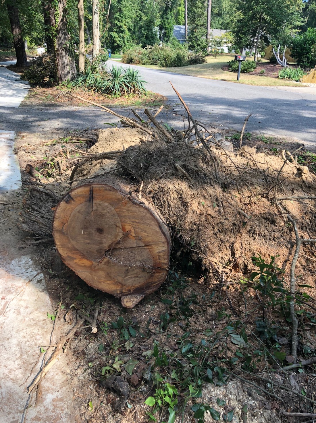
Much of the roadside “debris” in town is impressive in size.
The confusion was evident Tuesday evening in their questions, in their facial expressions, and in the unanimous decision they made to instruct the Town Planning Board to continue to look for “further exceptions” to the nonconforming lots ordinance they enacted Sept. 5, 2018: The Southern Shores Town Council still does not have a grasp on how the Town Code currently deals with nonconforming lots and whether its regulation reflects good land-use planning, in light of how the town was platted and lots were sold.
The intent of the Town’s nonconforming lots ordinance, which is Code sec. 36-132 (“Regulation of Structures and Uses Nonconforming”), is to restrict the number of lots being developed that do not conform to the Town’s minimum dimensional requirements. In the RS-1 single family residential district, where most of us live, Town Code sec. 36-202(d) specifies that the minimum required lot area is 20,000 square feet, and the minimum required lot width is 100 feet.
Unfortunately, while these dimensions readily apply to oceanfront lots and other lots on Ocean Boulevard, they do not comport with standard-size lots in sections of the town that were platted and developed later.
There has long been regulation in Southern Shores of nonconforming lots. Last September the Town Council did not enact a new ordinance; it enacted a replacement ordinance. As Town Attorney Ben Gallop explained Tuesday (yet again), the previous sec. 36-132 contained “loopholes.” The language of the ordinance, he said, “was loose.”
While The Beacon has disagreed with Mr. Gallop’s interpretation of the previous ordinance, we agree that it was not clearly and unambiguously written.
When the Town Council unanimously voted Tuesday to approve ZTA 18-09PB01, which carves out exceptions to the replacement Town Code sec. 36-132, it did so to alleviate “hardships” experienced by property owners, as Councilman Fred Newberry noted. The Beacon supported relief for all such owners who do not own oceanfront property.
Each of the exceptions enumerated in ZTA 18-09PB01 could be, and has been, identified in public meetings by the last name of the property owner who was disadvantaged by replacement Town Code sec. 36-132, which tightened up the preexisting 36-132: Hurd, Ausband, Love, Roughton. Those of us who have followed the Planning Board’s deliberations know which of the measure’s provisions is “the Hurd exception” or “the Love exception.”
Planning Board Chairperson Elizabeth Morey told the Town Council Tuesday that her Board’s intent with ZTA 18-09PB01 was to create a “very targeted list of exceptions.” The Planning Board deliberately identified “which lots we wanted to give exceptions to,” she said, based on “conditions that we were aware of.”
Ms. Morey indicated that the Planning Board would be willing to consider drafting more zoning text amendments to create more exceptions to sec. 36-132.
The Beacon believes that taking such an approach would be a major mistake.
The Beacon asks: Why is the Town Council stuck on this issue and metaphorically running in place? Why are members continuing to consider the issue of regulating nonconforming lots as a matter of carving out exceptions to the rule, rather than examining the equities of the rule? Where is the wholistic view? The big-picture approach?
Perhaps it is the legal language of Town Code section 36-132 and the legal language of proposed amendments to the section that confound Mayor Tom Bennett and the four Town Council members. Or perhaps it is a lack of preparation, follow-through, and comprehension on the part of individual members of the Council.
Certainly the Town Council has not “owned” the issue by showing initiative and leadership. That one member, Councilman Christopher Nason, who voted against the replacement nonconforming lots ordinance enacted last September, has had a business and personal relationship with a well-known property owner who would like to develop a nonconforming 50-foot-wide oceanfront lot certainly has not furthered thoughtful discussion among them. Nor has that property owner’s decision to have his attorney, Starkey Sharp, speak in his behalf at Planning Board and Town Council meetings.
On Tuesday night, Council members not only went over old ground, they asked Interim Town Manager/Planning Director Wes Haskett to do an assessment of nonconforming lots in Southern Shores—a task that he has already done, and the results of which he has already submitted and posted on the Town website.
After a months-long effort, undertaken pursuant to a Feb. 5 request by the Town Council. Mr. Haskett presented the results of a survey he compiled with the help of Town Permit Officer Dabni Shelton and the Dare County Register of Deeds office at a special April 23 meeting of the Planning Board. He reported its completion to the Town Council at its May 7 meeting. (These dates are contained in a staff report prepared by Mr. Haskett, which was included in the Council’s Sept. 10 meeting packet.) This information is readily available online:
The Beacon is not going to hazard a guess as to how many Town Council members have accessed and studied these data.
We first reported the survey results on 4/24/19 and have referenced them subsequently in other postings. We also have repeatedly credited local builder and Southern Shores native Matt Neal, who is running for Town Council, with presenting maps and lot information to the Planning Board and the Town Council, starting many months ago, that should have informed both boards about where the nonconforming lots are and why.
The fact is, most current nonconforming lots were platted that way. Lot-size standards differed from area to area, as Southern Shores was developed. There are apples and oranges throughout town.
Mr. Haskett reported in April that there are 3,037 total lots in Southern Shores, 846 of which—or about 28 percent—are less than 20,000 square feet in area. He also reported that, of the 3,037 lots, 241 of them, or about 8 percent, are 50-foot-wide lots that are part of parcels consisting of two or more lots. Of these 241 lots, 28 are vacant: They represent less than 1 percent of the total number of lots in Southern Shores
Perhaps it “all boils down to,” as Councilman Gary McDonald said during the Town Council’s discussion Tuesday, a lack of planning by the Council itself.
“This Board needs a plan to go forward with,” Mr. McDonald said, after noting that it is up to the Council to determine “what the town wants.”
The Planning Board and the Town Council have been kicking around the problem of developing nonconforming lots in town for at least 17 months. It arose because property owners on and near the oceanfront were demolishing structures that were built on 100-foot-wide parcels and selling off the land as two 50-foot-wide lots, each of which could be developed, thus doubling the number of houses. The replacement Code sec. 36-132 stopped this trend, but its regulatory mechanism extended too far.
Councilmen Nason and McDonald delved Tuesday into changing what Mr. McDonald called “zoning districts” in order to reflect the realities of how Southern Shores was platted and developed. The Beacon believes this is thinking oriented in the right direction. If the minimum dimensional requirements imposed by the Town Code according to residential district do not reflect the realities of Southern Shores, then changes must occur.
It is unfortunate that the Town Council seems incapable of giving even basic informed direction to the Town Planning Board about such changes. In concluding the Council’s discussion on nonconforming lots, Mayor Bennett spoke of “pass[ing] this venture to the Planning Board” for “further ordinance consideration.”
DELAY OF TOWN MANAGER HIRING
Mayor Bennett also chose to delay any action in the search process for a new town manager until the new Town Council is seated in December.
By the time the first step in the selection process is initiated, it is likely to be January, nearly six months after former Town Manager Peter Rascoe announced his retirement.
Councilmen Gary McDonald and Fred Newberry protested this delay, but to no avail. A motion made by the Mayor to have the new Town Council, which will be seated in December, handle all aspects of the town-manager hiring, even the selection of the search firm that the Town will use, was seconded by Mr. Conners and supported by him and Mr. Nason in a 3-2 vote.
Per the Town Council’s request last month, Interim Town Manager/Planning Director Wes Haskett compiled a list of four search firms (aka recruiters) for the Town Council to consider. They are N-Focus of Kannapolis; Developmental Associates, LLC, of Chapel Hill; The Mercer Group, Inc., of Raleigh; and Hartwell Wright of Raleigh. Mr. Haskett did not explain how he happened to choose these four, nor did any Council members inquire.
Mr. Newberry questioned the Mayor’s motion—pointing out all of the steps that must be taken in the hiring process, from selecting the search firm, to advertising the position, to reviewing applicants, interviewing attractive applicants, etc. He then asked him why he would deliberately delay the process, to which Mr. Bennett replied: “What’s the harm?”
Mr Bennett followed up with a statement that The Beacon considers very biased: “We have a manager in place, and he’s doing a fine job.”
“That’s not the issue,” Mr. Newberry replied, making the case for opening up the search for the benefit of the public, who might like more choices in, and a voice in choosing, who runs the everyday operations of the Town.
“We owe it to the public,” Mr. Newberry said, to “give them that opportunity.”
Councilman Nason, who clearly was the swing vote in this decision, expressed concern over the “qualities” that he might seek in a new town manager versus the qualities that the new Town Council might seek.
“I don’t want to saddle the new Council with my opinions,” he said.
The Beacon doubts that people would disagree much, if any, over the necessary qualifications for a good town manager. That wheel has already been invented. We also do not see how interviewing the four firms; selecting one from among them; and having that firm advertise the position would do anything but assist the new Town Council in the search process. The hiring decision rightfully belongs to the new Council.
After the vote was taken, Councilman McDonald persisted in his protest of it, saying to the Mayor: “I personally feel that this is just delaying the process. You were not in favor of going forward with this process at the last meeting. This is just a delay tactic, Tom.”
Annoyed, Mr. Bennett terminated all further discussion, citing the vote, and saying, “That’s pretty much the end of it.”
That we have a mayor who thinks he can anoint the next town manager, according to his own personal preference (Wes is “doing a fine job”), is appalling to The Beacon. He is only doing a disservice to Mr. Haskett, who deserves to earn the job competitively.
We also wonder how Mr. Haskett can adequately serve as both town manager and planning director for six months. Doesn’t the Town need both? Mayor Bennett said nothing about the workload that Mr. Haskett will be shouldering until a new town manager is hired or, if he is promoted, until a new planning director is hired.
The Town paid Mr. Rascoe $206,913 in total salary and benefits for FY 2018-19 and had budgeted $214,902 for his salary and benefits in FY 2019-20. Mr. Rascoe was the highest paid town manager on the Outer Banks. (The Beacon has salary data from the other beach towns and still intends to write a story.)
As deputy town manager/planning director, Mr. Haskett earned $108,260 in total salary and benefits in FY 2018-19 and is slated to earn $112,613 in FY 2019-20. He is receiving only $1,000 more per month ($250/week) for taking over Mr. Rascoe’s job.
It would seem that the Mayor’s delay decision may prove the expendability of a staff position. Certainly, it saves taxpayers money.
IN OTHER NEWS FROM TUESDAY’S MEETING:
DEBRIS REMOVAL: In his Town Manager’s report, Mr. Haskett said that he hopes to be able to announce the Town’s debris removal schedule and protocols by the end of the week. There will be only one debris pickup, he said, “one pass through the town,” so you must have your debris in the right-of-way and ready for pickup when your time arrives. The Town will send a special announcement by email to its newsletter subscribers and post a notice on its Facebook page when the schedule is known.
If the storm is declared to be ineligible for FEMA assistance, Mr. Haskett said, there may be restrictions on pickups from private streets in town.
SOUTH DOGWOOD TRAIL SIDEWALK CONTRACT BID OPENING DELAYED; ADA COMPLIANCE TO BE DETERMINED: Mr. Haskett also reported that the South Dogwood Trail sidewalk bid opening that was scheduled for Sept. 5 has been postponed to Oct. 3 at 10 a.m., in order to give the Town time to ensure that the sidewalk design complies with the Americans With Disabilities Act (ADA).
According to Mr. Haskett, the Town will “have a small number of sections of the path [design] evaluated” for ADA compliance prior to the opening of the bids. If redesign of the walkway is necessary, there may be cost added to the contract.
Homeowner Al Ewerling of South Dogwood Trail has adamantly insisted at Council meetings that the Town Engineer’s sidewalk design comply with the ADA.
In public comments Tuesday, Mr. Ewerling expressed appreciation for the Town’s decision to evaluate the sidewalk design with the ADA in mind, but he also advised that “The Town seems to be doing [things] backwards,” by building a sidewalk before it addresses the Town’s traffic problems, especially on South Dogwood Trail.
CUT-THROUGH TRAFFIC: As for the traffic, The Beacon gave an update on the petition to dead-end Hickory Trail at Hillcrest Drive and on the Town Council-sanctioned traffic committee yesterday. We will further mention only that Lauren Van Riper, of Hillcrest Drive, made quite an impression when she told the Town Council that she has twice been hit by moving cars when she has retrieved her mail at the road! Ms. Van Ripen also described being stuck in her home during summer weekends, from 8 a.m. to 8 p.m., because of traffic backups on Hillcrest Drive, and having drivers honk at her when she tries to pull out of her driveway.
Norman St. Laurent of Hickory Trail repeated his urgent request for police enforcement of the 25-mile-an-hour speed limit on his street.
UPDATE FROM LIBRARY COMMITTEE: Chairperson Michael Fletcher reported that the Exploratory Committee for a Potential Branch Library in Southern Shores has eight members on it, including non-voting members. The committee has done a “property suitability” study of “four or five” potential library sites, he said, and one of them, which he would not identify, is “very promising.”
Mr. Fletcher also said the committee would be generating a survey to distribute to surrounding communities to determine “their potential use of the library.” He concluded by saying that he was “optimistic” that the committee’s work would be “done in the next few months.”
“We’re making pretty good progress,” he said.
COMING UP NEXT:
The Planning Board meets Monday, Sept. 16, at 5:30 p.m. for its regular monthly meeting in the Pitts Center.
BEACH NOURISHMENT: The Town Council will meet for a special long-range planning session Sept. 17 at 5:30 p.m., also in the Pitts Center. The agenda for this special meeting is loaded. At the top of it are a presentation by the coastal engineering consultant of the latest beach survey results and the Council’s consideration of beach nourishment. Additional topics, which merit their own exclusive forums, include: seasonal cut-through traffic, stormwater runoff, rehabilitation/replacement of town buildings, an update of the Town’s land-use plan, and more.
The intersection of Sea Oats Trail and Duck Road around midday on Monday.
Dear Readers:
I will be posting a full report of last night’s Town Council meeting tomorrow. Because of preexisting commitments, I do not have the time today to do more than post a few highlights.
Many of you will be interested to know that David Watson withdrew his petition to dead-end Hickory Trail at its intersection with Hillcrest Drive. Mr. Watson, a homeowner on Hickory Trail, is now a member of Tommy Karole’s Town Council-sanctioned committee to explore ways to curb the cut-through traffic. Mr. Karole announced last night that Victoria Green, a homeowner on Hillcrest Drive, is also a member of this committee, which Councilman Fred Newberry oversees.
Mr. Karole reported to the Town Council that he anticipates holding two public forums on the traffic this fall, one next month and the second in November. He further provided an email address where people can reach him: TOSStraffic@gmail.com. Interim Town Manager Wes Haskett will be meeting with Mr. Karole soon to discuss setting up a Town email address for his committee. Communications with Mr. Karole will be a matter of public record.
Mr. Karole and his family have been coping this summer with the illness and death of a very close loved one. The Beacon extends its sincere condolences to Tommy, his wife, and children.
Despite frequent trips out-of-town during the past three months, Mr. Karole said last night that he has talked to a number of people about their cut-through traffic solutions. He also has been carefully considering committee members and will likely add more to a group that he would like to be representative of the different areas of town.
The Beacon would like to thank everyone who contacted the Mayor and Town Council about the petition signed by Hickory Trail and Red Bay Lane property owners, whether you opposed or supported it. As I said on The Beacon Facebook page yesterday, I viewed the petition as the start of a much-needed community conversation. In public comments last night, I called it a “cry for help.”
Please don’t go away. Keep raising your voices. And make a point of attending all public forums and asking Town Council candidates where they stand on this important issue.
NONCONFORMING LOTS
In other action last night, the Town Council, as expected, unanimously approved ZTA 18-09PB01, which grants exceptions to the nonconforming lots ordinance (Town Code sec. 36-132), enacted last September, to known individual property owners. The vote was 4-0 because Town Councilman Christopher Nason was recused.
During the public hearing on ZTA 18-09PB01, Councilman Jim Conners heatedly interrupted remarks I was making, seeking to prevent me from using the words I chose to use. I was not being profane or inflammatory in my advocacy.
Interruptions by the Town Council during public remarks have long been considered inappropriate; hostile interruptions like Mr. Conners’s are even more objectionable.
I was explaining how a 50-foot-wide oceanfront lot at 64 Ocean Blvd. was created from a 137 ½-foot-wide vacant parcel owned by SAGA Realty and Construction when Mr. Conners cut me off, and Mayor Tom Bennett intervened, seeming to support his objection. The Mayor certainly did not chastise his colleague for censoring me.
My personal opinion is that ZTA 18-09PB01 is ill-conceived and that the subject of nonconforming lots—which exist throughout Southern Shores because of how the town was platted and developed—should be considered wholistically in big-picture planning.
It does not make sense to apply the minimum dimensions for oceanfront lots, for example, to lots in the dunes and elsewhere that were not platted with the same dimensions in mind.
Local builder and Town Council candidate Matt Neal has been carrying maps of the town, showing the variations in lot area and width, to public meetings since at least last January, perhaps even last year. Despite Mr. Neal’s presentations, the Town Council has supported a piecemeal approach of identifying exceptions to the prohibition of nonconforming lots in town.
Again last night, Mr. Conners made a motion, which was unanimously approved, to refer the issue of nonconforming lots back to the Town Planning Board to “look for further exceptions.” Mr. Conners singled out as possible exceptions lots in Seacrest Village.
It has long been known that Seacrest Village is a community of nonconforming lots. This should not be news to any Town Council member. Mr. Neal has publicly stated this fact on several occasions, including before the Town Council, and The Beacon has published it. Nonconforming lots on Skyline Road and Wax Myrtle Trail also have been discussed before the Town Council and the Planning Board.
I will end this writeup about last night’s meeting, which I intended to be brief, with mention of an instrument that I recalled for Councilman Conners and that we all should prize: the First Amendment. Americans are privileged to live under the U.S. Constitution, especially the extraordinary Bill of Rights.
No member of a governmental body should ever censor a member of the public simply because he does not like what he is hearing. If Mr. Conners is not able to listen open-mindedly to all of his constituents, without imposing judgments upon them of what he believes they should be permitted to say, he should resign his office.
IN CASE YOU HAVE NOT YET HEARD . . . Dr. Greg Murphy, a Republican who currently serves in the N.C. legislature, is our new U.S. Congressman.
This debris pileup is on Hickory Trail, near East Dogwood Trail, where quite a few trees came down in the roadway, and one hit a nearby house.
A special election for North Carolina’s third U.S. Congressional district will be held today to determine who will serve out the term of the late Walter Jones, the longtime Congressman who died Feb. 10, after being reelected last November.
Voters in Southern Shores may cast their ballots at the Pitts Center until 7:30 p.m. Polls opened at 6:30 a.m.
The candidates are, in alphabetical order:
Tim Harris (Libertarian Party)
Greg Holt (Constitution Party)
Gregory Murphy (Republican Party)
Allen Thomas (Democratic Party)
The third congressional district includes all or part of 17 northeastern N.C. counties, including Dare, Currituck, and Hyde counties, as well as Marine Corps Base Camp Lejeune in Jacksonville and Marine Corps Air Station Cherry Point in Havelock.
Please vote if you have not done so already.
Note: The special election will not conflict with the Town Council meeting in the Pitts Center at 5:30 p.m. The polling station is set up in the hallway outside of the main meeting room.
DEBRIS PICKUP
In other news, the Town of Southern Shores sent an email out to property owners on its newsletter-subscriber list late yesterday afternoon announcing that the schedule and protocols for storm-generated debris would be announced “as soon as possible.”
The Town advises all property owners to place their debris in the roadside right-of-way and to separate it into piles consisting of: 1) vegetative debris; 2) construction and demolition debris; and 3) white goods (appliances).
Earlier, I suggested, based on past storm experience, that there would be no pickup of construction materials. This was an error.
In a bulletin (#10) issued the morning of Sept. 7, Dare County Emergency Management advised that Dare County Public Works would pick up vegetative debris, construction and demolition materials, metal (appliances), and household hazardous waste and electronics (e.g., oil, bleach cleaners, televisions, computers). It was unclear to me then if the Town of Southern Shores would be handling pickup independently or if the County would manage it. The Town’s email does not clarify this point.
Hazardous waste and electronics are not included among the storm-generated debris that the Town advises will be picked up.
The Town’s autumn solid waste/bulk item pickup will be held in October. The Town’s email asks that you not place items that are suitable for removal then at the roadside now.
DISASTER RELIEF: The Outer Banks Community Foundation is collecting disaster-relief donations for Dare County and Ocracoke. If you would like to donate, please visit http://www.obcf.org/disaster. All donations are tax-deductible and will be used exclusively for direct assistance to people in need.
BY THE WAY . . . if you see a person walking around with a laptop, looking officious, that’s a U.S. Census worker, not a town or county employee assessing storm damage.
Northbound cut-through traffic backs up on Sea Oats Trail near its intersection with Duck Road in the early afternoon today.
Exceptions to the new nonconforming lots ordinance that the Town Council enacted just a year ago will again be the subject of a scheduled public hearing when the Council meets tomorrow for its monthly meeting, 5:30 p.m., in the Pitts Center.
Besides the public hearing and possible action by the Town Council on Zoning Text Amendment (ZTA) 18-09PB01, which seeks to amend Town Code sec. 36-132, the Council will hear from homeowner David Watson about a petition signed by Hickory Trail and Red Bay Lane property owners regarding curbing seasonal cut-through traffic and consider how to move forward with hiring a new town manager.
Town Manager Peter Rascoe retired Sept. 1, after nine years as head of the Southern Shores town staff. Wes Haskett, who has been serving as deputy town manager and planning director, has assumed the duties of interim town manager.
Included in the consent agenda business for tomorrow’s meeting is a resolution to designate Mr. Haskett as deputy finance officer. This appears to be a perfunctory action taken pursuant to N.C. statute to ensure that if Finance Officer Bonnie Swain is not available, Mr. Haskett has the power and duty to serve in her absence.
Most of the pages of the 62-page packet are devoted to Mr. Watson’s petition, as a copy of the form that each property owner signed is appended. (Full disclosure: I was a signee.) The petition reads:
“In an effort to restore Hickory Trail and Red Bay Lane to their original purpose and design as streets for ingress and egress; We the owners of said homes and lots along Hickory Trail and Red Bay Lane ask that the Town of Southern Shores dead end Hickory Trail at the Hickory and Hillcrest intersection allowing only pedestrian, bicycles, etc., to pass on to said intersection, thus reducing unnecessary and unwanted automobile traffic on this side street.”
Also scheduled on the meeting agenda is a report by Mike Fletcher, chairman of the Exploratory Committee for Potential Branch Library. In light of Hurricane Dorian, the police and fire chiefs’ monthly reports, prepared for August, are likely to include information about how the town fared in recent days, as well.
NONCONFORMING LOTS
As you may recall, the last time ZTA 18-09PB01 was set for public hearing (in July), the Town Council unanimously tabled it until December. A month later, the Council unanimously reversed course and scheduled ZTA 18-09PB01 for hearing in September.
See The Beacon’s blogs of 7/17/19 and 7/18/19 for background.
At the Town Council’s Aug. 6 meeting, Councilman Jim Conners made a motion to “reschedule a public hearing and Council discussion and /or action at the regular meeting of September 10, 2019 to consider the Planning Board recommendation of ZTA 18-09PB01” and asked Town Attorney Ben Gallop to “prepare for Council discussion, a separate ordinance that addresses only the tear down of a structure located on two or more non-conforming parcels of land and then building two or more structures on non-conforming lots.”
According to Mr. Conners, as The Beacon reported 8/7/19, his motion envisioned: 1) the passage of ZTA 18-09PB01 “to give immediate relief” to unfairly disadvantaged property owners; and 2) the “repeal and enactment of an ordinance that addresses the limited situation” of tearing down a structure that is situated on two adjacent nonconforming lots and selling off the two lots for separate development.
Included in the meeting packet on pages 21-23 is a new ordinance currently designated ZTA 19-X that proposes to address the limited situation that Mr. Conners described. The language of ZTA 19-X is language that Mr. Gallop drafted last year, but the Town Planning Board did not endorse.
As longtime readers know, The Beacon has been reporting on the nonconforming lots issue—some might call it a dilemma—since spring of 2018 when The Beacon debuted. On Sept. 5, 2018, the Town Council revised the then-existing Town Code sec. 36-132, titled “Regulation of Structures and Uses Nonconforming,” by enacting language that clearly stopped the trend of property owners selling off developed 100-foot-wide parcels as two 50-foot-wide lots, which could be (and were) separately developed.
This trend arose on the oceanfront and west side of Ocean Boulevard, where the majority of houses were required by custom and restrictive covenant to be built on 100-foot-wide lots, ensuring the low-density-population development for which Southern Shores is noted and acclaimed.
Historically, the developers of the Southern Shores oceanfront sold 100-foot-wide parcels as two 50-foot-wide lots, which were expected to be, and were, combined into one buildable lot. When, during the past few years, old structures built upon these 100-foot-wide parcels began to be razed and two structures began to appear in their place, as property owners sold off 50-foot-wide lots, the Town Council stepped in to regulate.
Upon passing the replacement ordinance for sec. 36-132 last September, the Town Council tasked the Town Planning Board with assessing the fairness of imposing the now clearly delineated requirements of lot conformity on individual property owners. ZTA 18-09PB01, which the Planning Board devised and unanimously approved, is written to give relief to known, identifiable property owners.
The Beacon has written extensively about nonconforming lots and the Town’s response to the higher-density-development trend, and we do not believe that the Town Council has yet hit on the proper approach. We believe that the impenetrable and confusing legal language of ZTA 19-X only exacerbates the confusion.
The problem traces back to Town Code enactment by the Town Council of minimum lot dimensions in the various residential districts that failed to take into account how the town was developed. The Council that established the minimum dimensions—some time around 2000, Mr. Gallop has stated—painted with too broad of a stroke.
In the RS-1 single-family residential district, in which the vast majority of us live, the minimum lot size is required to be 20,000 square feet, and the minimum lot width is 100 feet. (Town Code sec. 36-202(d).) Any lot that does not conform to these minimums is considered “nonconforming.”
But here’s the rub: Oceanfront properties may have been sold as 100-foot-wide parcels, but Southern Shores properties sold subsequently were narrower. As local builder and Town Council candidate Matt Neal has pointed out on numerous public occasions, all of the lots in Sea Crest Village are 75 feet wide. Sixty-foot-wide lots were sold on Skyline Road. It is safe to say that the variation in lot size among the different areas of town development is substantial.
The Beacon believes that the Town Council should examine the minimum lot standards established historically in the various areas when they were developed and revise the Town Code to conform with those standards. We urge the Council not to enact more torturous legal language. Change the minimum dimensions within the residential districts to reflect the different prevailing standards in various areas of those districts. It may take more research to do so, but the outcome will be more satisfactory for all property owners.
Visitors may freely enter all areas of Dare County north of Oregon Inlet today starting at 4 p.m., when “Priority Four” stage reentry takes effect, according to a bulletin posted this morning by the Dare County Control Group. Priority Three reentry will begin in Hatteras Island, effective at noon, the Control Group said.
The Control Group advises all visitors to check with their rental-property providers before traveling to ensure that their accommodations are available.
Dangerous surf conditions remain. Beachgoers may check conditions at https://www.weather.gov/beac/mhx, according to the bulletin.
The Town of Southern Shores has not made any announcements about tree-debris removal. The Town customarily picks up limbs, leaves, branches, and other vegetative debris that is left unbagged at the roadside. It will not pick up building materials, shingles, concrete, and the like.
You may expect a regular trash collection tomorrow.
No sooner had I posted my last blog in which I said that the Dare County Control Group had proved me wrong by not ordering Priority Three reentry today than the Group posted a bulletin at 7:45 p.m. announcing that Priority Three reentry was effective immediately for the areas north of Oregon Inlet.
Priority Three applies to nonresident property owners and employees of non-critical businesses. (For more details on Priority Three, please see earlier blogs.)
The Dare County Control Group also announced that Priority Two reentry is effective immediately for areas south of Oregon Inlet, i.e., Hatteras Island.
The Control Group’s next bulletin will be issued no later than tomorrow at 8 a.m.
Hurricane-related damage along Ocean Boulevard in Southern Shores was confined to relatively few structures and was minimal. Damage visible on a driving tour today under clear blue skies of the oceanfront and westside areas between the Kitty Hawk-Southern Shores line and the Ocean Boulevard-Hickory Trail intersection tended to be on rooftops, as pictured above. Shingles blew off roofs, and some screens and sections of siding also took flight in Dorian’s winds, landing in yards and on the roadside.
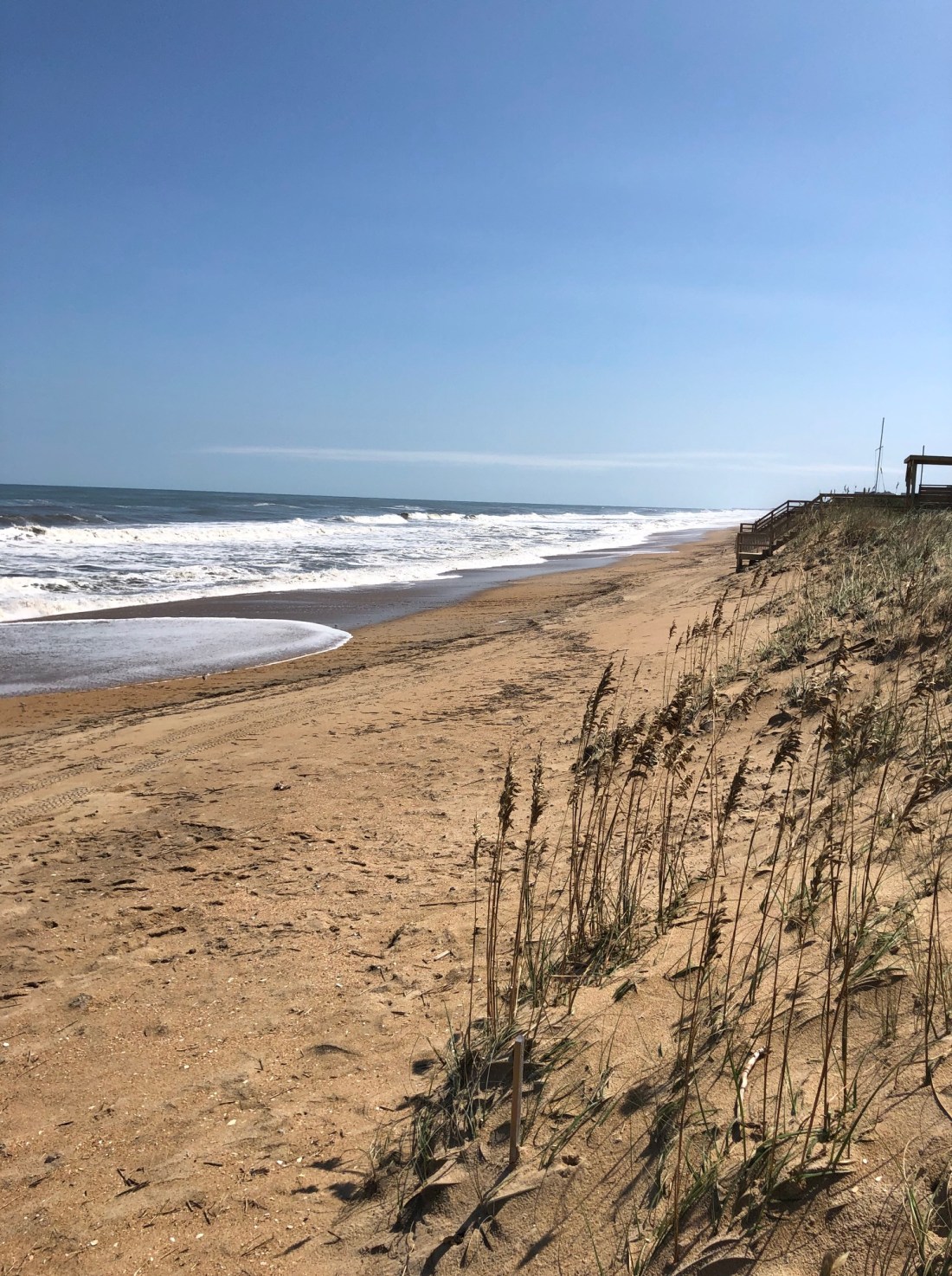
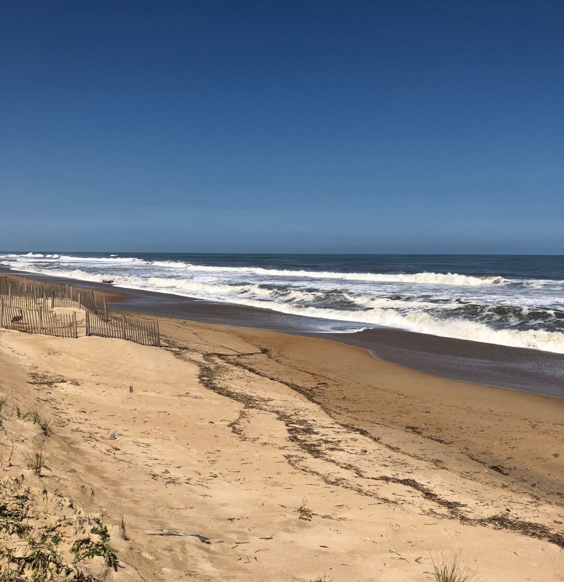
But such damage was the exception. The Southern Shores beaches and vacation cottages fared very well in the storm.
This window (above) blew out of a westside bedroom in a beach box near the Duck Road split, but it landed intact in the yard. Nearby, a crimp near the top of the AT&T cell tower could be seen:
There were no reports, however, that the damage to the tower’s structural integrity caused any cell-phone service problems.
It was a gorgeous beach day. A beautiful September day with nary a reminder of the hurricane’s battering, bashing, scraping, lashing, hammering, pounding, slamming, smashing, ripping, and rocking. The news media used all of these provocative verbs and more in describing Dorian’s action.
The Dare County Control Group has proved me wrong about reentry. I thought the third priority stage would take effect today, and all visitors would be allowed access to the Dare County towns north of Oregon Inlet tomorrow. It would appear instead that another announcement about reentry staging will not be made until tomorrow morning.
While out and about, I saw no safety hazards in Southern Shores outside of the maritime forests on the soundside and in Chicahauk, and these could be managed by driving cautiously and alertly. Because of fallen trees and tree debris, some of the roads were passable only as single lanes.
Tree-removal and electricity contractors have been working diligently to restore power and clear roads to the wooded neighborhoods. Many residents were out today, clearing their driveways and yards and even the streets in front of their homes.
It was business as usual in the Southern Shores-Kitty Hawk commercial district on U.S. Hwy. 158.
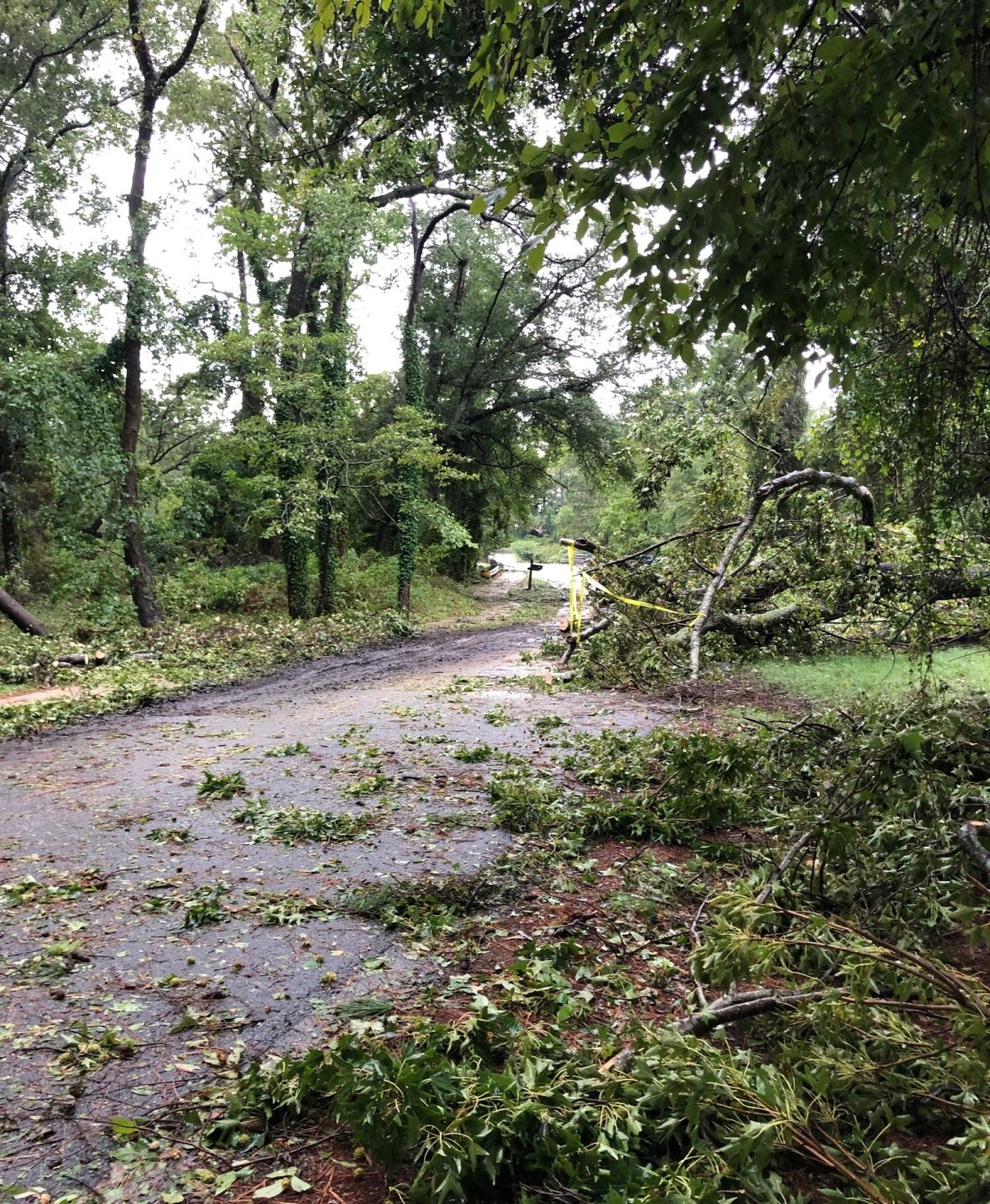
This photograph of a downed tree across Hickory Trail was taken this morning shortly before a tree-removal crew arrived to clear it.
“Priority two” permanent Dare County residents and essential personnel for critical businesses may return to areas north of Oregon Inlet today starting at noon, as Dare begins its priority reentry staging.
In a bulletin issued at 9:30 a.m., the Dare County Control Group advised that it has started the reentry process for the northern towns, including Southern Shores, but has continued to keep access to Hatteras Island closed until further notice. The county has established a checkpoint to restrict entry to Hatteras Island.
According to the bulletin, the Control Group “will continue to meet to assess conditions and implement reentry for additional priorities as conditions improve and power is restored.”
Priority two permanent residents must present a valid N.C. driver’s license or a government-issued ID card with a local address in an area north of Oregon Inlet in order to gain access. Essential personnel of critical businesses must present a priority two reentry permit with a matching government-issued ID, according to the Control Group’s advisory.
Priority one applies to essential personnel; priority three applies to nonresident property owners and employees at non-critical businesses; and priority four encompasses all visitors, including renters who have booked vacation cottages starting today.
Based on my experience and my observations, I do not envision the Control Group moving into priority four reentry until tomorrow. Priority three reentry could occur later today.
According to the DCEM bulletin, Southern Shores streets have been cleared for access. Town staff will be assessing the storm-generated debris and providing debris-removal information as soon as possible. As for our neighboring towns:
The bulletin advises that, although a town-wide damage assessment has not been completed in Duck yet, the damage there appears to be minor, just some minor siding, roof, and fence damage. N.C. Hwy 12 and all side roads in Duck are passable, despite some standing water and tree debris.
The DCEM bulletin did not provide details about conditions in Kitty Hawk, but notes that traffic signals are inoperable in parts of Kill Devil Hills and Nags Head. Generally speaking, standing water, tree limbs, and debris still remain on some roadways in the towns south of us.
There will be no ocean swimming today because of dangerous surf conditions and strong rip currents.
To obtain detailed information about the staged reentry process and to apply for a permit, which you can print out, visit http://www.darenc.com/reentry.
Surf’s up on the beach at 11th Avenue, and the road to reach it remains passable, with very little standing water, according to SSCA President Rod McCaughey, who submitted this photo. Nearby houses, he reports, only suffered minor shingle damage.
The mandatory evaluation for Dare County remains in place because of hazardous conditions, and access to Dare County remains restricted, until the DCEM’s Dare County Control Group meets tomorrow morning to review safety assessments and determine reentry procedures.
In a bulletin issued at 4:35 p.m. today, Dare County Emergency Management described existing hazards as including “downed power lines and trees, impassable roadways, and widespread power outages.”
Southern Shores definitely experienced downed trees, impassable roadways, and some power outages, but they appear to have been largely in the woods, according to what readers have reported to The Beacon. Like Rod McCaughey, who photographed the ocean at 11th Avenue, Nancy Lorell of 13th Avenue saw a “very high and angry” ocean when she ventured to the beach this afternoon.
Ms. Lorell described “some ponding” on her street, “but not as bad as Matthew,” which caused widespread flooding on the oceanside three years ago. Thirteenth Avenue also has “some small limbs and leaf debris” on it, “but nothing major,” Ms. Lorell said.
A single lane is passable on East Dogwood Trail near its intersection with Hickory Trail, thanks to quick work by the SSVFD which, according to neighbors, cleared a number of downed trees from the roadway.
Roadways on Hatteras Island are covered with sand and water, DCEM reports, and N.C. DOT is working to assess damage along N.C. Hwy. 12 there.
All of Hatteras Island is without power, just as is Ocracoke Island, which is in Hyde County, not Dare. Water service to Hatteras Village has been turned off due to a leak that cannot be found and repaired because of flooding. Repair crews are standing by.
The Dare County Control Group has established a curfew for Hatteras Island from 8 p.m. through 8 a.m. tomorrow. It applies to all areas south of Oregon Inlet.
The Control Group will determine the timing for the staged reentry process, which, as The Beacon previously described, will occur according to the “priority” status of returning persons.
Essential personnel may return first during stage one. Resident property owners who have the proper identification or a reentry permit may return during the priority two stage; nonresident property owners with proper ID must wait until priority three stage. Priority four applies to the general public and all other visitors. For more information about the reentry process, see https://www.darenc.com/departments/emergency-management/hurricanes/reentry.
If you would like to receive a DCEM alert via text, voice mail, or email, you may sign up at http://www.darenc.com/alerts.
(UPDATE MINUTES AFTER POSTING THIS: A reader reports that the AT&T cell tower at the Duck Road-Ocean Boulevard split was damaged during the storm.)