An unsightly scene on the beach road on a June Saturday.
The agenda for the Southern Shores Town Council’s Aug. 7 meeting, which was posted on the Town website yesterday, shows that a revised version of the nonconforming lots ZTA 18-07 has been prepared and will be subject to a hearing before the Planning Board at its Aug. 20 meeting, if the Town Council does not adopt the current zoning text amendment next week.
Also noteworthy on the agenda are two new business items: consideration of a draft fire services contract, which would be effective July 1, 2019, a day after the current SSVFD contract expires; and concern raised by Councilman Fred Newberry about trash and recycling cans lining NC Hwy. 12, which includes Ocean Boulevard and Duck Road.
Both the Town Council and the Planning Board meetings are scheduled for 5:30 p.m. in the Pitts Center.
Designated ZTA 18-07A, the new nonconforming lots draft was prepared at the direction of the Town Council, which unanimously tabled ZTA 18-07 at its July 10 meeting and specifically directed Town staff to revise the amendment’s text so as to limit its scope.
If adopted, either ZTA would amend Town Code sec. 36-132, which has gaps in its application, such that property owners have been able to divide conforming lots, which have been typically 100-feet wide, into nonconforming lots, typically two 50-footers—despite restrictive covenants that do not permit the smaller lots. Constructing two houses on a land parcel where once only one house stood clearly does not comport with the Southern Shores vision of low-density development and open space.
As of this writing (noon, July 31), ZTA 18-07A had not been posted on the Town website.
I would like to add a personal note to Councilman Newberry’s concern about refuse cans on the beach road. I knew as soon as the recycling date was changed to Wednesday that rental property companies and rental house owners, like myself, would have a problem. It’s asking too much for renters to put out their recycling or the recycling left by the previous renters in the middle of the week. It’s enough to get them to put out their recycling and trash on the day that they depart, which is typically Friday, Saturday, or Sunday. As a hands-on owner who manages her own repairs and maintenance, I can tell you that many do not.
My experience of the past 30 years is that too often, trash and recycling cans—usually filled to the point of overflowing—line the beach road for days, generating litter and creating an unsightly scene. The photo above is one that I took on June 16 from across the street of my family’s cottage in what is known as the low-traffic area. I often pick up trash and recycling scattered around cans, especially when they blow over. The trash and recycling collectors do not get out of their trucks to right overturned cans.
(For background on the decision to change the recycling pickup day, see The Beacon’s post on June 16.)
A man walks through flooding near the densely developed oceanfront south of Southern Shores after Hurricane Matthew in October 2016.
Yesterday while returning from errands, I noticed how many sections of South Dogwood Trail were flooded with stormwater. There were pools of standing water in the usual places near the driveways into the country club, but also along the road at Wood Duck Court, 92 S. Dogwood, 138 S. Dogwood . . .
And then I wondered what the road will look like after a storm when there is a bike path/walkway along the length of it, as Mayor Tom Bennett has been advocating for years and the South and East Dogwoods Task Force recommended. (See the Task Force’s final report at https://www.southernshores-nc.gov/wp-content/uploads/2015/10/170117-FINAL-REPORT-DWTF.pdf.)
If you remove a sizeable number of trees, which act as a barrier during storms, and cover up the ground with a 5-foot-wide concrete path—not the Task Force’s preference, but a possibility—what will happen to South Dogwood Trail and travel along it?
My thought after that was that, if the East Dogwood Trail bike path goes ahead as planned, I will not have to wonder about South Dogwood Trail. I’ll get to see a preview on East Dogwood of what a bike path on South Dogwood Trail might look like.
Town Manager Peter Rascoe reported at the July 10 Town Council meeting that the East Dogwood Trail project is out for bidding this month. According to Mr. Rascoe, property owners on the south side of East Dogwood Trail have been advised about the sidewalk that is to be built in front of their homes and are not opposed to it.
The proposed East Dogwood bike/walking path will be made of concrete, not a pervious material, which would allow rain to pass through it and be absorbed by the ground. Stormwater mitigation should be a factor in the design process, but concrete is definitely what engineers and planners refer to as impervious.
Coincidentally, I took a car for inspection this morning to Outer Banks Automotive on Woods Road, just across U.S. Hwy. 158, and got an earful about flooding from owner Kevin Bradshaw, whom I’ve known since we were teenagers and his father owned the repair business. Ever since the Town of Kitty Hawk built an impervious bicycle path on the west side of Woods Road, Mr. Bradshaw has had flooding in front of his mechanic’s shop—flooding that threatens the vehicles he has parked on his property.
Mr. Bradshaw said he spent four hours yesterday pumping stormwater that had pooled in his driveway to the other side of the road, using his own generator-powered pump. He said he has repeatedly called the Town of Kitty Hawk to complain and has asked why the bike path wasn’t built on the east side, where there is no commercial development. The answer: “We don’t know.”
LAND COVERAGE, TREE REMOVAL
With this latest storm system, Southern Shores property owners have been given a potential preview of our future if our elected officials allow more land coverage to occur—through changes in the calculation of the 30-percent lot coverage requirement (proposed Zoning Text Amendment 18-04); through the construction of impervious bike path/walkways; and through a failure to prevent the development of nonconforming lots, in particular, 50-foot-wide lots, to which one town councilman—architect Chris Nason—has publicly said he has no objection.
You have only to look to the south and north of us to see what happens during storms, such as the one we’ve been weathering the past few days, in densely developed areas.
According to The Outer Banks Voice, the Town of Kitty Hawk has started pumping standing water from roads between the highways into the ocean, thus necessitating the posting of signs to warn people of possible health risks. The water removed from the streets may be contaminated with disease-causing microbes. Certainly, there is an increased chance of contamination, and swimming is not advisable at discharge locations. (Update 7/27: I understand State environmental quality-experts are recommending against swimming in the ocean anywhere because of polluted stormwater runoff. The waters will have to be tested.)
The Voice also has posted a video that shows a deluge of water across N.C. Hwy. 12 in Duck and motorists driving through it. Duck is a charming village, but it’s also one big impervious surface. (It’s never a good idea to drive into flood waters, but the road is open, and, therefore, presumed to be passable.)
In less-dense Southern Shores, clear-cutting of residential lots contributes to standing water in the roads. There currently is no Town Code ordinance to prevent clear-cutting, and the Southern Shores Civic Assn. Architectural Review Board (ARB) only encourages homeowners not to do it. According to its written guidelines, it urges “restraint.”
There was a time when the ARB looked at individual trees on a lot and told the property owners which ones had to remain, but those days are over. I would like to see a more assertive approach taken by the Town.
A perfect example of how the wholesale removal of trees on a lot, in preparation for home construction, creates a flooding hazard exists at 259 North Dogwood Trail, which is close to my mother’s residence. Ever since the property owners clear-cut the lot at this address in order to build their dream house in 2010-2011, stormwater has run off of the sloping front yard into the road, flooding the width of it, i.e., going north and south.
I became acquainted with one of the homeowners and asked him several years ago why he had taken down so many trees. He said he didn’t have a choice, or so he believed, but he clearly did. I think he was misled.
You don’t have to “hug” trees to know that trees contribute to stormwater management. Tree leaves and branches intercept rain, slowing it down as it falls, and rainwater evaporates on trees’ surface areas and their leafy canopies. Further, tree roots contribute to soil stabilization and make the soil more porous and, thus, more water-absorptive. Trees also use rainwater to grow: The bigger the tree, the bigger the thirst.
Recently, someone purchased the vacant lot adjacent to 259 N. Dogwood Trail and clear-cut it, before starting construction of another dream house on another hill. No sooner had construction begun than a “for sale” sign went up at 259. I know that the personal circumstances of the homeowner at 259 have changed since he built his house, but I suspect the encroachment of the new house at 257 also figured into his decision to sell.
These two luxurious soundfront homes—259 N. Dogwood sold in June for $1.6 million—are on top of each other, separated by the mandatory 30 feet of side setbacks and a dividing strand of bushes and trees, and every time it rains, the road in front of them floods.
SWIMMING POOLS
I use the term dream house deliberately because that is the description that I often hear whenever people discuss (argue about) land restrictions. Such a discussion usually evolves into one about individual freedoms, specifically, the right of a property owner to do what he or she would like to do on his or her property without intrusion from the town government.
I think this is unfortunate. It encourages NIMBY thinking—NIMBY meaning “Not in my back yard”—and pits property owners against each other, to the detriment of the community in which all live.
You may have noticed that the SSCA has enhanced the recreational opportunities at Sea Oats Park and more people are using it. Judging from comments made at its July 5 meeting, the SSCA Board has a gazebo in mind for the site and possibly musical events. Could there be in the works a clubhouse, an indoor pool, and other amenities . . . as long as it’s “not in my back yard”?
I like to think that your back (or front) yard is also mine. If I had a home on Hillcrest Drive or Sea Oats Trail across from, or near, the Sea Oats Park, how would I feel about what the SSCA has done and proposes to do? At what point do the recreational plans of others infringe too much on my quiet enjoyment?
Swimming pools can be a major point of contention between adjacent homeowners and certainly are a source of contention over ZTA 18-04.
If it were enacted as it now is written, ZTA 18-04 would exempt from the maximum allowable 30-percent lot coverage, as set forth in Town Code sec. 36-202(d)(6), 500 square feet of the water area of a swimming pool. (The Beacon has extensively covered this ZTA in both the Planning Board and the Town Council. See July 11 for an update.)
Obviously, if you eliminate 500 square feet of a pool from a calculation of the coverage total, then 500 square feet would be available to a homeowner to cover elsewhere. This would affect stormwater absorption. So, too, would the other exemptions proposed by the ZTA:
*50 percent of pervious materials and turfstone/pavers for driveways and parking areas.
*Gravel walkways
*The outermost 4 feet of eaves
*Open-slatted decks that allow water to penetrate through to pervious material, not exceeding a total of 25 percent of the total footprint area
There’s no getting around the fact that if you subtract for an exemption, you add to the total that may cover the lot elsewhere, in the form of a garage or a wider or deeper house or a larger swimming pool with a gazebo or other structure. A property owner still would be limited by the 30-percent cap and by setbacks, but these restrictions would not prevent expansion of the buildable area, which, in turn, would affect stormwater absorption.
I am encouraged that the newly constituted Town Planning Board, chaired by Glenn Wyder, is sensitive to stormwater concerns and other lot-coverage issues. The Board is currently scheduled to reconsider ZTA 18-04 at its Aug. 20 meeting.
“A pool should not be used as a catch-basin,” Mr. Wyder said during the Planning Board’s earlier deliberation on ZTA 18-04, noting that his swimming pool overflows after a heavy rain.
During the Town Council’s July 10 consideration of the zoning text amendment, Mr. Nason, who is the chief proponent of the lot-coverage change, noted that homeowners can drain their pools of some water before storms.
I wonder if Mr. Nason has any idea how many rental houses in Southern Shores have swimming pools and how unrealistic a suggestion that is.
I am all for dream houses and dream swimming pools, but not at the expense of other homeowners and the community at large. There must be compromise.
PRESERVATION
The common denominator that most of us share in Southern Shores is a desire to maintain the character and appeal of the town, and that means maintaining low-density development, protective trees, and open space.
I have heard from residents throughout Southern Shores this week about flooded roads and flooded yards: on Duck Woods Drive, on Poteskeet Trail in front of the park, before the Juniper Trail bridge, on Ocean Boulevard in the low-traffic area, on Sea Oats Trail, at intersections on N.C. Hwy. 12, north of 4th Avenue, and so it goes.
Each flood merits its own analysis about cause, but I think it’s safe to say that development plays a key role.
We can’t remove the roads. We also can’t control the rain or the saturation capacity of ground that has not been altered by development. But we can exercise some control over lot coverage and the removal of trees.
It is my hope that the new Planning Board will take a long view when it reconsiders ZTA 18-04 and that it will not stop there. The preservation of Southern Shores depends on public servants who rise above NIMBY thinking and political and financial pressures to objectively evaluate the causes of problems such as flooding and to take practical steps to prevent them.
The Southern Shores Planning Board unanimously elected Glenn Wyder, a relatively new addition to the Board, its 2018-19 chairperson, and Elizabeth Morey, a Board veteran of five years, its vice-chairperson, in its first meeting of the fiscal year at the Pitts Center last night. Mr. Wyder then presided over his first Board of Adjustment (BOA) hearing on a variance application.
By a vote of 4-1, Board members denied variance requests from a homeowner on Duck Road who violated rear- and side-setback requirements when he constructed a hot tub, greenhouse, decking around an above-ground swimming pool, and other structures in his yard. The lengthy variance hearing featured intervention by Jacqueline Shea, an adjoining property owner, who argued that she was adversely affected by the setback violations committed by Edward J. Ryan of 291 Duck Road.
Appointed by the Town Council to his seat on July 10, Board member Andy Ward nominated Mr. Wyder (pronounced Wee-der), who also serves as president of the Chicahauk Property Owners Assn. (CPOA), for the chairpersonship, and David Neal, who was appointed last week to his second term on the Planning Board, nominated Mr. Morey.
New Planning Board alternate Michael Basilone participated in the unanimous votes that each nominee received, filling in for absent Board member Joe McGraw. He also voted against granting the variances on Mr. Ryan’s property. Mr. Neal cast the only vote in Mr. Ryan’s favor. He empathized with the homeowner and said of his role on the BOA: “This is not only uncomfortable, it’s no fun.”
During the comment period at the end of the meeting, Mr. Ward asked thoughtful questions of Town Attorney Ben Gallop about the Planning Board’s authority and powers, thus suggesting to me that this Board, with Mr. Wyder’s leadership, may be more proactive than past boards have been in matters pertaining to the physical development of Southern Shores.
Ms. Morey also spoke critically during the comment period about the Town’s removal of trees on public property next to Ginguite Trail, which occurred without any notice to homeowners. Town officials “should put up a sign and explain what they’re going to do,” she said.
OPINION: The FY 2018-19 Planning Board made an auspicious start.
PLANNING BOARD MEMBERS
Before I elaborate a little on the variance application and the issues that arose with it, I’d like to tell you more about the new chairperson and vice-chairperson.
The Town Council appointed Mr. Wyder, a New Jersey native, to the Planning Board on April 3, elevating him from an alternate’s seat. He had three months remaining on a three-year alternate term to which he was appointed after Mr. McGraw was elevated to the Board upon the resignation of Gray Berryman.
(Mr. Berryman resigned from the Planning Board in August 2017, and the Town Council appointed Mr. McGraw Sept. 5, after Chairman Sam Williams requested his appointment. The Town Council did not name a new alternate until Dec. 5–its first meeting after the November election. Mr. Wyder’s time as an alternate was brief.)
Like many of us who love Southern Shores, Mr. Wyder figured out how to live here while continuing to work elsewhere. He is general manager of Mediterranean Tile & Marble in Bernardsville, N.J., to which he returns for about a week about every six weeks.
Currently in his second year as CPOA president, Mr. Wyder has a strong sense of civic-mindedness. Last night, he said he felt “honored” to be the Planning Board chairperson and pledged to work diligently and cooperatively with his colleagues for the betterment of the town “that we and its residents. He has told me, personally, that he may not always agree with me, but he’ll always be honest. That works for me.
Ms. Morey is retired from the Dare County Health Dept. and a former employee of the N.C. Dept. of Environment and Natural Resources in Raleigh. In a June telephone interview with The Beacon, she said that she interacted regularly in her previous employment with builders, acting in the capacity of a local government regulator. She has been self-employed since 2016, engaging in political-campaign management and counseling.
When I asked Ms. Morey what drew her to Planning Board service, she said, “I like the idea of trying to contribute to the community.” She also shared childhood memories of seeing her father, who was on the Fulton County, Georgia Planning Board for many years, working at the family dining room table, with papers strewn about.
Her father, who served as his board’s chairperson, was trying to “make [Fulton County] a better place to live,” she said.
Mr. Neal and Mr. Ward are well-known, longtime builders and Southern Shores residents. Mr. McGraw is also a builder.
Mr. Basilone is a Kitty Hawk firefighter who lives in Southern Shores. Former Town Councilman Leo Holland, whose background is in construction, is the other Board alternate. They conferred to decide which of the two would be seated on the Board last night. (In future blog posts, I will try to tell you more about these Planning Board members.)
Southern Shores Town Code sec. 24-24(a) requires the five Planning Board members and two alternates to be appointed by the Town Council, for staggered terms of three years.
Ms. Morey’s and Mr. McGraw’s terms expire next June; Mr. Wyder’s term expires June 30, 2020. He was appointed to complete an unexpired term left vacant.
BOARD OF ADJUSTMENT; VARIANCE DENIAL
Since April 1, 2014, the Planning Board has served in a dual capacity as the Town’s Board of Adjustment, whose decisions are subject to court appeal, not to Town Council approval. The BOA is a quasi-judicial body that has legal representation and conducts due-process hearings. (See Town Code sec. 36-365.)
Among its duties, the BOA has the power to grant variances from the Town’s dimensional lot requirements, spelled out in Code sec. 36-202(d), such as the 25-foot rear setback and 15-foot side setbacks from which Mr. Ryan sought relief. Mr. Ryan was represented by local attorney E. Crouse Gray, Jr., who elected not to ask for a specific reduction in footage, such as to 10 feet on the side.
I will give you only an overview of Mr. Ryan’s application and hearing. As Mr. Gallop pointed out, there was nothing “exceptional” about his property—not its location, its topography, or any other physical conditions—that supported the granting of any variances. His lot is like many other lots on Duck Road and elsewhere in Southern Shores.
Mr. Ryan bought 291 Duck Road in January 2016. A salt-box cottage, built around 1987, sits at the rear of the property, which the testimony showed, is heavily wooded. It appears from a recent survey of the property, which the applicant commissioned after the Town Planning Dept. served him with a notice of violation, that the original home builder constructed the cottage in a location that breached the 25-foot rear setback requirement. A long concrete driveway leads from the road to the secluded home.
Since he took possession of the house, Mr. Ryan has built an above-ground swimming pool, an inflatable hot tub, decking, and more structures, near the house, without securing any Town permits and in violation of more setbacks. According to Mr. Haskett, it was only when Mr. Ryan arranged last November through R.A. Hoy for a “change-out” of his HVAC system that his failure to obtain permits and inspections and his setback violations were discovered by Town Building Inspector Buddy Shelton.
When asked why he had not sought permits, Mr. Ryan said that he did not think he was required to do so. “I just didn’t think anyone would care,” he explained.
Mr. Gallop directed his questions of the applicant to how Mr. Ryan could remedy the violations by moving the pool, the hot tub, the decking, and other structures. He returned to this focus in his closing argument. “There’s no unnecessary hardship,” the Town Attorney said, citing the standard that the Board of Adjustment must find is met before it can grant a variance. “Just cost and convenience.”
During his direct testimony, Mr. Ryan said that his primary objection to Mr. Gallop’s suggestions was that he would have to cut down a lot of trees. His next-door neighbor, Edward Graham, testified in his behalf that it would be a “travesty” to force Mr. Ryan to tear any of his structures down, especially his “well-constructed, nice-looking deck.”
In his closing, Mr. Gray concluded: “We want to keep what’s there where it’s presently at.”
That’s not going to be allowed to happen. None of the Board members was pleased with Mr. Ryan’s disregard of Town permit regulations.
The initial warning notice issued by the Town instructed Mr. Ryan that he had 15 days either to removal the “encroachment” or to remove the entire structure, including the swimming pool, which standing alone, does not violate any setbacks.
Mr. Ryan may appeal the BOA’s decision to the Dare County Superior Court, if he’d like.
If you would like to know more about the facts of this case and this variance hearing, please email me at ssbeaconeditor@gmail.com.
PLANNING BOARD’S ROLE AND AUTHORITY
The Planning Board’s administration, general authority, and powers and duties are set forth in Town Code secs. 24-24 through 24-27. As I read these ordinances, the Board’s responsibilities and duties are broad. It need not sit back and wait for the Town Council to give it direction. It may initiate action.
Sec. 24-27(a) specifies that it is the duty of the Board “to prepare plans and to coordinate the plans of the town and those of others so as to bring about a coordinated and harmonious development of the area.”
In the execution of this duty, the Board may—among eight enumerated powers—“prepare and recommend ordinances or amendments to existing ordinances promoting orderly development of the area, along the lines indicated in the comprehensive plan, including a zoning ordinance and subdivision regulations.”
While no one would like to see the Planning Board “go rogue,” some of us would like see the Board exercise its independence and raise its voice. Last night Mr. Ward showed interest in ZTA 18-03, the zoning text amendment about lot-coverage calculation, and ZTA 18-07, about nonconforming lots. Both of these ZTAs, in either a new or amended form, are expected to be taken up by the Planning board at its next regular monthly meeting, Aug. 20. Mr. Ward questioned the input that the Board can have in reworking these important amendments, with or without Town staff assistance.
The notice that Ms. Morey said the Town should have to give residents before it cuts down trees in proximity to their homes is an issue that the Planning Board could take up on its own. Too often, the new vice-chairperson said, town officials are “nearsighted when they implement some capital-improvement projects.” The new Planning Board could bring some considerations into focus.
Planning Board meetings and BOA hearings are also voice-recorded. According to Mr. Haskett, there have been occasions when hearings have been videotaped, but that is not routine procedure. I asked Town Manager Peter Rascoe about videotaping meetings and hearings, and he said the cost would be prohibitive.
****
CORRECTION: In my July 11 report of the July 10 Town Council meeting, I reported the Council’s vote to send ZTA 18-04, about lot-coverage calculation, back to the Planning Board for further consideration as 3-2 in one place and 5-0 in another. The vote was unanimous. I regret the error. Sometimes my mind plays tricks.
It was not a re-creation of the Continental Congress, 1st or 2nd, but aspects of last night’s Town Council meeting struck this colonist as revolutionary.
Last night’s Town Council meeting was wild. It included two happenings that I’ve never witnessed before: a 45-minute break while the Mayor and Town Council met in closed session with Town Attorney Ben Gallop, and a motion by one Council member to censure another. In bottom-line action:
The Town Council voted unanimously to send ZTA 18-07, about the 50-foot-wide nonconforming lots, back to town staff to rewrite it in light of Council’s instructions about what it specifically seeks to prevent. There currently is a nonconforming lots ordinance in the Town Code. ZTA 18-07 was an attempt to improve on it. I haven’t mentioned this fact since the Planning Board approved ZTA 18-07, because I didn’t expect the Town Council to tackle its difficult-to- understand legalistic language, which I opposed. To its credit, the Council is doing so–but it should have been prepared to do this a month ago. (That latter statement is my opinion.)
In a similar vein, the Town Council voted unanimously to send ZTA 18-04, about changing how the maxmimum 30 percent lot coverage is calculated, back to the Planning Board for reconsideration. This suggestion was first made by builder Andy Ward in his comments during the public hearing for the zoning text amendment. Mr. Ward was appointed to a voting seat on the Planning Board shortly before he spoke, so he will be involved in the reconsideration. I supported this move as a compromise position.
In addition to Mr. Ward, builder David Neal was appointed to another three-year term on the Planning Board. Former Councilman Leo Holland and Kitty Hawk firefighter Michael Basilone, who lives in Southern Shores, were appointed alternates.
Police Chief David Kole presented his report on the no-left-turn weekend. No official Town Council action related to the control of cut-through traffic and the NLT weekend occurred. At the SSCA general membership meeting Monday night, Mayor Bennett indicated that he was following up with NC DOT. In a Facebook post yesterday, I reported that the Mayor said he was talking with DOT about the signage and lights and looking into how to contain costs for a left-turn ban, which he showed support for considering. Specifically, the Mayor told SSCA membership that he was considering a turn prohibition on summer weekends starting in late June and continuing until early August.
ZTA 18-04, PROPOSED CHANGE IN LOT-COVERAGE CALCULATION
Starting with the July fireworks first, the motion to censure came during a passionate discussion about ZTA 18-04, after a public hearing in which all five speakers argued against its passage, in its current form. Councilman Chris Nason made the motion in regard to Councilman Gary McDonald. Here’s the story:
Upon conclusion of the hearing, Councilman McDonald moved to reject ZTA 18-04, which is a restyled version of ZTA 17-03, defeated by the Town Council, 3-2, on Sept. 5, 2017. Councilman Fred Newberry, who seconded Mr. McDonald’s motion, joined with former Councilman Leo Holland and Mr. McDonald last September to defeat ZTA 17-03. I wrote just two days ago about this “second bite of the apple” occasioned by Councilman Jim Conners’s election. (Such political decisions “happen everywhere” in the nation, all of the time, Mr. Conners defended last night.)
Before a vote was taken on the motion, Councilman Chris Nason, an architect who owns Beacon Architecture & Design in Kitty Hawk, said he wanted to discuss it.
It became clear from Mr. Nason’s lengthy remarks that he was the driving force behind the resurrection of the defeated ZTA, which both Councilman Conners and the Mayor supported.
Saying that he respectfully disagreed with the five speakers, including longtime builder Andy Ward, who collectively argued that the changes to the lot-coverage calculation would aggravate stormwater runoff and retention; increase house size; reduce open space; and otherwise hurt the environment and aesthetics of Southern Shores, Mr. Nason explained that the ZTA is designed “to encourage people to do low-impact projects.”
“Everything in [the ZTA] is a compromise,” he asserted. “It won’t change the character and aesthetics of Southern Shores.”
Councilman Newberry interjected: “You’re not going to convince me that four feet of eaves is aesthetically pleasing.” Mr. Nason agreed, saying that two feet would be better.
The Beacon did not time Mr. Nason’s remarks, nor have I viewed the videotape, but I would estimate that he spoke uninterruptedly for 10 to 15 minutes about the various exemptions from the 30-percent lot coverage calculation that ZTA 18-04 would add—including gravel walkways, four feet of eaves, 500 square feet of a swimming pool’s water area, and 50 percent of pervious materials for driveways and parking areas; relevant State standards and lot-coverage calculations in other towns on the Outer Banks; the recommendations from Codewright in the Town Code “update”; and other considerations.
Also while Mr. McDonald’s motion was pending, the Mayor stated the Council’s options on ZTA 18-04 as three: 1) defeat it; 2) pass it; or 3) send it to the Planning Board for further consideration, a measure he appeared to favor.
After Mr. Nason stopped speaking, Mr. McDonald pointed out that all of the speakers in the public hearing were “intelligent” and didn’t need a “lesson” from Mr. Nason. He reiterated the public’s support for leaving the lot-coverage calculation as it is and cited Codewright’s public survey, which showed that 68 percent of those who responded did not want the lot-coverage ordinance to change. (At some point during the discussion, Councilman Conners characterized the consultant’s survey as “poorly written.”)
It was during his rebuttal that Mr. McDonald turned to Mr. Nason and asked: “How much money do you need to make?”
Ka-boom! Fireworks went off! Cannons roared! Mr. Nason called Mr. McDonald’s inflammatory remark “uncalled for,” and Mr. Conners angrily jumped into the fray. Mr. Nason made a motion to censure Mr. McDonald, and Mr. Conners quickly seconded it.
I may have the sequence of events slightly out of order—everything happened so quickly—but suffice it to say that the Mayor restored order in a commendable show of leadership. The motion to censure was defeated 3-2, with the Mayor and Councilmen McDonald and Newberry voting against it.
In the last public-comment period of the night, Glenn Wyder, who is president of the Chicahauk Property Owners Assn. and a member of the Town Planning Board, called Mr. McDonald’s question “out of line” and said his behavior was worse than any misconduct he has seen on the many boards he has served. Mr. Wyder complimented the Mayor for his management of the breach and urged Town Council members to “put your personal differences aside so we can all work as a team for the good of Southern Shores.”
The Beacon believes that both Mr. McDonald’s hot-button question, asked in obvious frustration, and Mr. Nason’s and Mr. Conners’s reactions to it were rash and ill-advised, but not unexpected in a political forum about a divisive issue that came up just last September. (The Beacon wrote about the politics of ZTA 18-04 in its April 20 report after the Planning Board’s April 16 hearing on the amendment. It has become a veritable litmus test for who has more influence in town: the building industry or the public. That’s why Mr. Ward’s comments were so critical.)
As for Mr. McDonald’s motion to defeat ZTA 18-04, it failed 2-3, with Mr. Newberry voting with Mr. McDonald. The five Council members then united to unanimously pass the Mayor’s motion to send the amendment back to the Planning Board for more consideration.
After the meeting, I asked Mr. Gallop what, if any, legal effect a censure would have had, and he said none. Apparently, it would simply have been an official expression of disapproval.
In his comments at the end of the meeting, Mr. Newberry returned to the subject of public opinion and the town’s land-use plan and poignantly said: “We are elected by the people to represent them whether we agree with them or not.”
ZTA 18-07, NONCONFORMING LOTS
Inasmuch as I have greatly detailed the fracas over the lot-coverage ZTA, I will be more concise in my coverage of other agenda items.
I believe the Town Council showed great practical wisdom in suspending the meeting after the first public-comment period to have a closed session with Mr. Gallop about ZTA 18-07. The motion to do so was made by Mr. McDonald and seconded by Mr. Newberry.
The purpose of ZTA 18-07 was to replace the language of current Town Code sec. 36-132, which addresses nonconforming lots, with language that is more comprehensive and less ambiguous. I believe that Town Attorney Ben Gallop achieved this objective, accounting for as many “what-ifs” as he could imagine in his effort to prevent (re)development on 50-foot-wide nonconforming lots.
Unfortunately, the language of ZTA 18-07 is very legalistic and not easy to understand for someone who is not a lawyer. Before the Town Council’s hearing last night, 2015-18 Planning Board member David Neal, who has been especially concerned about the issue and whom the Council subsequently reappointed to the Board, said to me, “People are confused.” I agree.
During the Town Planning Board’s May 21 consideration of the measure, Board member Elizabeth Morey asked Mr. Gallop: “Are you pretty confident that what you have put together is comprehensive enough to stop what we want to stop?”
Mr. Gallop replied that he thought it was. But the Planning Board obviously struggled with his language and approach. (See The Beacon’s coverage on May 16 and May 23 for background.)
By its action last night, the Town Council suggests that it believes Mr. Gallop has been too comprehensive.
After Council members returned from their 45-minute closed session with the Town Attorney, Mr. Conners made a motion to send the ZTA back to town staff for revision so that it achieves the limited purpose of preventing a property owner who has a single structure (house) on a double lot (two 50-foot-wide lots) from 1) razing that structure and building two structures on his/her property; or 2) selling his property to other people who would rebuild on the smaller lots. At least, this is the meaning that I took away from Mr. Conners’s motion and from Mayor Bennett’s explanation to me after the meeting.
THE POLICE REPORT ON NLT WEEKEND AND BIAS (This is an editorial based on news reporting.)
During his report on the no-left-turn weekend, Police Chief David Kole said he was only reporting the facts, i.e., the vehicle counts on the four monitored roads: NC 12 at Skyline Road; 286 Sea Oats Trail; 182 S. Dogwood Trail and South Dogwood Trail at Wood Duck Court; and Trinitie Trail in Chicahauk. He was not reaching any conclusions about whether the weekend was a success or a failure.
But he did make a point of informing the Town Council and the assembled audience about how short-handed the assignment of two officers to the NLT enforcement left his force—apparently, only three officers are on duty during these peak hours when the transient population swells—and sharing the content of some of the anonymous complaints he received. One voicemail left by an unidentified person, the Chief advised, “said the traffic was bumper-to-bumper” on a residential street. But he didn’t name the street or specify the day or the time or the length of the backup.
The Chief also entertained the Town Council with his account of how two irate out-of-towners called him to complain that the traffic citations they received for illegally turning left at South Dogwood Trail during the June 23-24 restriction were “illegal” because their GPS had directed them to take the turn. The Virginian-Pilot’s article, you may recall, had out-of-towners “fussing” at officers about being stopped for left turns that their GPS allegedly suggested they take.
In reporting that only 17 fewer cars traveled on South Dogwood Trail on June 23 than had traveled on June 16, the Chief said, “I was dumbfounded.” I was immediately sorry that I had traversed South Dogwood Trail at least five times that day, monitoring the traffic; without my travel, the Chief could have reported 22 fewer cars.
Gee, I wonder if I went door to door and polled property owners on how many times they traveled north on South Dogwood Trail on June 23–because, for a change, it was wide open–if I could add some more numbers to the 17 total. Perhaps we should install cameras so we know exactly how many cars with OBX or other local license plates travel north on South Dogwood Trail, and then we can subtract them from future vehicle counts. Ditto with Sea Oats Trail and Trinitie.
During the Town Council’s discussion on the NLT weekend, Councilman Chris Nason made the following calculation: After learning that the traffic ban cost the Town $6800 to $7000 to implement, he divided this total by 17 to arrive at what the Town spent per fewer car on South Dogwood Trail, roughly $400.
How do you argue with such illogical thinking? I am dumbfounded. I wonder if Mr. Nason traveled on South Dogwood Trail on either day of the NLT weekend and observed firsthand its conditions.
There’s no way to know who was traveling on South Dogwood Trail and why and which direction they came from on either NLT trial day. Nor do we know if the traffic counter at 182 S. Dogwood Trail was operating properly on June 23, June 16, last year during the comparable June weekend, or any other time. The Chief actually admitted that the devices “don’t always work.” He also said that the devices will not count vehicles that are traveling at less than 3.5 miles per hour. How many cars moving bumper-to-bumper June 16 on South Dogwood didn’t register for the count? Who knows? And what about swift-moving bicycles? Were they part of the count on June 23?
At no time during his presentation did Chief Kole ever mention the positive experience that so many of us had during the NLT weekend. Not once. If he lives in Southern Shores and talks to residents, then he has to know. Either he’s withholding information, and, therefore presenting a biased picture, or he’s not talking to many of the people he serves.
The Chief reiterated that now familiar line about how “the traffic has to go somewhere” and added to it that he knew when he moved to Southern Shores that traffic was a problem, the implication being that when you move to a nuisance, you shouldn’t complain about the nuisance.
Let’s just suppose that there wasn’t a nuisance when some of us moved here and that we know how to get rid of the nuisance–to the betterment of the tourists who drive through our town en route to the northern beaches, as well as ourselves. Are we all supposed to just grin and bear it?
After the Chief concluded his negative assessment, Mr. Conners took yet another thinly veiled shot at me, branding as “despicable” bloggers and other social media people who called the Chief and his report biased. By that point, dear readers, I’d had enough. I didn’t go to law school just to sit quietly by while one public official presents a skewed and incomplete picture of a community event and another public official unjustly criticizes and seeks to intimidate me. I scrapped what I had planned to say in public comments and spoke about bias.
One example: assumptions about vehicle counts that serve an individual’s interests, but are not factually supported. The Chief doesn’t know why people traveling north on NC 12–at least at Skyline Road–on Fri., June 22, were on the road, nor does he know their destinations.
During my remarks, I mentioned that Mayor Bennett had said in his report to the SSCA Monday night that people told him they loved the NLT weekend. My point was that the Mayor had told that truth, whereas the Police Chief would not. The Mayor quibbled with me about omitting the rest of what he told the SSCA, but I wasn’t informing people about all that the Mayor said. I was only reporting that the Mayor had said people loved it.
I will tell you now, as I reported on The Beacon’s Facebook page on Tuesday, that the Mayor reported “mixed results”: People either loved it, he said, or they complained about the cost to the taxpayers for blocking the turn. After the Council meeting, he told me: “I was honest.”
(So much for being concise!)
AND FINALLY . . .
The Town Council unanimously approved the Capital Infrastructure Improvement Plan for fiscal year 2018-19, as presented (See The Beacon on July 2), and approved with a change in one setback, ZTA 18-03, an amendment submitted by the Southern Shores Volunteer Fire Dept. to amend several Town Code sections in order to establish the necessary parking, signage, and setback requirements for the anticipated new fire station.
According to Town Planner and Deputy Town Manager Wes Haskett, the new station “site plan is still a work in progress.”
The vote on Planning Board applicants was as follows:
For seat 3, full voting Board member: David Neal, 5-0.
For seat 4, full voting Board member: Andy Ward, 3-2; Leo Holland, 2-3.
For alternate one: Leo Holland, 5-0.
For alternate two: Michael Basilone, 4-1.
The next regularly scheduled Town Council meeting is Aug. 7. The Council may meet before then to take up the revised ZTA on nonconforming lots. I’ll let you know.
The next Planning Board meeting is Mon., July 16. The Board members will select a chairperson for the next fiscal year. I’ll give you a meeting agenda preview soon.
ZTA 18-04 would allow 500 square feet of the water area of a swimming pool to be exempted from the 30-percent lot coverage calculation.
Proposed ZTA 18-04, which alters the calculation of the Town’s 30-percent lot coverage requirement, is déjà vu for the Southern Shores Town Council.
It is also partially nouveau vu, to coin a new phrase.
The zoning text amendment, which will be the subject of a public hearing and a first reading by the Town Council at its meeting tomorrow night (Tuesday), was defeated, 3-2, in a slightly different form last September.
For the amendment to be adopted upon its first reading, a 4/5 majority vote is required.
Former Councilman Leo Holland joined with Councilmen Fred Newberry and Gary McDonald at the Council’s Sept. 5, 2017 meeting to defeat what was then ZTA 17-03.
Five months later, newly elected Councilman Jim Conners joined with Mayor Tom Bennett and Councilman Chris Nason to resurrect the measure, with insubstantial minor changes, as ZTA 18-04.
The Beacon believes the Mayor and Councilmen Conners and Nason were playing politics, at the expense of the public, when they revised the defeated ZTA 17-03 during the Feb. 6 Town Council meeting–just three months after Mr. Conners’s election
OPINION: They should not have been allowed this second attempt to influence house sizes in town. Maneuvering like this undermines the integrity of the lawmaking process and trust in government.
Thanks to the Town Planning Board, which held a hearing on the lot-coverage ZTA on April 16, the amendment now has “nouveau” elements.
ZTA 18-04 would amend Southern Shores Town Code sec. 36-202(d)(6), which defines “maximum allowable lot coverage,” by adding language about exemptions.
Currently, this section contains no exemptions. It defines maximum allowable lot coverage in the low-density single-family residential district as 30 percent, except for town-owned facilities and fire stations, which are permitted 85 percent coverage.
As written now, ZTA 18-04 would eliminate from the building footprint, and, therefore, from the lot-coverage calculation the following:
*Gravel walkways
*The outermost 4 feet of [roof] eaves
*Up to 500 square feet of the water area of a swimming pool
*Open-slatted decks that allow water to penetrate through to previous material (not to exceed a total of 25 percent of the total footprint area)
ZTA 18-04 also would exempt from lot-coverage calculation 50 percent of the area consumed by pervious materials and turfstone/pavers for driveways and parking areas.
Lot coverage is the ratio of the total footprint area of all structures on a lot to the net lot area. The footprint typically includes principal (your house) and accessory structures, such as garages, carports, covered patios and roofed porches, decks, swimming pools, driveways, and parking pads.
The chief objectives of lot-coverage laws are 1) to ensure stormwater retention in the ground, so that runoff into streets and adjacent lots doesn’t occur; and 2) to protect open space, which is a critical element of Southern Shores’ land-use plan.
In its April 16 consideration of ZTA 18-04, the Town Planning Board largely focused on the stormwater issue. The Planning Board voted, 3-1, to remove an exemption for gravel and grass driveways with a pervious base and unanimously voted to qualify the open-slatted decks exemption, as italicized above.
Although Board members unanimously voted to approve ZTA 18-04, as they amended it, they split, 2-2, on eliminating the swimming-pool exemption.
Town Planner Wes Haskett advised that his report to the Town Council would include mention of the tie vote on this critical provision. (See The Beacon’s report of April 20.)
Unfortunately, both regular member Joe McGraw and alternate member Carlos Gomez were absent for the vote, and the Town Council did not appoint someone to the alternate’s seat that Glenn Wyder vacated when he was appointed to the full Board.
Chairman Sam Williams and Board Member Elizabeth Morey favored exempting up to 500 square feet of the water area of swimming pools from lot coverage; Mr. Wyder and Board Member David Neal did not.
“A pool should not be used as a catch-basin,” Mr. Wyder said, noting that his swimming pool overflows after a heavy rain.
The Beacon agrees with Mr. Wyder and Mr. Neal. There should be no exemption for swimming pools.
We also object to any exemption for driveways, parking areas, and walkways and are apprehensive about the effect the other exemptions might have on total lot coverage. If the eaves provision leads to increased roof size, roof stormwater runoff will be increased, too.
LARGER HOUSES
In their comments April 16, three Planning Board members left little doubt that they recognized that the proposed changes in lot-coverage calculation would lead to larger homes being built. The Beacon opposes such a result.
Ms. Morey actually stated: “They [the Town Council] want bigger houses.” Mr. Neal, who is a builder, said he wished he could “visualize the potential,” voicing concern that this amendment “is not going in the direction that we want to go in.”
Ms. Morey later cast a dissenting vote, indicating that she did not believe the proposed lot-coverage changes were consistent with the town’s land-use plan.
ZTA-18-04 differs from ZTA-17-03 in two only minor respects:
It adds 1) the provision about open-slatted decks, which The Beacon believes is a de minimis change, and 2) a provision stating that only those building/zoning permit applicants (for a single-family home or adjacent swimming pool) who present “a survey with all applicable requirements, including plan certification, for a Lot Disturbance and Stormwater Management Permit” may avail themselves of the swimming-pool and open-slatted deck exemptions to lot coverage.
The “survey with all applicable requirements” proviso strikes The Beacon as business as usual, certainly not a substantive change.
At the Feb. 6 meeting, Councilman McDonald objected to the proposed amendment’s reconsideration as a violation of the Council’s rules of procedure. According to meeting minutes, Town Attorney Ben Gallop apparently said reconsideration was permissible because of the new language.
OPINION: More should be required for the reconsideration of a defeated zoning text amendment than mere “tweaking,” as occurred in this instance. Southern Shores property owners should be able to rely upon the outcome of the notice-and-hearing period for a proposed ZTA and the Council’s final vote to pass or defeat it.
The Beacon is also concerned about the Planning Board’s decision last year to send ZTA 17-03 to the Town Council ahead of a report to the public about the Board’s review of the Town Code update and rewrite.
In an Aug. 11, 2017 memorandum from Chairman Sam Williams to Mayor Bennett, Mr. Williams advised that the Planning Board, which had been painstakingly reviewing the proposed Town Code rewrite submitted by paid consultant, Codewright, would be making recommendations to the Council for possible Code changes on a piecemeal basis, before its full review was finished.
Mr. Williams zeroed in on two zoning changes that the Board decided to take up: 1) the manner in which building height is calculated; and 2) the manner in which lot coverage is calculated. These zoning restrictions are of great importance to Southern Shores property owners.
Three property owners spoke in opposition to ZTA-17-03 during the Sept. 5 hearing, including former Town Council candidate Geri Sullivan, who noted that 62 percent of those who completed the survey conducted by Codewright said they did not want to change lot coverage.
Does the Town Council care about Codewright’s public survey? Or public opinion, at large? Does the Planning Board?
To give elected officials who individually favor the lot-coverage exemptions proposed by ZTA 18-04 two bites at the same apple is unseemly. Such second chances erode public confidence in the decision-making process and in the decision-makers themselves.
ENDORSEMENT OF NEAL AND BASILONE TO PLANNING BOARD
Town Manager Peter Rascoe will recommend at tomorrow’s meeting the following four applicants for appointment to the Planning Board: 2015-18 Planning Board member David Neal, firefighter Michael Basilone, former Councilman Leo Holland, and builder Andy Ward.
There are two vacancies for regular-voting, seated members, and two vacancies for alternate members, who do not vote unless called upon in the absence of a voting member.
While all applicants possess the necessary qualifications, the Beacon endorses Southern Shores builder David Neal for another three-year term on the Planning Board and Kitty Hawk firefighter Michael Basilone, who lives on Sea Oats Trail in Southern Shores, to the seat held until recently by Board Chairman Williams, who decided not to seek reappointment for another three years.
During his first term on the Planning Board, Mr. Neal consistently displayed thoughtfulness, intelligence, open-mindedness, and preparedness. In his application for the Board, Mr. Neal writes:
“As a residential home builder for 34 years I have watched the Outer Banks grow and change. I would like to help with not only preserving the quality, space, and individuality of our beloved Southern Shores, but also to try and accommodate the inevitable continued growth with an appreciation for quality construction, preservation of space [and] trees, natural growth where possible, and respect for the individuality of those who now live here and those to come.”
Town residents and property owners cannot ask for more than this, but Mr. Neal also brings three years of Planning Board and Board of Adjustment experience/history with him. He represents continuity.
With Mr. Neal’s reappointment, the five-member Planning Board will have two builders on it. The Beacon strongly believes that a non-builder should be appointed to the seat that Mr. Williams held, and, in Mr. Basilone, the Town Council has a stellar applicant. His four-page volunteer application, which can be found in tomorrow’s meeting packet, jumps off the page. It attests to a strong commitment to public service and a facility with both community and human relations.
Besides being a fire captain in the Kitty Hawk Fire Dept. since 2010, a position that has wide-ranging responsibilities, Mr. Basilone worked for five years in Virginia Beach as an environmental scientist and did part-time residential and commercial construction work during his high-school and college years. He earned a BS degree in geography, with a minor in environmental science and oceanography, from Old Dominion University in 2001 and is currently working on a master’s degree in public administration, with a focus on emergency-services management.
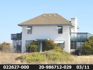
These two three-story rental houses, each with a swimming pool, replaced a one-story duplex at 103 Ocean Blvd. A restrictive covenant that ran with the land required a minimum lot width of 75 feet. Each of these houses sits on a 50-foot wide lot.
The Southern Shores Civic Assn. has a stake in the Town Council’s vote tomorrow on ZTA 18-07, which seeks to prevent the creation and (re)development of 50-foot-wide “nonconforming” lots in town. If the Town Council fails to pass it, the SSCA may have a proverbial can of worms on its hands.
At the first reading June 5 of the zoning text amendment, the Town Council approved it, 3-2, a vote that fell short of the 4/5 majority needed for passage. Mayor Tom Bennett and Councilman Chris Nason opposed the measure.
A second reading of the ZTA is scheduled for the Town Council’s regular monthly meeting tomorrow, at 5:30 p.m., in the Pitts Center. Only a simple majority approval is now required.
On May 21, the Town Planning Board unanimously approved ZTA 18-07, recommending that the Town Council adopt it.
(The Beacon has extensively covered this proposed amendment: See reports on May 11, 17, 23, and 24, and June 4 and 7.)
In a June 20 special report, I discussed restrictive covenants that run with the land in Southern Shores, focusing in particular on minimum required lot frontages.
My research of the past few weeks, which includes a meeting with the Town Planner, the Town Manager, and the Town Attorney; informal discussions with SSCA Board members; an examination of SSCA documents; and more deed tracking in the Dare County Register of Deeds office, reveals that the SSCA likely has the power to enforce these restrictive covenants.
But, that power may depend on the block location of the subject lot. It’s “case-by-case,” said Town Attorney Ben Gallop.
(Please note: Chicahauk has its own protective covenants. I am not referring here to Chicahauk properties.)
Among the covenants that developer Frank Stick, his partners, and later the Kitty Hawk Land Co. (KHLC) declared in deeds were those requiring lot frontage of 75 or 100 feet. They also established minimum dwelling setbacks from Ocean Boulevard (NC Hwy. 12) and from side and rear boundaries.
Stick and company platted and recorded blocks of 50-foot-wide lots, initially on the oceanfront and the west side of Ocean Boulevard, but they sold the lots in pairs and restricted development on them by imposing the covenants.
It is because the developers chose to plat and record 100-foot-wide building sites as two 50-foot-wide lots, rather than as one 100-foot-wide lot, that we now have an issue with higher-density redevelopment on “nonconforming” lots, such as the two houses that were constructed at 103 Ocean Blvd. (See photograph above.)
By definition, nonconforming lots do not meet the Town’s legally mandated dimensional requirements, which include a minimum width of 100 feet and a minimum size of 20,000 square feet. (See Town Code sec. 36-202(d))
The property owners at 103 Ocean Blvd. disregarded an underlying restrictive covenant dating to 1967—12 years before the Town’s incorporation—that required a minimum building-lot width of 75 feet; and no one sought to stop them. ZTA 18-07 would have.
Beacon editorial board member Ursula Bateman, a native New Yorker and former SSCA Board member, keeps telling me: “Ann, just tell people that you don’t want to be in your living room and hear your neighbor sneezing in his. Like on the Jersey shore. Keep it simple.”
If only it were! I’ll try.
With ZTA 18-07, the Town seeks to amend the Town Code of Ordinances to ensure that housing construction that enables you to hear your neighbor sneezing in his living room while you’re sitting in yours does not continue to occur.
SSCA ENFORCEMENT POWER
As far as I can discern, and Mr. Gallop and SSCA Board member Jeffrey Johnson, who is an attorney, concur, the SSCA does not have the legal “duty” to enforce the restrictive covenants on minimum frontage or any other covenants. A duty would mandate the Association’s intervention; a power makes it discretionary.
It would appear from the SSCA’s bylaws and other written statements, and from its actions, since its 1975 incorporation, that it believes it has the right to enforce such covenants.
In my research at the Register of Deeds, however, I could not find one all-encompassing document recorded by the Kitty Hawk Land Co. that assigns to the SSCA its covenant rights. Instead, I found multiple declarations of “protective covenants and conditions” by the KHLC that are applicable to certain blocks of lots. These declarations specify that the KHLC and its “successors and assigns” have covenant enforcement powers and rights.
For example, the declaration recorded in Dare County deed book 271, at page 447, covers Southern Shores block 92; and the declaration in book 576, page 209, applies to certain sections of block 129.
Each of these documents states that the powers and rights reserved by and to the KHLC and its successors and assigns “shall not . . . inure to the individual lot owners.”
Interestingly, the block 92 declaration, which was executed in 1978, contains a section that requires all property owners in the block to become members of the Southern Shores Civic Assn. It further states that the KHLC’s powers “shall” inure “only” to the SSCA “at such time when the powers are vested in it” or to successors to whom the KHLC expressly assigns powers.
Although I love research, I’m not inclined to search for declarations block-by-block.
If the Town Council rejects ZTA 18-07, a court may have to decide if the SSCA truly does have enforcement rights in a given situation. This should not be allowed to happen.
THE TOWN’S INVOLVEMENT
Certainly, the Town does not have the responsibility, much less the duty, to enforce restrictive covenants. Mr. Gallop adamantly stressed this.
Town Planner Wes Haskett, who co-authored ZTA 18-07 with Mr. Gallop and officially because deputy town manager on July 1, told me that he never deals with them. He does not even have copies of covenants in his office.
As a courtesy, Mr. Haskett said, the Town planning department sends the SSCA a list of lot disturbance-stormwater management (i.e., building) permit application filings every Monday. “We should work together,” he said.
The SSCA’s Architectural Review Board (ARB) follows up by giving each building-permit applicant an “application for deed and covenant restriction approval.” This document directs landowners to familiarize themselves with covenants and refers them to the SSCA office, where you can find them in binders. (All of the ARB documents to which I refer here can be found on the SSCA website.)
The ARB conducts what it calls in a policy document a “covenant review process,” the purpose of which is multifold: One stated objective is “to ensure compliance with the relevant restrictive covenants.”
I contacted Ben Packard, chairman of the ARB, and arranged a meeting with him, which he subsequently canceled after speaking with Rod McCaughey, who is the SSCA Board of Directors’ ARB member. Both considered it more appropriate for me to speak with the Board, which I eventually did through informal means. I spoke with SSCA president Larry Galleck; Mr. McCaughey, who is also in charge of bylaws and long-range planning; and Mr. Johnson, who oversees membership and marina boat slips.
Because my conversations with these Board members could be considered “off the record,” I am not going to quote them. Understandably, no one is keen on getting involved with enforcing restrictive covenants.
On the record, Mr. Packard emailed me: “Any enforcement outside denying a submitted application falls on the SSCA Board.”
The ARB policy document concurs: “Ultimate responsibility for legal enforcement of the covenants on behalf [of] the SSCA is the duty of the SSCA Board of Directors.” (The SSCA may wish to reconsider this representation. Certainly, it needs to change the word duty.)
In a packet of permit-process material that Mr. Haskett provides to contractors and property owners, the Town “strongly” urges applicants to “obtain approval from the appropriate association before you apply for a permit and begin construction.
“Failure to do so,” it warns, “could result in legal action by the association to enforce the covenants.”
While some show of enforcement muscle—for example, informing a property owner that he cannot park a recreational vehicle on his land—would be easy for the SSCA to dispense, and perhaps immediately effective, the enforcement of other covenants could lead to expensive and protracted litigation.
While I am sympathetic to the SSCA’s financial limits and to the argument that it “must choose its battles,” I also am sympathetic to property owners who have reason to believe that the Civic Association will fight important battles for them. Why should an individual property owner, who happens to live in a block where another property owner is violating a restrictive covenant, be out of pocket for enforcement costs?
Southern Shores property owners should know if and when the SSCA will ever intervene, in their behalf, in enforcing restrictive covenants and decide if this is what they expected when they became members.
PROTECTING THE TOWN VISION
Seventy years ago, the founder of Southern Shores envisioned a community of low-density housing with a lot of open space. Artist and conservationist Frank Stick (1884-1966) wanted people of more modest means to enjoy the luxurious privacy that ultra-rich oceanfront property owners in the Northeast enjoyed.
The Town perpetuates his vision in its land-use plan, which states that the “quiet seaside residential community” of Southern Shores is “comprised primarily of low density neighborhoods consisting of single family homes primarily on large lots (i.e., at least 20,000 sq. ft.).”
The preamble to ZTA 18-07, which is the “whereas” section that elaborates upon the Town’s purpose and authority, repeats this language. It refers to the Stick-KHLC two-50-footers-as-one-100-foot-wide lot system as an “informal” combining of parcels.
“In recent years,” the preamble states, “the Town has seen a trend toward redevelopment of such informally combined parcels . . . back into the smaller nonconforming lots and building dwellings upon the nonconforming lots.
“Such redevelopment is inconsistent with the low density character of the Town.”
ZTA 18-07 would require the “recombination” of adjacent lots under the “same ownership” into a single conforming lot or multiple lots, if certain situations apply.
As Mr. Gallop has explained at hearings, each of five enumerated situations, all of which involve proposed development and/or sale, would “trigger” the “recombination” of adjacent lots, one or more of which is nonconforming.
The Town Attorney has been meticulous about defining the term “same ownership,” so as to prevent “affiliated” legal entities—such as limited liability corporations with different names, but overlapping controlling interests—and individual landowners and their “affiliates” from getting around the zoning law.
ZTA 18-07 also includes a provision that permits the construction of a single-family dwelling in the residential district on what I call a “stand-alone” nonconforming lot—meaning the lot owner does not own any land adjacent to the 50-foot-wide, or smaller, lot.
According to Mr. Haskett fewer than 10 such lots exist.
ZTA 18-07 permits owners of stand-alone lots to use a side-yard setback of 12 feet. The original draft of the amendment proposed a 10-foot side setback, but the Planning Board amended it to 12 feet.
This important zoning text amendment seeks to preserve the Town’s low-density character, which drew most of us to Southern Shores and continues to draw tourists to our beaches. In the process, it also “enforces” crucial restrictive covenants on lot frontage.
It’s a win-win for the SSCA and for the Town’s future. The Town Council must pass it.
Gezundheit!
Ann G. Sjoerdsma, July 9, 2018
***
SIDEBAR: THE CASE OF 85A OCEAN BLVD., OR BUILDING A RENTAL COTTAGE ON A FORMER 50-FOOT-WIDE PAPER STREET
During the Town Council’s June 5 hearing on ZTA 18-07, Rick House of House Engineering in Kitty Hawk argued that his client, Richard M. White, would be unduly harmed by passage of the amendment, and that an exception should be created for him.
Mr. White, of Elizabeth City, owns 85 Ocean Blvd., two 50-foot-lots that he bought in 1996 and developed as one 100-foot-wide property.
In 2014, Mr. White bought the vacant 50-foot-wide adjacent lot—to the north, next to 87 Ocean Blvd.—from a subsidiary of the Kitty Hawk Land Co. for $25,000. This lot, according to Mr. Haskett, was a “paper street.”
Paper streets usually occur when developers or planners lay out streets that are never built. They appear on maps, but do not really exist.
Mr. White would like to build a rental house on this former paper street, which he is calling 85A Ocean Blvd. If ZTA 18-07 becomes Town Code, he will be unable to develop or to sell this 50-foot-wide lot separately. The lot would be “recombined” with his adjacent 100-foot-wide tract.
OPINION: This is as it should be. Mr. White is not being blindsided. No inequity would occur in this case.
According to my research, the initial deed for Mr. White’s property at 85 Ocean Blvd. dates to Aug. 31, 1976, and includes a restrictive covenant running with the land that states “no more than one dwelling shall be constructed on each 100 feet of lot frontage.”
Mr. White’s own deed specifies that his land transfer is “subject to restrictions of record.” It is reasonable to presume that his real-estate agent and/or attorney advised him of all restrictive covenants.
Even if Mr. White were unfamiliar with the minimum-frontage covenant, by 1996, the current zoning law, which requires the same minimum 100-yard frontage, had been in effect for years.
Mr. White is not out hundreds of thousands of dollars for an investment property. At the worst, he purchased, at minimal cost, an attractive buffer for his rental house. According to Dare County tax records, the lot is currently assessed at $54,500.
In fact, Mr. White might be able to recoup his $25,000 investment by selling all or a portion of his buffer to the property owner at 87 Ocean Blvd. He can build a larger rental house than the one he currently owns on the combined 150-foot-wide tract or sell the whole tract to someone else who could.
Mr. House sought a side-setback variance for Mr. White. On May 21, the Town Board of Adjustment unanimously denied his request for a reduction from 15 yards to 10 yards.
According to Mr. Haskett, Mr. House filed a new variance application on June 5, requesting 12-foot side-yard setbacks, but he “retracted” it on June 13.
Does Mr. House know something we don’t know?
We’ll find out at the Town Council meeting tomorrow night.
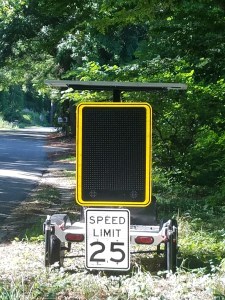
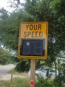
This speed indicator at 182 S. Dogwood Trail also counts vehicles. A different device (at right and below) detects speed and vehicles at 286 Sea Oats Trail, which is in a lightly traveled block of the road.
Daphne Porter lives on Sea Oats Trail in the dunes of Southern Shores, at the road’s intersection with Hickory Trail.
During the June 23-24 no-left-turn (“NLT”) trial weekend, Ms. Porter and her housemate stayed home and worked in their yard, observing the traffic. “We were paying attention out in the yard,” she said.
Their opinion of the trial? “We absolutely loved it.”
Besides watching the flow of vehicles turning left from Hickory Trail on to Hillcrest Drive—the customary north-bound vacationer cut-through route—and on to their street, Ms. Porter and Cynthia Barth surveyed conditions on NC 12 : They have a bird’s eye view of Duck Road from their back deck.
When the traffic slowed on NC 12 to between 4 and 11 mph, according to Ms. Porter, who monitored it, WAZE, the free social navigation app that allows drivers to share real-time traffic and road conditions, directed motorists to Wax Myrtle Trail. But not that many Wax Myrtle “rerouters” accessed it via Hickory Trail, she said.
“We didn’t hear the traffic, and we didn’t see the traffic [on and near their street],” Ms. Porter told The Beacon in a telephone interview. The weekend “was nothing but positive for us. . . . It was fantastic.”
As most of you know, the left-turn prohibition at the U.S. Hwy. 158-South Dogwood Trail intersection was in effect from 8 a.m. until 6 p.m. June 23-24, during which time Southern Shores police officers implemented “zero-tolerance enforcement.” They issued 25 citations for illegal turns, all but three of them on Saturday, according to the Police Department’s “summary” NLT report, which is available on the Town’s website.
With the exception of Stephen Uperti, who lives with his wife Tina on Wax Myrtle Trail near its intersection with Porpoise Run—a hop-off point recommended by WAZE, according to a Duck restaurant employee—the cross-section of people in town whom The Beacon called for comment and the people who emailed The Beacon and posted on our Facebook page during the NLT trial and immediately afterward were exceedingly enthusiastic about its results.
“Everybody raved about it,” said Al Ewerling, who lives on South Dogwood Trail at its intersection with North and East Dogwood Trails. “I have not heard anybody on South Dogwood say anything negative about it. . . . [B]icyclists, people walking their dogs, people out jogging, they all said [traffic] was a lot better.”
Even Mr. Uperti, who said that the traffic off of NC 12, onto Porpoise Run, and then driving past his house was much heavier than usual, concluded: “It didn’t really bother us because there was no backup.” He and at least one of his neighbors, who placed an orange cone in the street in front of his house, were concerned, however, about the speed of the motorists, who came careening around the Porpoise Run/Wax Myrtle curve.
By the time the Wax Myrtle traffic reached Vincent Ferretti’s home, however, about a mile west of the Upertis, it was “light,” the former Maryland trial judge said. Mr. Ferretti did not notice the heavy traffic that Police Chief David Kole reportedly told The Outer Banks Sentinel some residents on Wax Myrtle Trail complained about. That’s not what he experienced, Mr. Ferretti told The Beacon. “The traffic was great,” he said. No problems.
On Sat., June 30, Nona Post, who also lives on Wax Myrtle Trail, posted on The Beacon’s Facebook page: “It was hell coming home. Please please stop left turns going forward.”
Indeed, the assessment of The Beacon’s sources, some of them obtained by random calls, contrasts sharply with the pessimistic analysis issued by Chief David Kole to local media on June 28, as well as public comments he reportedly has made—none of which reflects the peace and quiet, the relief, and even the elation that so many residents experienced.
“This has been a wonderful weekend with no backups in our neighborhood!” exulted Lori Harrell Worthington, who lives at the north end of Sea Oats Trail, where traffic backs up each summer weekend as cut-through motorists seek to enter the traffic flow on NC 12, often blocking the intersection and impeding the thoroughfare.
“I was wondering if I was on a different planet last weekend after reading” remarks by Chief Kole to the Sentinel, Ms. Worthington posted on The Beacon’s Facebook page.
According to Jim Kuykendall, traffic was backed up June 30 on 11th Avenue, the NC 12 “side street” where he lives, for 10 hours. On the NLT weekend, he reported on Facebook, “Traffic on our street was null!!!!”
The Police Department’s summary NLT weekend report contains vehicle counts that purportedly show a minimal impact on South Dogwood Trail traffic and an adverse impact on certain streets, including Juniper/Trinitie in Chicahauk. But John Booth, of Gravey Pond Lane, and Susan Dineen, of Deer Path Lane, told The Beacon traffic was “light” on Trinitie all weekend. They both said they kept an eye on it.
The Beacon has reason to question the relevance of the police vehicle data, as well as their manner, means, and location of collection. Let’s look at the numbers.
NUMBERS ARE INSIGNIFICANT; GO WITH THE FLOW
The police NLT report provides vehicle counts on June 23-24 for northbound traffic on South Dogwood Trail, NC 12, Trinitie Trail, and Sea Oats Trail. It further compares these counts with counts from the previous Saturday and Sunday, June 16 and 17, 2018, and counts from the “same weekend” in 2017, June 24-25.
As hackneyed a phrase as it is, it is appropriate here: The Town is comparing apples and oranges. I will elaborate below. Before I do, though, I have to examine the methodology of the data collection. I can only go so far in such an analysis, however, because the Town has not provided necessary operational facts about the counting process.
What The Beacon has learned is that 1) these counts were obtained at the following locations:
182 South Dogwood Trail
NC 12 (Ocean Blvd.) and Skyline Road
56 Trinitie Trail
286 Sea Oats Trail (between Hickory Trail and Hillcrest Drive)
. . . and 2) the counts were made by visual or sensory or other means of detection by the speed-limit devices that you frequently see on the side of the road. (See the photos above.)
This equipment apparently can calculate the number of vehicles that pass on the road, going in a certain direction, but how? Is it sensitive enough to count only motor vehicles, or does it sense and count bicycles, joggers, and pedestrians, too? How does someone set the counting mechanism on the device? Can traffic be counted for just a specific 10-hour period, or must the count be for a full day? If a counter malfunctioned, how would the Town know? How often are the devices checked during a test period?
I would like to know a lot more about these devices than I currently do. I also would like to know if the same equipment was used the previous week in the same locations during the same times and on June 24-25, 2017 in the same locations during the same times. If you can’t compare apples to apples, then there’s no point in comparing at all.
In past years, the Town has used strips across the road for counting vehicles. If the Town used the strip method on June 24-25, 2017, then a comparison of data between the years is impossible. That’s a fact that a high-school science student would immediately grasp.
I heard Chief Kole explain to the Town Council at one of its meetings that vehicle counts collected by the strip method on South Dogwood Trail were not valid because whenever a vehicle reached a particularly low speed—8 miles per hour comes to mind—it didn’t get counted! I thought this problem arose just last year. If so, then the numbers provided for 2017 may be gross underestimates.
Regardless, here are the Police Department’s vehicle counts for this year, versus last year:
The Police Department did not provide vehicle counts for Trinitie Trail in 2017.
I frankly don’t see a reason to compare the NLT counts with counts from the June 16-17, 2018 weekend because, traditionally, mid-June is not the high season. Nor, for that matter, is the third week in June, but it’s getting much closer.
Speaking as a Southern Shores rental cottage owner of 27 years, I’ve often had trouble renting early- to mid-June weeks, because schools either are still in session or just letting out for the summer. Speaking as a homeowner on Hickory Trail, near East Dogwood Trail, for the past 20 years–of which only the past eight years or so have been marred by the traffic–I take mid-June traffic in stride, and prepare for traffic backups thereafter.
(Of course, my experience is only anecdotal evidence, just as any opinions on the traffic on Friday, June 22, 2018, which some have suggested was heavier because of the NLT weekend, are. They’re personal anecdote and conjecture about motorists’ motivation.
(I noticed no increase in cut-through traffic on Hickory Trail while I was home Friday evening. Mayor Tom Bennett may have detected an uptick in vehicles, as The Sentinel reported, but I didn’t.)
My opinion aside, here are the week-to-week numbers:
The only statistics that strike me as at all significant are those for Sea Oats Trail, but only because they don’t add up.
Chief Kole has been citing the “more than doubling” of vehicles on Sea Oats Trail from June 16 to June 23, 2018—321 to 825—as a downside to the NLT trial. A closer look reveals this result to be more than a little curious.
The Sea Oats Trail counter was placed only two-tenths of a mile north of Daphne Porter’s house, in the block between Hickory Trail and Hillcrest Drive. Ms. Porter described her experience that weekend to The Beacon as “incredible” and “fantastic.”
I can think of no good reason for vacationers to travel this stretch of the road. If you cut through on South Dogwood Trail, you’re going to take Hickory Trail to Hillcrest Drive and then catch Sea Oats Trail off of Hillcrest; and if you jump off of NC 12, you’re going to take Wax Myrtle Trail, not Sea Oats Trail.
Constance LeSueur, who lives near 286 Sea Oats Trail, did not notice the traffic during the NLT weekend. “We have a problem every now and then,” she told The Beacon, “but not much.”
Over on Hillcrest Drive, Stefan Herzog, who lives about a half-mile north of the Hickory-Hillcrest intersection, noticed that the “traffic was lighter” that Saturday. There was a slight slowdown near his driveway about 4 or 5 p.m., he noted, but it didn’t last long.
The NLT weekend “cut into my neighbor’s lemonade stand,” Mr. Herzog wryly complained.
Where, I wonder, did the 1,722 vehicles that reached 182 South Dogwood Trail that day go? Why would about 800 of them skip a lightly traveled Hillcrest Drive and opt for Sea Oats Trail instead? I certainly didn’t see a diversion to Sea Oats Trail when I drove through the dunes, checking the traffic.
Even more vexing to me is the apparent 58-percent drop in traffic on Sea Oats Trail between the June 24, 2017 count (1,967) and the June 23, 2018 count (825). It makes no sense. There’s no way that 2,113 vehicles drove up South Dogwood Trail, and then 1,967 of them bypassed Hillcrest Drive and got on Sea Oats Trail off of Hickory, instead.
Apples and oranges. The 1,967 figure must reflect traffic on the northern end of Sea Oats Trail, where it always backs up and where a counter should be located; and this year’s count calculates vehicles elsewhere or, perhaps, incorrectly.
TOWN COUNCIL MUST ACT
Daphne Porter would like to see the left-turn ban in effect for about a month to six weeks each summer, starting in late June.
“The traffic was calm,” she said, “and I was calmer.” I agree, and that’s a very good thing.
In previous blog posts about the NLT weekend, I’ve reported that traffic appeared to move at speed on both U.S. Hwy. 158 and NC 12 for most of Sunday, if not all day. (See The Beacon, June 25 and June 29, 2018.) It may well be that the NLT option would inure to the benefit of arriving vacationers, keeping them calmer and less aggressive on and off the road.
All traffic has to merge eventually on to Duck Road and then get through the Duck bottleneck. The speed of the traffic flow on the thoroughfare is not contingent alone on the volume of traffic. The merging of side-street traffic substantially affects it, too.
After Chief Kole gives his summary report on the NLT weekend at the Southern Shores Town Council’s July 10th meeting, the Council must define a next step for securing cut-through traffic relief on our residential streets. This trial cannot be a “one-time deal,” as our police chief called it at the Council’s May 1 meeting. There’s plenty of the money in the budget to fund another NLT weekend this summer or to exercise another option. It’s a question of priority. (See The Beacon’s budget report, May 29, 2018.)
The community-at-large needs and deserves action, and if our elected officials are truly listening to their constituents, they will deliver it.
Please attend the Town Council meeting, which starts at 5:30 p.m. in the Pitts Center behind Town Hall. If you can’t make the meeting, please let Mayor Bennett and the Town Council know what you think: Email them at council@southernshores-nc.gov.
This is the permanently installed speed and vehicle detector, front and back, at 286 Sea Oats Trail.
Ann G. Sjoerdsma, July 6, 2018; updated, July 7, 2018
(Joe Van Gieson, Geri Sullivan, and Ursula Bateman contributed to this report. The photographs are courtesy of Peggy Irvin.)
I planned to give you a preview of the Southern Shores Town Council’s agenda for its July 10 meeting today, before I steal away for a few days of R&R, but I got distracted by a story published online by The Outer Banks Sentinel about the June 23-24 no-left-turn trial. I frankly was appalled by the article’s factually inaccurate headlines, “Southern Shores’ left turn ban produces no breakthrough: Slightly reduces S. Dogwood traffic, while adding congestion on other roads,” which were based on Police Chief David Kole’s highly negative and biased assessment of the weekend turn ban.
In an online comment responding to the article, I wrote, “This is nonsense. It couldn’t be further from the truth.” I then referred The Sentinel and Chief Kole to the real-time reports posted by Southern Shores residents, whom I don’t personally know, to The Beacon’s Facebook page, as well as the article I posted to this blog on June 25.
I live on a highly traveled cut-through street near South Dogwood Trail, and I made a point of driving throughout Southern Shores over the June 23-24 weekend to observe traffic. The residential roads, including my Hickory Trail and the Dogwoods, were very lightly traveled. I even drove at the speed limit on a usually congested section of NC 12 on Sunday afternoon, during the peak tourist-arrival time. The traffic flowed smoothly. We had a quiet, peaceful, and safe weekend.
“I was wondering if I was on a different planet last weekend after reading the [Sentinel] article!” wrote Lori Harrell Worthington, who lives on the north end of Sea Oats Trail, today on The Beacon’s Facebook page.
Mary Ann Gouzie Hurd called the article “fake news” and posted, “I live on the most heavily traveled cut through . . . Sea Oats Trail We had NO backups either Saturday or Sunday. Actually had very little traffic.”
This is all I’m going to say about the Sentinel’s article. My online reports speak for themselves. I know what I saw, as do Beacon traffic monitors who biked and drove throughout the town. I understand from Sentinel editor Mark Jurkowitz that there will be a follow-up to the article, based on reader response.
NOW, RETURNING TO THE JULY 10 AGENDA . . . I would like to remind you that there will be two public hearings on zoning text amendments, one of which concerns the highly important issue of lot coverage and how it is calculated and the other of which pertains to the anticipated new fire station; and a second reading of ZTA 18-07, which is comprehensively designed to stop the creation and development of nonconforming 50-foot-wide lots in town.
The Beacon reported April 20, 2018, in detail, on the lot coverage ZTA, which is a second attempt by a three-member majority on the Town Council to change the regulations, and has reported extensively in several blog posts on the nonconforming lots ZTA, which received a favorable 3-2 vote at the first reading June 5, when a 4/5 majority was required for passage.
Another important item on the Southern Shores Town Council’s July agenda, which is also scheduled for a public hearing, but has received less attention, is the Council’s adoption of a Capital Infrastructure Improvement Plan for fiscal year 2018-19.
CAPITAL INFRASTRUCTURE IMPROVEMENT PLAN
I publish below the plan recommended April 4, 2018 to the Town Council by the Capital Infrastructure Improvement Plan Committee, which is chaired by Mayor Tom Bennett and Councilman Jim Conners. The plan prioritizes infrastructure projects and is available on the Town website, if you would like to click links. I thought I’d make it easier for you here, by reproducing the list without links.
Southern Shores Town Manager Peter Rascoe, who attends CIIP Committee meetings, volunteered during a recent meeting that I had with him that the CIIP priority list is driven by “squeaky wheels.” So, if your street is not on the list, maybe you haven’t squeaked loudly or often enough.
The infrastructure project “targets,” in order of priority, are:
GROUP A, “Recommended” Targets:
1. YAUPON TRAIL—Phase 1 (north end): 700 linear feet, plus or minus (+/-) and all remaining bulkheading
2. YAUPON TRAIL—Phase 2 (south end): 1,000 LF (+/-)
The Town’s FY 2018-19 operational budget includes an appropriation of $654,870 for capital infrastructure projects. In order to balance the budget, which projects $6,355,402 in expenditures, Mr. Rascoe and Finance Officer Bonnie Swain transferred $282,828 from the Capital Reserve Fund for Capital Projects to Revenues. These monies, they confirmed in the meeting to which I earlier alluded, must be used for capital projects.
***
UPDATEON RESTRICTIVE COVENANTS: I am working hard on an update to my June 20, 2018 blog post about restrictive covenants, talking with Town staff and SSCA officials and conducting more research in the Register of Deeds office. I have other people to contact and more research to do. I will write a followup as soon as I can.
Happy 4th of July, everyone.
Ann G. Sjoerdsma, June 29, 2018
(Sorry about the technical difficulties! I had trouble with the traffic cone.)
Based on reports The Beacon received from Southern Shores residents, by email and by Facebook post, and my own observations, the Town’s no-left-turn trial this past weekend at the U.S. Hwy. 158-South Dogwood Trail intersection gave both homeowners and northbound motorists a break from the stress and aggravation of traffic backups. It created a safer and more peaceful environment.
At no time during the two-day, 8-a.m.-to-6 p.m. prohibition on turning left from Hwy. 158 to South Dogwood Trail did traffic back up on any of the town’s residential roads, including those in Chicahauk, residents reported. Typical of comments from homeowners at the north end of Sea Oats Trail, which is the last entry for “cut-through” motorists to rejoin the traffic flow on NC 12, was this Facebook post from Lori Harrell Worthington:
“This has been a wonderful weekend with no backups in our neighborhood!”
Other Sea Oats Trail homeowners were flabbergasted. Said Mary Ann Gouzie Hurd, who posted on Facebook throughout the weekend: We’ve had “no traffic” all day, each day. This is “unheard of.” More than that, “This is weird.”
Lest there be any concern that Chicahauk was bearing the brunt of the no-left-turn trial, John Booth, who lives on Gravey Pond Lane in Chicahauk, reported “light traffic on Juniper/Trinitie” on both days.
Susan Dineen, who also lives in Chicahauk, agreed. On Saturday, Ms. Dineen wrote: “I watched the Juniper/Trinitie traffic flow all day, and it was very light, which is typical for any day here.”
Pictured at top is a photo of the 158-South Dogwood Trail intersection that a Beacon reader downloaded from the N.C. Dept. of Transportation website at 12:47 p.m. Saturday. (A larger reproduction of the image appears on The Beacon’s Facebook page.)
The depicted conditions represent the worst congestion that occurred during the weekend trial, and it reportedly did not extend very far on the Wright Memorial Bridge. The congestion also did not persist throughout the day, as both Hwy. 158 and NC 12 opened up.
According to Sunday reports, traffic moved at speed on both Hwy. 158 and NC 12 for most of that day, if not all day. I drove through the 158-South Dogwood Trail at 2:30 p.m. and 3:30 p.m. on Sunday and observed traffic moving at speed, with no slowdowns. At 3:30, I drove north on South Dogwood Trail and then turned right on East Dogwood Trail, taking it to NC 12, where I joined the traffic heading north. I was pleased and shocked to be in this traffic moving at the speed limit. I stayed with it until I turned into the dunes on Sea Oats Trail; I could see a clear road ahead on NC 12.
Some readers observed that the traffic volume seemed lighter this past weekend than it usually is on a summertime weekend. Tommy Karole, owner of the Paper Canoe Restaurant in north Duck and a Southern Shores resident, said his employees who crossed the Wright Memorial Bridge reported “light traffic.” Perhaps. Or it may simply have seemed that way because the Hwy. 158 traffic flow was faster. The Town’s traffic counters should provide some insight into the number of vehicles that traveled on NC 12 and elsewhere.
The Beacon eagerly awaits an official report from TOSS Police Chief David Kole about the number of traffic citations issued during the no-left-turn trial, especially for making an illegal left turn; the number, location, and nature of any allegedly related traffic collisions that may have occurred; and the number of vehicles that crossed the Town’s counters.
I received several emails from excited residents who were thrilled to see Southern Shores police officers, “with their blue lights on,” pull out from the road shoulder, where they were parked, observing the intersection, and chase motorists who made illegal turns. The Beacon thanks all of the officers who endured the muggy heat to implement “zero tolerance.”
The OBX Locals Facebook page posted a report that the Southern Shores police issued 26 citations for an illegal turn on Saturday. This figure is unsubstantiated and should not be considered factual, absent police confirmation.
I would like to conclude this post by thanking Town Councilmen Fred Newberry and Gary McDonald, who listened to residents, who had been complaining for years about the cut-through traffic, and lobbied for a public meeting with representatives from the N.C. Dept. of Transportation. When these representatives made it clear at the Town Council’s Sept. 5, 2018 meeting that DOT would support the Town in any actions it wanted to try to curb the cut-through traffic, Councilmen Newberry and McDonald pushed for the directive that enabled the no-left-turn trial to occur.
The June 23-24 trial results are a meaningful start to a dialogue about traffic in Southern Shores, but they emanate from only one trial over one weekend. Such limited evidence is hardly enough to enable a full and fair evaluation of the effects that a left-turn prohibition at 158-South Dogwood Trail would have on traffic flow through Southern Shores—both on the residential streets and on NC 12. We would like to see another trial occur this summer in July, which is our peak vacation month, or August.
If you agree, please let the Mayor and the Town Council know: Email them at council@southernshores-nc.gov. Let them know what you think.
Built in 1948, the Graves Cottage at 64 Ocean Blvd. was a two-story flat top. SAGA bought it in an estate sale in 2013.This dwelling is under construction at 64 Ocean Blvd. today. The land to the south of it is a newly created nonconforming 50-foot-wide lot.
Deeds transferring property in Southern Shores from its developers to initial buyers contained a number of restrictive covenants, a standard one of which specified a minimum lot width of 75 feet or 100 feet for every dwelling constructed.
These covenants expressly ran with the land and, thus, moved from deed to deed as the property was transferred from one owner to the next. They were tied to the land, not to the owner, and did not have an expiration date. Subsequent deeds in a property “chain” commonly referred to them.
I finally had an opportunity to do research at the Dare County Register of Deeds in Manteo. What I discovered in looking up old deeds, which are unavailable online, was a clear intent by Southern Shores developer Frank Stick, his partners, and their business entity and successor, the Kitty Hawk Land Co. (KHLC), to establish minimum dimensional requirements for building lots.
They didn’t have a town zoning code. They had restrictive covenants.
During the past two years, an unwelcome trend has emerged in Southern Shores to redevelop 100-foot-wide land tracts on or near the oceanfront—which are platted and recorded as two 50-foot-wide lots—as two “nonconforming” lots. Since the Town enacted zoning ordinances in the 1980s, the minimum width for a lot has been 100 feet, and the minimum size has been 20,000 square feet.
In proposed Zoning Text Amendment (ZTA) 18-07, which The Beacon has covered extensively, the Town seeks to amend the Town Code of Ordinances to ensure that the development of smaller nonconforming lots does not continue to occur.
Although difficult to understand, ZTA 18-07 essentially requires the “recombination” of adjacent lots under the “same ownership” into a single conforming lot or multiple lots, if certain situations apply. Those situations involve proposed development and/or sale.
ZTA 18-07 would replace the current confusing and inadequate Town Code section on nonconforming lots, which is sec. 36-132.
The proposed amendment received a 3-2 favorable response from the Town Council on its first reading June 5. Mayor Tom Bennett and Councilman Chris Nason, an architect who has designed oceanside houses in Southern Shores, voted against it. The second reading for ZTA 18-07 is expected to be July 10.
Having now unearthed the bedrock restrictive covenants of Frank Stick and his vision of Southern Shores, I’m left wondering: Are these decades-old restrictive covenants legally enforceable? If so, by whom? The Town? The Southern Shores Civic Assn.?
In not enforcing them, has the Town, the Southern Shores Civic Assn., or both allowed illegalities to occur?
In this special report, I will detail three property situations in which restrictive covenants were ignored, to the detriment of the Southern Shores vision and land-use plan. But before I do, I’d like to impart some history.
***
The Beginnings of Southern Shores
“Founding Father” Frank Stick bought the 2800-acre tract that he named Southern Shores shortly after World War II. He envisioned an ocean-to-sound residential community of open space and luxurious privacy for people of more modest means than the ultra-rich who owned oceanfront property in the Northeast.
I have referred to this arrangement in previous posts as a non-negotiable “package deal.” Purchasers bought two lots, but always treated them as one lot for development purposes.
The Stick-McMullan-Aydlett partnership was nothing if not orderly: The partners divided the Southern Shores subdivision into blocks, some of which had sections, and decided the minimum building lot size per block, as well as minimum dwelling setbacks from Ocean Boulevard and from side and rear boundaries.
In 1967, my parents bought a pair of oceanfront lots for $10,000. I now know that underlying their 1967 deed was a 1951 deed from KHLC to the initial buyers that restricted the construction of a dwelling to “each 100 feet of property conveyed.” My parents’ deed references this 1951 deed by its recording citation, but I had never looked it up before. The earlier deed also includes a covenant requiring a dwelling to be constructed 100 feet from the east edge of Ocean Boulevard.
Mr. Stick (1884-1966), who was a nationally known wildlife artist, as well as a conservationist, and real-estate speculator, investor, and developer, designed the Southern Shores “flat top,” based on block homes he had seen in Florida. He built his own flat top in 1947 at 60 Ocean Blvd. from cement blocks. For some time after this, flat-top construction was made mandatory through a restrictive covenant in deeds that regulated architectural design.
***
The Irony of 64 Ocean Blvd.
All of the oceanfront properties around the Stick home site were 100-foot-wide lots, made up of two 50-footers, but they were platted in blocks in which the minimum required building lot width was 75 feet.
According to Ms. McNaughton’s book, a cluster of flat tops developed in this area that became known as “The Compound.” In 1948, Edward Spencer Graves of Lynchburg, Va., built an atypical two-story flat top at 64 Ocean Blvd. for his mother, who had 17 grandchildren and entertained “a constant parade of houseguests” from Lynchburg.
Known as the Graves Cottage (pictured above, at top), this historic home was destroyed by SAGA Realty & Construction to make way for its proposed 16-bedroom-with-a-ballroom “event” house, which it planned to build in 2016.
SAGA was forced to abandon its construction when the Southern Shores Town Council, by a vote of 3-2, capped home size at 6,000 square feet. Mayor Bennett and Councilman Nason, who has worked with SAGA, opposed the size limitation.
My research shows that the underlying deeds at 62 and 64 Ocean Blvd. contain the standard Frank Stick-KHLC restrictive covenant about the minimum building lot being 75 feet of frontage, and subsequent deeds refer to “restrictive covenants as may appear of record in the Public Registry of Dare County” or similar language. And yet, a 50-foot-wide lot now exists between the large houses at these addresses.
How did this happen?
It happened because 1) Edward Graves unduly complicated ownership by leaving each of his mother’s grandchildren an undivided interest in Lots 3 and 4, which made up 64 Ocean Blvd. property, and an acquired 37 ½ feet of adjacent Lot 5, originally part of 66 Ocean Blvd.; and 2) the Gupta family, principals of SAGA and related limited liability corporations (LLCs), bought the property through a 2013 court-ordered estate sale.
According to the deed history, Amit Gupta, who is a co-founder and partner of SAGA, submitted the winning bid for 64 Ocean Blvd. Several months later, Amit assigned his bid to 64 Ocean Blvd., LLC, which was managed by his brother, Sumit Gupta, another co-founder and partner of SAGA. Sumit (i.e., 64 Ocean Blvd., LLC), in turn, gifted Lot 3 to Nags Head Freehold, LLC, which their father, Prem Gupta, managed.
SAGA’s website lists Amit Gupta as its president; Sumit Gupta as its Chief Executive Officer; and Prem Gupta as its Chief Financial Officer.
In January 2016, after the Town Council restricted house square-footage, Nags Head Freehold, LLC sold this nonconforming lot, labeled “64A Ocean Blvd.,” to Steven D. Love and his wife, Kathleen Gorman, who own the adjacent property at 62 Ocean Blvd.
As I read the current, albeit fuzzy nonconforming-lot law, Town Code sec. 36-132(a)(2), the Guptas—no matter what corporate veil they use—should have been prevented from selling Lot 3. But, even if you view the law as favorable to them, the restrictive covenant requiring frontage of 75 feet should have run with Lot 3.
Taking no apparent notice of the covenant, however, the Town has treated 50-foot-wide Lot 3 as buildable: On May 16, 2016, the Board of Adjustment unanimously granted Mr. Love and Ms. Gorman a variance for 12-foot side-yard-setbacks.
The land tract at 64 Ocean Blvd., where a large house has long been under construction (see photo above, at bottom), is now 87 ½-feet wide, a size that is permissible under the old restrictive covenants, as are 10-foot-wide side setbacks; but impermissible under the current zoning law. (Would anyone care to measure the setbacks at the site?)
The Board of Adjustment’s approval of a variance on Lot 3 opened the door for other property owners, including those at 103 Ocean Blvd.
***
103 Ocean Blvd.: Did Confusion Lead to Illegality?
On July 18, 1967, the KHLC transferred two 50-foot-wide adjacent lots at 103 Ocean Blvd., to Moses E. and Mary V. Goldman, a married couple. Among the covenants listed within, the deed restricted the construction of a dwelling on the site to a land width of at least “75 feet of either ocean or highway frontage.”
Subsequent deeds in the chain of title for 103 Ocean Blvd., expressly referred to this and other covenants, even citing the book and page number of the Dare County Registry on which the first deed was recorded.
Thanks to action by the Town’s Board of Adjustment, however, 103 Ocean Blvd. is now the site of two three-story rental houses, each built on a 50-foot-wide lot.
How did this happen? To find out, you have to track the deeds.
On May 24, 1968, the Goldmans transferred a “one-half, undivided interest” in their property to Frederick and Mary Randall. This deed explicitly referred to the 1967 deed and stated that the transfer was subject to “those certain restrictions set forth in the deed of Kitty Hawk Land Company to the Grantors [the Goldmans].”
Thus, Moses and Mary Goldman had 50 percent, and the Randalls held the other 50 percent—of a 100-foot-wide property. They did not each have a 50-foot-wide lot. They thereafter built a brick duplex on the site that overlapped the two lots
Mary Randall died. On July 15, 1982, Frederick Randall and his second wife, Marguerite Randall, transferred their one-half interest to Edwin B. Goldman and his wife, Dorothea Goldman.
Edwin, you might speculate, was the son of Moses and Mary, but I could not confirm this relationship. Edwin and Dorothea’s deed clearly refers to the restrictive covenants recorded in 1967.
You might suppose that with the Goldman family owning all of 103 Ocean Blvd., the property would end up with the younger generation when the elders died, but that is not what happened. Instead, the one-half interest that Moses and Mary Goldman owned passed under Moses’s will in 1988 to Charles and Paula Pagano. Two trustees, including one named Harry L. Goldman, sold the interest to the Paganos, who sold it, in 2000, to Jimmie and Dana Summerell of East Lake, NC.
The Summerells, who are local investors, had to know they were not purchasing a 50-foot-wide lot. They also should have known the restrictive covenants that ran with the property, as well as the Town’s zoning requirements.
In the meantime, Edwin and Dorothea transferred their one-half interest to the Dorothea B. Goodman Trust, which became known in 2015 as the Georgia J. Goldman Trust.
Apparently with the advice of the Town of Southern Shores—public comments by Board of Adjustment members have indicated such—the Summerells and the trustees of the Goodman Trust executed transfers by gift in January 2017 that split the 100-foot-wide property into two 50-foot-wide lots, one owned by the Summerells, the other by the trust.
Shortly after these transfers occurred, the Board of Adjustment approved side-setback variances that enabled the two sets of owners to build on more lot square footage. They replaced the decades-old duplex with two near-identical three-story rental houses that look like they belong in crowded Nags Head, not Southern Shores. (IMHO)
Was the property owners’ and the Town’s disregard of the restrictive covenant requiring a minimum building-lot size of 75 feet in width legal? Should the Civic Assn. have intervened?
***
315 N. Dogwood Trail: Divided into A, B, C Lots
I now shift to soundside Southern Shores. In a June 4 blog, I looked at the online deed history of 315 North Dogwood Trail, an approximately 180-foot-wide land tract. (To view a deed recorded before 1999, you must go to the Register of Deeds.)
I took some heat in the June 5 Town Council meeting for referring to this property as being “subdivided,” although I clearly used the word in a non-legal sense to mean dividing a whole into smaller parts. I conceptualize what happened to this tract as an “un-combining” of lots—just like the un-combining at 64 Ocean Blvd. and 103 Ocean Blvd. See what you think about its treatment.
On Feb. 4, 1966, the KHLC transferred the land, designated as lots 34, 35, and 36, Block D, Section B, Soundside, to P.J. M. Bayne and his wife, Margie S. Bayne. Among the “covenants running with the lands and binding on the parties . . . their heirs and assigns,” listed in the deed, was the following:
“No more than one dwelling shall be constructed on each 75 feet of lot frontage, but one guest house may be built on each 100 feet of frontage in addition to the main dwelling.”
In 1973, the KHLC established the new road of North Dogwood Trail, which necessitated a revision of the boundary lines of the Payne property. KHLC and Margie S. Bayne, now a widow, agreed to an amended plat of the three lots, recorded in a new map book.
This agreement specifically stated that the “terms, conditions and restrictions stated in the instruments by which [Mrs. Bayne] initially acquired” her property interest still pertained.
In October 1991, Margie Bayne, now known as Margie S. Young, executed a deed of gift of the three soundside lots to Fred M. Suthard, reserving a life interest for herself. This deed makes no mention of the KHLC’s restrictive covenants, but Ms. Young does take “exception” to any “restrictions and covenants of record and any governmental regulations that may affect” her gift to Mr. Suthard.
Nearly 23 years later, in 2014, the executor of the Estate of Fred M. Suthard transferred title to the three soundfront lots to Raffaele Dibari and Shannon D. Dibari. The Dibaris bought the 37,000-square-feet parcel of land, which had a 45-year-old house on it, for $425,000. The parcel was treated, again, as a whole, not as parts.
Subsequently, the Dibaris subdivided—broke up? partitioned? un-combined?—the parcel by the lots, each of which is approximately 60 feet wide. They designated them 315A, 315B, and 315C N. Dogwood Trail.
Two years later, an Ohio couple paid $255,000 for the 315A lot. I only learned about this property because the Ohioans put “315A” up for sale on May 25. The online multi-listing for the lot indicates a sale is “pending.”
According to their respective deeds, the Dibaris and the Ohio couple both took title to their property subject to “easements and restriction of record, if any, in the Dare County Registry.”
This should mean that 315A is not a buildable lot because it is not 75 feet wide, as the underlying restrictive covenant in the Paynes’ deed requires. If, however, this covenant no longer has legal force, then the lot should be considered nonconforming under current Town Code zoning law.
The Dibaris, who still own adjacent lots B and C, appear to have a right to sell the A lot—because of a gap in the current nonconforming-lot law, which ZTA 18-07 would fill—but building on it is a different matter.
***
Questions arise: Do decades-old restrictive covenants have any meaning today? Does it matter if subsequent deeds do/do not refer to them as conditions of the land transfers? (It is fairly routine for land transfers to be subject to “restrictions of record.”)
What is the value of a restrictive covenant if it is not enforceable or enforced?
Shouldn’t adjacent and nearby property owners be able to trust that restrictive covenants will be enforced?
I am not a real-estate attorney, nor do I aspire to activate my law license in North Carolina and become one. I have not done any legal research on restrictive covenants, and I am not going to render a legal opinion on them. I do remember one guiding principle, however, from my first-year property-law class:
A restrictive covenant generally will not be enforced if the character of a neighborhood has changed so substantially as to defeat the purpose of the covenant.
You have to question the use and value of restrictive covenants if some property owners can blithely ignore them—especially those covenants that serve to regulate the density of development and, thus, have a profound effect on other property owners’ quality of life and land investment and on the character and ambiance of a town.
Restrictive covenants such as the ones I’m highlighting are what make Southern Shores, Southern Shores.
During the Town Council’s June 5 hearing on ZTA 18-07, Mayor Bennett expressed concern that the proposed amendment would “punish” some property owners by depriving them of an anticipated investment.
I would like to meet the Southern Shores property owner who thinks he/she would be “punished,” and then I’d like to go to the Register of Deeds and research his/her chain of deeds.
Frank Stick and company knew what they were doing. Do we, now?